National Ecological Security Patterns
2010-06-28
来源:Primary Study of National Scale Ecological Security Pattern Acta Ecologic Sinica, 2009,29(10):5163-5175
分享
Sponsored by: The Ministry of Cultural Heritages, China, The Ministry of Environment Protection, China
Research and planning team: Peking University Graduate School of Landscape Architecture, and Turenscape
Completed: 2008
Published at: YU Kong-Jian, LI Hai-Long, LI Di-Hua,QIAO Qing, XI Xue-Song, 2009, Primary Study of National Scale Ecological Security Pattern Acta Ecologic Sinica, 2009, 29 (10):5163-5175
China, with its huge population and relative meager natural resources, fragile ecosystems, plus the unprecedented urbanization and economic growth in terms of speed and scale, are facing sever challenges of sustainability and survival. Addressing this challenge requires that the national land shall be planned and used wisely. This research is a pilot project aiming at establishing ecological security patterns at the national scale that will protect the most sensitive ecological landscapes and critical pattern as a strategy for wise conservation and wise development. Critical natural processes are analyzed systematically at the national scale, including headwater conservation, soil erosion prevention, storm water management and flood control, the prevention of desertification, and the biodiversity conservation. Individual security patterns for safeguarding each of these natural processes are identified and then integrated into an overall ecological security pattern. Three levels of National Ecological Security Pattern are defined, the lower security level, the moderate security level and the higher security level, which account for 35.7%, 65.1% and 84.9% of the national land respectively. This study is expected to provide a scientific basis for the under-going national function zoning and land use planning at the national scale.
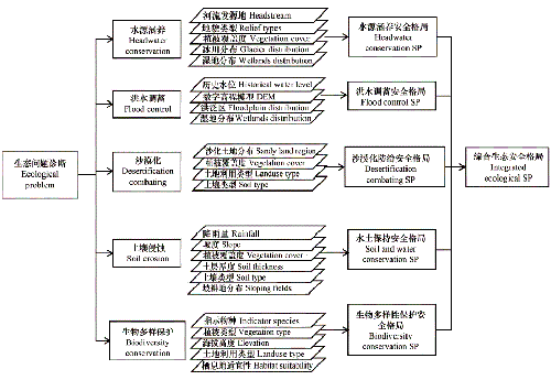
Fig. 1. The framework for national ecological security patterns
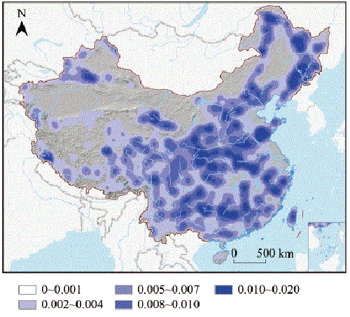
Fig.2 5 calss headstream density map
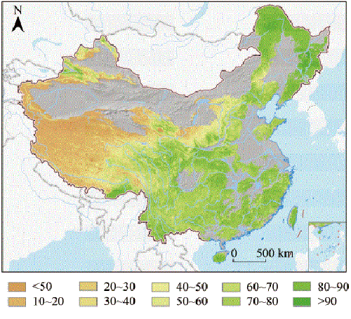
Fig.3 Vegetation coverage of headwater conservation region
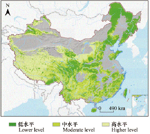
Fig.4 Ecological security pattern for headwater conservation
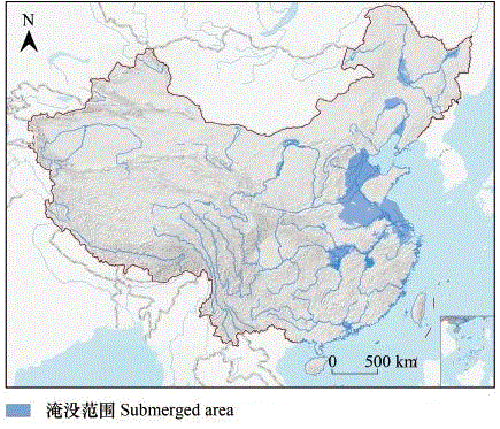
Fig.5 Flood simulation result
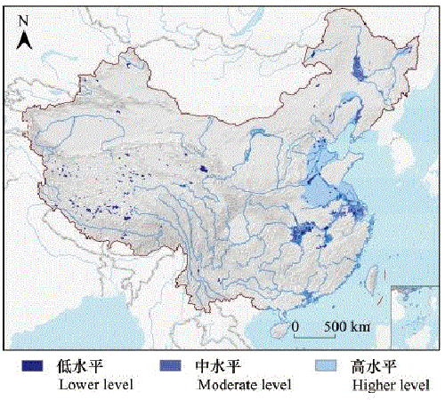
Fig.6 Ecological security pattern for flood control
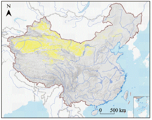
Fig.7 The source of desertification
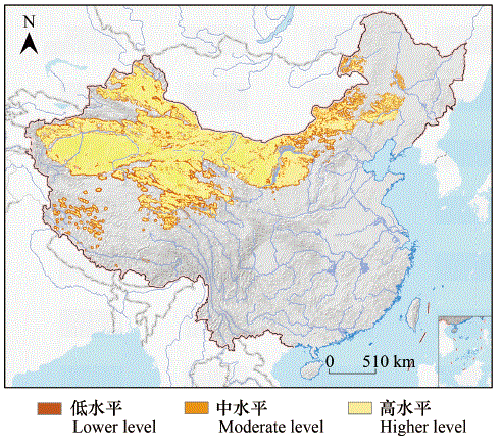
Fig.8 Ecological security pattern for desertification combating
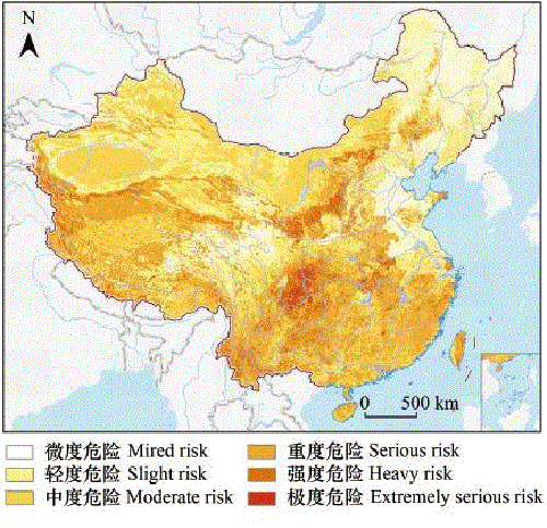
Fig.9 Potential soil erosion risk assessment result
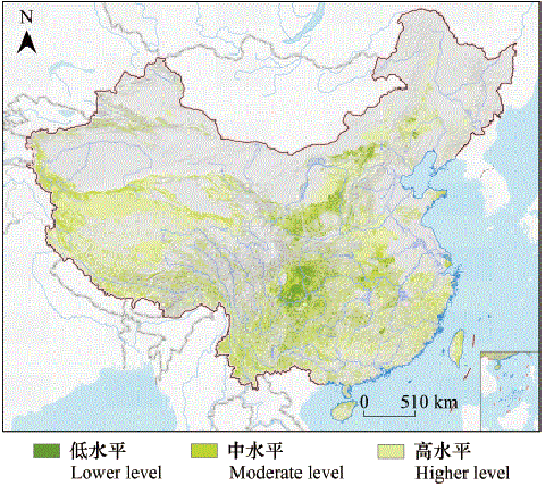
Fig.10 Ecological security pattern for soil and water conservation

Fig.11 Key region for flora protection
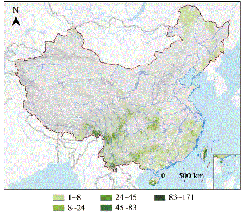
Fig.12 Key region for fauna protection
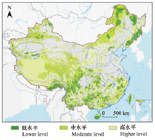
Fig.13 Ecological security pattern for biodiversity protection
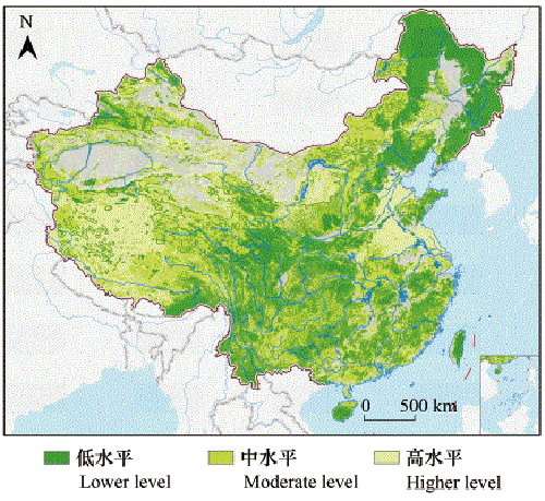
Fig.14 Ingrated national ecological security pattern
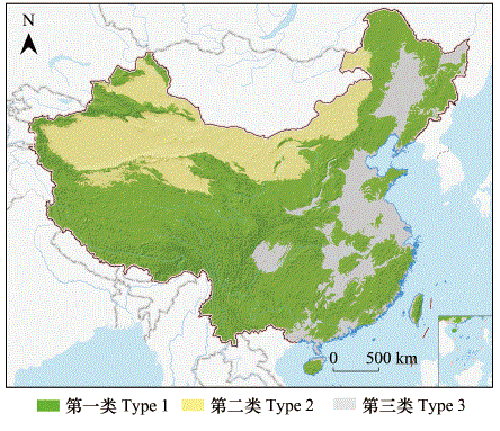
Fig.15 Ingrated national ecological security pattern type
