POST: 中国的“海绵城市”是什么?城市洪水解决方案正在全国各地进行试验,以应对日益致命的问题

What does water want? This radical question runs counter to mainstream culture’s well-established urge to control water with dams and levees. But as increasingly severe and frequent floods and droughts strike people around the world, “water detectives” are realising that it’s not just climate change amping up these disasters, but also our development choices: urban sprawl, industrial agriculture, and even the engineering we use to try to control water.
As China’s cities face more and more flooding, scientists and engineers are finding new ways to bring cities more in line with natural water flows, as Erica Gies explains in this excerpt from her book Water Always Wins: Thriving in an Age of Drought and Deluge (2022).
In its liquid state, with sufficient quantity or gravity, water can rush across the land in torrential rivers or tumble in awe-inspiring waterfalls. But it is also inclined to linger to a degree that might surprise many of us, because the infrastructure of the modern world has erased so many of water’s slow phases, instead confining it, containing it, or speeding it away.
These slow stages are particularly vulnerable to human interference, because they tend to occur in flatter places – once floodplains and wetlands – that we blocked or drained so that we could settle.

Erica Gies, author of Water Always Wins: Thriving in an Age of Drought and Deluge.
But when water slows and stalls on land, that’s when the magic happens, providing habitat and food for many forms of life above and below. The key to greater resilience, say the water detectives, is to find ways to let water be water, to reclaim space for it to interact with the land.
Innovative water management projects aim to slow water on land in some approximation of natural patterns. For that reason, I’ve come to think of this movement as “Slow Water”.
Like the Slow Food movement – founded in Italy in the late 20th century, in opposition to fast food and all its ills – Slow Water approaches are bespoke: they work with local landscapes, climates and cultures rather than try to control or change them.
The engineered response to water scarcity has usually been to bring in more water from elsewhere. But desalinating and transporting water consumes a lot of energy: in California, for example, the giant pumps that push water south from the Sacramento Delta are the state’s largest user of electricity.
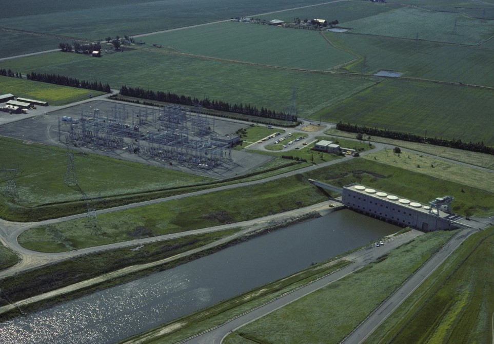 A pumping station near Tracy, in the US state of California. Photo: Tribune News Service via Getty Images
Withdrawing water from one basin and moving it to another can deplete the donor ecosystem, or introduce invasive species to the receiver. Water engineering is also an environmental justice issue. Between 1971 and 2010, 20 per cent of the global population gained water from human interventions on rivers, including dams, but 24 per cent were left with less water, according to a 2017 study.
Bringing in water from elsewhere can also harm the people receiving it. A big new reservoir imparts a false sense of security – when we live long distances from the source of our water, we don’t understand the limits of its supply, so we’re less likely to conserve it.
We also don’t understand how the water we use supports its local ecosystem. By over-expanding human populations in places where there isn’t enough local water, we make those places and those people more vulnerable to drops in supply. Water transfers also create a well documented cycle of scarcity, akin to the way that adding more lanes to a motorway just attracts more cars.
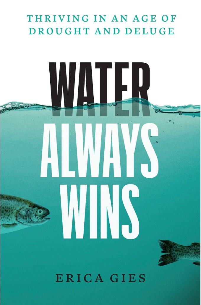
Cover of Water Always Wins: Thriving in an Age of Drought and Deluge, by Erica Gies.
Nowhere has urbanisation happened more rapidly than in China, where a mass exodus from the countryside over the last 40 years has seen the number of urban dwellers boom, from around 20 per cent of the population in 1980 to almost 64 per cent in 2020. Cities sprawled and new ones were built from scratch.
Builders paved floodplains and farmland, felled forests and channelised rivers, leaving stormwater that once filtered into the ground with nowhere to go but up and over levees. Then, one notable flood struck the national government where it lives.
On July 21, 2012, Beijing was hit by its largest storm in 60 years. As much as 46cm of rain fell on some parts of the city, filling underpasses and flooding roads a metre deep. Landscape architect Yu Kongjian barely made it home from work. “I was lucky,” he says. “I saw many people abandon their cars.”

Landscape architect Yu Kongjian, co-founder of Turenscape. Photo: Turenscape
Seventy-nine people died, many of them drowned in their vehicles, electrocuted or crushed by collapsed buildings. The damage stretched across 14,000 sq km (5,400 square miles), costing nearly US$2 billion.
Yu, co-founder of the acclaimed landscape architecture firm Turenscape and a leading figure in the Slow Water movement, was frustrated. He had warned the government years earlier that disaster was coming.
He had led a research team in mapping what he called the city’s “ecological security pattern”, showing the government which parcels of land were at high risk of flooding, and urging it to block development and instead to use them to absorb stormwater. They ignored his recommendations.
“The 2012 flood taught us the lesson that the ecological security pattern is a life-and-death issue,” Yu told me when I met him in Beijing in 2018.
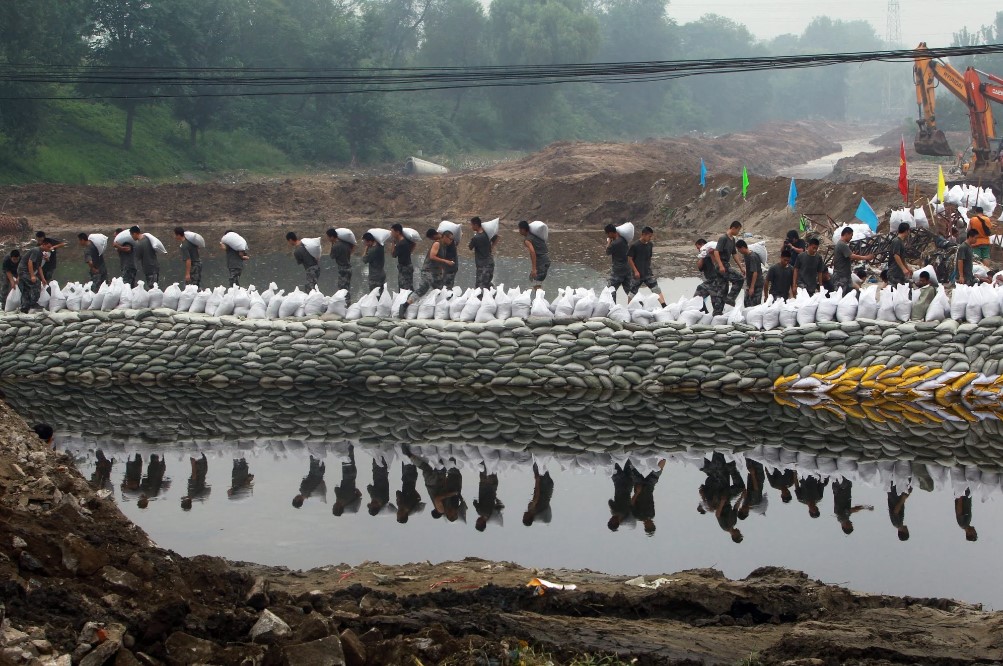
Rescuers pile sandbags along a riverbank to prevent more flooding in Fangshan, the worst-hit area in Beijing after the Chinese capital was struck by its largest storm in 60 years in July 2012. Photo: AFP
Urban sprawl is exacerbating water scarcity in China, especially in the north and west. In some of China’s densest cities, because of rain running off buildings, streets and car parks, only around 20 per cent of precipitation soaks into the soil.
Instead, as in many other cities around the world, drains and pipes funnel it away – lunacy, Yu thinks, in a place with water shortages. Beijing is pretty dry outside the summer monsoon season. For decades, the city has pumped groundwater to supply its growing population and rising rates of consumption. This is lowering the water table by about a metre each year, causing the ground to sink as well. This phenomenon is also happening elsewhere, such as in Mexico City and California’s San Joaquin Valley.
But now Yu is leading the way as China re-engineers old cities and designs new ones to accept rather than fight natural water flows. His landscape architecture projects incorporate Slow Water principles in order to lessen floods, save water for dry spells and reduce water pollution.
The 2012 Beijing disaster was a turning point. A month later, a Turenscape stormwater project in Harbin, a city about 1,300km (800 miles) northeast of Beijing, won a top design prize in the United States. Chinese state television broadcast a high-profile interview with Yu. He said a government minister told him afterwards that President Xi Jinping had seen it.
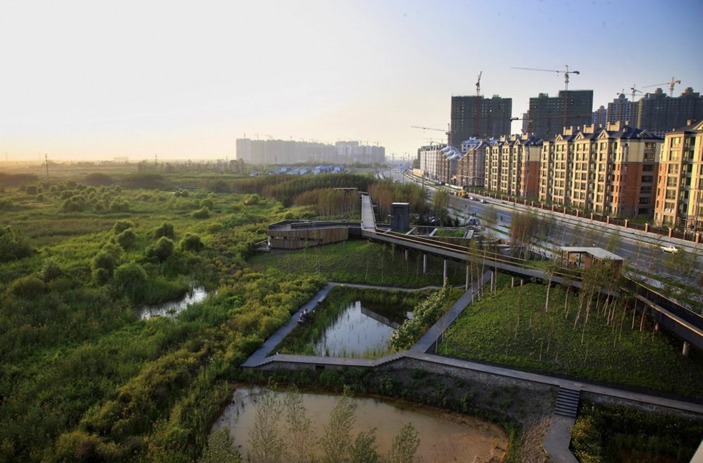
Artist’s impression of the Qunli Stormwater Park in Harbin, in Heilongjiang province, designed by Turenscape. Photo: Turenscape
Less than a year later, Xi stood in front of China’s national urbanisation conference and announced his sponge city initiative, boosting the idea from fringe concept to national mission. It is part of Xi’s Ecological Civilisation agenda, which aims to clean up the pollution, flooding hazards and associated costs caused by his predecessors’ industrial civilisation.
With its centralised government, China built its industry and its economy at a blistering pace. Similarly, now it is pursuing sponge cities on a scale difficult for most countries to even consider.
Globally, urban flooding has become particularly acute as the land area covered by cities worldwide has doubled since 1992. Researchers from Johns Hopkins University calculated how impervious surfaces increase flooding: every time a city increases coverage of absorbent soil with roads, pavements or car parks by 1 per cent, run-off boosts the annual flood magnitude in nearby waterways by 3.3 per cent.
To counteract this trend, sponge cities seek places throughout urban areas for water to sink into the ground.
Artist’s impression of the Qunli Stormwater Park in Harbin, in Heilongjiang province, designed by Turenscape. Photo: Turenscape
The system works best when these features are linked together so the water can travel along some approximation of its natural path. Cities can convert old industrial areas beside rivers into parks, and cut through paving to make way for run-off channels lined with water-loving plants, infiltration ponds and seepage wells.
The idea is to mimic nature as much as possible. Where human space is non-negotiable, designers sometimes use surrogates, such as permeable paving and green roofs that can absorb water.
In 2015, the Chinese government began demonstration projects in 16 cities, adding 14 more in 2016. Each project covered at least 13 sq km, although some were much larger. Objectives included reducing urban flooding, retaining water for future use, cleaning up pollution and improving natural ecosystems.
The goal was, by 2020, for each project to retain 70 per cent of the average rainfall on site, both to help prevent flooding and to store water underground for the dry season.
During heavy rains in 2021, one pilot city, Zhengzhou, still suffered significant flooding and deaths. Absorbing rainfall across 13 sq km of a city that spans thousands wasn’t enough to avert disaster.
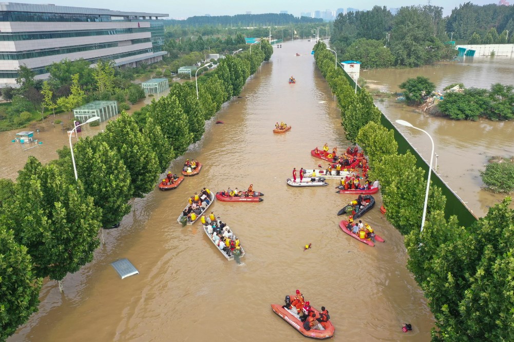
Zhengzhou, in Henan province, is one of 31 Chinese pilot cities where at least 13 sq km has been set aside to absorb stormwater. However, this flood in 2021 showed the scheme was not large enough. Photo: Getty Images.
Yu and other urban water detectives are looking to manage water to a grander extent, seeking out connected routes for water to slow and flow across entire watersheds, which often extend beyond jurisdictional boundaries. Solving a city’s flooding problems requires coordination with communities and landowners upstream.
Ideally urban designers could absorb water where it falls, reducing stormwater run-off at every rooftop and every field upstream. Yu is dreaming beyond sponge cities to sponge land.
“This is a philosophy for taking care of the continental landscape,” he tells me. “It’s time to expand the scale.”
When planning a project, Yu and other urban designers start by trying to figure out what water did before a city spread, and what it does now within its current confines.
Like many of the water detectives I met, the staff at Turenscape use spatial mapping software from the Environmental Systems Research Institute (ESRI), which can map watersheds from mountains to ocean, modelling floods, plant succession, infrastructure and much more.
The tool allows designers to comprehend complex systems and interrelated challenges, such as how to reduce flooding while also preserving other species, building smarter cities and reducing resource waste.
The first thing planners plot is topography, or the highs and lows of the landscape – a primary factor in how water flows.
Models also include soil type, which can dramatically affect how water drains; and vegetation, because that affects how much water soaks in, runs off or evaporates from plants into the air. Plus, soil acidity can affect which plants will thrive or die in a restored area.
Turenscape also models historic and ecological data, as well as information on the local population, economy and transport systems.
The data comes from various sources. Hydrology records can help to predict rainfall and flooding more accurately. Topography data can be gathered by aeroplanes with lidar sensors, which use lasers to survey under buildings. City maps can show transport corridors, parks, domestic gardens and industrial buildings with giant roofs.
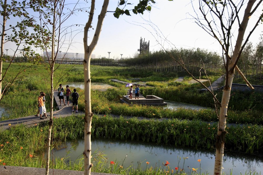
Artist’s impression of the Qunli Stormwater Park in Harbin, in Heilongjiang province, designed by Turenscape. Photo: Turenscape
Getting good soil data in urban areas can be tricky because builders often move soil from one place to another. To know for sure what’s down there, engineering firms typically drill a hole and take a core sample.
With this information, Slow Water practitioners can better understand how a particular variable affects the way water behaves. When their landscape maps are complete, they send test floods through the digital model they’ve created. These experiments allow them to identify pinch points where water is constrained and will flood first.
Then they experiment with a topography adjustment or the addition of a wetland or pond to see how each affects stormwater behaviour.
Yu told me he traces his passion to repair humans’ relationship with water back to the agricultural commune where he grew up, in Zhejiang province, southwest of Shanghai. There he observed the Chinese “peasant wisdom” for managing water, practised for thousands of years.
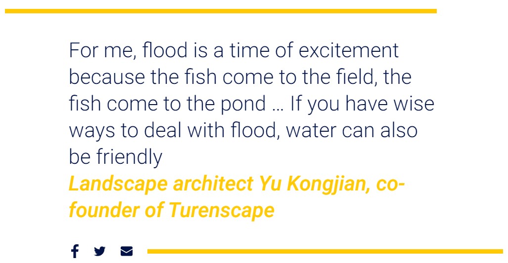
Farmers maintained little ponds and berms to help rainfall soak into the ground, storing it for a dry day. The seasonal creek next to his village swelled and retreated with the seasons. “For me, flood is a time of excitement because the fish come to the field, the fish come to the pond.” He saw that flooding need not be the enemy. “If you have wise ways to deal with flood, water can also be friendly.”
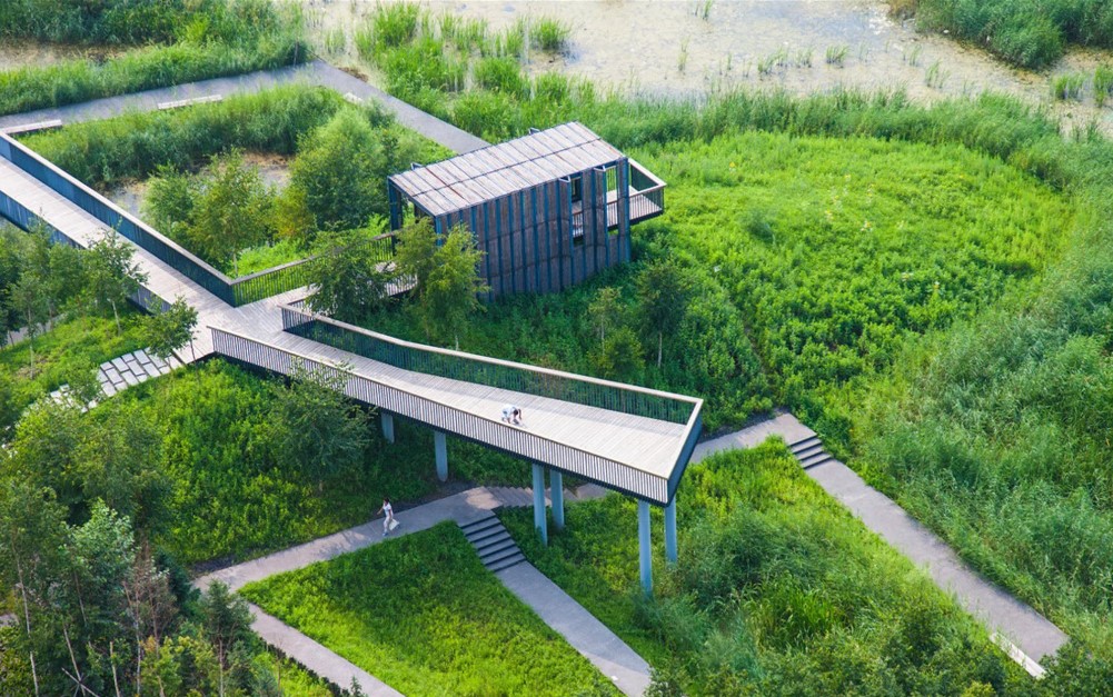
A week after meeting Yu, I visited one of Turenscape’s projects in progress, Yongxing River Park, located in Daxing, a far-flung exurb of Beijing. Satellite images from three years earlier showed open land surrounding the river, which was straightened and confined by steep concrete walls.
Today those images are chock-a-block with buildings around a more generous, meandering path for water. The project was nearly complete when I saw it in April 2018. About 4km long and perhaps two city blocks wide, the park follows the river.
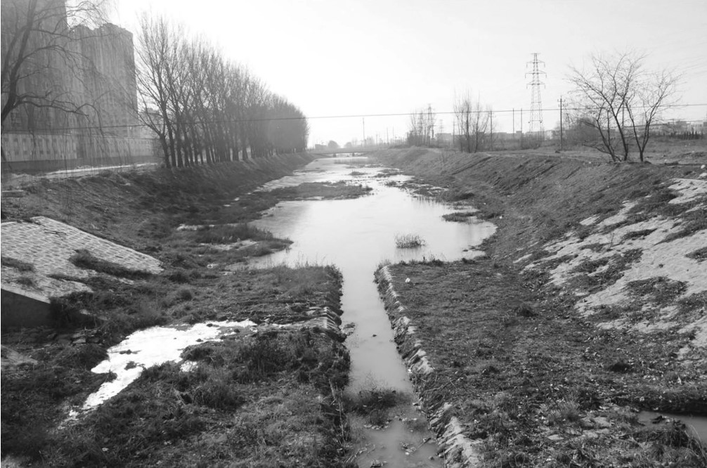
Beijing’s Yongxing River before redevelopment by Turenscape. Photo: Turenscape
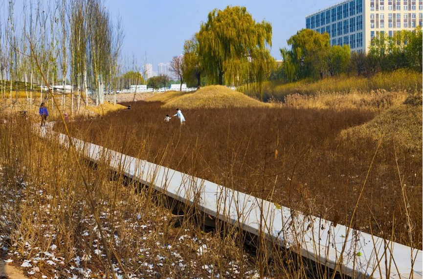
Artist’s impression of the Yongxing River Greenway, designed by Turenscape. Photo: Turenscape
Workers removed concrete along the river channel and excavated soil to widen the riverbed. That dirt was then moulded into a large berm running down the centre, creating two channels. The river flows on one side, while the other channel has large holes of varying depths that act as filtration pools and direct the water flow.
During the dry season, the filtration side is filled with partially cleaned effluent from a sewage treatment plant. Wetland plants in the pools slow the water, further cleaning it and allowing some of it to filter into aquifers. During monsoon season, that channel is reserved for floodwaters, and the effluent is treated industrially.
The broader riverbanks, newly freed from concrete, are dotted with thousands of small plants in closely set rows to hold the earth. As we walk the path between the two channels, we pass young willow trees scaffolded together with sticks for strength while they grow.
Willows, a native streamside plant beloved by beavers, have roots that reach for the air, like cypress and mangroves, allowing them to survive extensive periods of flooding. Elsewhere, reeds, small bushy willows, dwarf lilyturf and other native plants stabilise the soil. Existing large trees, including elms and poplars, were retained.
During big rains in 2020, Yu sent me photos of Yongxing River Park. The trees and grasses had grown considerably since I’d seen it two years earlier, turning it into a lush, green oasis. The channel contained a good amount of water, but was nowhere close to over-topping.
All Slow Water projects must factor in local climate, soil and hydrogeology. Consider two Chinese cities with diametrically opposed water needs. Kunshan, in Jiangsu province near Shanghai, is built on polders – land reclaimed from water with levees. The water table is so high that surface water does not soak away, but filtration – cleaning the water – is necessary.
Hotan, a desert city in far western Xinjiang province, gets less than 4cm of rainfall a year on average, so it needs to protect its groundwater supply.
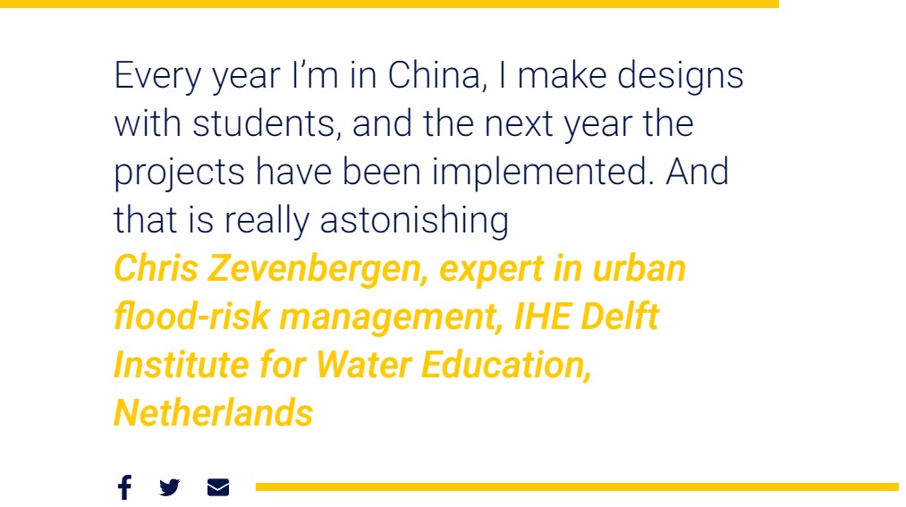
If China ignores this specificity, its broad ambition for sponge cities may falter, says Chris Zevenbergen, an expert in urban flood-risk management at the IHE Delft Institute for Water Education, in the Netherlands, and a visiting professor at China’s Southeast University.
The rush to develop cities in the past 20 years did not allow builders time to understand imperfections in design and make changes. That is what led to cities across China experiencing the same problem at the same time: widespread urban flooding.
Rushed implementation of sponge cities initiatives could also lead to missteps. Xi’s programme has strict deadlines, which may not allow time to monitor performance, adjust if necessary and transfer knowledge. It “takes time to learn and to reflect”, Zevenbergen warns.
A paper written by Chinese government research institutes in 2017 expressed similar concerns about a cookie-cutter approach. Although Zevenbergen expects the Chinese will make a lot of mistakes along the way, he thinks that “in the end, they will become the leaders in sponge cities. The same happened in the realm of renewable energy”.
The country has a culture of getting things done. “Every year I’m in China, I make designs with students, and the next year the projects have been implemented. And that is really astonishing.”
Water Always Wins – Thriving in an Age of Drought and Deluge, by Erica Gies, is published by Head of Zeus.
来源:https://www.scmp.com/magazines/post-magazine/long-reads/article/3184471/what-are-chinas-sponge-cities-urban-flooding
