Qinhuangdao Forest Park
- 摘要:
- Planted in the 1950s, the Qinhuangdao Forest covers 233 hectares (576 acres). The city of Qinhuangdao is a port city in Hebei Province renowned for being the worlds biggest coal hub and its proximity to the eastern end of the Great Wall of China. Forestation was both an attempt to form a windbreak for the city, and a way of mitigating the coastal erosion that was threatening rail links to the strategically important city on the edge of the Bohai Sea.
文献来源:Turenscape/Kongjian Yu, Qinhuangdao Forest Park, [M].Eco-Landscape Design, Springer,2014: 28-33.
Planted in the 1950s, the Qinhuangdao Forest covers 233 hectares (576 acres). The city of Qinhuangdao is a port city in Hebei Province renowned for being the worlds biggest coal hub and its proximity to the eastern end of the Great Wall of China. Forestation was both an attempt to form a windbreak for the city, and a way of mitigating the coastal erosion that was threatening rail links to the strategically important city on the edge of the Bohai Sea.
The fast growing species of poplar (Populus Tomentosa and Populus Canadensis) thrived alongside the black locust (Robinia Pseudoacacia) forming a dense, if monotonous forest punctuated only by rice paddies and fish ponds; most of which fell into decline when the area was designated a National Forest Park in 1993. In the 21st century the growing demand for public amenities beyond the confines of the city focused attention on the rejuvenation of the Qinhuangdao Forest.
The objectives set for the design team were detailed as follows:
Enrich and rejuvenate monotonous overgrown forest to enhance scenic value and biodiversity.
Rejuvenate the fishponds and agricultural land bringing them into the public realm for recreation and educational purposes.
Dramatically improve accessibility for all visitors to the Forest Park.
Achieve all of the above mindful of budget and programme.
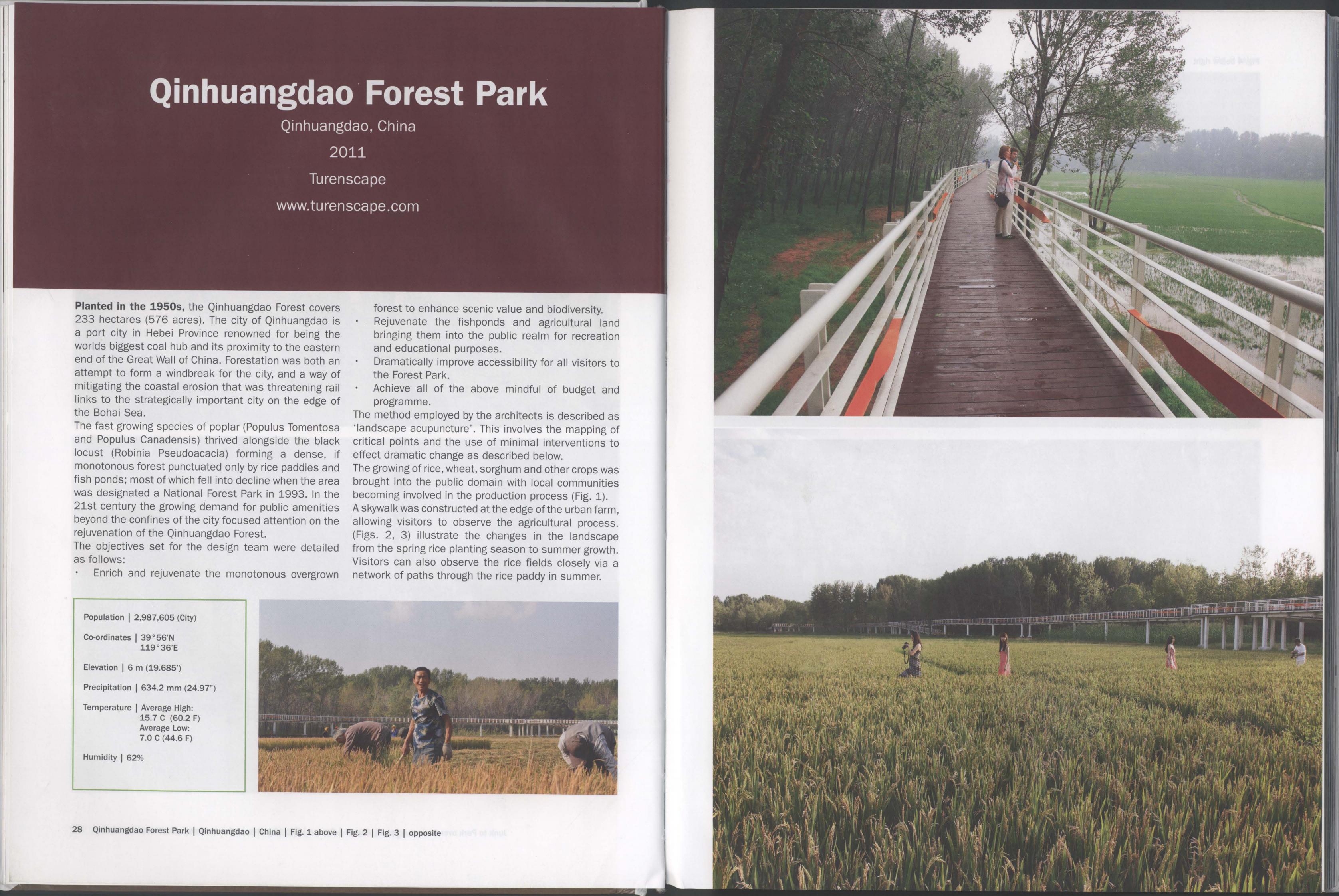
The method employed by the architects is described as 'landscape acupuncture'. This involves the mapping of critical points and the use of minimal interventions to effect dramatic change as described below.
The growing of rice, wheat, sorghum and other crops was brought into the public domain with local communities becoming involved in the production process (Fig. 1).
A skywalk was constructed at the edge of the urban farm, allowing visitors to observe the agricultural process. (Figs. 2, 3) illustrate the changes in the landscape from the spring rice planting season to summer growth. Visitors can also observe the rice fields closely via a network of paths through the rice paddy in summer.
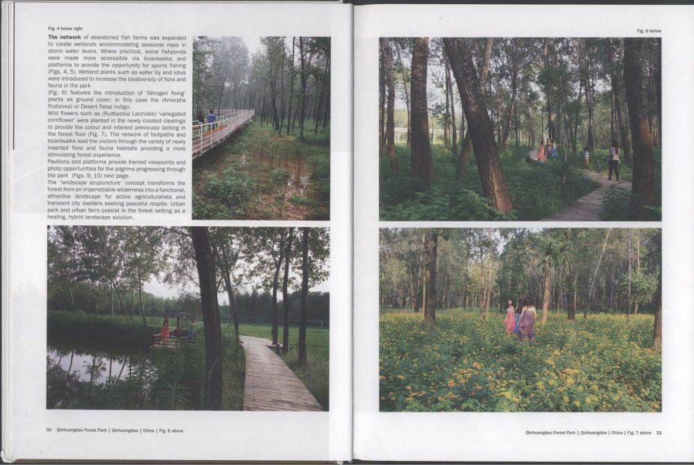
The network of abandoned fish farms was expanded to create wetlands accommodating seasonal rises in storm water levels. Where practical, some fishponds were made more accessible via boardwalks and platforms to provide the opportunity for sports fishing (Figs. 4, 5). Wetland plants such as water lily and lotus were introduced to increase the biodiversity of flora and fauna in the park
(Fig. 6) features the introduction of 'Nitrogen fixing'plants as ground cover; in this case the (Amorpha Fruticosa) or Desert False Indigo.
Wild flowers such as (Rudbeckia Laciniate) 'variegated cornflower’were planted in the newly created clearings to provide the colour and interest previously lacking in the forest floor (Fig. 7). The network of footpaths and boardwalks lead the visitors through the variety of newly inserted flora and fauna habitats providing a more stimulating forest experience.
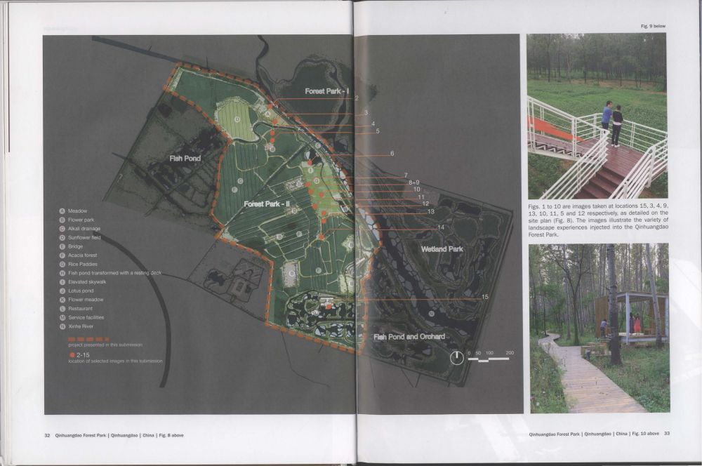
Pavilions and platforms provide framed viewpoints and photo opportunities for the pilgrims progressing through the park (Figs. 9, 10) next page.
The 'landscape acupuncture’concept transforms the forest from an impenetrable wilderness into a functional, attractive landscape for active agriculturalists and transient city dwellers seeking peaceful respite. Urban park and urban farm coexist in the forest setting as a healing, hybrid landscape solution.


