Kunming Greenways
Project Information
- Project Location:
- China Kunming,Yunnan
- Project Scale:
- 14 Hectares
- Design Time:
- May 2009
- Build Time:
- July 2010
- Client:
- Kunming Municipal People's Government
- Related Papers
Project Profile
1. Project Statement
China’s development pressures are tremendous and environmental and socio-cultural consequences devastating. Throughout China, rivers are channelized and hardly recognizable as the cultural gathering and social centers they once were. In Kunming (capital of Yunnan Province), the Pan Long River (Kunming’s ‘mother river’) has become a hardened landscape (with no natural edges) and a sewer for parts of the city. The project (re)develops the landscape structure in tandem with new urbanization and urban/rural requalification across scales.
2. Objective and Challenge
Kunming (population 5.7 million) is the capital and the largest city in the Yunnan Province in southwest China. It lies in the fertile lake basin of the Yungui Plateau at 1900m above sea level is surrounded by lakes and limestone hills. It is located near the border with Southeast Asian countries and has always had a special link to that region, as well as to India and Tibet. Kunming is known for having one of the mildest climates in China and for its Dianchi Lake (“the pearl of the plateau”) — China’s 6th largest fresh water lake. The city and region is a huge horticultural center, the largest flower export base in Asian and has a growing tourist destination. Its scenic landscape is a quality of the region that requires safeguarding and land stewardship.
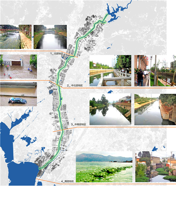
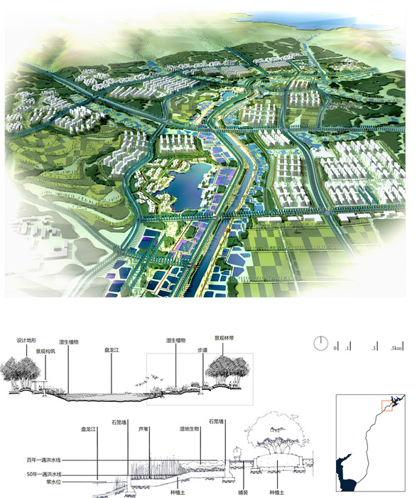
Kunming’s Pan Long River stretches 23km through the city’s central business district between the Song HuaBa Reservoir in the north and the Dianchi Lake in the south. The river is quite narrow (between 10-20m wide) and over the years has become channelized and embanked with 100-year-flood concrete steep slopes — and barely resembles a river anymore. At the same time, over the most recent decades, urban development has been proceeding at breakneck-speed and, as the permeable surface areas of the city decrease, the general risks of flooding in Kunming increase (during the summer, as the city has a subtropical highland climate). In addition, pollution in the river is increasing, due to, on the one hand, the fact that the city has an incomplete sewer network and a great deal of raw sewage that discharges directly into the region’s waterways and, on the other hand, the fact that there are a number of inappropriate land-uses along the riverfront (including industries and warehouses). As well, the river was once the cultural and social center of the city, and although there are number of important relics remaining they are mostly neglected and need re-linking to the ‘mother river.’ Today there is not convenient access to the riverfront and no natural buffers between the cityscape and the water.
3. Design Strategy
The Pan Long River Rejuvenation project, the planning of which was developed between 2008-9, works across multiple scales (region, city, and district) as well as in a realized stretch of the riverfront. In a most general sense it has four major objectives as follows:
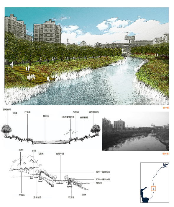
1] to reconfigure the Pan Long River as a channel to mitigate city’s floods (100-year flood) and (purified) stormwater, while, at the same time, giving public access to the riverfront in a friendly and landscape/ soft-engineered manner (requiring demolition of the hard concrete embankments);
2] to upgrade the Pan Long River and thereby rejuvenate the economy of the inner city and to more specifically increase the land values of the properties immediately adjacent to the riverfront itself;
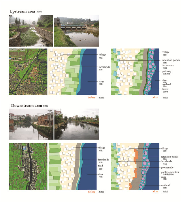
3] to pay particular attention to the upper and lower reaches of the river, where the farmland and rural land-use is dominant. It is evident that the territory is one in transformation, but the project seeks to build upon the inherent qualities of the particular landscape features adjacent to the northern reservoir and the southern lake;
4] to initiate ecological restoration along the Pan River and the region as a larger system to increase biodiversity (including to collect water in the wet season and to release it in the dry season), to strengthen the link between the natural and cultural heritage and to create new systems for recreational and public space uses for Kunming and the Yunnan Province.
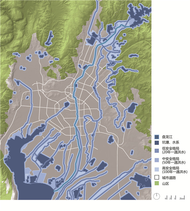
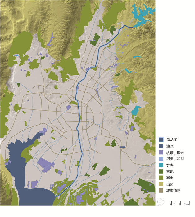
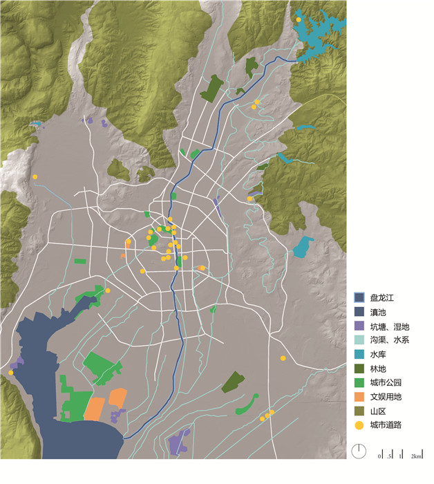
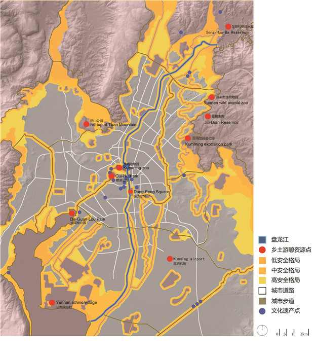
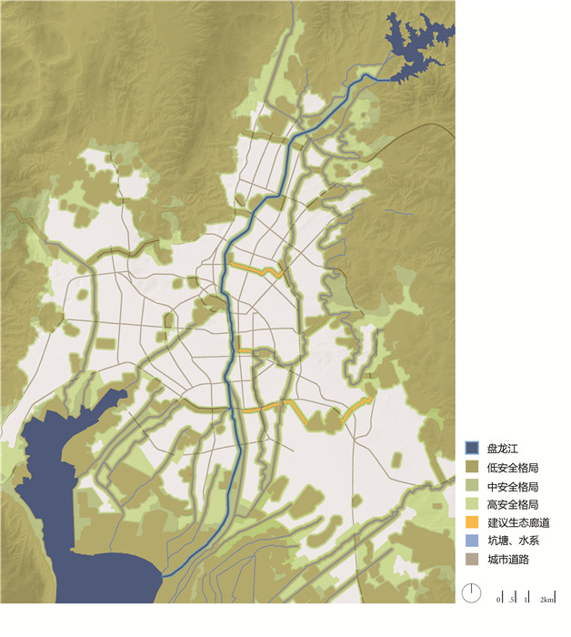
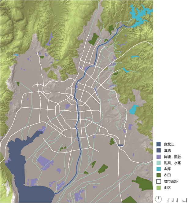
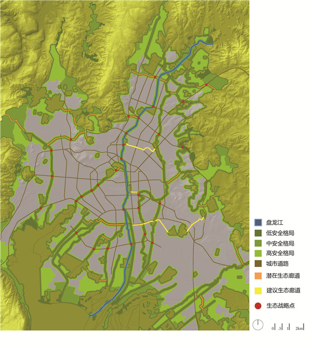
At the scale of the region, “ecological infrastructure” and “security patterns” were developed following analysis of existing conditions. Ecological infrastructure is intended to secure the integrity and identity of the landscape by identifying and working with essential natural, biological, and cultural processes. Ecological infrastructure includes both “defensive measures” (protecting threatened ecological networks) and “opportunistic” interventions to restore, complete, and integrate the damaged water network into the urban fabric. “Security patterns” identify the natural capital of ecology and stresses its non-renewable process-embedded value. The ecological infrastructure for Kunming, as a powerful tool for open public space conservation, focused on three categories of processes: abiotic (mainly water management), biotic (native species/biodiversity conservation), and cultural (heritage protection and recreation).
The strong analytical base for the project was provided by natural, cultural, and socio-economic data from GIS, and the interpretative maps led to projective design cartographies that were used to safeguard the three different processes in the landscape. The flood-security patterns at the regional scale sought alternative solutions to the usual engineered flood mitigation by capitalizing on the assets of the natural landscape and low- medium- and high- security patters were developed for 20- 50- and 100- year floods respectively. Landscape security patterns were set up to provide maximum natural water-retaining capacity. Stormwater management and flood protection depend on these interconnected networks of wetlands, low-lying grounds, waterways, and lakes—providing a sound substitute for concrete dams and riverbanks. The strategy for biodiversity conservation was built on analytical maps of land use and vegetation, combined with an analysis of habitat suitability (based on the spatial relationships between habitats and landscape ecological principles). Strategic points and critical areas were identified as the primary concerns for the management and design of interconnected ecological corridors. At the intersections of roads and the natural corridors, the proposed design interventions include underpasses for certain wildlife species and for water flows, plus bridges for animals.Security patterns for cultural heritage protection and recreation are also included, and these are based on careful analysis of the existing heritage site and potential linkages to it.
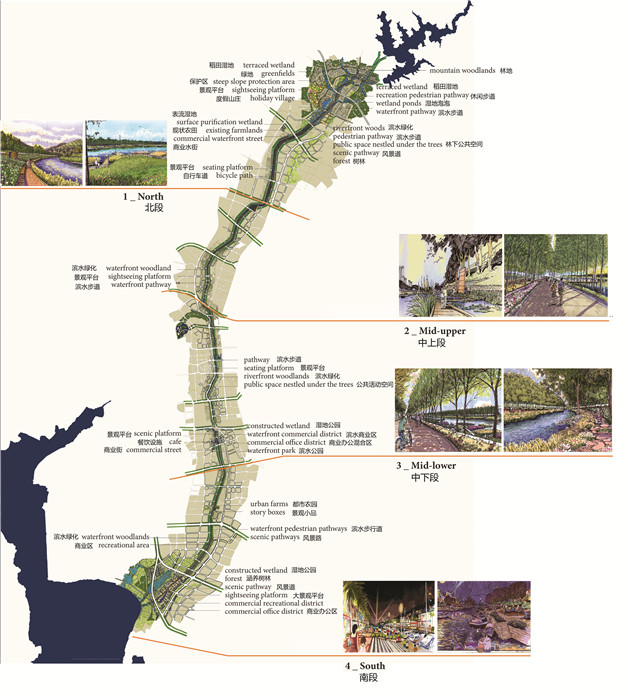
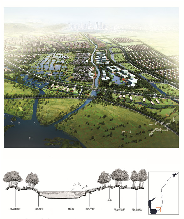
At the scale of the river itself, the 23km trajectory was analyzed also very carefully and recognized to have a number of very different inherent qualities. The north and south are presently rural, agricultural areas and this was considered a quality that could be respected in the new densification and development that would inevitably take place as urbanization continues its unstoppable pace. In a development plan for the area adjacent to the SongHuaBa Reservoir, new housing clusters are developed together with constructed wetlands and swales (in addition to protecting as many existing rural fish ponds and villages as possible) to create a new urban/rural morphology and housing typologies. In the area just north of the Dianchi Lake, existing villages are also maintained, the rice fields are converted into a wetland park to (re)purify water that is cleaned in a mechanical sewage treatment plant before releasing it into the Pan Long River. New urban development would complement the existing settlement structure, again creating a marriage of tradition and modernity and a host of new mixed-use morphologies and typologies. In the central stretched of the river — particularly through the CBD of Kunming— the river is upgraded and developed as a system of parks and gardens that links cultural amenities and creates public promenades and a low-speed traffic system for Kunming. A modification and adjustment of the existing morphologies and typologies along the greatest length of the river’s trajectory would significant change the quality of life in the city and shllow slopes along the banks would gives citizens accessibility to the riverfront once again and bring Kunming back to the Pan Long River.
4. Conclusion
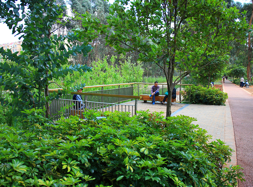
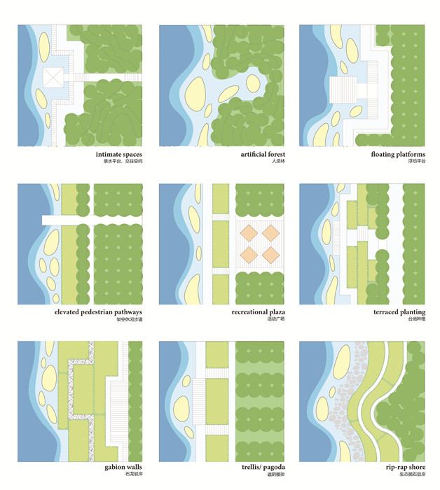
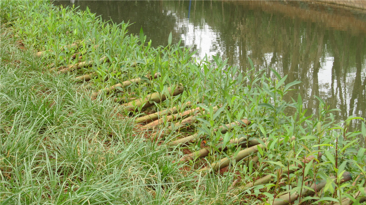
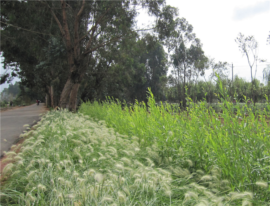
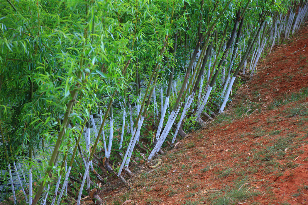
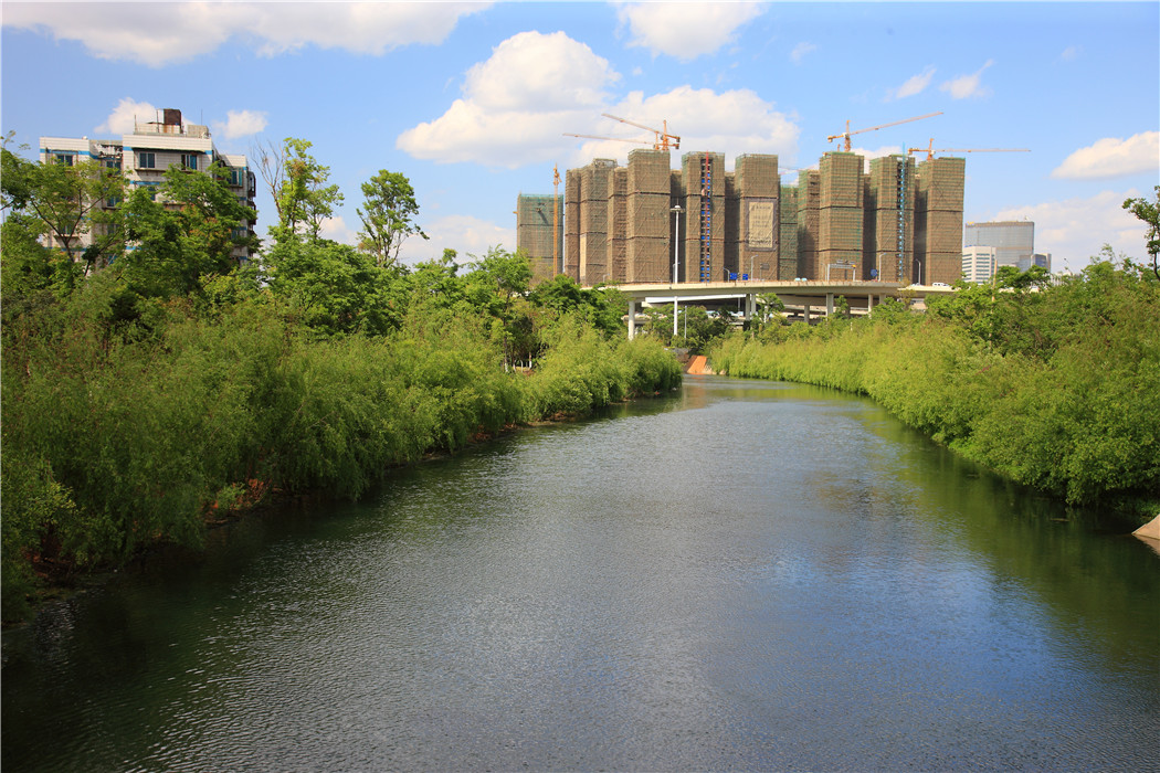
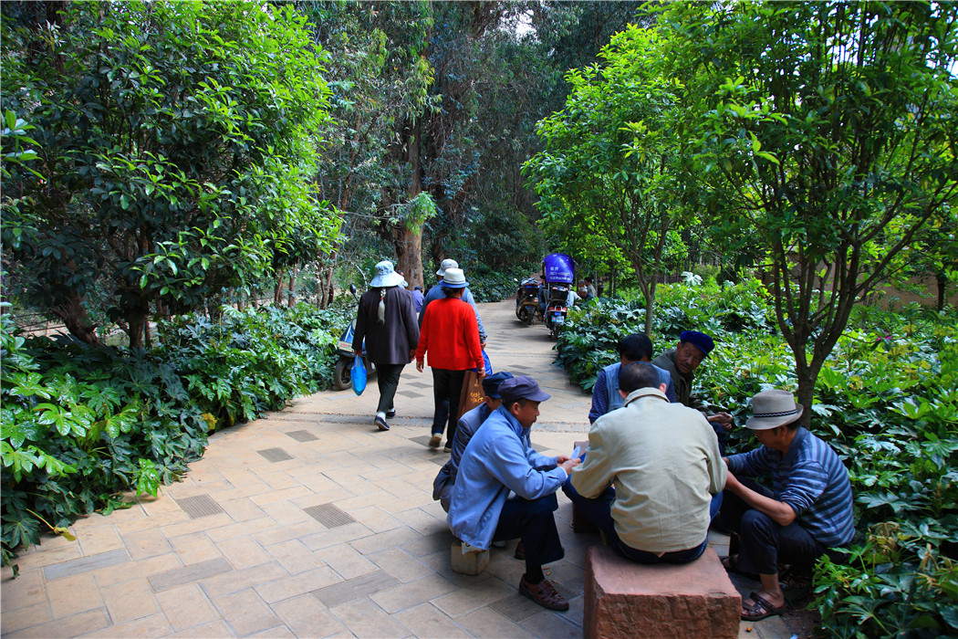
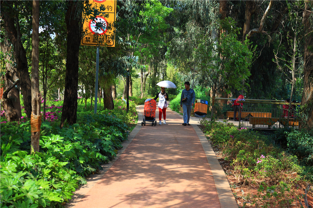
Phase I of the project was constructed between December 2009 and July 2010, and realized 8.3 km of the riverfront restoration of the downstream section of the river, from the Guannan Bridge to the mouth of the Dianchi Lake. The project includes riverbank stabilization using ecological engineering (live-staking and riprap) to strengthen the structure of the soil and provide added resistance to the erosive forces water flows; newly placed porous-paving bicycle and pedestrian trails along the river; native hydrology-based planting to restore the riparian system; and the inclusion of wooden platforms and urban furniture to create new social spaces along the riverfront. The dilapidated riverside has been transformed into a highly-used public green space and the river have once again been returned to the city as it s central spine.
Finally, the Pan Long River (as the mother river of Kunming) project is an important step for the recovery of the region’s 35 rivers (which are the source of pollution of the Dianchi Lake’s pollution). The mayor of Kunming has himself taken personal responsibility and supervised projects on the river and assigned each of his deputy mayor’s responsibility for the other rivers.
