Harbin Cultural Center Wetland Park

Project Information
- Project Location:
- China Harbin, Heilongjiang
- Project Scale:
- 118 Hectares
- Design Time:
- June 2011
- Build Time:
- July 2013
- Award List:
- 2016 Best Landscape Architecture of AZ Awards, 2016 Environmental Leadership Award of AZ Awards
- Related Papers
Project Profile
1. Project Statement
A deteriorated wetland was regenerated through adaptive design and turned into a working ecological infrastructure for stormwater management and the remediation of waste water from the city water supply plant. An otherwise inaccessible marsh was made accessible through minimal intervention of a network of boardwalks, paths and resting platforms, which are largely detached from the recovered natural habitats, allowing an intimate experience allowing visitors to touch nature without interrupting it processes.
2. Objective and Challenge
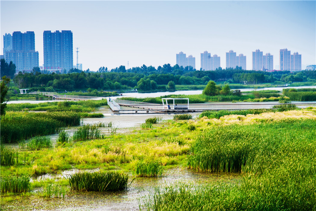
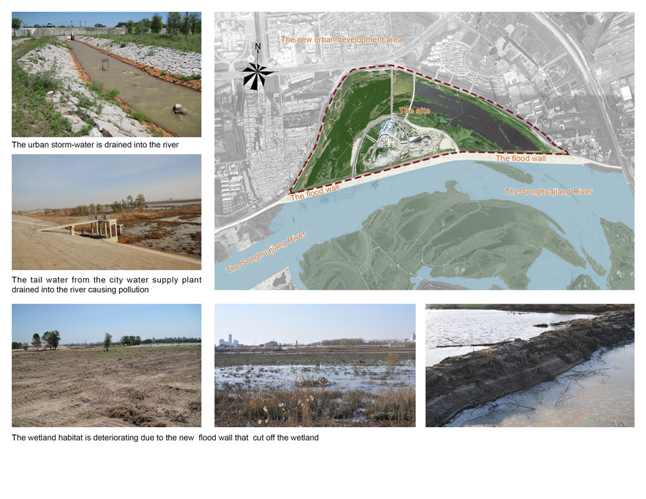
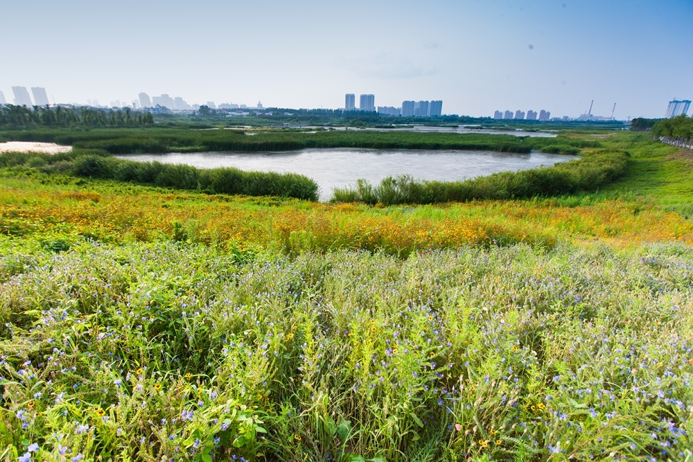
Harbin is one of the major Chinese cities in northeast area of the country, that are subject to flooding due to its location at the lower reach of the Songhuajiang River. An existing 500-year flood control wall along the riverbank cuts off a 200-hectare (494-acre) wetland from the main river. The wetland habitat was deteriorating due to the lack of water supply. Meanwhile, the rapid urban development north of the site caused severe storm-water inundation while the discharge of the contaminated storm-water caused the water quality of the river to decline. In addition, tail water from a newly built water supply plant dumps 1,500 cubic meters (53,000 ft3) of contaminated wastewater into the Songhuajiang River. The sum of these development and pollution inputs created worrisome problems for the local community. At the same time, public space is fervently desired due to the dramatic increase of urban population and development.
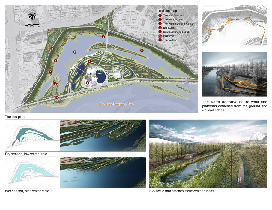
The initial understanding of the site was to turn the isolated wetland into a major park as well as a storm-water and wastewater remediation area that would enhance native wetland habitat. But thorny issues emerged as the result of further study. The landscape architect discovered that the seasonal change of the water table is as much as 2 meters (6’) between dry and wet seasons, which thwarts the intention to combine public spaces with a resilient wetland landscape. In addition, such a large public space would be difficult to manage since the restored native vegetation would soon become too messy and wild to allow access and used by the people year round.
The design objective was to use minimum intervention to fashion a water resilient wetland park, functioning as an integral ecological infrastructure that remediates storm-water and waste tail water from the water plant. In the process, the wastewater would rejuvenate the wetland habitat. Furthermore, the landscape architect determined that limited design interventions would best serve the project objectives and transform the wetland into an accessible public space, allowing urban residents to have an intimate experience of the recovered natural marsh.
3. Design Strategy
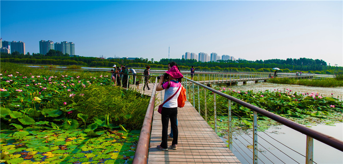
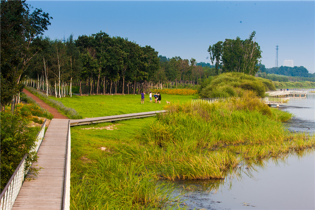
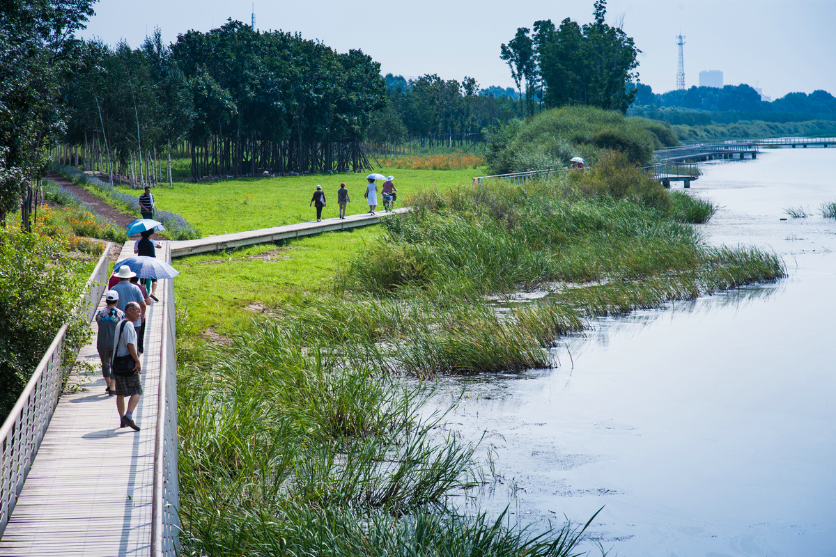
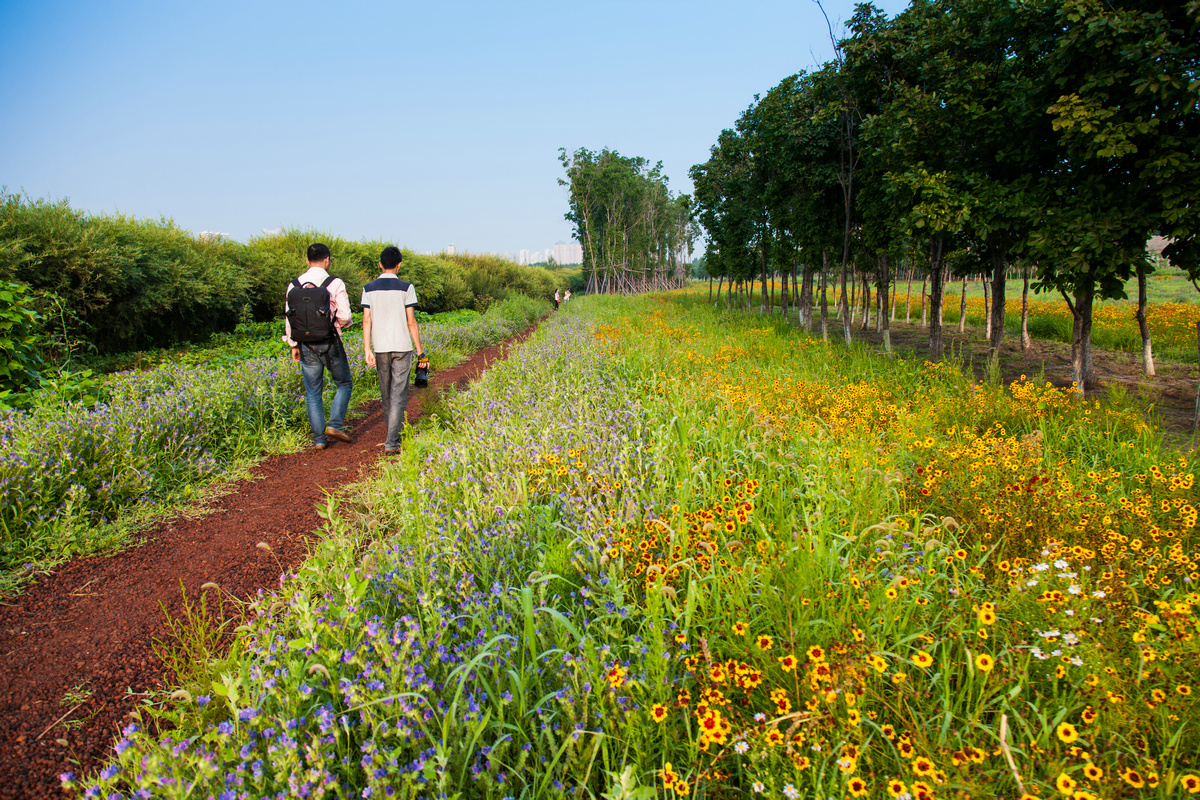
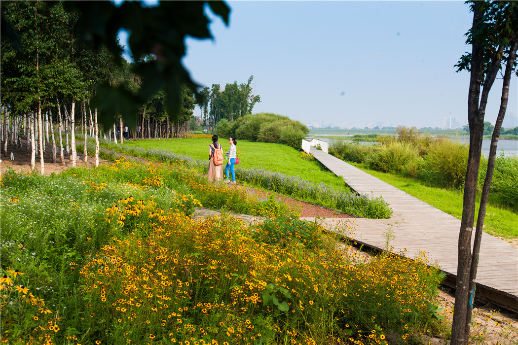
A working wetland: A series of bio-swales were designed for the periphery of the wetland park to catch and filter the storm-water runoff from the new development of the cultural center at the south and city at the north. Each day during the raining season, up to 20,000 cubic meters (706,000 ft3) of storm-water on average will drain into the wetland filtration system. The bioswales will reduce the sediment, suspended solids and heavy metals in the storm-water before it flows into the central part of the wetland. In addition, 1,500 cubic meters (53,000 ft3) of tail water from the nearby water supply plant is retained and treated in the wetland to avoid polluting the river. Adaptive revegetation was used in the design to accommodate the two-meter annual fluctuation of the water table. In the lower land, vegetation was left to respond to the process of natural succession. On the higher land, stretches of self-reproductive semi-natural meadow were sewn between the planted native tree groves (Betula platyphylla and Fraxinus mandschurica) to create color surprise in different seasons. Except for the minimum cut-and-fill earthwork necessary to create bio-swales, little grading was planned so that all of the existing trees and ground cover could be preserved.
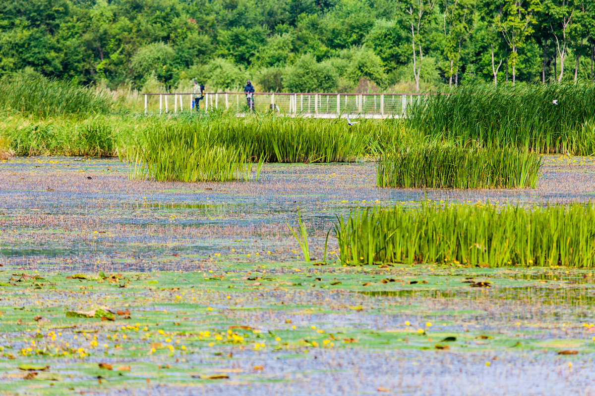
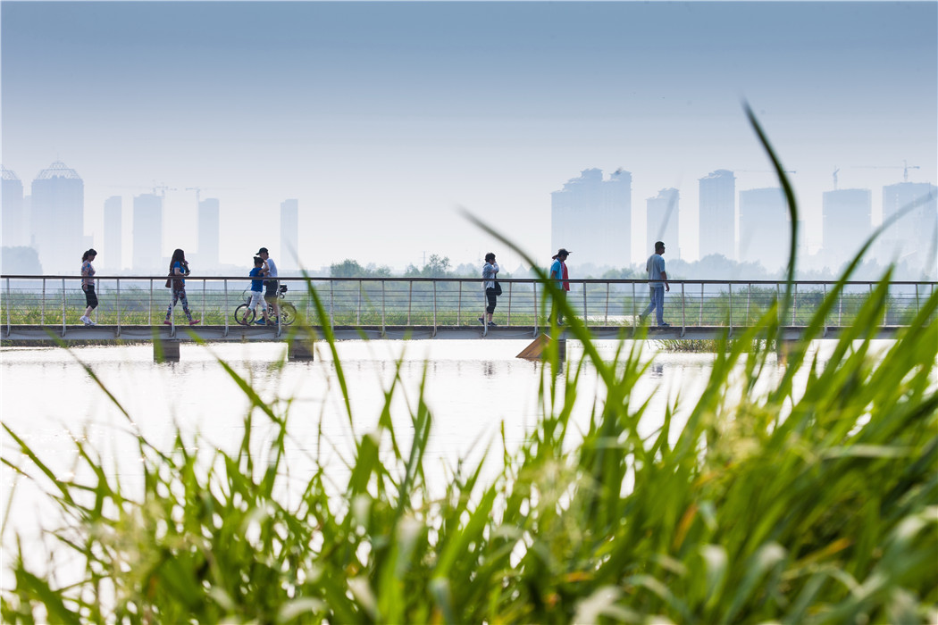
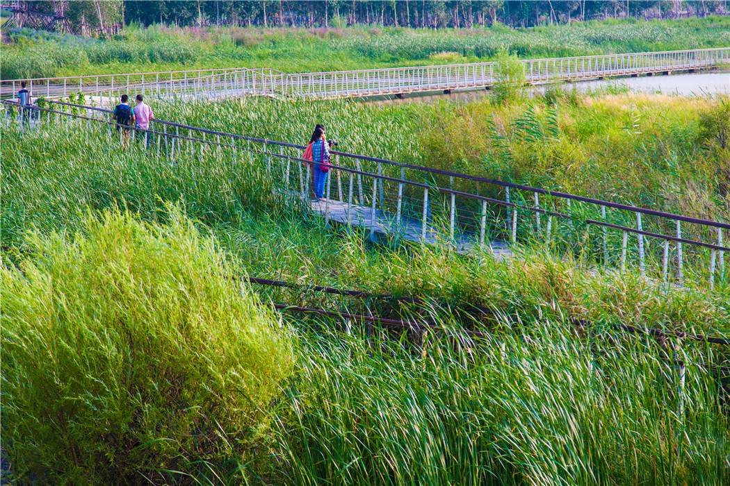
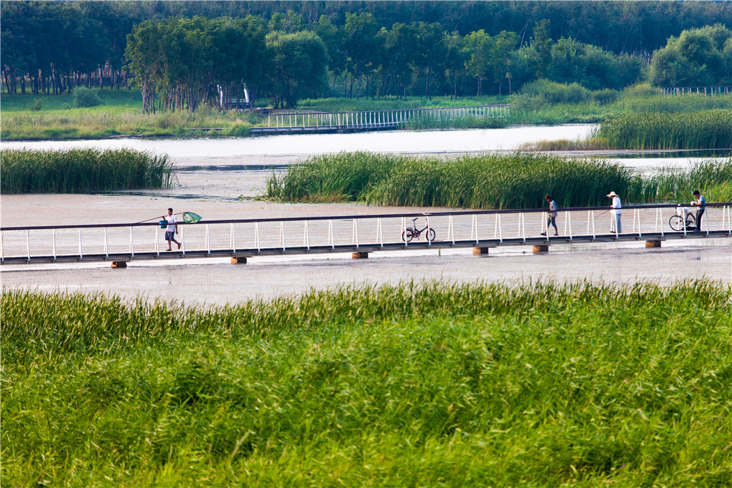
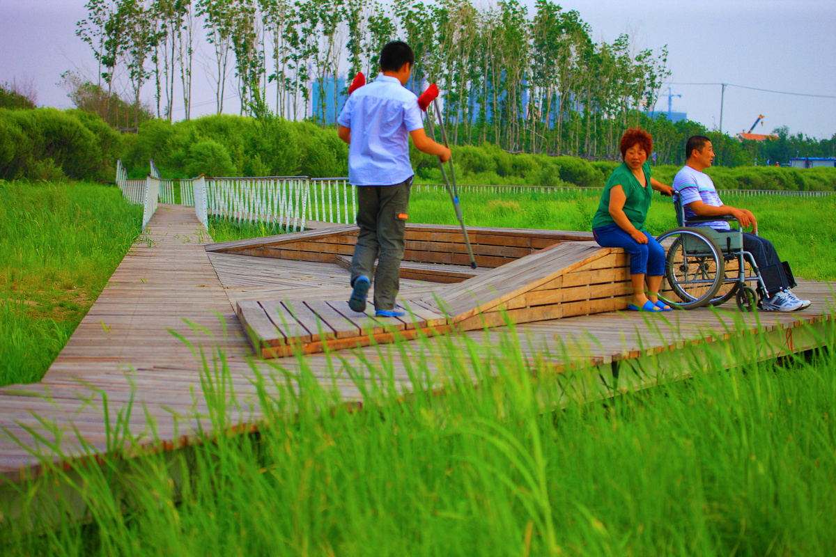
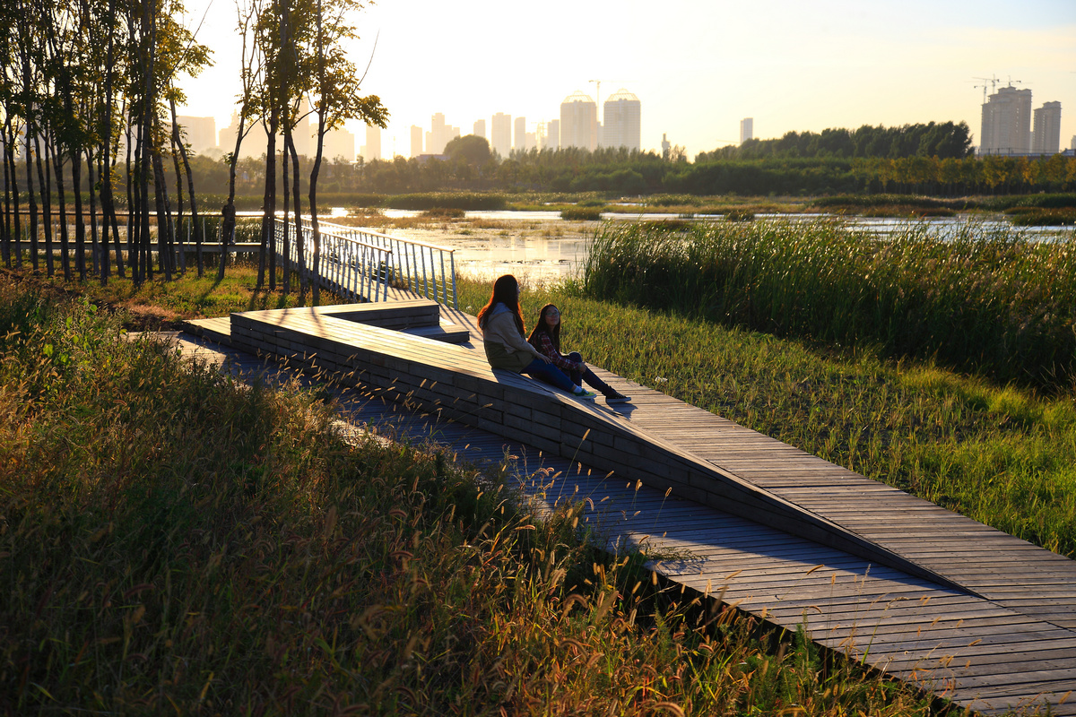
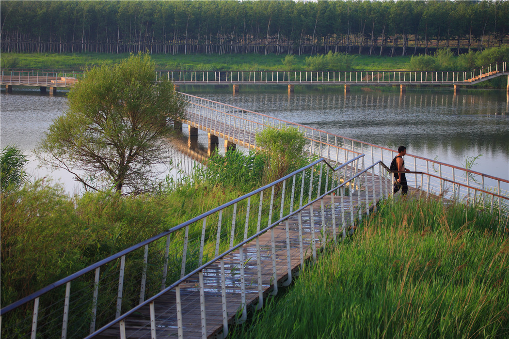
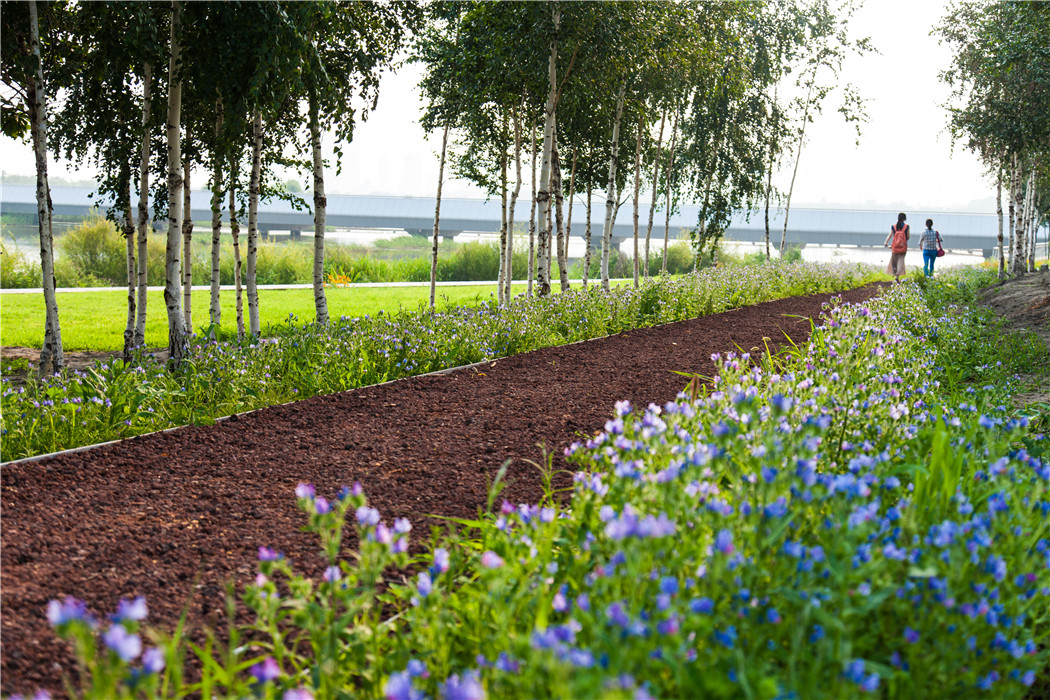
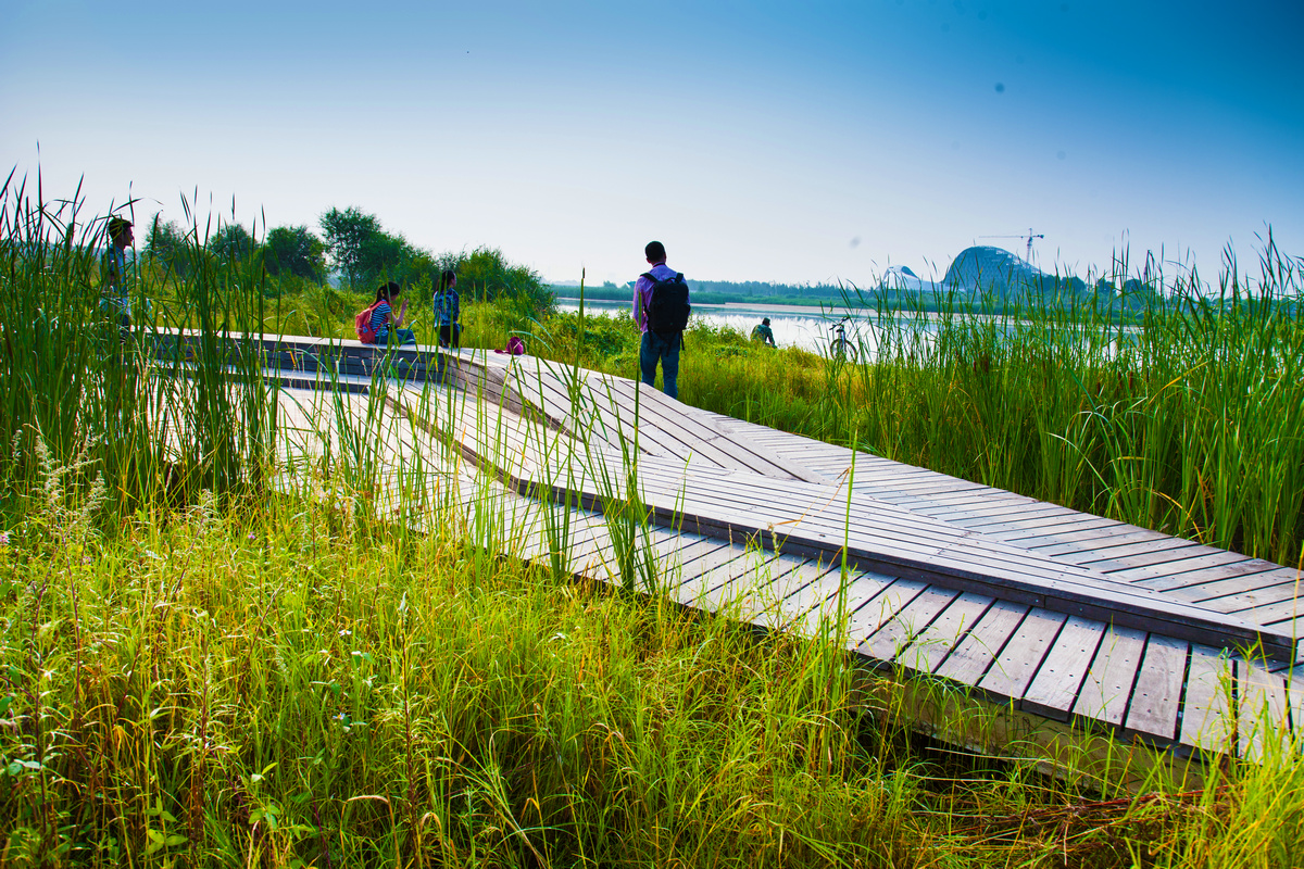
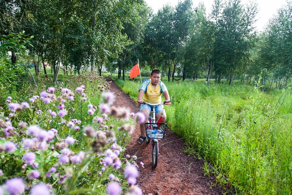
Floating Connection: The annual fluctuation of the water table creates an inaccessible muddy and water edge, and the overgrown wetland vegetation fertilized by the nutrient-rich urban runoff, turning the wetland into a lush but “messy” plant community. This posed a huge challenge to adapting the wetland into a public space that would be accessible year round. The design solution was an integrated network of boardwalks, bridges and resting platforms largely detached from the ground and wetland edge. Six kilometers (3.7 miles) of boardwalk and bridges were built, linking 13 platforms and pavilions. In addition, an eco-friendly network of pedestrian paths (using the permeable volcanic sand from this region) were built on the raised ribbons of land that penetrate the groves and meadows, providing a rich experience for visitors.
4. Conclusion
Using these two landscape strategies, the former deteriorated wetland habitat has been successfully transformed into a working marsh that remediates urban storm-water runoff and waste tailwater from the water supply plant. Since the wetland is largely under the control of natural, rather than human, processes, it is likely to become overgrown with seasonal wetland vegetation and ground cover, forming a wild and messy naturalized landscape. While detached from the ground and water allowing the native community to evolve, a network of boardwalk and resting places that fulfill the needs of recreational use and allows urban residents have an intimate touch with the nature and create an unique experience of the otherwise inaccessible marsh. This project showcase how to restore nature and how to make working landscape also pleasant through minimum intervention.
