Nanchang Fish Tail Park
Project Information
- Project Location:
- China Nanchang,Jiangxi
- Project Scale:
- 55.6 Hectares
- Design Time:
- June 2017
- Client:
- Nanchang Gaoxin Real Estate Investment Co., Ltd
- Award List:
- 2025 ASLA Award of Excellence General Design, 2022 AZ Awards Landscape Architecture Winner, 2022 AZ Awards People's Choice Environmental Leadership,2022 Architecture MasterPrize Design of the Year,2022 Fortune Best Designs
- Related Papers
Project Profile
A Floating Forest: Fish Tail Park in Nanchang City
1. Project Statement
In the city of Nanchang, within the Yangtze River flood plain in east-central China, we transformed a 126-acre badly abused landscape into a dreamlike floating forest that regulates storm water, provides habitat for wildlife, offers an array of recreational opportunities and gives local residents a new way to connect with nature. All of this lent a unique identity to the New District and served as a catalyst for urban development in the surrounding area. Fish Tail Park offers a replicable model of designed urban nature for regions with monsoon or variable climates that can address the multiple challenges of floods, habitat restoration and recreational demands. The project is part of a larger effort by the landscape architect to show that it is possible to open up new space in cities not just for people, but also for nature and for the powerful forces, like monsoon storms, that drive critical natural processes.
2. Objective and Challenge
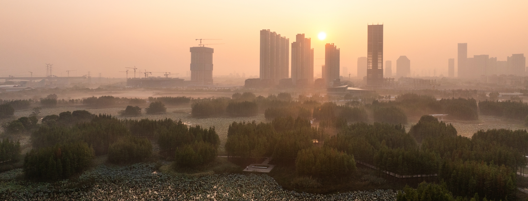
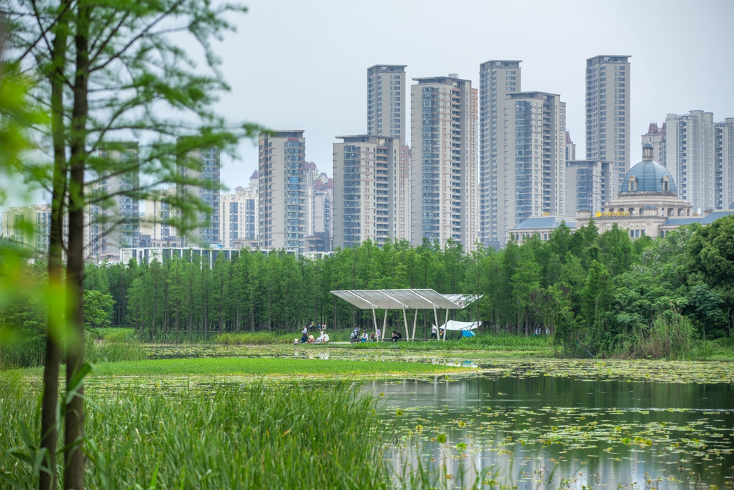
Nanchang is the capital city of Jiangxi Province and has a population of over 6.2 million people. It is one of the biggest cities in the middle reach of the Yangzi River and is located on the western shore of Poyang Lake, China’s largest fresh water lake. Flooding and urban inundation during the monsoon season has been a chronic challenge for the city. The problem has been worsening in recent years due to the impacts of climate change and rapid development on lakes and wetlands in the area, which has significantly reduced the natural landscape’s water-regulating capacity. At the same time, surface water has been increasingly polluted by growing amounts of urban runoff, impacting the habitat of resident and migratory birds and other wildlife. New public spaces are being designed and built to fulfill the recreational needs of the growing population, but the biggest challenge — and opportunity — for landscape architecture and urbanism is how to develop integrated, efficient solutions to tackle the full spectrum of issues at low cost and in a manner that can be replicable at large scale.
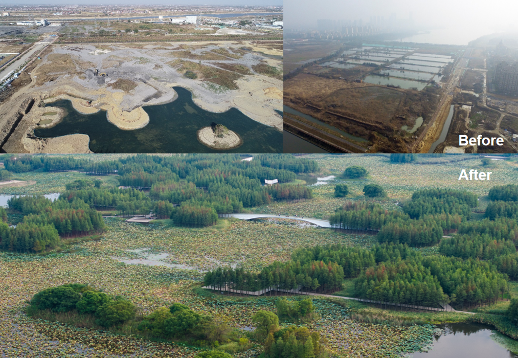
The site is 51 hectare (126 acre) former fish farm reclaimed from a natural wetland. Roughly 30% of the site is a former dump site for coal ash from power plants around the city. The water is polluted due to the coal ash and overuse of fish feed, as well as urban runoff. The area surrounding the site is slated for dense urban development, and both the local government and the developers hope to use the park as a catalyst to develop the entire New District. Seeing the challenges of the site as an opportunity, the landscape architect resolved to create a resilient, natural urban refuge. The park will provide numerous ecosystem services including urban flood regulation, water filtration, habitat for birds and other wildlife, as well as a public space for recreational activities, while catalyzing urban development and providing a replicable model for the shared challenges that many monsoon cities in fast-developing regions are facing.
3. Design Strategy
To tackle both the common challenges facing all monsoon cities and the unique challenges of this particular site, we pursued the following design strategies:
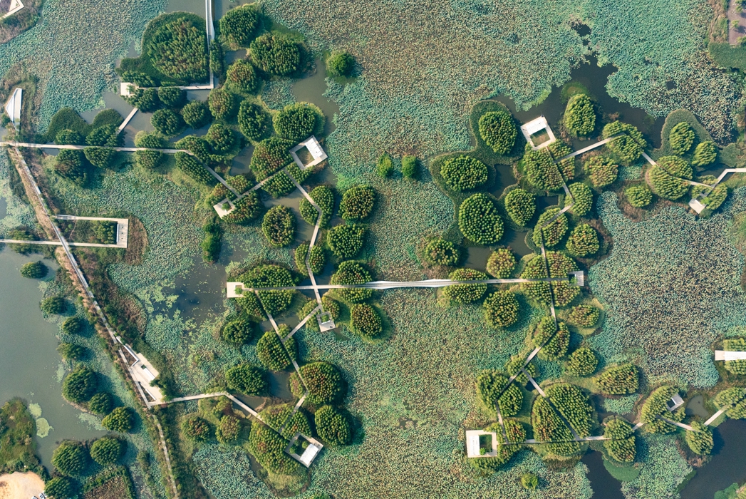
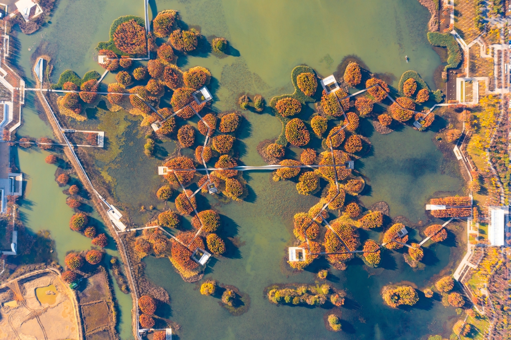
3.1 Transform an Urban Dumping Ground into an Island-Jeweled Lake
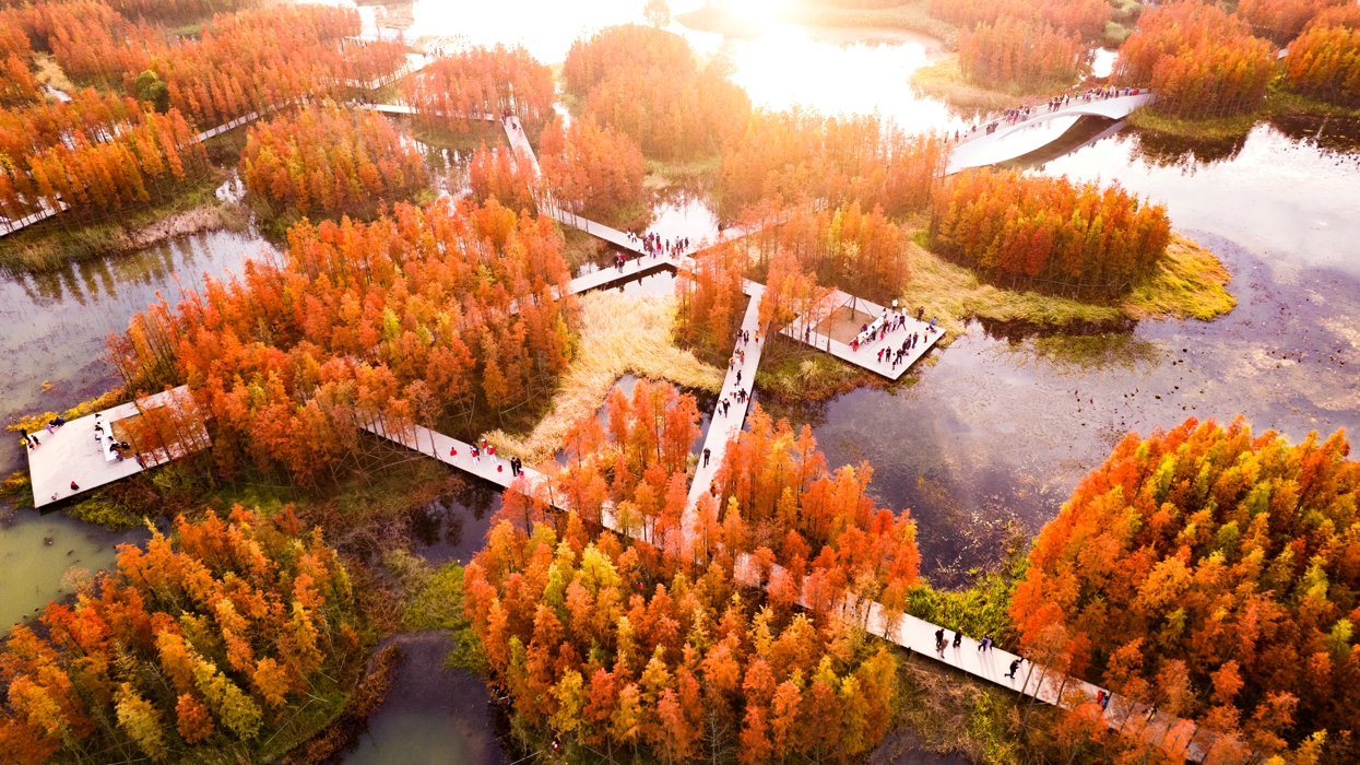
Inspired by the ancient concept of farming atop marshland, and by simple cut-and-fill techniques such as the Aztec Chinampas, or floating garden system, the coal ash dumped on site was recycled and mixed with dirt from the fish pond dykes to create numerous islets.
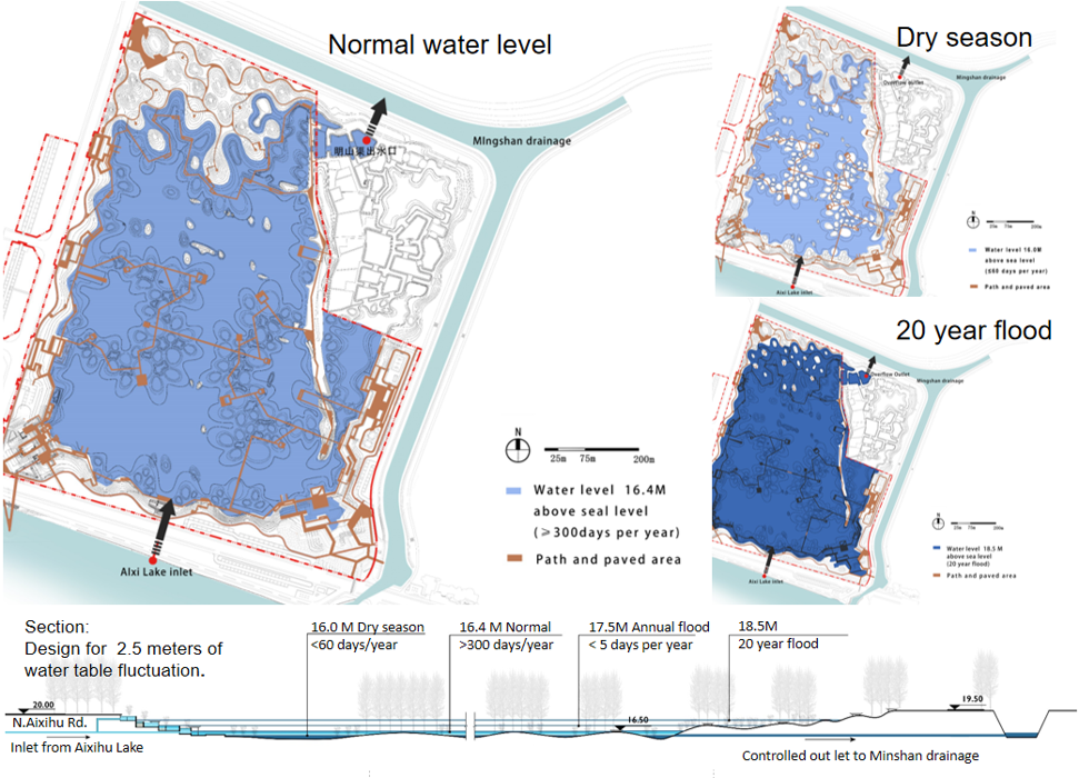
At the same time, a lake able to accommodate two meters (6.5 feet) of water-level rise was created, providing the capacity to catch a full 1 million cubic meters of storm water inflow.
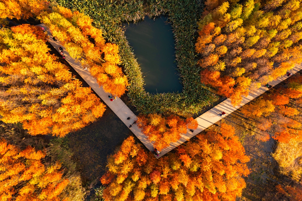
3.2 A Flood-Adapted Forest Is the Park’s Heart
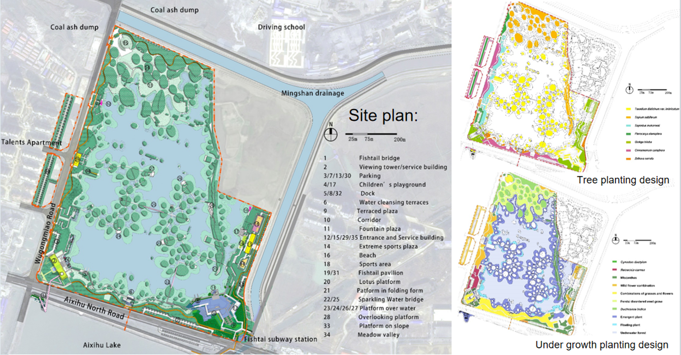
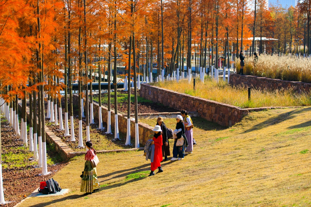
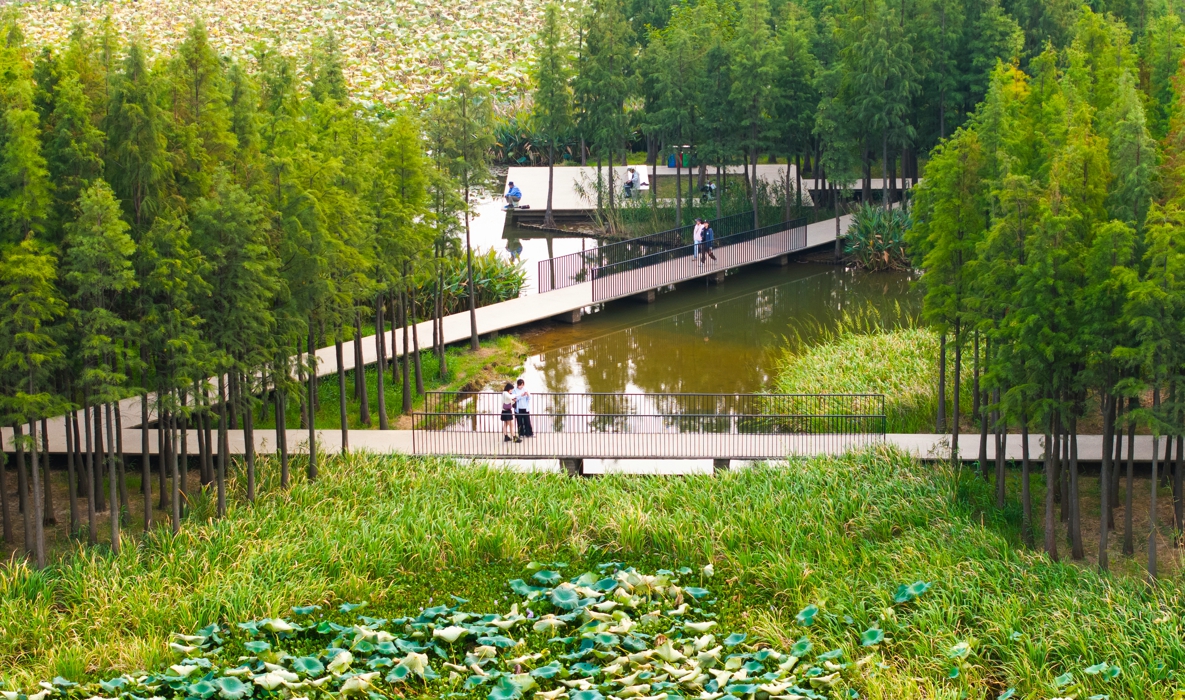
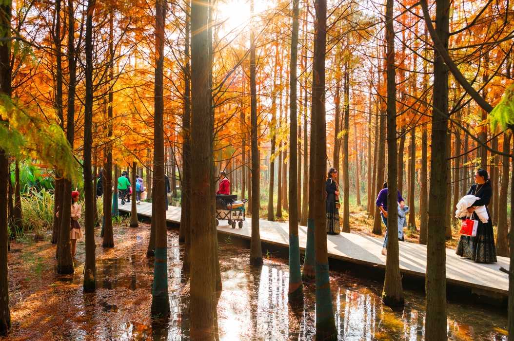
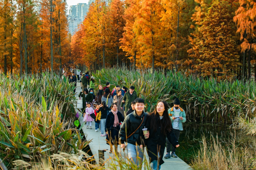
Inspired by Poyang Lake’s native monsoon-flood-adapted marsh landscape, we selected tree species that are able to survive fluctuating water levels, including Taxodium distichum , Taxodium distichum var. imbricatum and Metasequoia glyptostroboides. Because fluctuating water levels often expose barren muddy shorelines, perennial and annual wetland plants were planted along the shorelines and island edges, and lotus plants provide highly efficient lake cover.
3.3 A Recreational Waterfront at the Edge between City and Nature
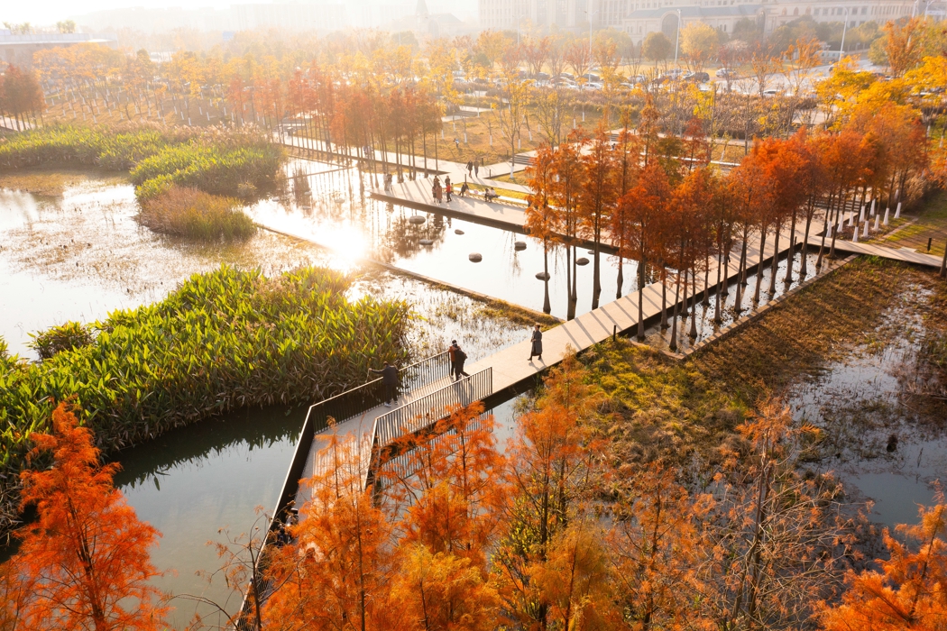
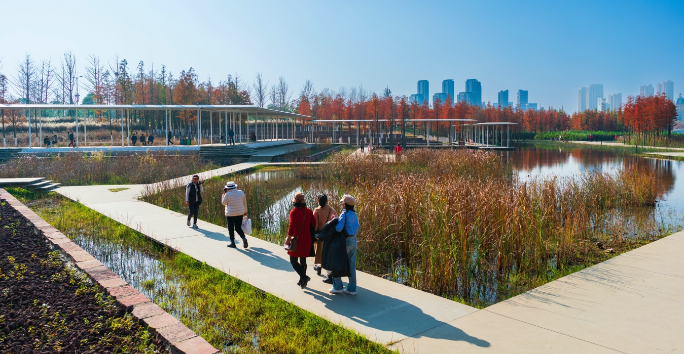
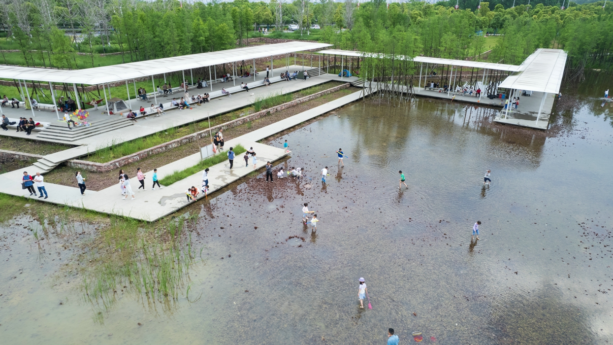
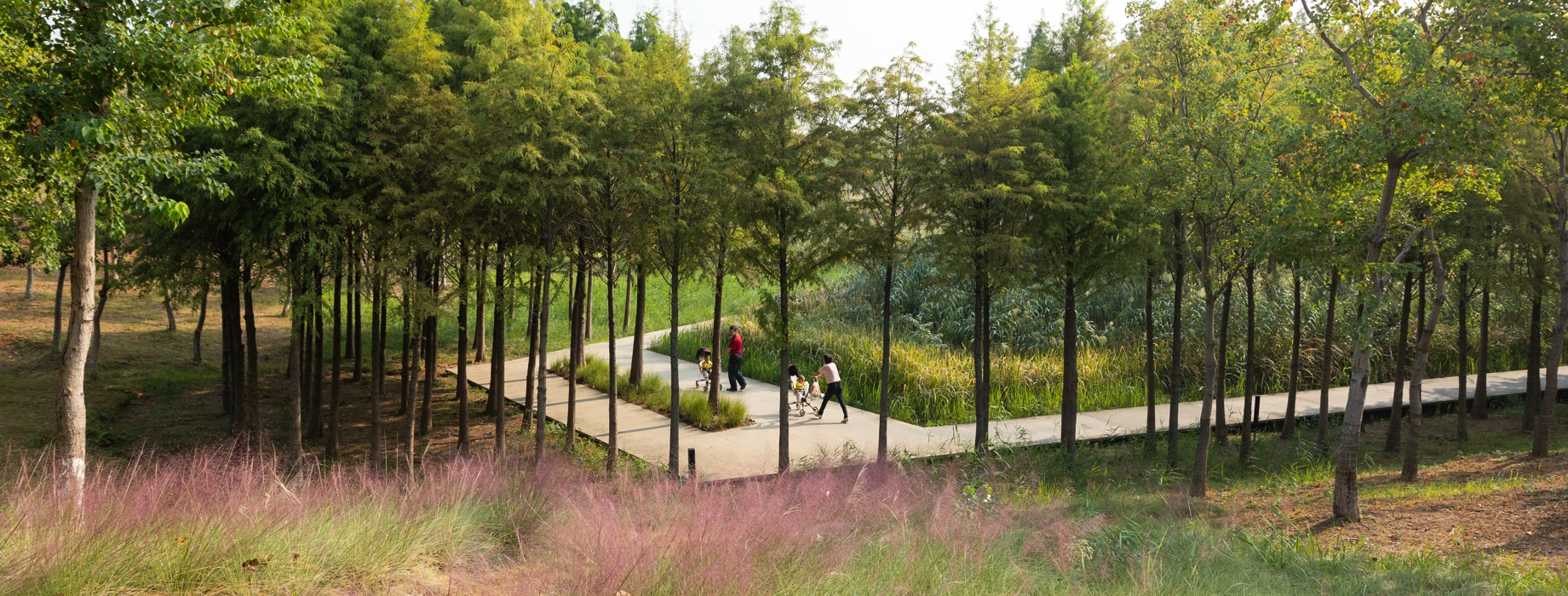
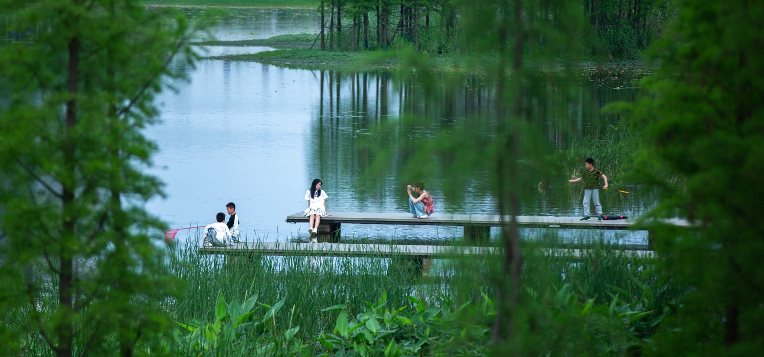
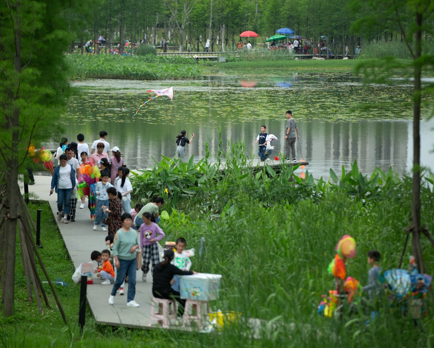
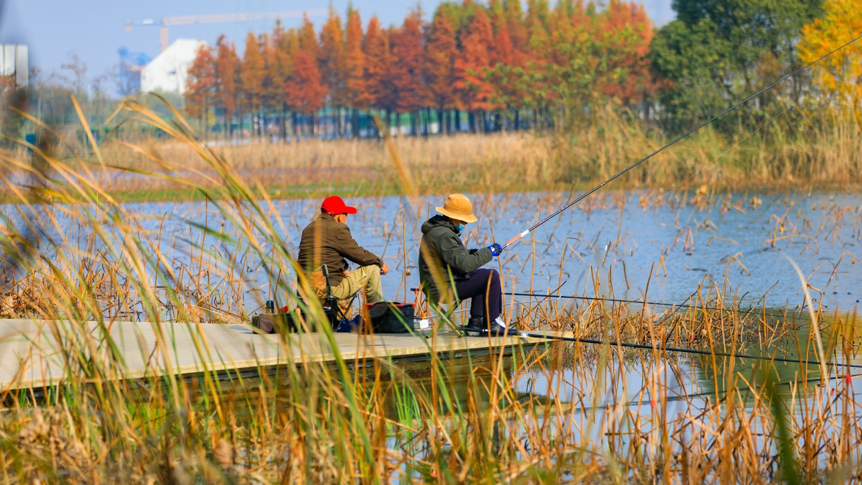
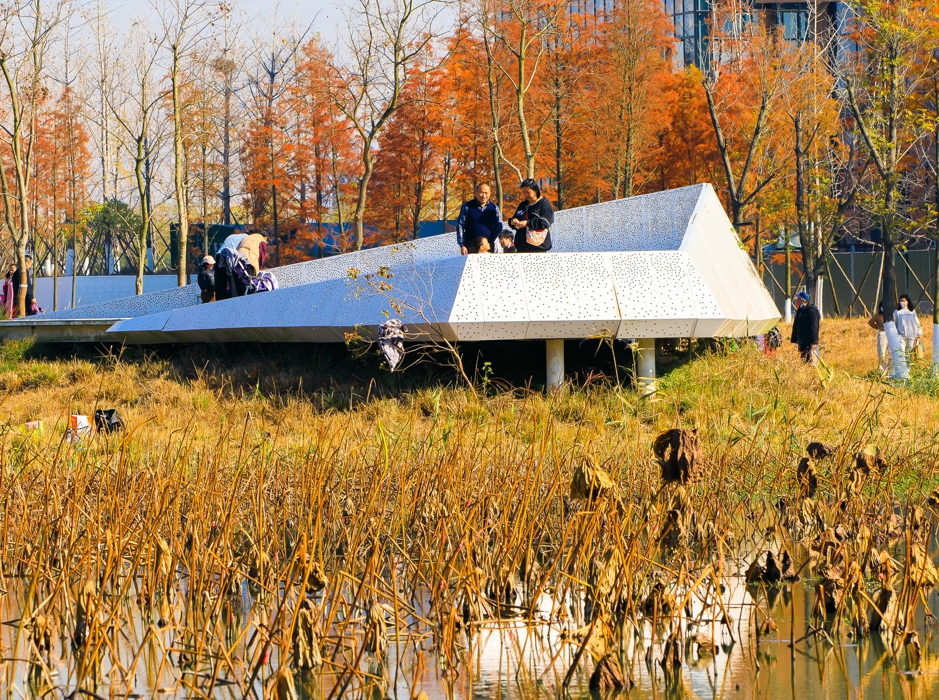
The central forest on the water, which is submerged during the annual monsoon floods, provides opportunities to explore nature and a “messy,” immersive marsh experience. The waterfront at the periphery of the park, meanwhile, is designed to accommodate 20-year floods and provide a zone that can meet the recreational needs of the local population, and includes natural playgrounds, beaches, fountains and lawns. Terraced constructed wetlands are designed to filter urban runoff.
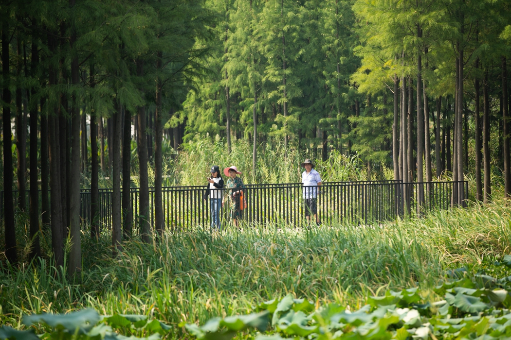
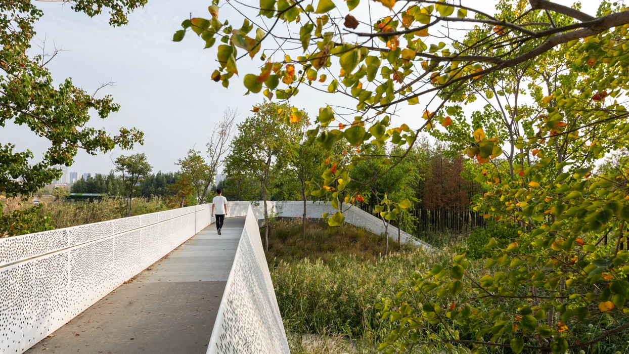
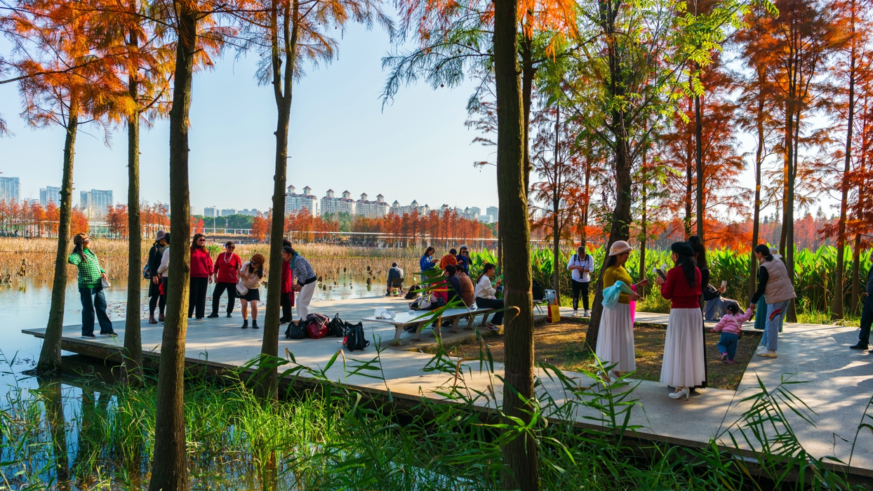
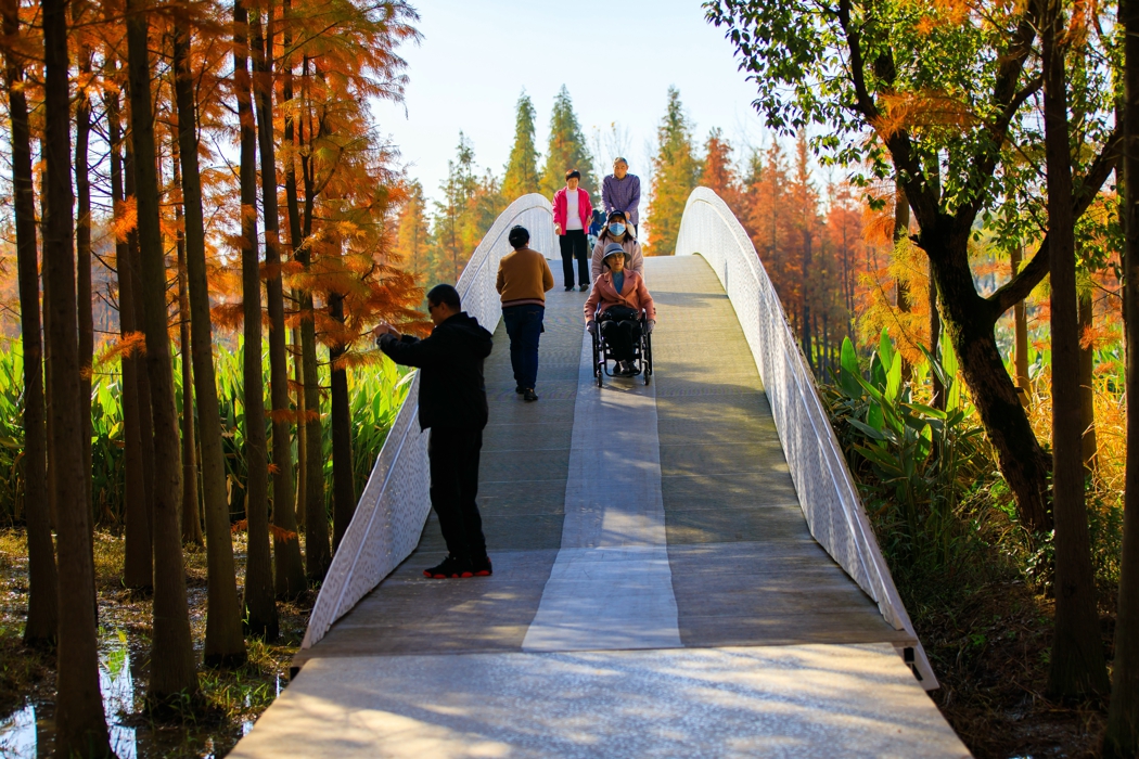
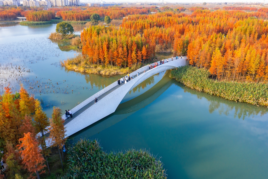
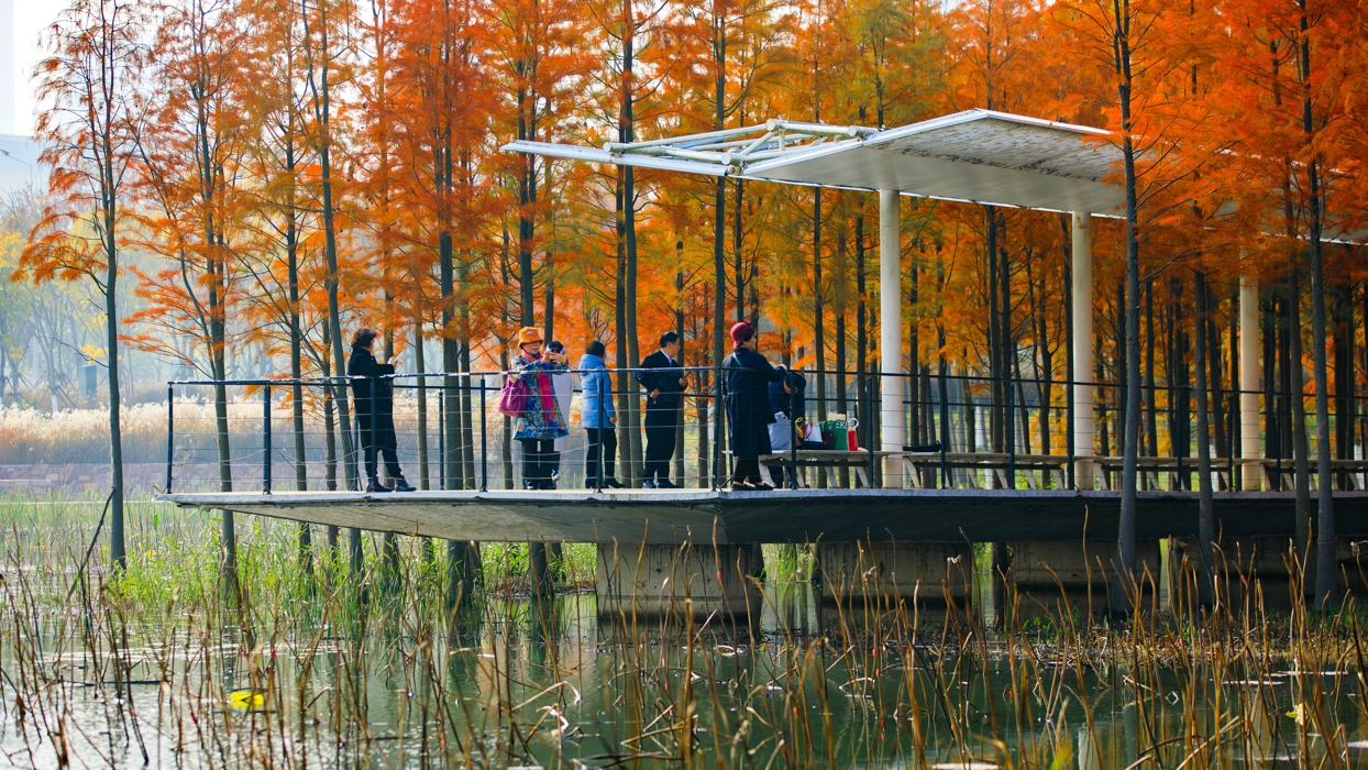
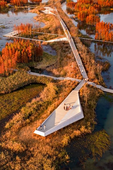
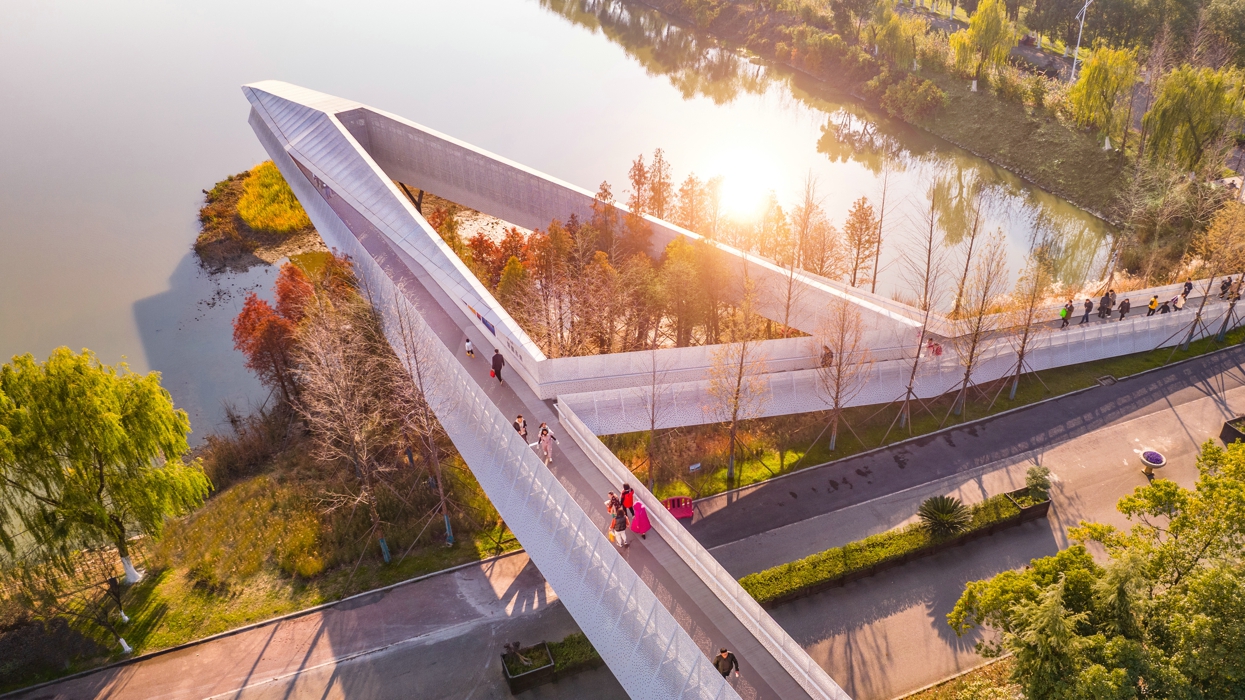
3.4 A Flood-Resilient Boardwalk and Spots for Immersive Contact with Nature
A bike route and service road follow the park’s periphery. A network of pedestrian paths and platforms surrounds the lake and provides access to the forested isles, offering visitors myriad opportunities to explore. The boardwalk is designed to be submerged during 20-year flood events and annual monsoon floods, which can render the central part of the park inaccessible several days at a time. While the circular pedestrian and bike paths are above the 20-year flood event line, the boardwalk and platforms are made of prefabricated concrete detached from the ground or floating above water and can be easily washed clean after being submerged, as are the benches, which are made of aluminum.
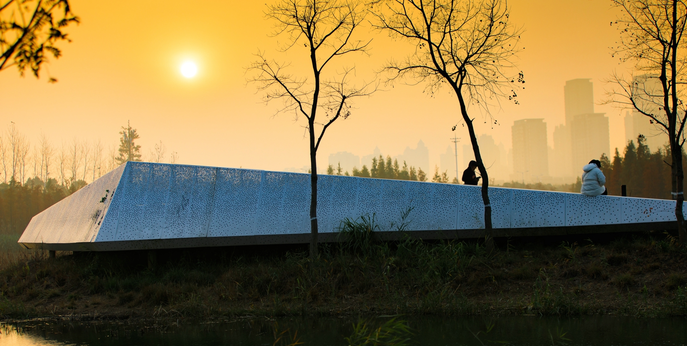
3.5 Contemporary Design and Inviting Focal Points
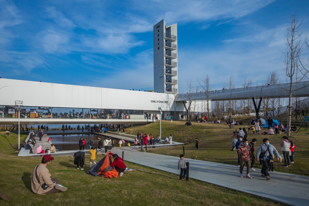
Bridges, platforms, pavilions and viewing towers are carefully placed to provide attractive focal points. Their contemporary design helps bring a modern taste and sense of progress to the ancient city, which dates back well over 2,000 years.. Perforated aluminum plate is the main material used for the installed structures, creating an arresting contrast with the natural setting. At the park’s main entrance, a cafeteria is integrated with an overpass across a six-lane road, connecting Fish Tail Park with the neighboring Aixi Lake Park.
4. Conclusion
Fish Tail Park has proved to be a great success. Built at an extremely modest budget of US $4 per square foot, the heavily polluted urban dumping ground and fish farm has been transformed into an urban oasis that regulates storm water, provides habitat for birds and other wildlife, and has quickly become one of the most-visited urban parks in the entire city. Regional and national media have widely reported on Fish Tail Park, which has helped give a distinct identity to Nanchang’s New District. The park is now a landmark stop on Nanchang’s subway system, and has become a catalyst for development in the surrounding area.
