Xinjiang River Ecological Corridor


Project Information
- Project Location:
- China Shangrao,Jiangxi
- Project Scale:
- 102 Hectares
- Design Time:
- January 2020
- Build Time:
- August 2021
- Client:
- Shangrao Urban Construction Investment and Development Group Co., Ltd
- Award List:
- 2025 WAF, Landscape of the Year
Project Profile
1. Project Statement
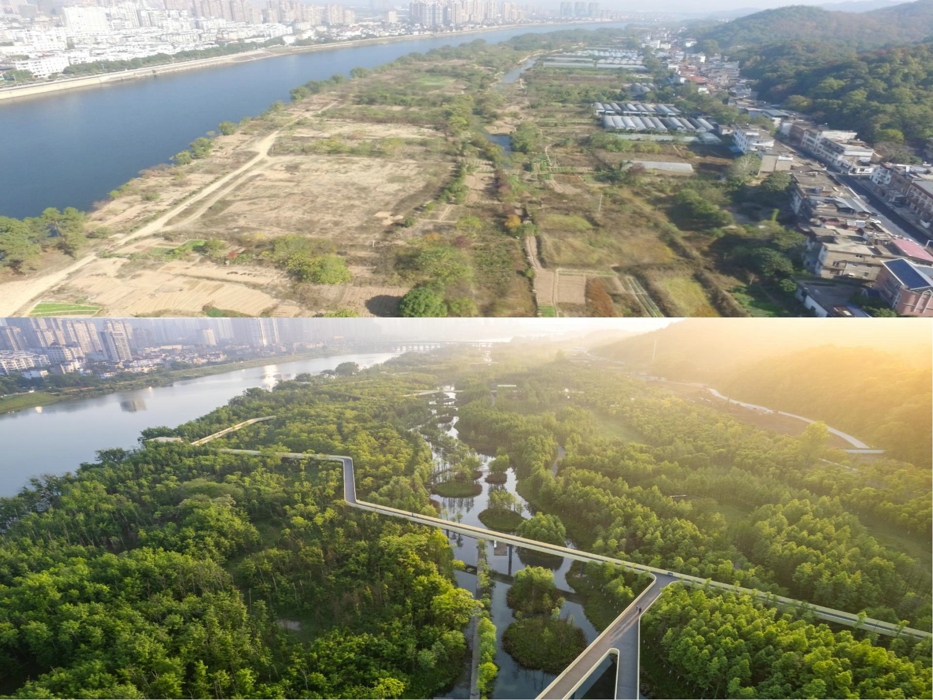
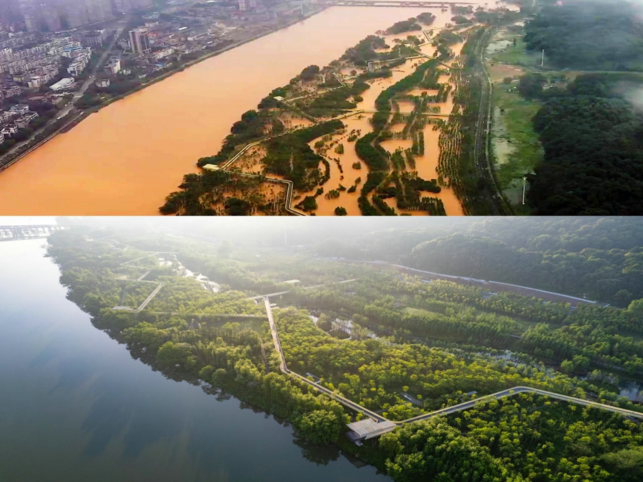
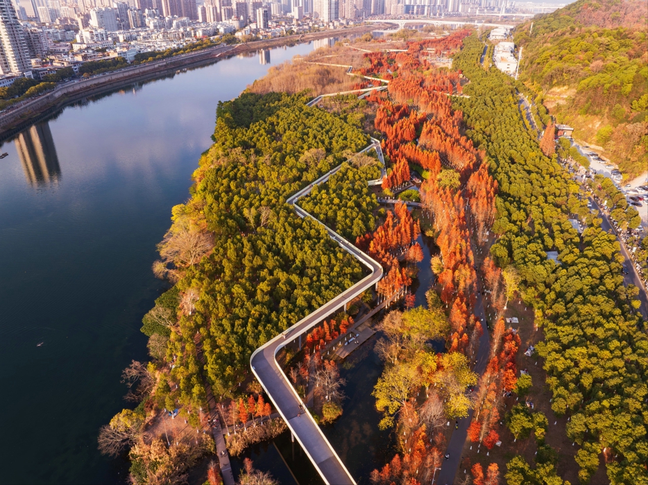
In Shangrao City, the Xinjiang River Ecological Corridor transforms a degraded 102-hectare floodplain into a thriving ecological infrastructure. Using sponge city strategies, it enhances flood resilience, restores native habitats, and offers diverse recreational spaces. The project embraces seasonal flooding as a design feature, ensuring year-round public access through multi-layered pedestrian systems. Delivered on a limited budget, the park integrates ecology and recreation, reconnecting people with nature while protecting the city from climate challenges. Now a regional landmark, it strengthens Shangrao’s urban identity and provides a scalable model for flood-prone cities worldwide.
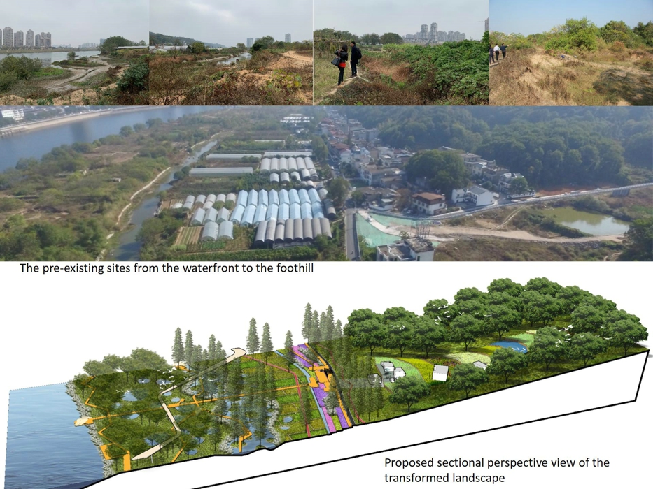
2. Site Challenges and Objectives
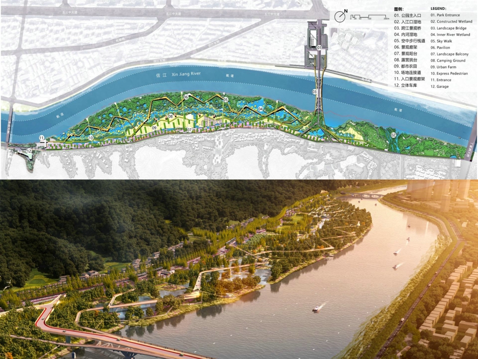
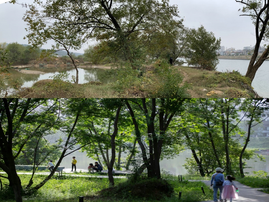
The 3-kilometer-long floodplain along the south bank of Shangrao’s “mother river” was degraded by invasive vegetation and casual agriculture. Seasonal flooding made the site largely inaccessible, with catastrophic floods occurring every 20 years. Shangrao’s 6.4 million residents, including 0.7 million living near the river, needed an accessible public space. The municipal government aimed to transform the floodplain into a flood-resilient park with these objectives:
- Improve flood management and water quality.
- Restore native habitats and support biodiversity.
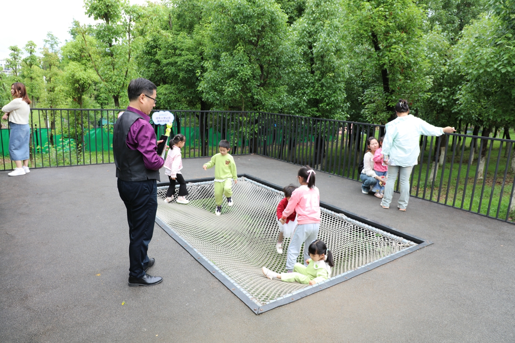
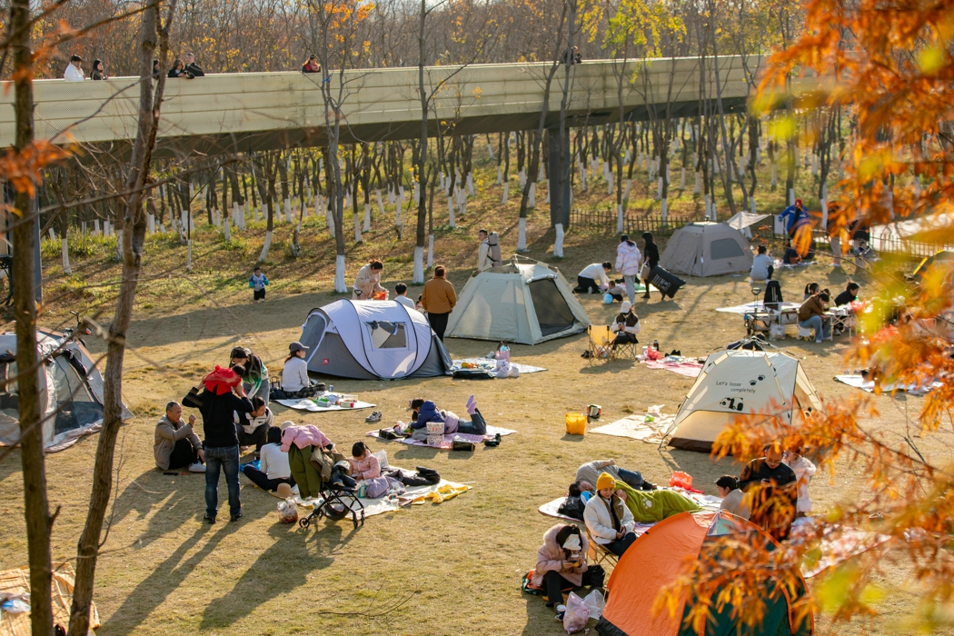
- Create recreational spaces that remain accessible year-round.
- Deliver a cost-effective and low-maintenance solution.
3. Design Strategy: From Floodplain to Ecological Corridor
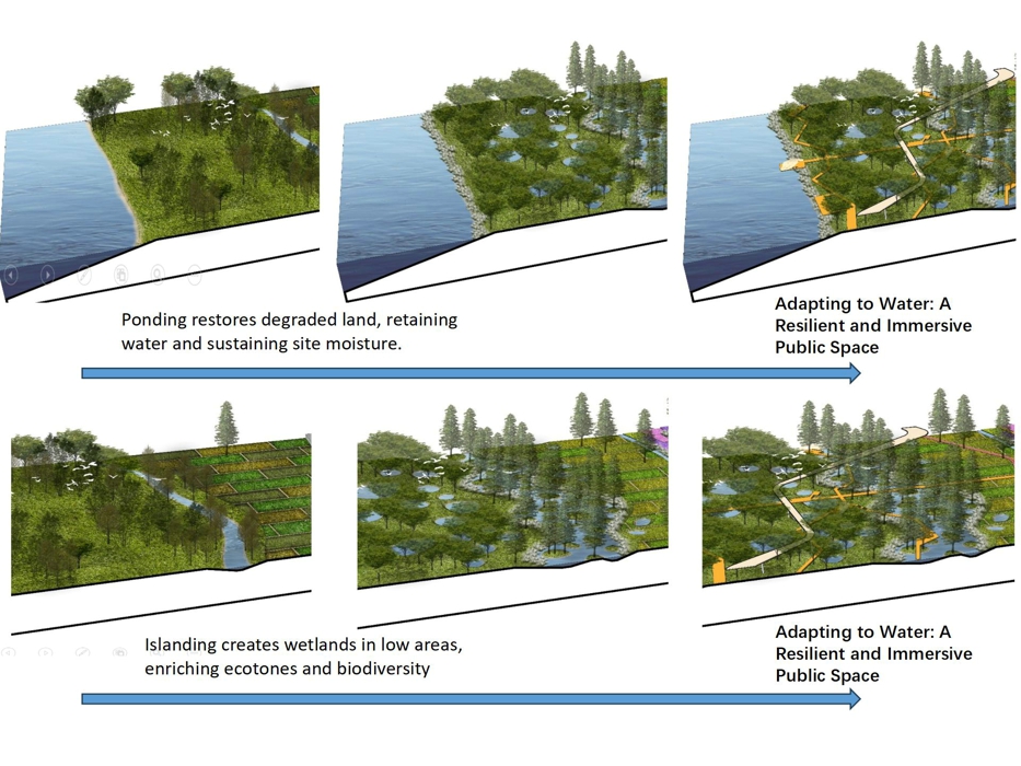
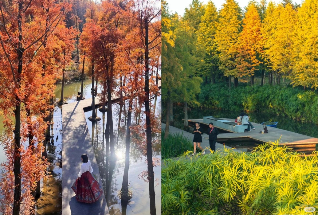
3.1 Ponding and Islanding to Transform the Landscape and Create Lush Native Habitats
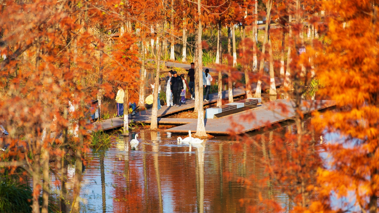
A key component of the project was the careful preservation of native trees, including Chinese tallow, river willow, and Chinese sweetgum, to protect the site's ecological heritage. Strategic landscape reshaping was achieved through selective ponding and islanding techniques.
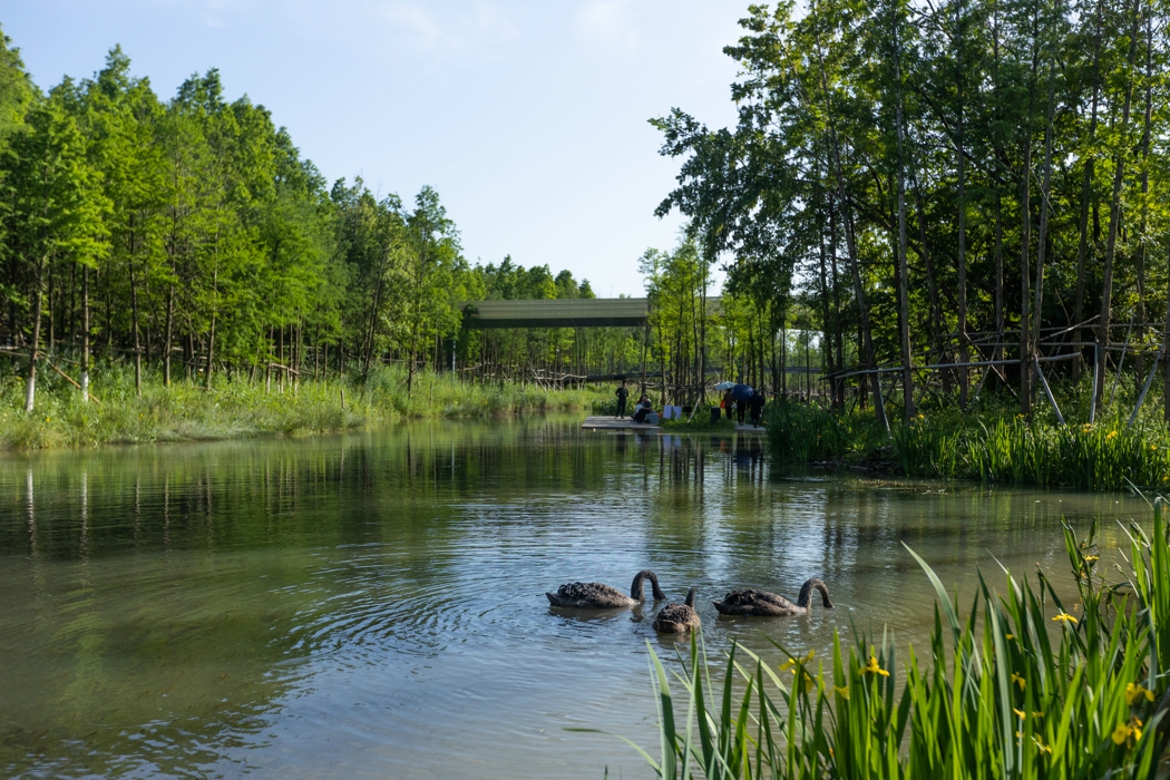
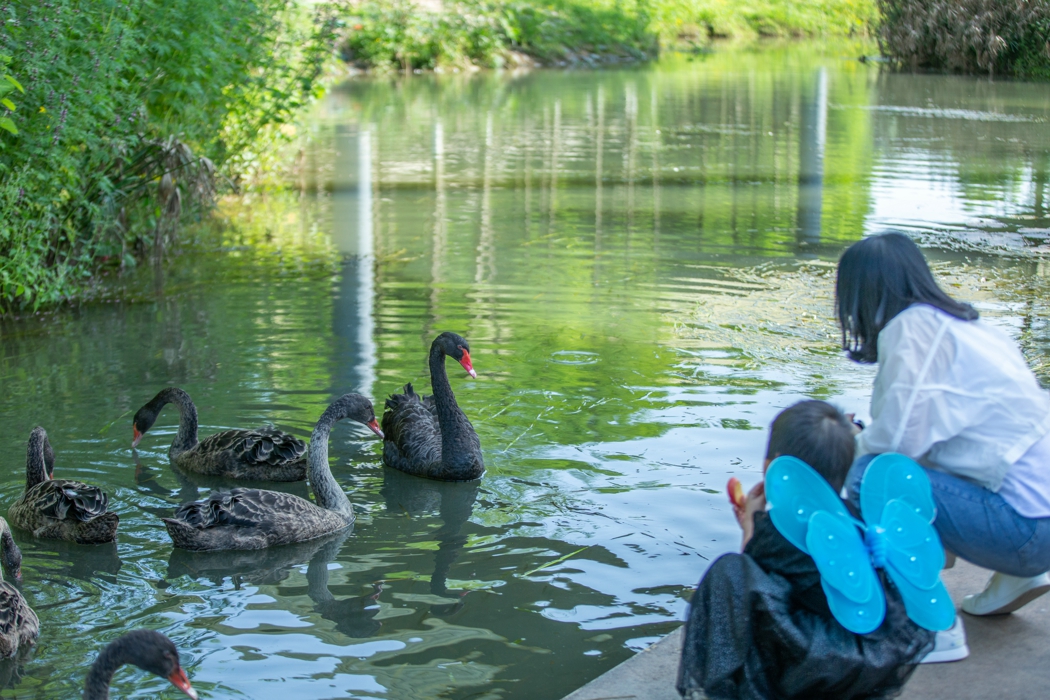
The ponding technique was applied to areas dominated by invasive species or degraded, barren land, creating a porous landscape that retains water and sustains site moisture. It was also used to form bioswales that capture and filter stormwater from mountain valleys on the park’s southern slopes. Meanwhile, the islanding technique was implemented in low-lying, water-submerged areas, fostering a diverse wetland habitat that enriches ecotones.
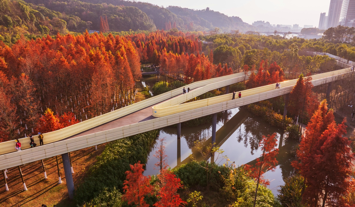
Both techniques support natural flood management, enhance biodiversity, and minimize environmental disruption while fostering a resilient ecosystem. Rather than resisting flooding, the park embraces it as a vital ecological process. Monsoon floods create nutrient-rich wetlands that regenerate the landscape as waters recede, offering visitors a dynamic and ever-changing environment.
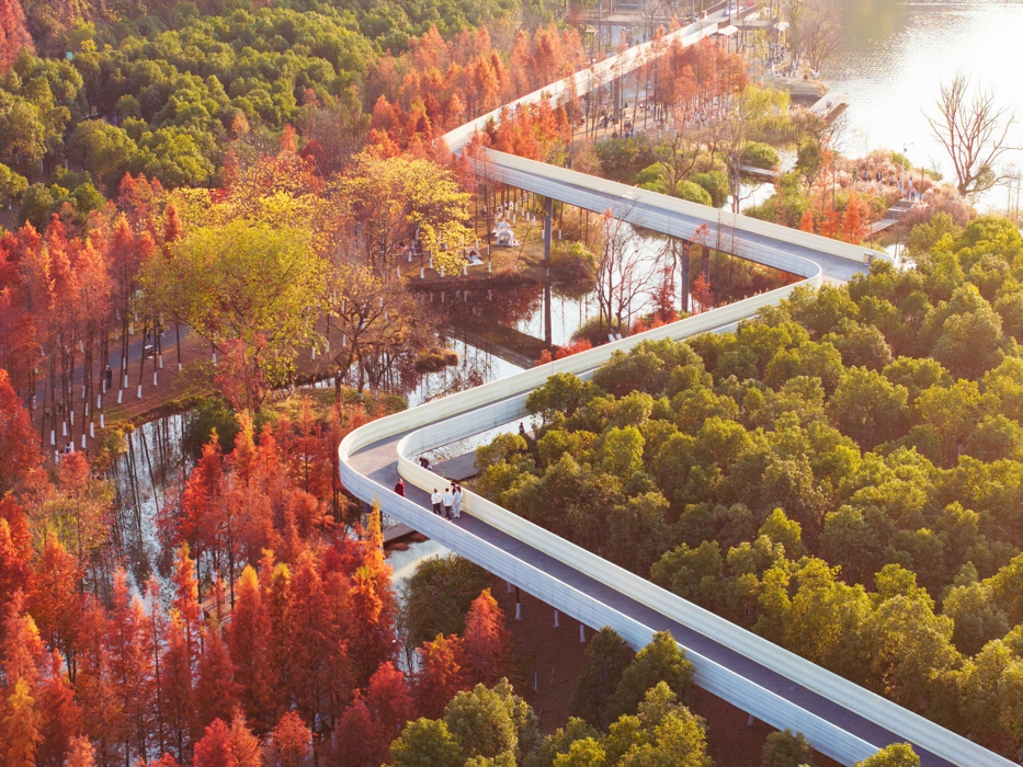
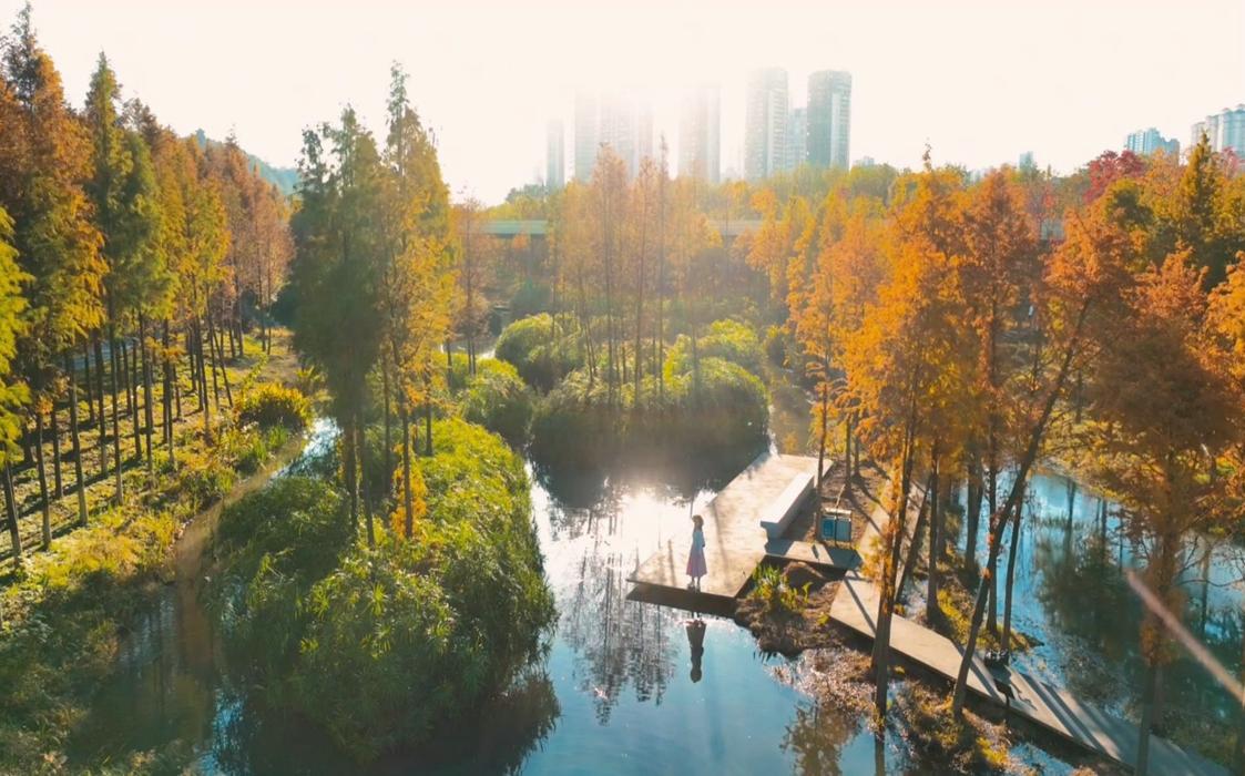
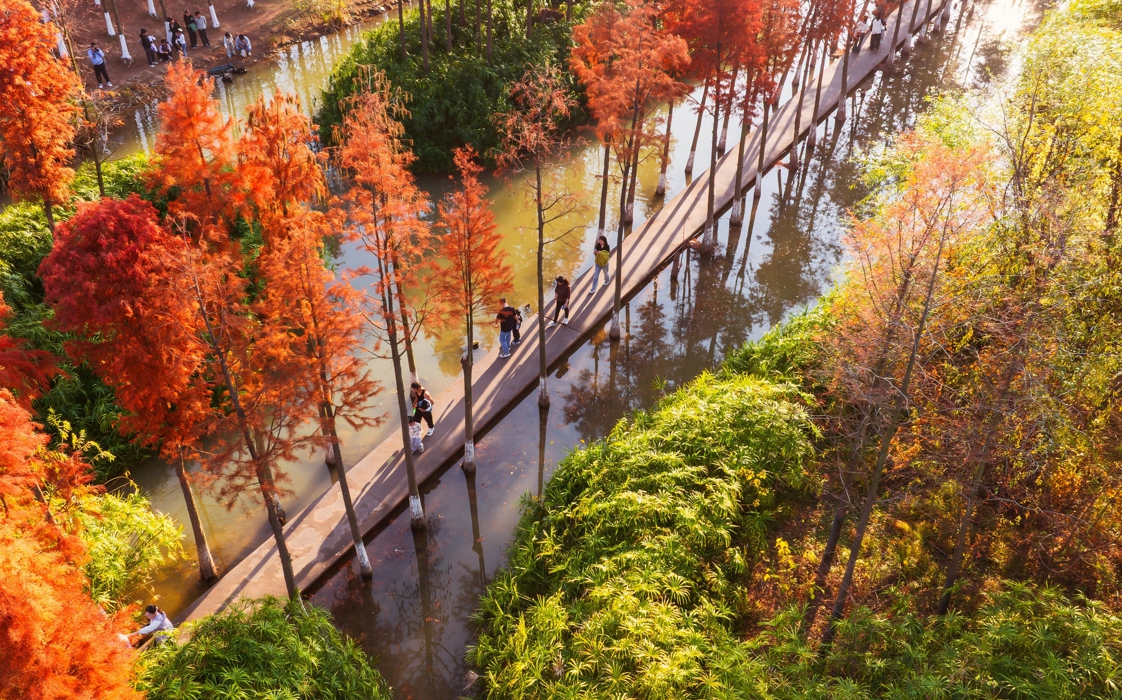
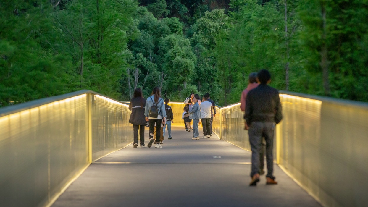
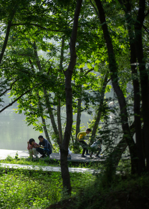
3.2 Adapting to Water: A Resilient and Immersive Public Space
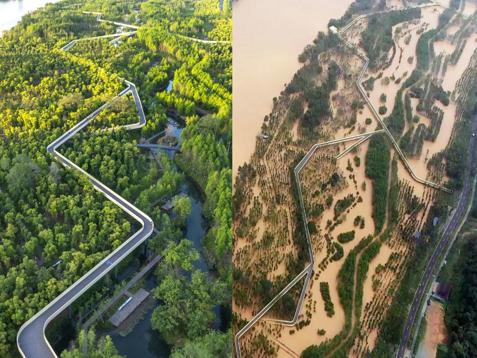
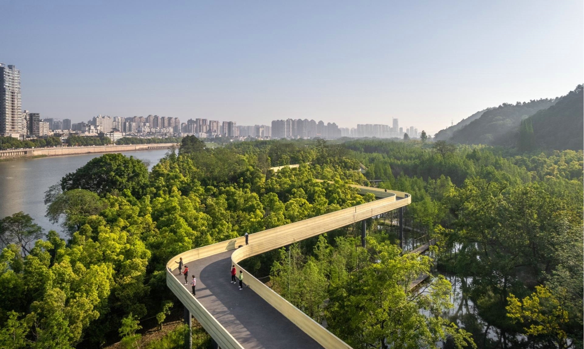
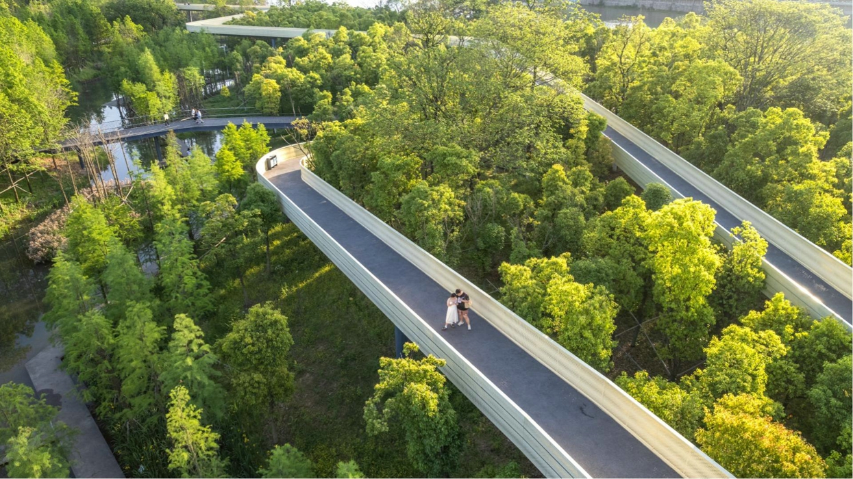
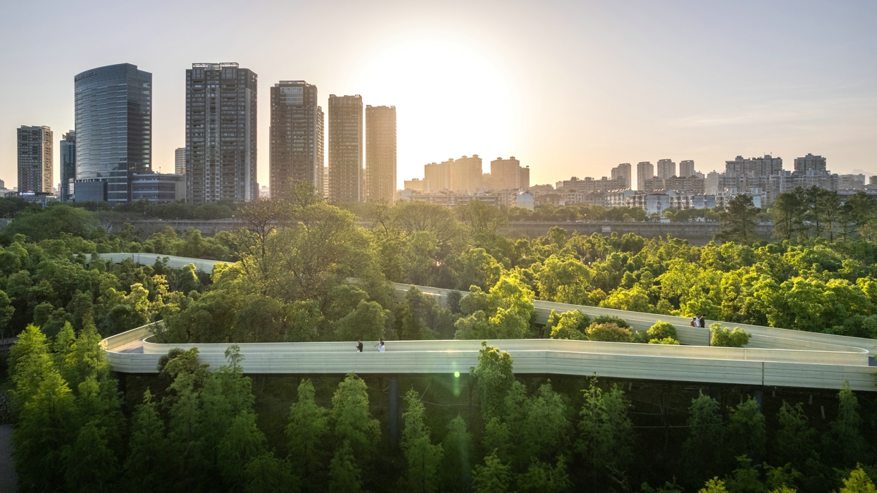
Flood-adaptive structures enable visitors to safely experience the dynamic waterscape. A dual pedestrian system ensures year-round public access, with an elevated skywalk above the canopy that remains dry even during a 50-year flood, offering panoramic views of the river, forest canopy, and city skyline. Below, three adaptive boardwalk layers respond to fluctuating water levels, with the lowest submerging during annual monsoons. Waterfront platforms and observation decks further enhance visitor engagement, seamlessly blending recreation with ecological education
3.3 Cost-Effective Materials
The design uses local materials and prefabricated components for quick assembly and low-cost maintenance. Modular concrete walkways on pole structure are flood-resilient, easily cleaned, and blend with the natural surroundings, ensuring durability while minimizing disruption.
4. Conclusion
The Xinjiang River Ecological Corridor is a model for nature-based resilience. It balances flood protection, ecology, and recreation, turning a degraded floodplain into a thriving public space. By integrating seasonal flooding into its design, it offers a dynamic visitor experience while enhancing urban resilience. Since its completion, the corridor has become a regional landmark, boosting biodiversity and improving quality of life. It provides a blueprint for cities seeking sustainable solutions for flood-prone areas.
