Guangzhou Baiyun Lake Digital Technology City Design
Project Information
- Project Location:
- China Guangzhou, Guangdong
- Project Scale:
- 28 Square Kilometers
- Design Time:
- 2019
- Client:
- Guangzhou Municipal Planning and Natural Resources Bureau Baiyun District Branch
Project Profile
1.Project Statement
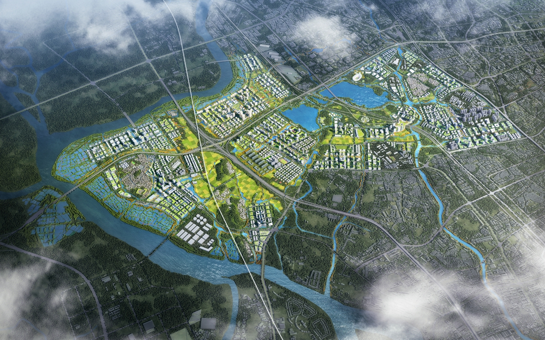
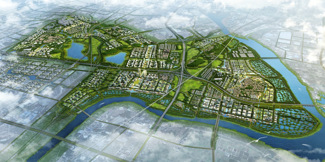
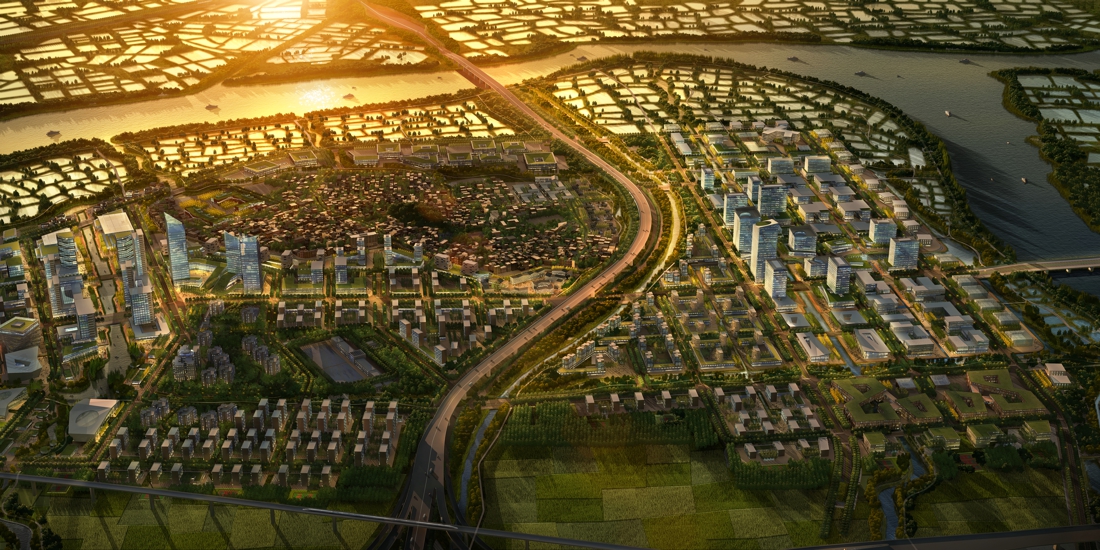
Baiyun Lake Digital Science and Technology City is located in the west of Baiyun District, Guangzhou, with an area of about 28 square kilometers. The Central Committee of the Communist Party of China and the State Council officially issued the "Guangdong, Hong Kong and Macao Dawan District Development Plan", and proposed to build an International Science and Technology Innovation Center for the Guangdong-hong Kong-macao Bay area.
We will deepen cooperation on innovation between Guangdong, Hong Kong and Macao, and take forward the development of the Guangzhou-Shenzhen-Hong Kong-Macao Science and Technology innovation corridor. We will build a global platform for innovation in science and technology and an important source of new industries. In order to fulfill the requirements of the construction of high-level and high-quality industry platform for the Digital Economy of the Municipal Party Committee and municipal government, the White Cloud Lake digital technology city came into being at the historic moment, seizing the commanding heights of the development of the digital economy. We are committed to building a significant platform for the coordinated development of the Guangdong-Hong Kong-Macao Bay area and Beijing-Tianjin-Hebei, as well as National and International Science and Technology centers.
2.Objective and Challenge
The planning area is located at the junction of the Liuxi River and the Pearl River, and historically it is located in a low-lying riverbank. In the agricultural era, the ancestors built high embankments to raise land, select high and live to prevent flood. With the changes in agricultural economic activities, the four waters and six foundations were planted with mulberry, digging the pond to build the foundation to inhabit, and shaping the unique local landscape.
With the rapid development of economy, the Baiyun Lake district, located in the suburb of the main city of Guangzhou, has become a transit and distribution center for goods entering and leaving Guangzhou due to its excellent traffic location.
In the era of ecological civilization, faced with the new background of Guangdong-Hong Kong-Macao Bay area construction and the new opportunity of the western science and technology corridor construction, Baiyun Lake area began to move from the suburban logistics area to the international stage. Driven by both ecological civilization and digital economy, it is planned to be located in the idyllic water city in the south of Lingnan, the world science and technology engine, to reshape the relationship between man and nature, and to build a future-oriented ecological city based on water ecological infrastructure That is, the ecological civilization of the urban form!
3.Design Strategy
Strategy 1: Eco-city: Ecological infrastructure framework to innovate urban form
(1) Establish ecological infrastructure (EI) to provide natural services to the site
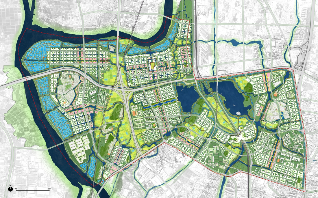
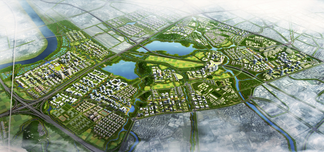
The plan is based on the traditional water adaptation model of the Pearl River Basin, and takes into account the natural elements such as mountains, water, forests, fields, lakes and grasses and earthquake fault zones and cultural heritages such as ancient and famous trees, ancestral halls and traditional ancient villages from a regional perspective. Through the six elements of “Water System Corridor + Flood Inundation Area + Mountain Forest + Basic Farmland + Cultural Heritage + Earthquake Fault Zone”, the regional health ecosystem will be constructed to provide natural services to the city.
(2) Urban design based on ecological infrastructure and current conditions
Ecological infrastructure guides land development boundaries
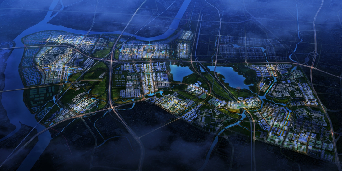
Coordinate with Guangfo and Guangqing. Connect ecological space. Isolate production space. Optimize living space. Build a multi-level, multi-functional, three-dimensional, network-based ecological corridor system of the region-group-community. Frame the land development boundary, and build the regional ecological “life community” to form a network structure of “One axis, Three corridors and Multiple networks”.
One axis: The green axis of the development of guangzhou-foshan city. Rely on the diversion channel from the Baiyun Lake and the Xiamao water. Connect Guangzhou Baiyun Mountain and Foshan Water. Build Guangfo coordinated development of the Green Axis jointly.
Three corridors: West Riverside Ecological Landscape corridor. Drawing on the traditional agricultural wisdom of the six-foundation-river system of the Yangtze River, the mulberry-based fish ponds on both sides of the Pearl River were restored by simple engineering measures of filling in and excavating on the spot, and the spectacular scenery of the stone gate was reproduced. It provides a variety of ecological services, such as Leisure and Recreation, rain and flood regulation and storage, and a variety of productive functions. Central landscape garden landscape gallery. Following the historical evolution of the site, integrating the fragmentation of natural elements, restoring the traditional landscape of the plains in the plains, reconstructing the natural spatial pattern of “mountains, water, forests, fields and villages” to provide urban residents with a livable and pleasant living environment. Eastern composite traffic landscape gallery. Through the natural elements such as water system, farmland and forest belt, the transit of the transit traffic such as the Guangqing Intercity Railway will be sutured to enhance the value of the Baiyun Lake.
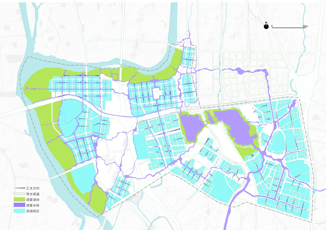
Multi-network: A number of blue-green networks connecting groups and infiltrating the community provide a foundation for the construction of sponge cities, and provide catalysts for technological innovation and a good environment and space for innovation.
Convenient and compact construction mode
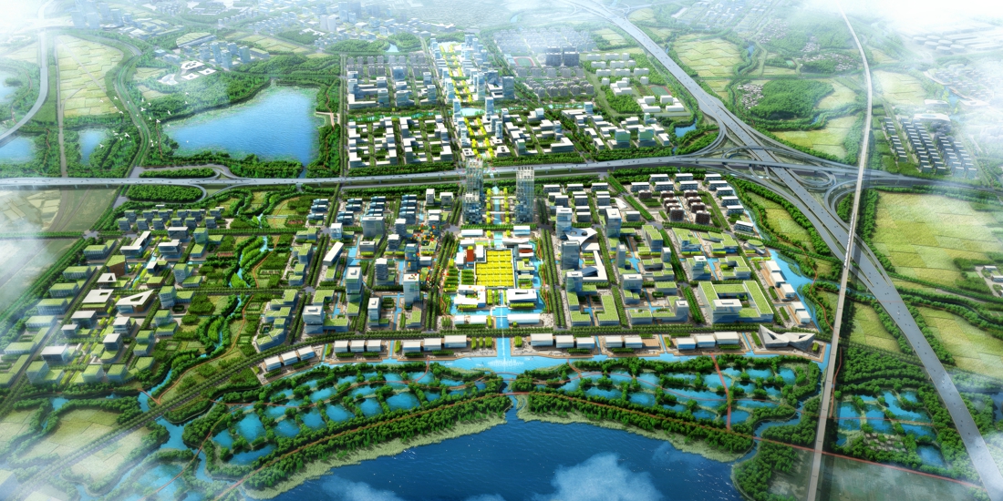
Plan through high-low orderly, moderately compact development intensity control, residential land and work sites, leisure and entertainment, public service facilities and other land mixed layout. Provide more employment opportunities in shorter commuting distance and time. Improve the functional diversity of the built-up area. Promote social life among residents. Build a good community culture. Enhance the vitality of the city. Form a space structure of two zones and one center with Blue-green intertexture and the integration of nature and city.
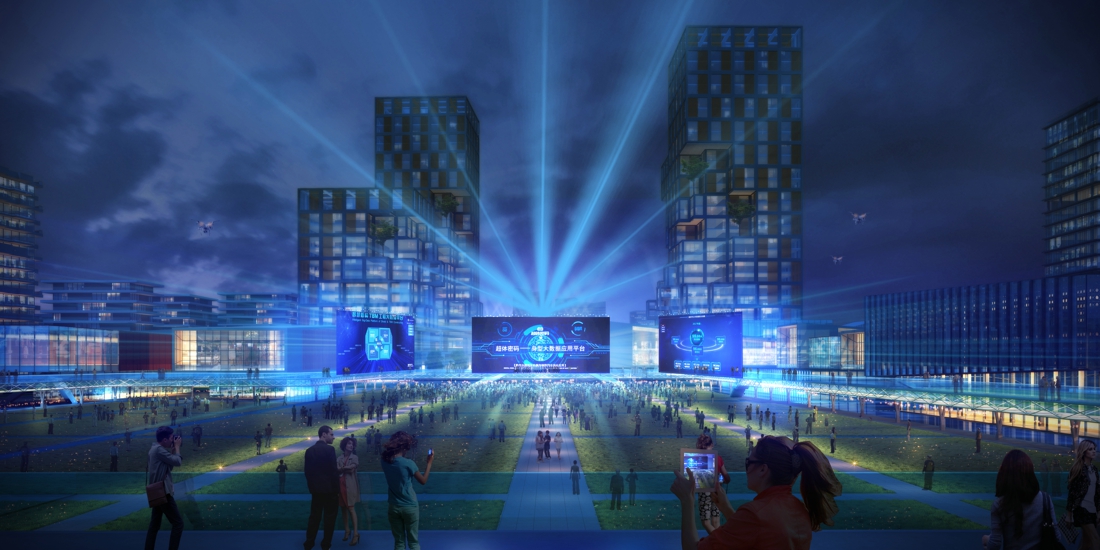
Strategy 2: Science and Technology Revitalization: A vibrant city driven by an industrial core
(1) Six major industries to create a "new generation of information technology and artificial intelligence" digital city
Guided by the national policy, regional planning and policy guidance of Baiyun District, the plan is based on the development trend of 5-10km circle industrial layout. Based on the principle of dislocation cooperation and complementary symbiosis, the six industrial directions suitable for the site are selected: That is, software application development, incubation science, cross-border e-commerce, digital marketing, smart city, big data.
Form a "one axis and one ring" industrial structure. One axis: the development axis of Guangfo City: around the three cores of shared facilities, cultural creation, economy and talent exchange, to build the overall development of the shared development belt of Foshan Electronic Information Industry Park and Baiyun New City. One ring: A (artificial intelligence), B (blockchain), C (cloud computing), D (big data) core technology application bands of the whole technology city in series;
(2) Three types of mixed industry land use patterns to create a "flexible, comfortable, open sharing" workspace
Plan and analysis based on the university, led by the government, and enterprise-led by the industries. Plan and analysis three types of science cities, which rely on universities, government-led and enterprise-led to deduce the functional ratio that accords with the nature of the plot.
Combined with the characteristics of the Internet and digital technology enterprises, such as small and flexible size in the incubation period, obvious synergy in mergers and acquisitions, stable growth period and rapid scale expansion, as well as the demand for portraits and office space of digital technology employees, compared with the cases of the same kind of international scientific research plots, this paper sums up three land plot models of Scientific Research Park, Headquarter Base and independent R & D, and makes reference to the characteristics of the prospective enterprises, according to the functional ratio of the three land plot models of different scale, from large to small adjustment of land block function, so that the program not only to meet the strategic development needs of industry, to achieve a reasonable position of industrial functions, but also in line with the recent positioning of enterprises, science city for the long-term development of the foundation.
Strategy 3: Living livable – TOD as the core to create a pedestrian city, and enjoy a good life with 8-character Water Corridor Service
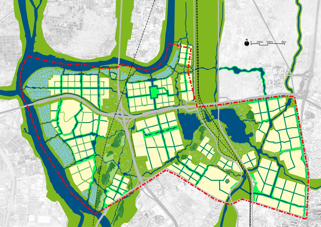
(1) Complete regional integrated transportation network
To Plan and implement the integration development strategy of “Guangzhou- Foshan integration” and “Guangzhou-Qingyuan integration”, and to strengthen the regional ties between Baiyun Lake digital technology city and Foshan and Qingyuan. Build One horizontal and four vertical transit traffic that is fast-in, fast-out, and linking Guang-Fo, Guang-Qing, airport and the central city.
One horizontal: Guang-Fo Expressway
Four vertical: Guang-Qing Expressway, Railway West Line, Railway East Line, Guanghua Express Road
(2) Efficient and convenient internal transport network
Planning through two ring multi-network traffic integration, linking up the groups to form an efficient and convenient internal transport network.
Two Rings: Inner Ring of Baiyun Lake + Huanqigang - Shimen - Baiyun Lake Outer Ring
Multi-network: multiple urban main roads connecting the groups
(3) A direct-to-direct public transport system
It plans to build a 15-minute city group with the “8” BRT line + 4 subways + 1 intercity railway as the core through the multi-level and multi-type bus travel mode of “trunk + branch line”.
8-shaped BRT line: arranged along the 8-shaped water street
4 north-south subway lines: Line 13, Line 8, Line 24, Line 14
1 intercity railway: Guangqing Intercity Railway (Baiyun Station)
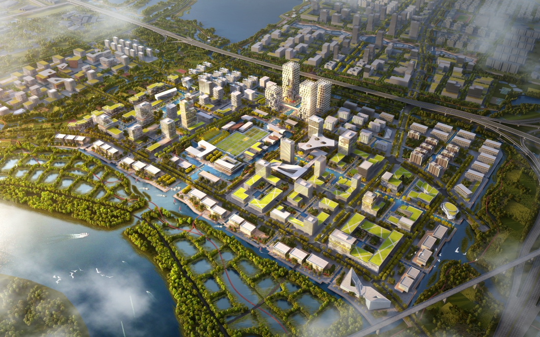
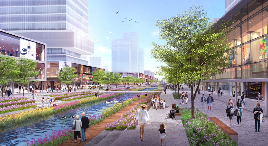
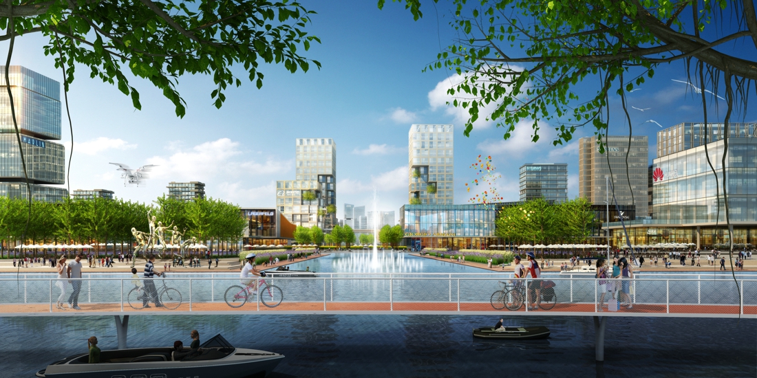
(4) 8-shaped water corridor integrated service zone: Lingnan style charming city comprehensive service zone
Smart walking service
Relying on the 8-shaped water corridor to build a link with the surrounding, multi-dimensional, multi-type, all-weather walking system, to provide daily leisure and recreational services for residents.
Business supporting services
Relying on the waterfront commercial space, it provides convenient daily commercial services for residents of the Science and Technology City. At the same time, it creates a large number of employment and entrepreneurial spaces, and strengthens the vitality of the community center. Activate the remaining three villages of Yagang Village, Chaoyang Village and Xiamao Village to provide comprehensive services such as residence, commerce and culture for the Science and innovation community.
Cultural and entertainment services
Through the 8-shaped commercial water corridor, connet libraries, exhibition halls and other cultural and entertainment venues,and carry new urban culture and festival activities to create a spiritual space for the city.
Education for all ages
Provide equal access to full-age education services such as nine-year schools, international schools, science and Technology Training Institutes, etc. to ensure life-long education and liberal education for all.
Community health service
Provide residents with integrated health care and health care services, and implement more systems such as doctor practice, graded diagnosis and treatment, and national medical insurance.
(5) Lingnan Water City: Let Guangzhou return to the waterfront life
City life returns to the Pearl River
The plan draws on the wisdom of the traditional stagnation and refuge, and achieves the earthwork balance by restoring the Sangji fish pond, raising the construction land to waterproof, creating a large amount of hydrophilic space through the ecological flood control system, and accommodating rich and hydrophilic activities.
City life returns to Baiyun Lake
Plan to inherit the tradition of public activity space of water-based settlements, to optimize the spatial relationship between the city and White Cloud Lake, to restore the ecological buffer zone along the lake shore, and to plant ficus trees throughout the lake to form a water-based forest to purify White Cloud Lake's water, to create the characteristic ecological landscape and enrich the activity type and activate the waterfront space.
City life returns to the river
Plan to carry forward the traditional comb-style layout mode of adapting to the water potential, to sort out the current situation of rivers and irrigation canals, to construct the space system of streets and alleys interwoven with river networks, to integrat public service space spaces such as ancestral halls, arches, stage, etc., to inherit and carry forward intangible cultural heritage like lion dances, dancing fire dragons, etc., to active the urban space.
