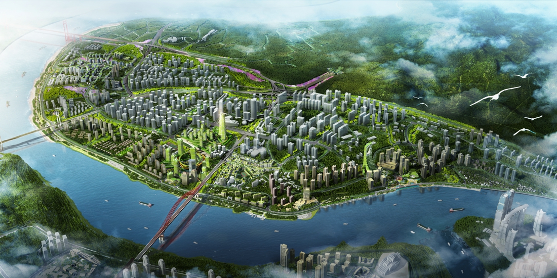
Chongqing Changjiahui Danzishi Area Urban Design
Project Information
- Project Location:
- China Chongqing
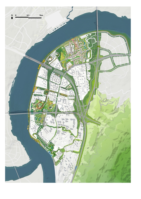
- Project Scale:
- 5.87 Square Kilometers
- Design Time:
- 2021
- Client:
- Peoples Government of Nan’an District, Chongqing City / Chongqing Municipal and Natural Resources Bureau
Project Profile
1. Project Statement
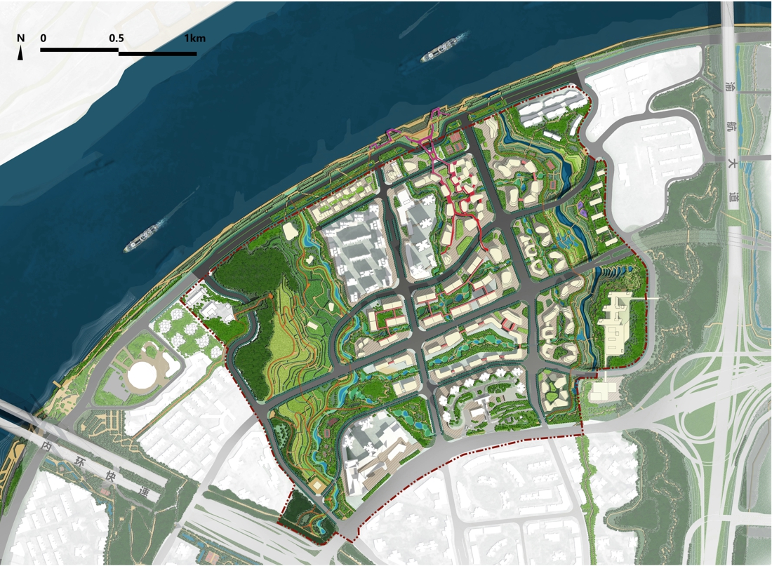
Changjiahui is located in the core area of “Two Rivers and Four Banks” in Chongqing. It is the core of Chongqing’s six “business cards”. The Danzishi area is located on the golden section of the cultural and ecological “business cards”. This project is based on the problem-strategy methods, proposing macro-planning strategies based on current problems, as well as the specific planning and design strategies for important corridors and key areas.
2. Objective and Challenge
(1) Ecological issues
The site is faced with comprehensive water ecological problems brought about by rapid urbanization, including floods, droughts, water pollution, the disappearance of biological habitats and traditional pond systems.
(2) Cultural and rural heritage issues
There are many heritage resource points within the site, but they lack integration. Some traditional old neighborhoods are gradually disappearing due to urban construction, and the slopes, ridges, and ladders that reflect the spirit of Chongqing people no longer exist.
(3) Urban vitality issues
There is a lack of high-quality outdoor open space within the site, which cannot match the needs of residents. They can only gather in the rest space on both sides of urban roads and outside the commercial complex, and even the construction sites are used as the space for communication.
(4) Characteristics issues
The shoreline within the site is all hard embankments, forming a "vertical blockade" that makes it difficult for people to approach the water. At the same time, the strong traffic of Nanbin Road has also formed a "horizontal blockade." The traditional river-city relationship of narrow streets, stepping roads, and rocky beaches no longer exists, and the spatial characteristics of Changjiahui are missing.
3. Design Strategy
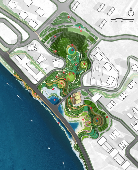
(1) Sponge city with blue and green intertwined
Based on landscape evolution research and regional hydrological analysis of the site, GIS is used to identify stormwater runoff corridors and potential flood hazard areas in order to construct the water security pattern and establish a source (detention)-process (energy dissipation)-end (resilient adaptation) system of blue-and-green sponge city network from the mountain to the river, with a total of 14 key runoff corridors and a regulating wetland area of 21 hectares identified.
(2) Culture on footprint with original history
Base on excavating and sorting out the old trees, stone slab roads, and stepping roads with historical memory value within the site, as well as cultural heritage such as Yuhua yarn factory, French navy barracks, Big Buddha Temple, etc., we build the local and cultural heritage security pattern based to establish a comprehensive cultural experience network, focusing on the cultural heritage and riverside leisure corridors. At the same time, a super greenway running through the north and south will be established to complement each other with the Nanshan Trail, allowing the faded city memory to reconnect the colorful stories across the eras.
(3) Civil atmosphere with vitality network
Based on the ecosystem services provided by the blue-and-green system, and extend it into the urban space, we construct a comprehensive network of life service, healthy sports, leisure gatherings, and public art that is full of Chongqing's characteristic vitality and civil atmosphere, making Changjiahui truly a local "great scenic spot" where residents live happily and visitors linger.
(4) Landscape terraces and rhythmic “piano keys”
Horizontally, combined with multi-level and step-by-step topographic features, a belt-shaped "terraced field" space gradually transitioning from urban public functions to non-public functions is established from the Yangtze River to Nanshan, with the urban landscape coordinated hierarchically. The ecological corridor is combined vertically to form landscape viewing corridors, and the rhythmic changes between the green space and the city is organized. Meanwhile, the "piano key" nodes are constructed in conjunction with important buildings to fully demonstrate the beauty of the city's rhythm.
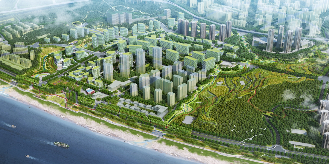
Urban design for key areas: four major nodes, repairing mountains and the city
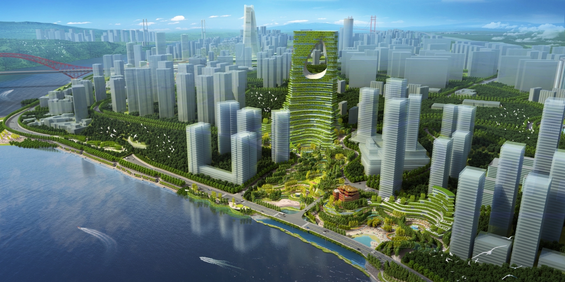
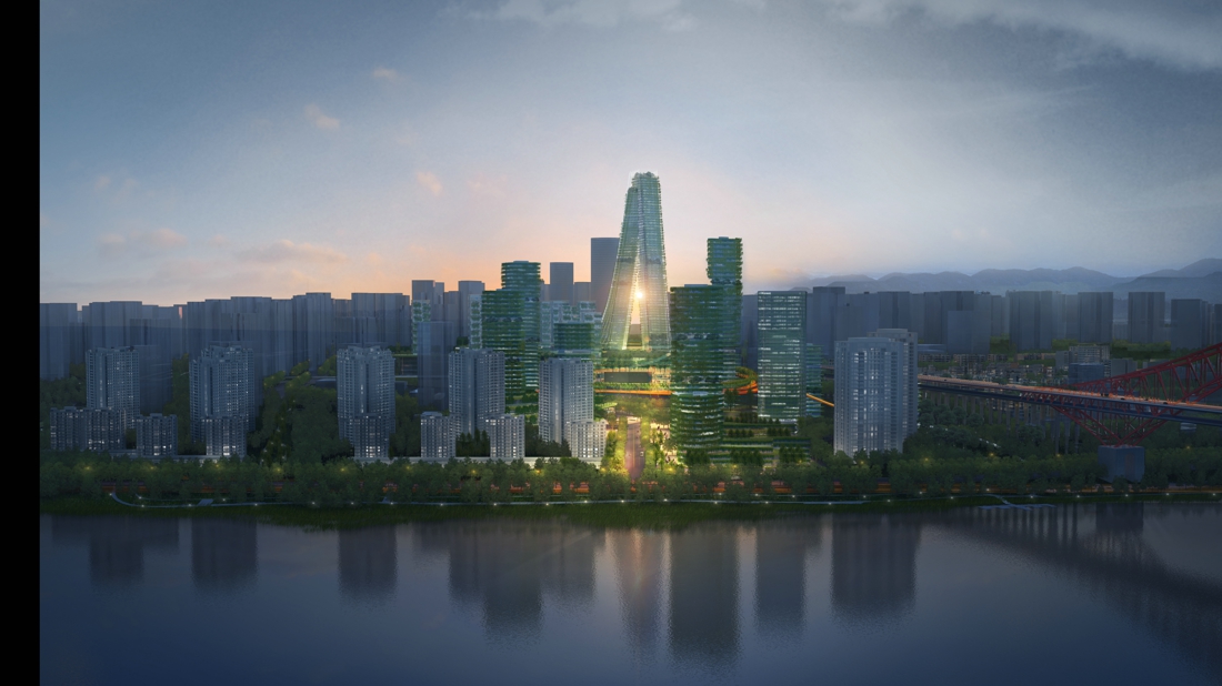
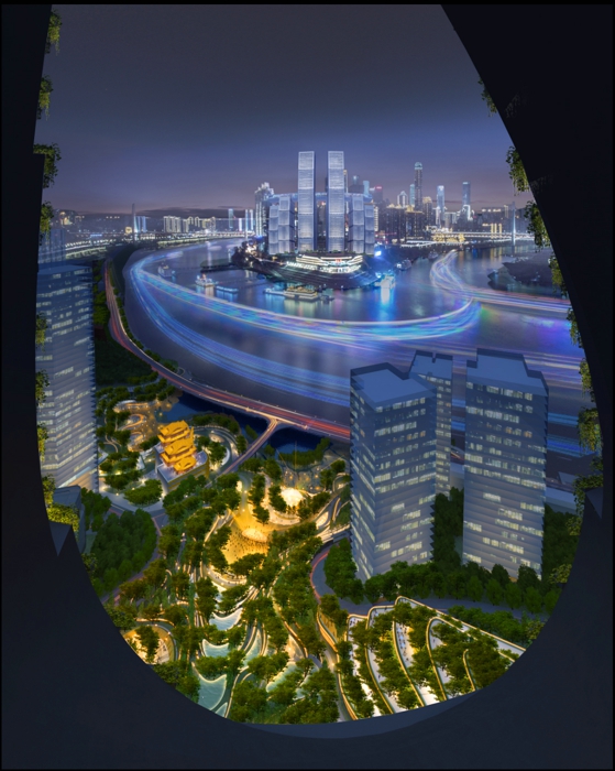
(1) The Bell Tower Square area: integrating mountains and the city, constructing buildings into peaks
The Bell Tower Square area is an important node of the culture core area of the Two Rivers and Four Banks, forming a tripartite relationship with Jiangbeizui CBD and Raffles. The design echoes the geological process of Chongqing with urban orogeny, and creates the impression of Chongqing with the integration of mountains and the city, the appearance of the landscape and the symbiosis of the city and nature, through strategies such as introducing rivers into the city, constructing buildings into peaks, vigorous living rooms, three-dimensional ecology, and intensive functions.
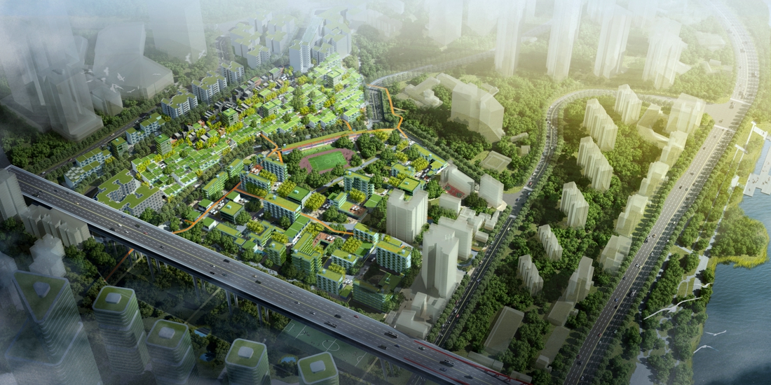
(2) Weiguo Road area: symbiosis of new and old with civil style
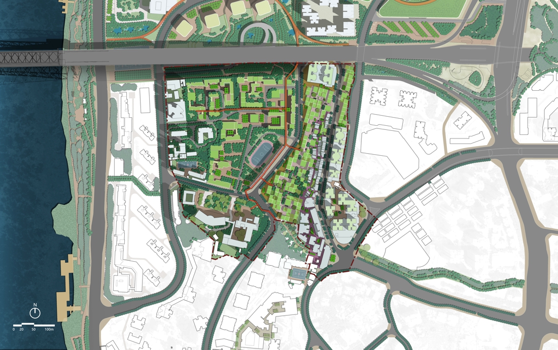
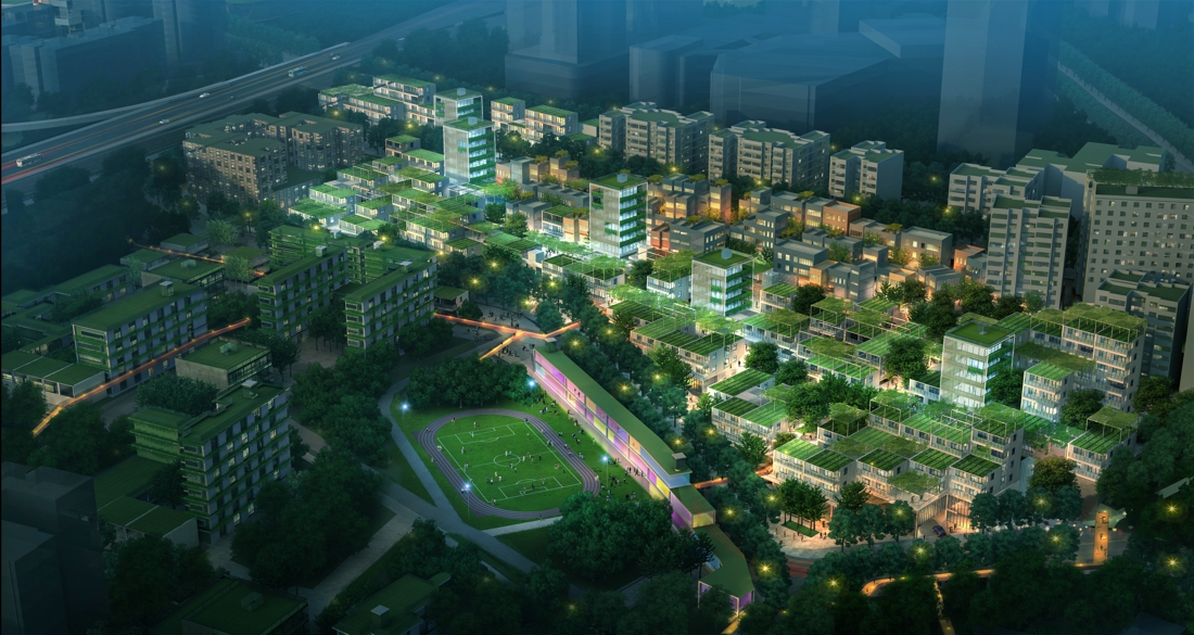
The Weiguo Road area witnesses the development of Danzishi Old Street and the city’s industry. It is the link between old and new. The design achieves Jobs-housing balance through the improvement of small-micro incubators and builds a diversified industrial chain of production, education, research, and housing, realizing a civil-style talents community and reproduces the old view of Chongqing. The overall strategy follows the principle of non-antique and non-old-fashioned, constructing a creative street space with pleasant scales, integrated functions, civil atmosphere, as well as the symbiosis of new and old by using recognizable and reversible design materials and forms.
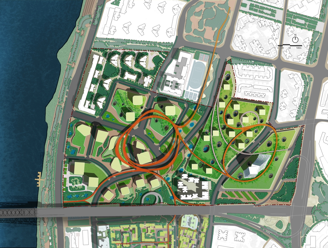
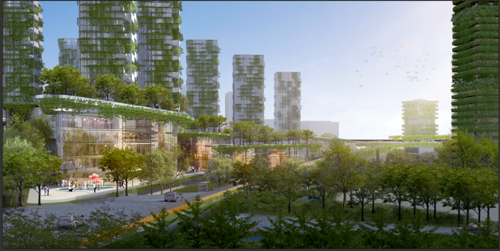
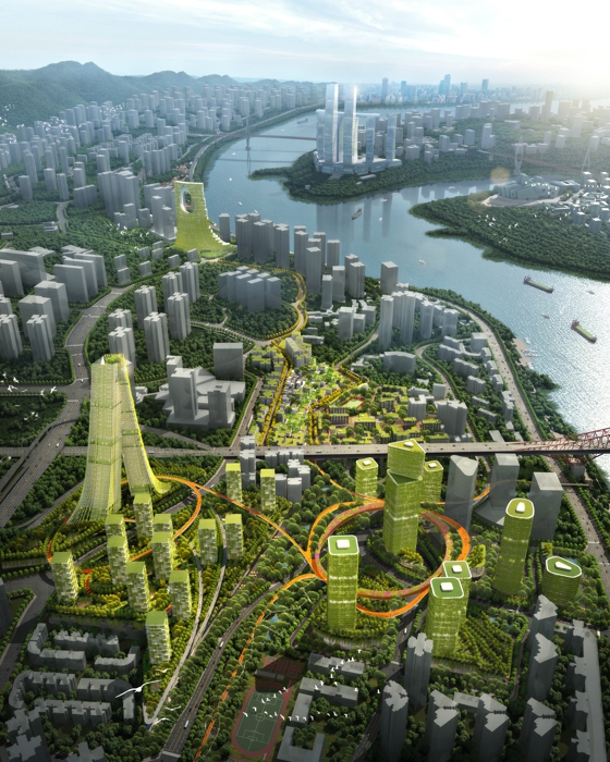
(3) Headquarters Economic Zone area + No. 8 block: multi-hole twin city & three-dimensional forest
The headquarter economic zone is an important functional component of the central business district and an important node in the new era from industrial civilization to ecological civilization. The design is to create urban twin cities to achieve three-dimensional integration. The lower level is a “red” city with vibrant commercial functions, and the upper level is a green forest city with poetic flower strolling paths. The idea of porous patio system connecting the upper and lower layers inspires from the Wulong Tiankeng, which is not only a lighting patio, but also covering rich and diverse activities. As a link, the ring-shaped gallery bridge integrates each functional section of the headquarters economic zone to form a floating space of communication. The gate-shaped tower serves as the high point of the whole area, creating a new riverside landmark of Chongqing’s Nan’an District with a peak view.
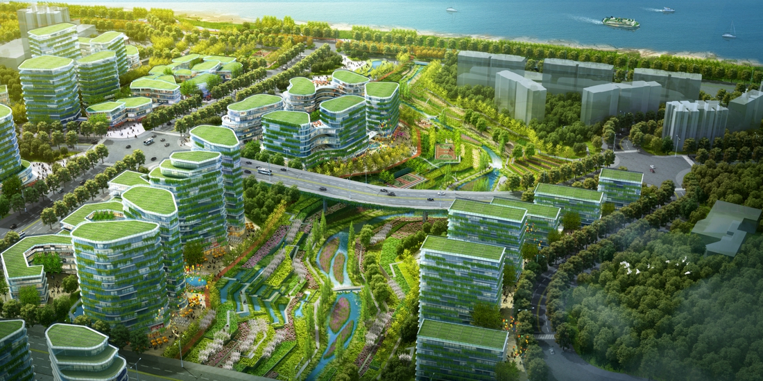
(4) Yangren Street area: sponge community & neighborhood life
The Yangren Street area is located between the two valleys and is an important channel for stormwater from Nanshan to the Yangtze river. Facing the future, Yangren Street will grab the opportunity of new-city construction to build a green, vigorous and livable new ecological area, and become a new model for the sponge city construction in Southwest China. The design adopts the strategy of introducing sponges, restoring two streams, restoring two mountains, introducing slow travel, implanting vitality, as well as connecting the river to the city, in order to construct a sponge network and slow system that connects residential communities and ecological bases, repair the fragmented city-river relationship and create a colorful and vibrant neighborhood life.
