China (Hainan) Pilot Free Trade Zone of Haikou Jiangdong New District Conceptual Planning


Project Information
- Project Location:
- China Haikou, Hainan
- Project Scale:
- 418 Square Kilometers
- Design Time:
- July 2018
- Client:
- Leading Group of Haikou Jiangdong New Area, China (Hainan) Free Trade Zone
Project Profile
1.Project Statement
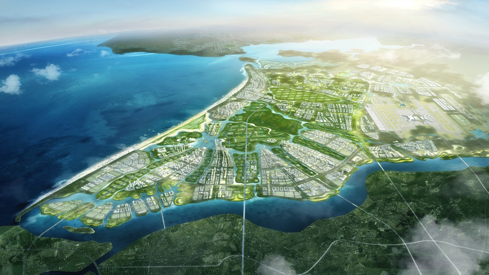
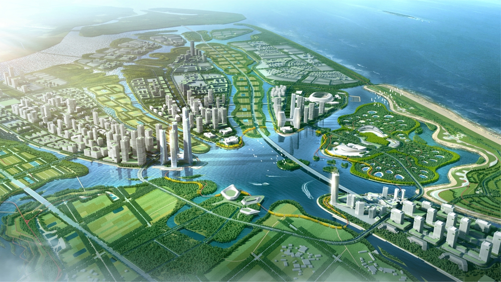
Haikou, the famous coastal garden city of South China, an important fulcrum of the national “Belt and Road” initiative and the South China Sea strategy. It shoulders the important historical mission of implementing the strategic positioning of the "three districts and one center" and building a free trade zone and a free trade port with Chinese characteristics. Jiangdong New District, located between the main urban area of Haikou and Wenchang Mulan Bay, Planning range 418 square kilometers.It is an important hinterland for the development of the city to the east. Meanwhile a green basement city surrounded by sea, port and river.
2.Objective and Challenge
(1) How to deal with the "water problem syndrome" in tropical coastal areas such as frequent floods, deterioration of water quality, and biological reduction?
In the history of the planning area, it is a delta river floodplain formed by the westward shift of the Nandu river and the natural accumulation of sediment. With the development of urbanization, local people rebuild river embankments, fill ponds and build land, and expand urban areas. The hard ground area has expanded significantly, and the corresponding ecological base area has a considerable degree of shrinkage. At the same time, the increase in the density of the traffic network has been cutting the ecological base. These improper measures have seriously damaged the natural "sponge", Unable to play the ecological effect. It leads to series of "water problem syndromes" such as frequent floods, deterioration of water quality, loss of habitats, etc.
(2) How to minimize the impact of the typhoon on the Typhoon Corridor?
The planning area is located in the typhoon corridor, and the frequency of windstorms is high. Between 1987 and 2018, there were even 378 typhoons. Through the impact assessment of the typhoon risk level, the results show that there are three high-risk areas inside the site: Hekou, Hongzhaigang-Hanjiang, southwest area. In addition, due to human damage, coastline erosion and other factors, the original windbreak forest belt is gradually being eaten, resulting in further increase of wind pressure.
(3) How to ensure the safety of the city on the earthquake fault zone?
There are two hidden earthquake fault zones in the planning area, east and west, north and south.its Maniao-Puqian fault zone, Qinglan-Puqian fault zone. It has the ability to generate an earthquake of magnitude 6-7.5, leads to Marine geological disasters such as geological disasters, earthquake tsunamis, and rapid sinking of coastlines. In addition, there is a large area of sand liquefaction area in the planning area, Make future urban construction face greater geological security risks.
3.Design Strategy
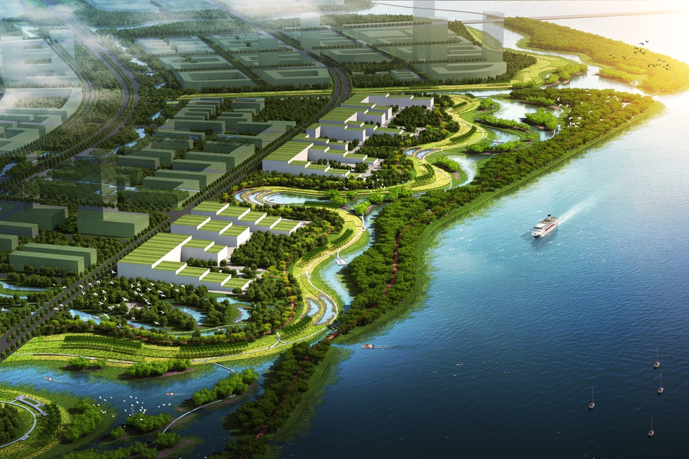
(1) Constructing a water ecological infrastructure system to solve water problems
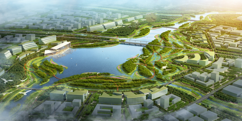
a) Divert water into the city, Flexible flood control (tidal). Recovering the connection between Nandujiang and Tanzhan River, Meiya River, Daomeng River and Furong River through simple engineering measures for on-site filling and excavation.
b) Forming four major flood detention areas, namely Shashang Port, Dongying Port, Zhuxi River and Xitou Port, to respond flexibly to flood surges.
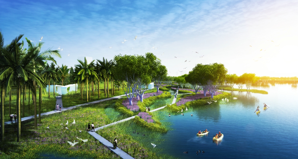
c) The big and small size of the sponge, dispersed stagnant flood. A series of ecological measures such as sponge city, sponge road, sponge garden, sponge water system, cascade purification water shore, and terminal purification wetland can achieve a sponge city goal such as natural accumulation, natural penetration, and natural purification.
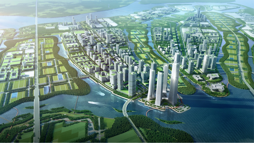
(2) Multiple forest nets and finger structures alleviate typhoon disasters
Combination of protection and drainage, collaborative reduce disaster. According to the perennial wind direction of Haikou, Create a multi-level coastal defense line of "grass straw belt - seawall base forest - wetland forest belt - farmland forest network". Protecting from wind and sand, preventing wind and waves, protecting coastal wetlands, and responding flexibly to extreme weather disasters such as typhoons through ecological means. At the same time, combined with finger-shaped wind guide corridors, coordinate building height and layout, reduce the impact of typhoon disasters, and alleviate urban heat island effect.
(3) Finger-shaped island chain structure effectively evades seismic fault zone
Solidified to zero, blue-green mosaic, Breaking up the traditional pie-style urban structure. The city is embedded in the blue-green system in the form of fingers, providing a healthy life mode for Haikou people to get close to the waterfront. At the same time, it effectively avoids the impact of the fault zone and ensures urban safety.
4.Conclusion
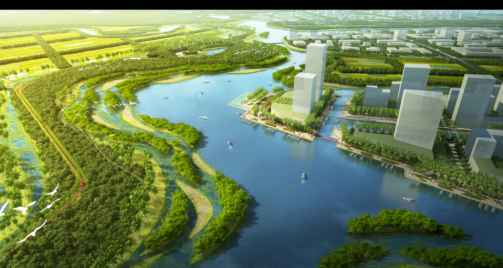
Planning based on water ecosystems, wind and disaster reduction systems, plan to establish 12 rainwater corridors, four major flood detention areas, and one core protected area. Restore the water system connectivity of Tanyu River, Meiya River, Nanyue River, Daomeng River, Furong River and Nandu River. Construct a buffer zone along the river vegetation, intercept the non-point source pollution of the farmland, and form the first line of defense for pollution prevention. At the same time, five end ecological purification wetland areas are formed, which are coupled with the flood detention area to form a second line of defense for non-point source pollution prevention. For the area affected by the earthquake fault zone, corresponding evasive measures are proposed.
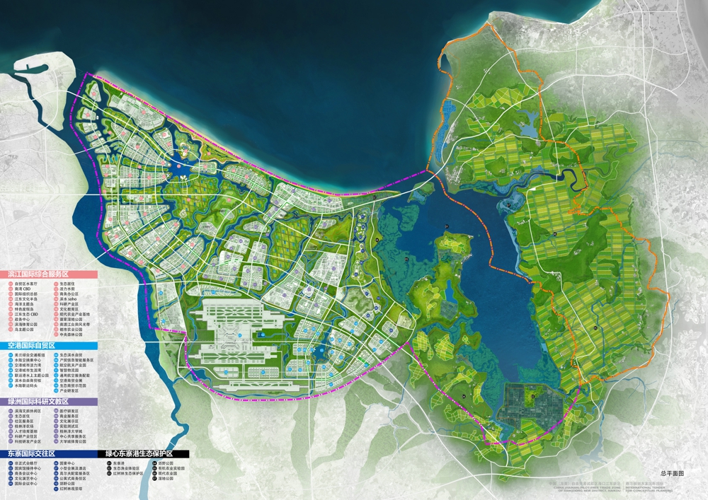
By combing the blue-green vein, delineating the three-zone and three-line, The basic farmland area is about 52.6km2, the ecological protection area is about 271km2, and the urban development and construction area is about 147km2. Forming a “one core, two hearts and multiple corridors” finger ecological space structure. Building health "ecological life community".
