Xixian Fengxi New City Sponge City System
Project Information
- Project Location:
- China Xixian, Shanxi
- Project Scale:
- 44 Square Kilometers
- Client:
- Fengxi New City Management Committee
Project Profile
1. Project Statement
In order to achieve the planning goal of building a sponge city in the flat terrain of the Fengxi New City in the Western Xian'an New Area, this plan transforms the central green corridor planned in the overall urban design into a green sponge body and uses it as the main network to organize the storage, infiltration, and drainage of urban rainwater. In the specific design, considering the geological conditions of the site, the strategy of deep excavation of green valleys is proposed. By excavating sand to build green valleys and using sand to replenish investment, the design is combined with the construction process, solving the problem of how to build a sponge city in new cities with flat terrain like Fengxi New City.
(1) Regional and Site Characteristics
a. Western Xian'an New Area - Sponge City Planning of Fengxi New City
The Western Xian'an New Area is the first national-level new area established with the theme of innovative urban development methods approved by the State Council. It is located between the built-up areas of Xi'an and Xianyang in Shaanxi Province, with a planned control area of 882 square kilometers. As the core area of the Guanzhong- Tianshui Economic Zone, the Western Xian'an New Area has obvious location advantages and profound historical and cultural heritage.
Fengxi New City is one of the five new towns in the Western Xian'an New Area, with a total planned area of 143 square kilometers and a core urban area of 44 square kilometers. It is located in the historically significant and fertile Fengwei Plain, surrounded by the Wei River, Feng River, Xin River, and Sha River (old channel), which provide superior natural conditions for the new town. Moreover, the ancient capitals of Xi'an and Xianyang bring deep historical and cultural heritage to Fengxi New City, with historical sites such as the Gaoking Site located in Fengxi New City
As an extension area of Xi'an and Xianyang's functions, the overall positioning of Fengxi New City is to serve as the future international comprehensive service sub-center and strategic emerging industry base of Xi'an, providing urban service functions such as commerce, culture, and residence for approximately 500,000 urban residents in the future.
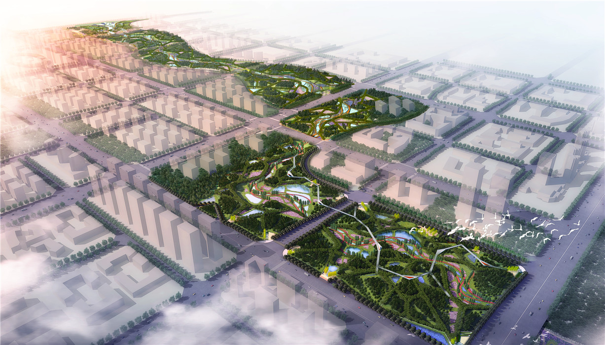
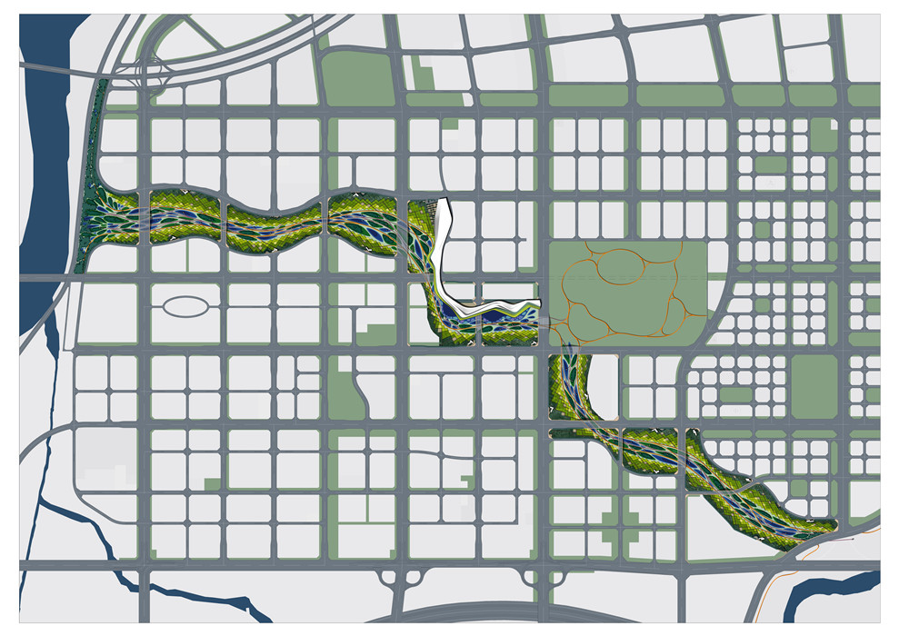
Therefore, in the overall urban design, a central green corridor crossing the city center was planned, forming a green slow-moving corridor connecting the Feng River and Wei River, while also serving as an ecological corridor to provide necessary ecological services for the city. It is this forward-looking urban design that has left space for the sponge city planning of Fengxi New City, making the planning and implementation of sponge cities possible in the future.
Commissioned by the Fengxi New City Management Committee, Turen Design took the central green corridor of Fengxi New City as the core of the planning and conducted sponge city planning research on the core urban area of Fengxi New City.
b. Site Characteristics of Fengxi New City
The region where Fengxi New City is located has a warm temperate semi-humid continental monsoon climate, with hot and rainy summers and slightly cold and dry winters, moderate climate, distinct seasons, and an annual rainfall of about 600 millimeters (rainfall less than evaporation), which is unevenly distributed. In ancient times, in order to develop agriculture in the Fengwei Plain, the people formed a developed agricultural irrigation system, mainly planting wheat and cotton, making it an important grain-producing area in China.
Currently, the area where Fengxi New City is located is still predominantly agricultural land, with some scattered villages. The overall terrain of the site is flat, with the maximum height difference within the site being around 3 meters.
As a floodplain of the Wei River and Feng River, the surface soil of the site is fertile, and the underlying soil is mainly sedimented river sand accumulated over many years. Currently, due to controlled water sources from the Wei River and Feng River, local farmers mainly use well pumping to irrigate underground water, leading to a yearly decline in the local groundwater level. On the other hand, the Wei River and Feng River are also important objects for flood control and drainage in the local area.
Therefore, the urban construction of Fengxi New City is facing a series of problems and challenges, especially in terms of urban stormwater management.
2. Objective and Challenge
a. The Fengwei Plain is excessively flat, with uneven precipitation, leading to water shortages in the dry season and susceptibility to flooding in the rainy season.
Due to the excessively flat terrain of the core urban area of Fengxi New City located in the Fengwei Plain, precipitation is uneven. During the agricultural era, there were frequent water shortages in the dry season and flooding in the rainy season. It can be envisioned that when this 44 square kilometers of land is developed in the traditional urban manner, with the surface runoff coefficient increasing from 0.2 to the conventional 0.6, 40% of the rainwater will no longer be able to infiltrate and replenish groundwater, exacerbating the decline in groundwater levels in the area. Additionally, before urban development, only about 20% of rainfall eventually formed surface runoff, whereas after land hardening, approximately 60% of rainwater becomes surface runoff (Che Wu and Li Junqi, 2006). To effectively discharge this rainwater and reduce the risk of urban flooding, significant investment in constructing a large-scale underground rainwater pipe network system is inevitable.
On one hand, there is a significant amount of rainwater that needs to be discharged, while on the other hand, groundwater cannot be effectively replenished. The uneven distribution of precipitation over time and excessively flat terrain in the Guanzhong region present significant problems and challenges to our urban development.
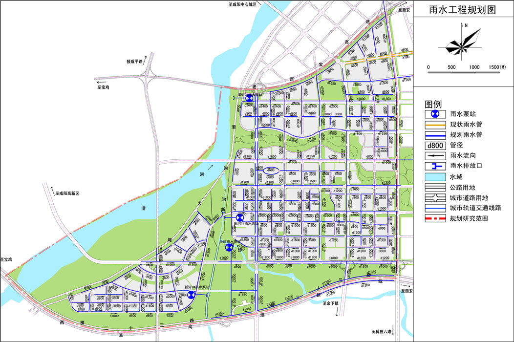
b. Traditional control-oriented rainwater pipe network planning has already been completed.
When commissioned for planning and design, Fengxi New City had already completed the detailed planning of the central urban area. Among these plans, the rainwater pipe network was designed to collect rainwater in segmented areas and ultimately discharge it into surrounding rivers through pumping stations, following traditional municipal engineering practices. This means that every drop of rainwater falling within the city needs to converge in the rainwater pipe network as long as it does not infiltrate. Moreover, due to the excessively flat terrain, the rainwater finally collected cannot be naturally discharged and must be forcibly discharged into the river through artificial means. Therefore, in addition to substantial upfront construction costs, significant ongoing maintenance costs are required. This will make the new city highly energy-consuming and costly to maintain in terms of urban stormwater management, with minimal output.
As the planning and design unit, we once suggested to the client to thoroughly adjust the traditional rainwater pipe network planning. However, during the time when guidance for sponge city planning and design was not yet issued, the client, for safety and other reasons, explicitly stated that the original rainwater pipe network planning could not be adjusted but could be supplemented with some facilities to meet the requirements of sponge city planning. Therefore, integrating the planned traditional rainwater pipe network with the upcoming planned green sponge system through planning and design becomes particularly important.
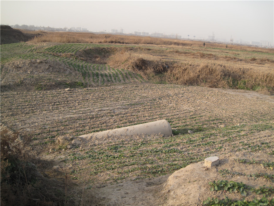
c. The thick layer of deposited river sand presents challenges and opportunities to urban construction.
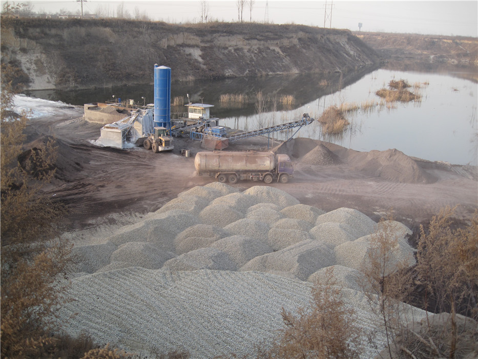
After conducting preliminary geological exploration of the area where Fengxi New City is located, it was found that beneath the surface collapsible loess lies a layer of river sand deposits that are over ten meters thick. The thick layer of river sand poses both challenges and opportunities for urban construction. On one hand, it is a disadvantageous factor as it requires deeper foundations to ensure the safety of buildings, leading to increased construction costs. However, on the other hand, the thick layer of river sand itself serves as excellent construction material. There are sand mining sites along the southern edge of the site, particularly in the old channel of the Sha River, where sand is excavated.
The thick layer of river sand underground can be fully utilized in the urban construction of the new city. The excavation and utilization of river sand make it feasible to significantly alter the elevation of the site through design interventions.
3. Design Strategy
a. Implementing Low-Impact Development Strategies for Planned Parcels to Facilitate On-Site Stormwater Infiltration
The most effective and economical approach to creating a sponge city is through source control, beginning with low-impact development (LID) strategies on the source parcels. Therefore, the plan initially establishes landscape design guidelines for parcels of different land use types:
(i) Utilize permeable materials for hard paving as much as possible to reduce surface runoff coefficients and minimize potential surface runoff. For instance, permeable bricks can replace fired bricks, permeable concrete and asphalt can substitute regular concrete and asphalt, and small-sized stone paving with coarse joints can replace large-sized stone paving with tight joints.
(ii) Implement vertical design to ensure that green spaces within parcels are lower in elevation than hard surfaces, allowing runoff to be retained and infiltrated within green spaces. For example, along roads and hard surfaces, low green ecological drainage ditches are set below road surface elevations to organize runoff retention and infiltration.
(iii) Set up dispersed concave wetlands within green spaces according to the direction of runoff, maximizing the retention and infiltration of rainwater. For instance, concave rain gardens are designed to further retain rainwater.
(iv) Install overflow outlets at the highest water level in concave green spaces. For parcels closer to the central green corridor, overflow can be directed directly into the central green corridor if vertical elevation permits; otherwise, overflow is directed to underground stormwater pipes. The control target for surface runoff coefficients after urban construction on each parcel of land is set at 0.2 based on local conditions, which is an economically feasible goal.
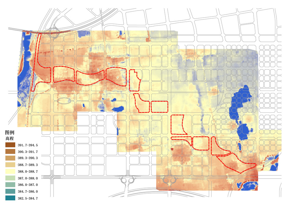
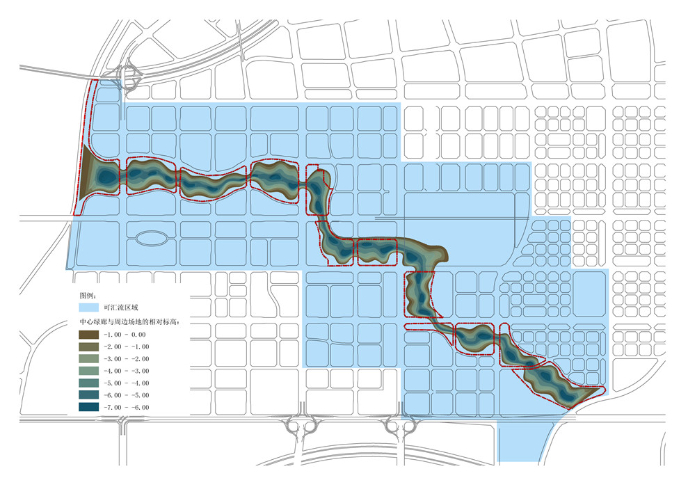
b. Excavating the Central Green Corridor to Form a Green Valley and Constructing an Ecological Stormwater Corridor
To effectively address the water ecological environment issues of Fengxi New City, beyond the on-site infiltration strategy for individual parcels, a backbone network for rainwater retention and infiltration needs to be established at the urban scale. The central green corridor planned in the overall urban design can serve this role. However, the major obstacle to the central green corridor acting as the main stormwater corridor of Fengxi New City lies in its excessively flat terrain and the longitudinal distance exceeding 4 kilometers from north to south. This prevents runoff from adjacent parcels from naturally flowing into the central green corridor. To maximize the absorption of runoff from surrounding parcels, the design elevation of the central green corridor needs to be lowered based on the existing elevation. By calculating that reducing the design elevation of the green corridor by 4-6 meters can achieve organized rainwater management and runoff for approximately 1/4 of the core urban area, about 12.5 square kilometers of land, through gravity flow.
However, the major obstacle to adopting the deep excavation design strategy is the significant amount of earthwork that comes with the decrease in average elevation. It is estimated that reducing the design elevation of the green corridor by 4-6 meters would result in the excavation of approximately 6 million cubic meters of soil, leading to a substantial increase in project investment and directly affecting the feasibility of the scheme.
To address this issue effectively, preliminary geological exploration reports of the site revealed that river sand is buried only about 2-3 meters below the surface. This means that about half of the earthwork generated from excavating the green corridor could consist of river sand, which can be directly utilized as construction material in the new city. By excavating and utilizing the river sand during the construction of the green corridor, the excess soil generated is transformed into economic value. Therefore, a bold proposal is made in the planning and design process to excavate and store surface soil and bottom-layer river sand separately during the construction of the green corridor. The surface soil is used as planting soil for backfilling after the formation of the central green corridor, while the river sand, as a good construction material, can be directly used in the construction of the new city. Based on the planned design of the central green corridor, approximately 6 million cubic meters of earthwork will be generated. Considering a market price of 60 yuan per square meter for external soil transportation, the additional investment is estimated to be 360 million yuan. However, the river sand that needs to be transported externally is approximately 2.6 million cubic meters (approximately 4.68 million tons). Calculating based on a market price of 80 yuan per ton for construction sand, the recoverable investment is estimated to be 374 million yuan. This means that apart from the additional investment cost due to the earthwork generated from deep excavation of the central green corridor, there is still a surplus of 14 million yuan, making the deep excavation of the corridor economically feasible.
After obtaining preliminary feasibility, considerations are made regarding water drainage area, excavation volume, bridge construction, ecological service functions of the corridor, etc., ultimately determining a excavation depth of 4-6 meters. This decision is primarily based on the following factors:
(i) Balancing the rainwater regulation function of the green sponge with the landscape ecology function. Given that the central green corridor averages over 100 meters in width, excavating a green valley 4-6 meters deep favors creating a favorable landscape spatial experience, while excessive depth may cause discomfort and imbalance in spatial scale. Excavating a 4-6-meter-deep green valley can effectively retain nearly 1/4 of the rainwater in the core urban area as planned.
(ii) Balancing transportation requirements with investment. Excavating a green valley will require roads crossing it to become bridges, forming a three-dimensional intersection with the recreational roads inside the valley. A depth of 4-6 meters is the minimum requirement for such a three-dimensional intersection scheme; otherwise, bridges crossing the valley would need to be elevated, increasing investment. Deeper schemes carry certain risks, such as uncertainty about sand extraction rates, which could affect investment returns.
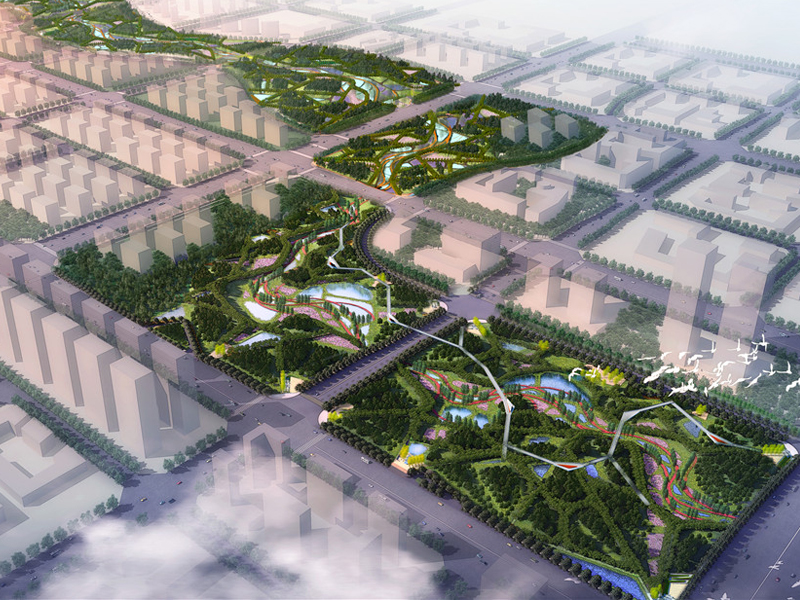
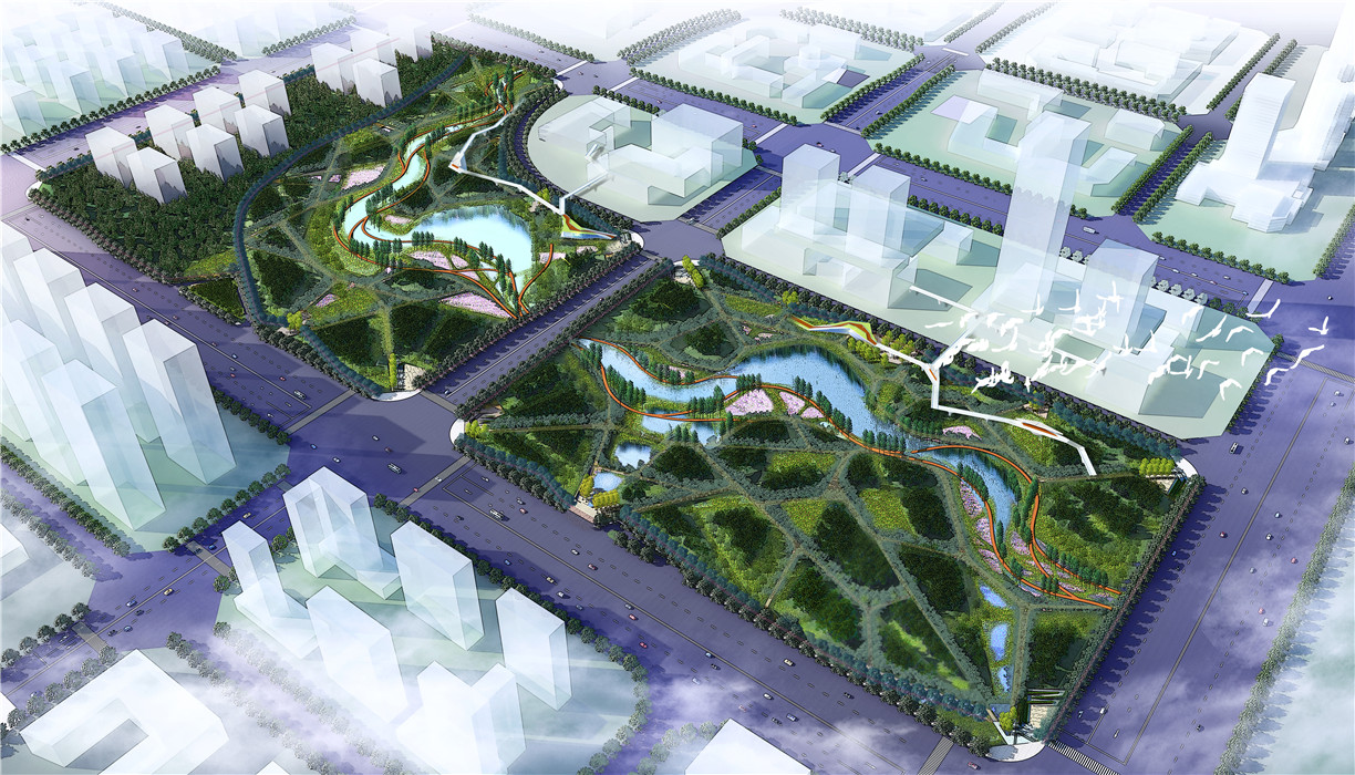
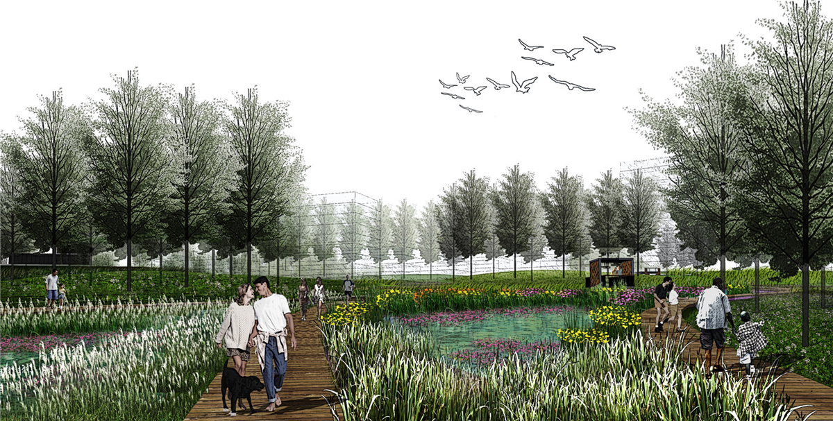
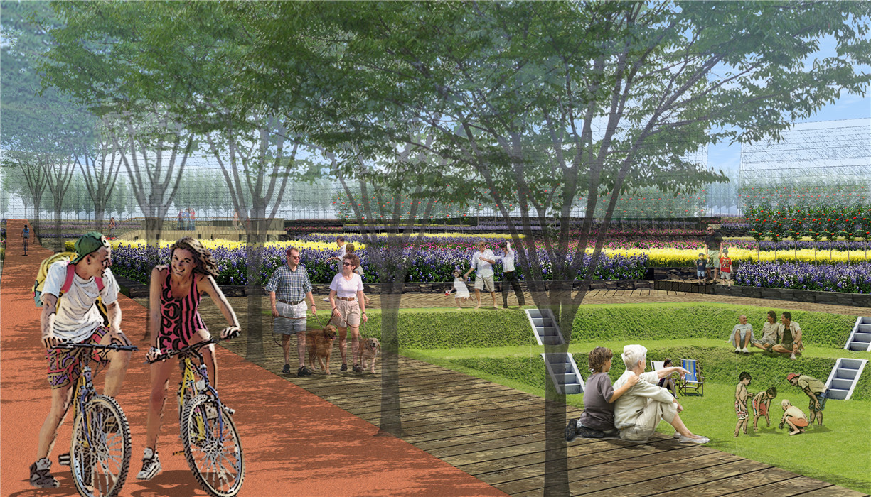
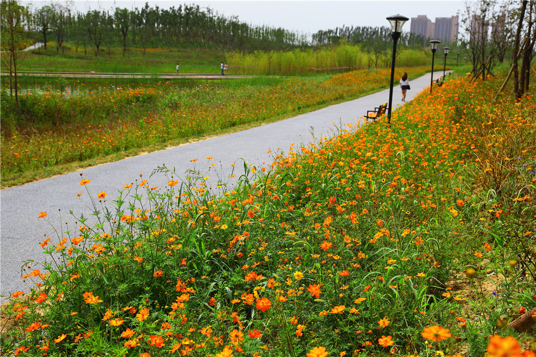
c. Constructing Wetland Landscape in the Central Green Corridor to Combine Urban Leisure Function with Rainwater Management Function
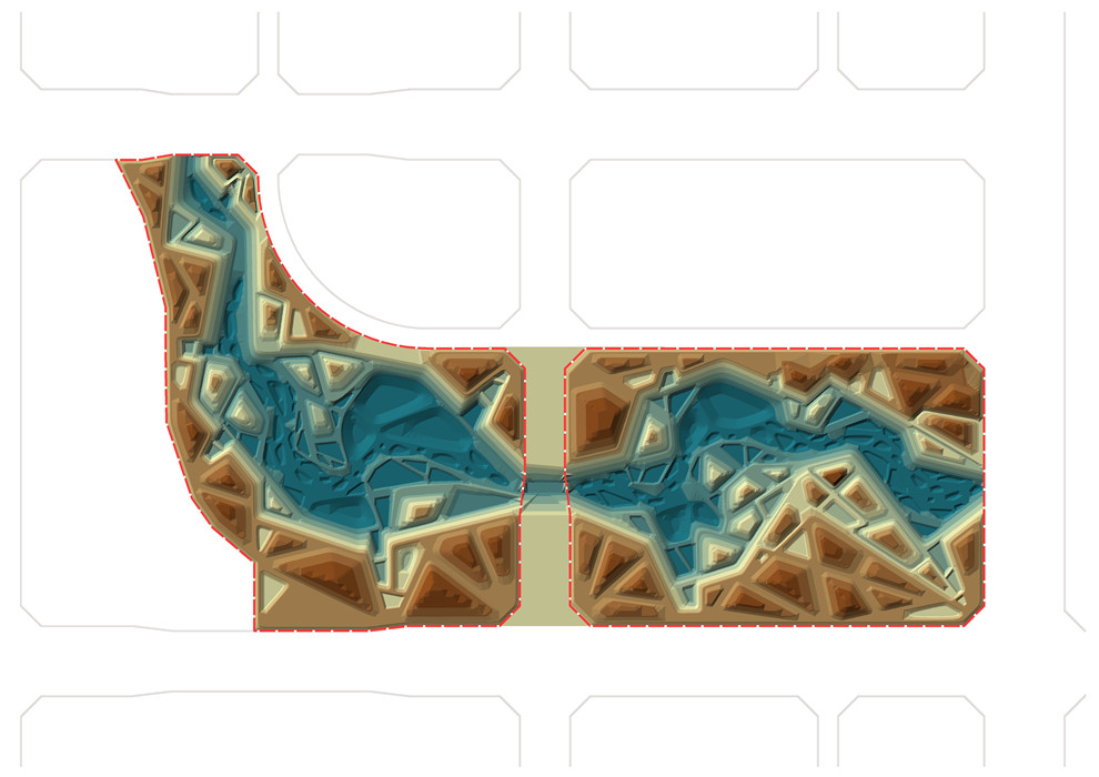
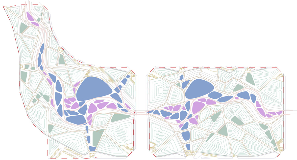
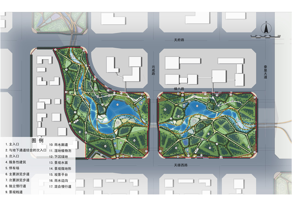
To achieve the ecological service, urban leisure, cultural tourism, and other functions of the central green corridor, the plan proposes utilizing the green valley and urban rainwater to create seasonal wetland landscapes. The specific design strategies include:
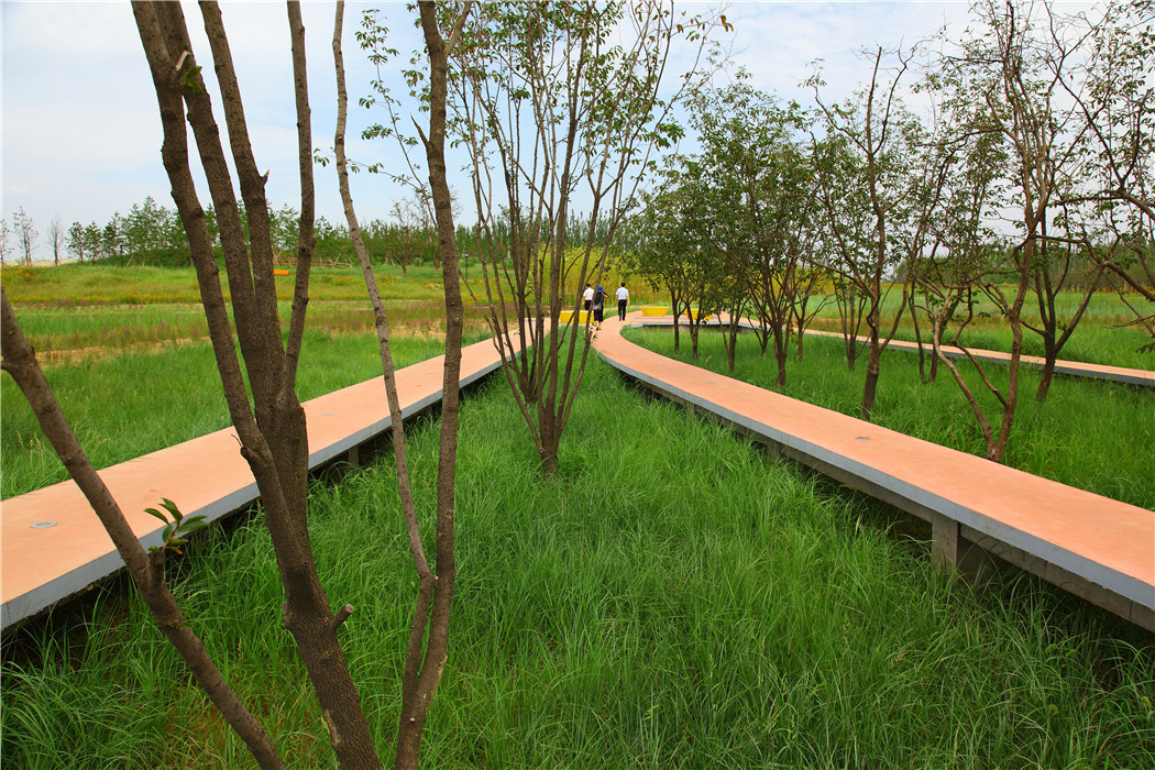
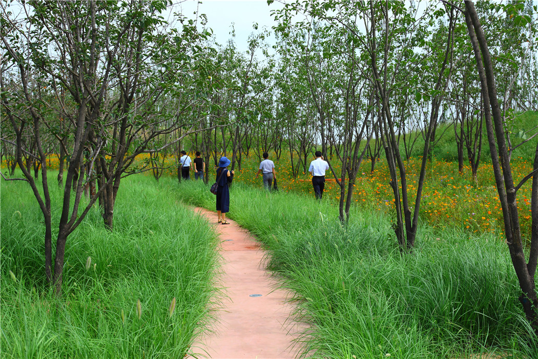
(i) Setting up a series of seasonal wetland pools of varying elevations at the bottom of the central green corridor for rainwater storage, regulation, and drainage. The entire valley bottom serves as a huge green sponge, where urban rainwater is regulated in these seasonal wetland pools. For this purpose, multiple intersecting and parallel walkways are designed in the landscape, each with varying design elevations corresponding to different water levels during dry and wet seasons, to create a pleasant waterside leisure experience. Meanwhile, the wetland pools are designed to form a series of islands of varying heights for citizens' recreational activities.
(ii) Conducting on-site excavation and filling within the central green corridor. Design a series of water pools and terraces of different elevations on both sides of the central green corridor, with each terrace descending layer by layer. The higher parts of the terraces connect with surrounding parcels and underground stormwater networks to filter and infiltrate rainwater, while the lower parts connect with seasonal wetlands for rainwater retention. Furthermore, each time rainwater flows into the central green corridor, it passes through each terrace and lowland, providing natural irrigation to the plants on the terraces and forming a unique ecological landscape feature.
(iii) Locating non-submergible service buildings and other facilities in entrance squares consistent with urban
4. Conclusion
As a flat terrain new city plan, Fengxi New City has been fortunate to incorporate central green corridors and abundant river sand deposits into its early planning, making the concept of sponge cities economically feasible. However, for other cities with similarly flat terrain but lacking river sand resources, achieving the goals of sponge city planning may prove more challenging. In such cases, the early planning of green rainwater corridors becomes particularly crucial. By integrating the concept of green sponge into urban planning and design, and embedding green networks into urban plots, it is possible to reduce the difficulty of later implementation and achieve the objectives of sponge city planning without the need for extensive earthworks.
After two years of effort, the first phase trial section of Fengxi New City has been largely completed and has become a model for sponge cities nationwide, attracting visits from domestic and foreign visitors, including state leaders.
References:
Che Wu, Li Junqi. Urban Rainwater Utilization Technology and Management. Beijing: China Architecture & Building Press, 2006.
Yu Kongjian, Li Dihua, Yuan Hong, Fu Wei, Qiao Qing, Wang Sisi. Theory and Practice of "Sponge City". Urban Planning, 2015, 39(6): 26-36.
