Fengjiajiang Coastal National Wetland Park

Project Information
- Project Location:
- China Beihai, Guangxi
- Project Scale:
- 4.46km²
- Design Time:
- July 2017
- Client:
- North China Municipal Engineering Design &Research Institute Co., Ltd.
Project Profile
1. Project Statement
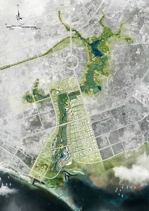
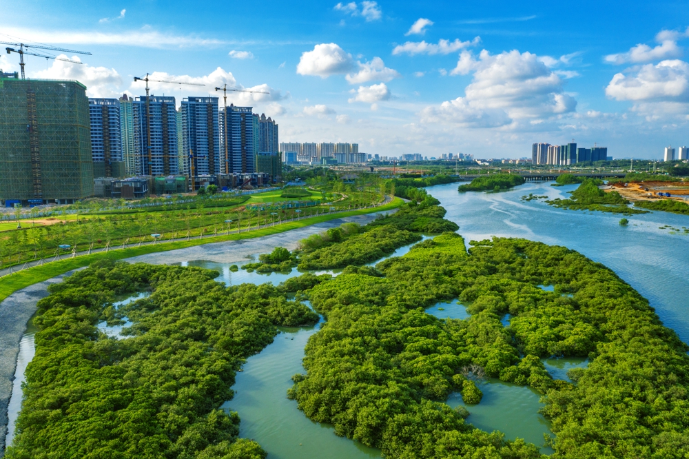
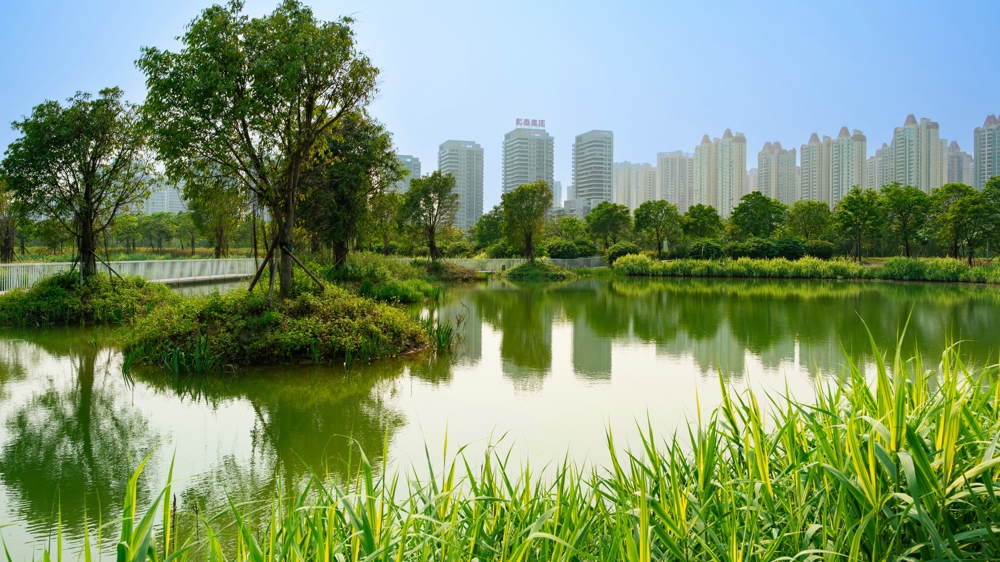
Located in Guangxi Province, Beihai City is an important coastal city in the Beibu Gulf area of China. The project site mainly includes Fengjiajiang River, Liyudi Reservoir and its tributaries, covering most of Binhai National Wetland Park in Beihai City. It is the core green corridor connecting the mountains and seas and linking the new and old urban areas. Combining with environment engineering measures such as pollution control and flood control level improvement, the project takes the aquaculture pond transformation as the starting point, which proposes three strategies for returning the pond to the mangrove forests and beaches, to wetlands, or to entertainment spaces by adopting ecological design techniques. On the basis of the ecosystem restoration and sponge system construction, the construction of transportation, recreation, lighting and other systems were established, to reverse the current situation of Fengjiajiang River's serious pollution, mangrove decline, and inaccessible conditions, and to create a national wetland park with good ecology and vitality which is located in the future city center.
2. Objective and Challenge
Objective: On the basis of ensuring flood control safety and clean water quality, improve the park's ecological environment, enhance the recreation of waterfront green space, by which build the core green corridor of Beihai City, in order to drive the development of the city and surrounding areas.
Challenge 1: Coordinating the contradiction between protection and transformation of aquaculture ponds
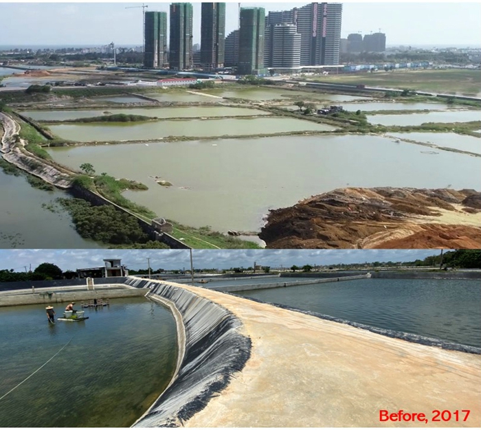
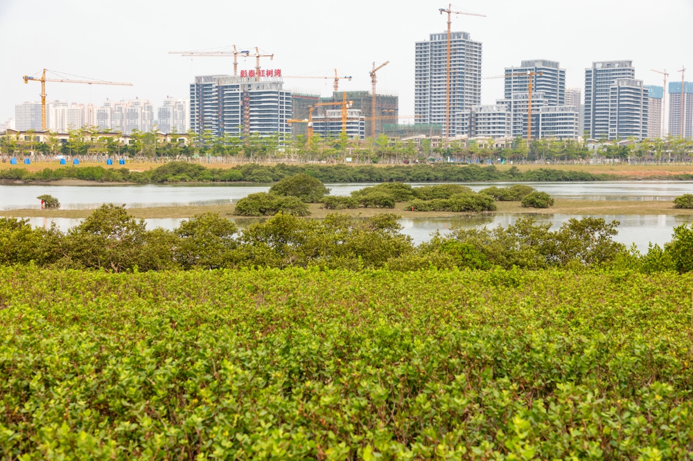
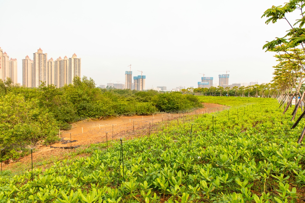
Aquaculture ponds are texture memory branded on the Fengjiajiang River, but they are a serious threat to the environment. The current aquaculture ponds are distributed on both sides of the Fengjiajiang River, which were built by the citizens since the 1980s to live their livelihoods, becoming the core landscape elements of the site. However, as an artificial ecosystem, aquaculture ponds have caused serious damage to the environment of Fengjiajiang River and its surrounding areas: 1) Invasion of mangrove habitats. Aquaculture ponds are built by cutting down a large number of mangroves, and their embankments hinder the migration of mangroves to the land, hindering natural succession. 2) The pollution is serious. The amount of feed in aquaculture ponds is much larger than required one, and exceeds the self-purification capacity of water bodies, resulting in eutrophication of water bodies. At present, the water quality of Fengjiajiang River is inferior to the V category, which is deteriorating year by year. 3) Loss of ecological function. The use of cement or impermeable membrane to prevent seepage, blocks the exchange of surface water and groundwater, destroying the habitat of benthic organisms. How to comprehensively solve the three major problems of preserving site memory, restoring ecology and providing recreation opportunities is the first major challenge of this project.
Challenge 2: Mangrove Ecosystem Conservation and Restoration
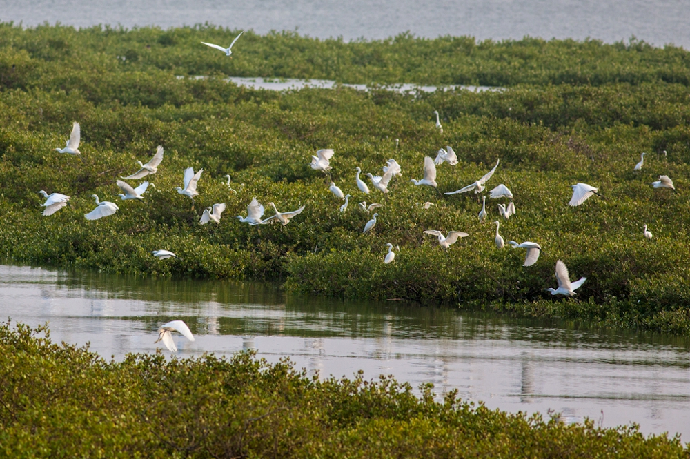
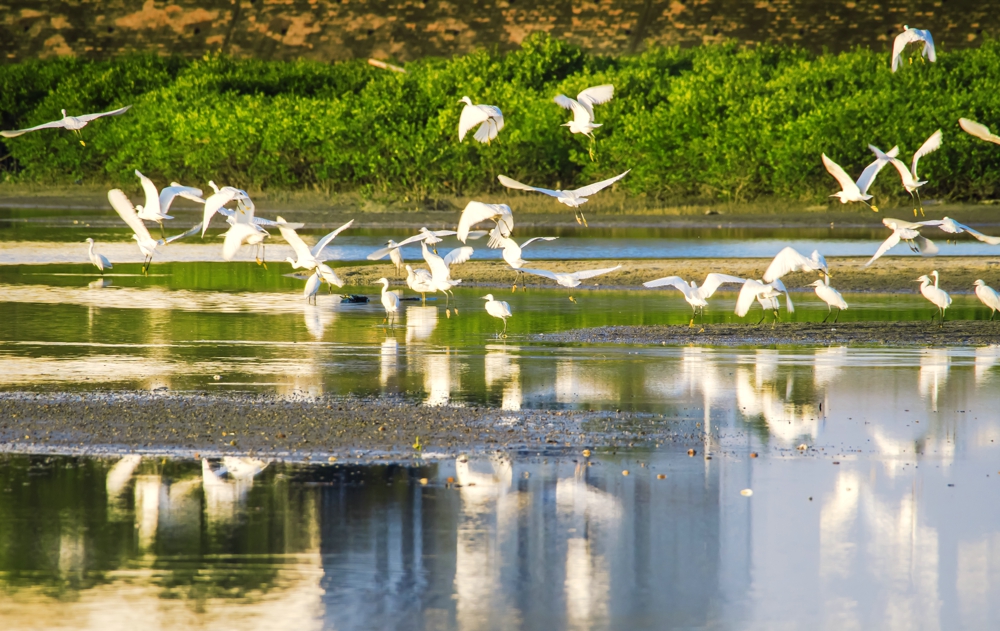
Mangrove forest is a typical ecosystem in the coastal area of South China. Mangrove plants can provide a variety of habitats for benthic organisms and reduce the impact of wind and waves in coastal areas, because of which it is known as the “guardian of the coast”. In April 2017, President Xi Jinping inspected Beihai and pointed out that the protection of rare plants is an important part of protecting the environment. It is necessary to respect science, implement responsibilities to protect mangroves. However, due to problems such as felling, embankment, pond construction and pollution in recent decades, the number of mangroves on both sides of the Fengjiajiang River has dropped sharply, and a large number of ecological functions have been lost. How to gradually restore mangrove habitat on the basis of current mangrove conservation is the second major challenge of this project.
Challenge 3: Soften water conservancy projects and waterfront landscape boundaries
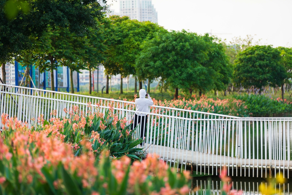
The upper plan puts forward the flood control standard for Fengjiajiang River Basin in once per 30 years. According to the traditional water conservancy project, a flood control levee about 2-3m above the ground would be established on both sides of the river, completely cutting off the way for the citizens' waterfront experience and mangrove succession, which seriously hindered the continuity of ecosystems and urban recreation systems. At the same time, Fengjiajiang River is affected by tides, the average level of which is as high as 2.49 meters. Therefore, how to improve the recreational experience of the citizens while protecting the city's flood control and moisture protection, and how to coordinate the freshwater and brackish water landscape to ensure the harmonious coexistence of people-nature-city is the third major challenge of the project.
3. Design Strategy
First, Multi-purpose transformation of aquaculture ponds, retaining site memory and enhancing ecological environment
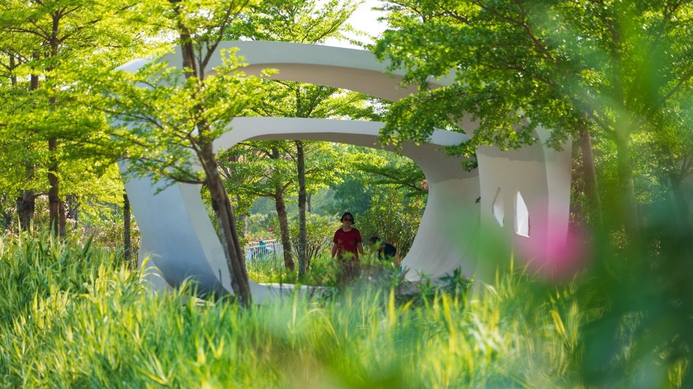
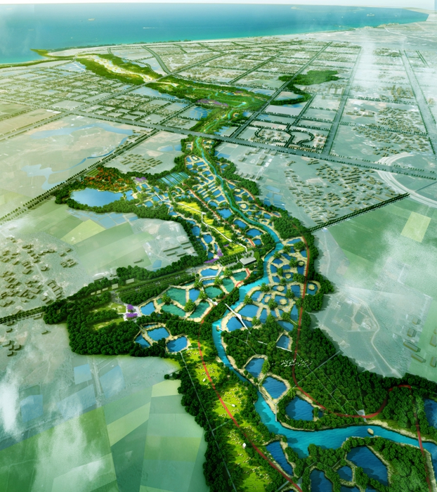
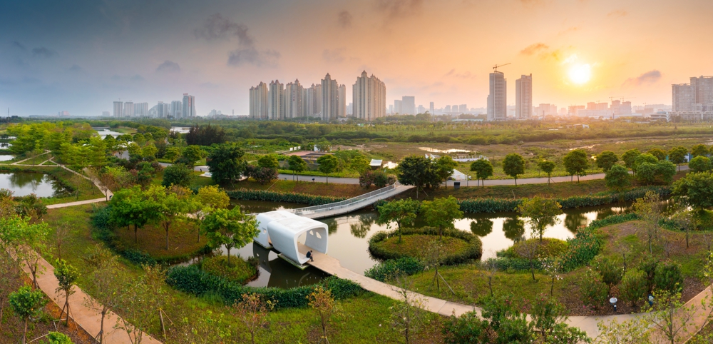
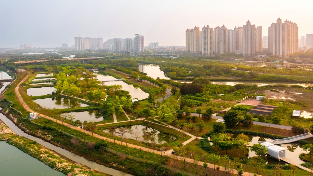
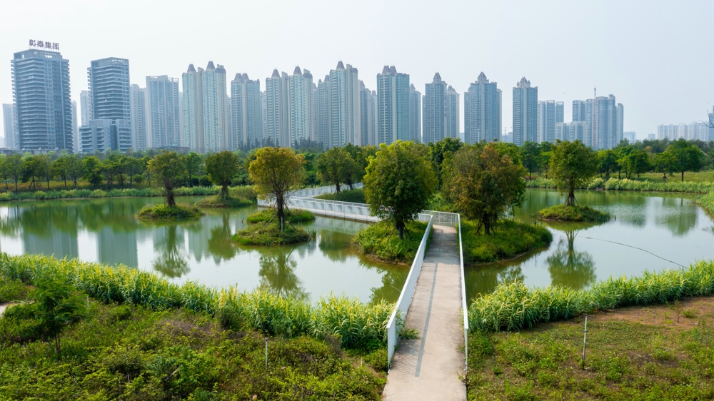
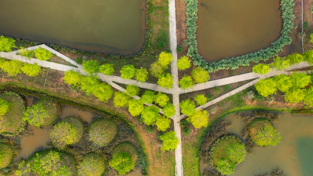
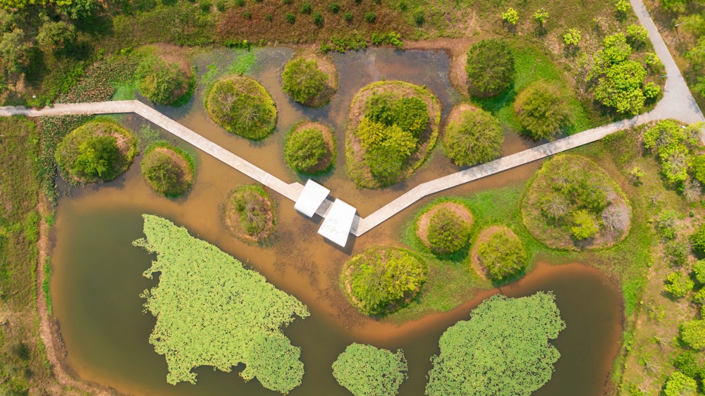
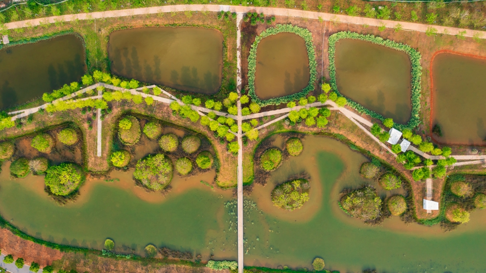
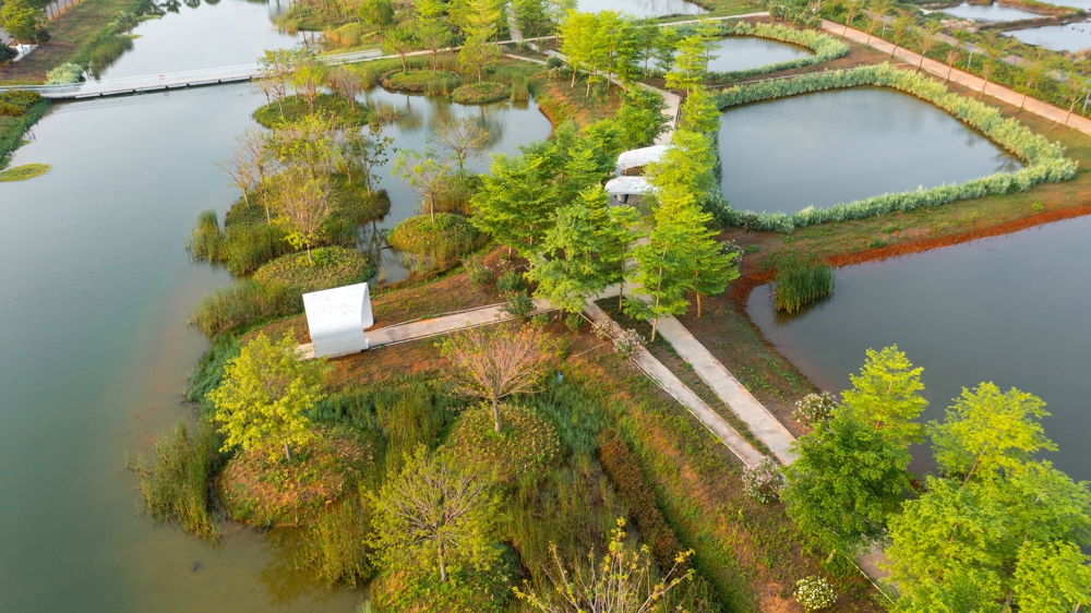
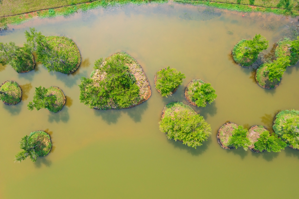
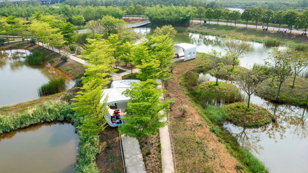
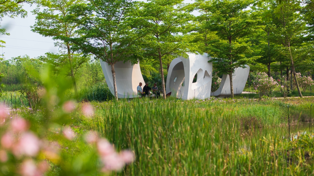
The project takes the transformation of aquaculture ponds as the starting point, retains most of the texture of ponds, eliminates the breeding function to avoid the hidden dangers of pollution, and proposes three major restoration and reconstruction strategies to provide ecological restoration, rainfall storage and purification, and landscape recreation services: 1. Returning the ponds to mangrove forests and beaches. Through mangrove suitability analysis and other methods, the mangrove restoration is carried out with the topography transformation and vegetation planting as the core method, and the heron beach is restored to provide habitat for birds. 2. Returning the ponds to wetlands. Through the methods of seepage materials upgrade and pit-connected, the aquaculture ponds outside the embankment will be restored to a sponge with rainfall storage and purification function, providing ecosystem services such as storage and purification, flood mitigation, irrigation and water supply. 3. Returning the ponds to entertainment spaces. Through the method of terrain reconstruction, some breeding ponds will be transformed into sunken activity places.
Second, transforming the beach topography into suitable range, restoring mangroves scientifically.
Mangroves are growing on intertidal zones with alternating brackish water. They are generally grown on places with flat terrain, suitable water salinity, temperature and water immersion time where are easy for sediment accumulation. The scheme restores the mangroves by the following steps: 1. Applying the factor superposition method to determine the range of beaches with suitable tidal for the Fengjiajiang River mangroves. 2. Retreat some aquaculture ponds in this area and broaden the range of mangrove. 3. Divert water into the beaches, to form islands, increasing the chance of internal mangrove immersion, and provide a channel for rapid seawater discharge. According to the monitoring data of the tide level in the Beihai from 2013 to 2017 (a total of 35,712 data), the elevation values corresponding to the suitable flooding frequency of the mangroves in Fengjiajiang River are obtained. Do vertical design to establish beaches with rich layers which is beneficial to form mosaic growth mode of different types of mangrove communities, And to lead to the formation of a mixed forest with strong impact resistance. 5. According to the requirements of different vegetation on the frequency of flooding and salinity, the pioneering mangrove community, the true mangrove community and the semi-mangrove community were respectively arranged, and finally a mangrove ecosystem with rich layers and dynamic balance was formed.
Third, combining gray and green facilities to ensure urban security and create a resilient landscape.
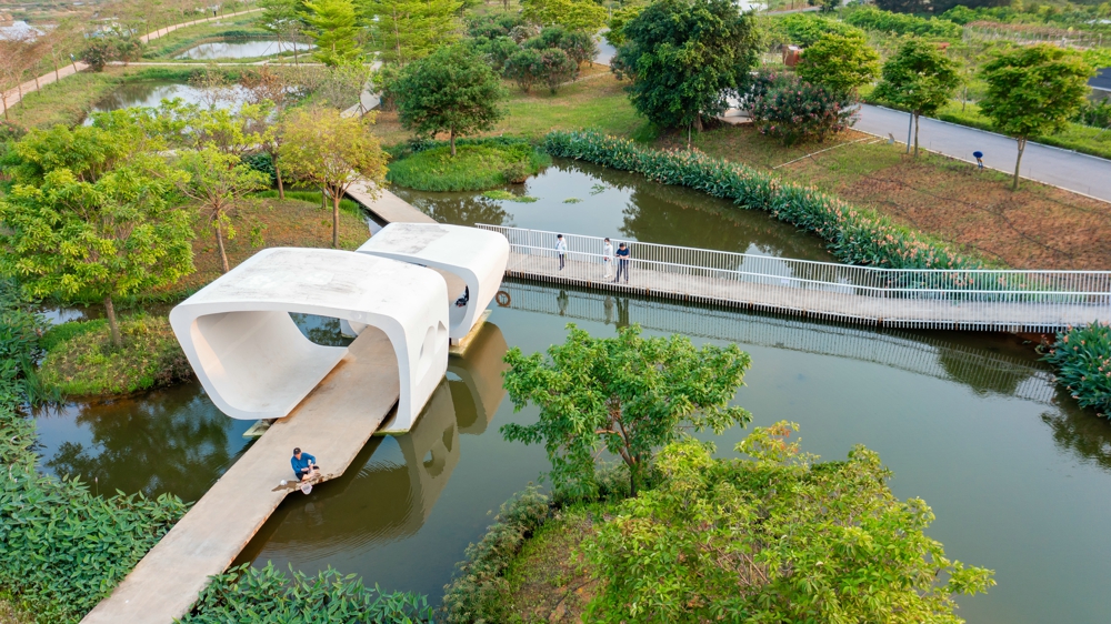
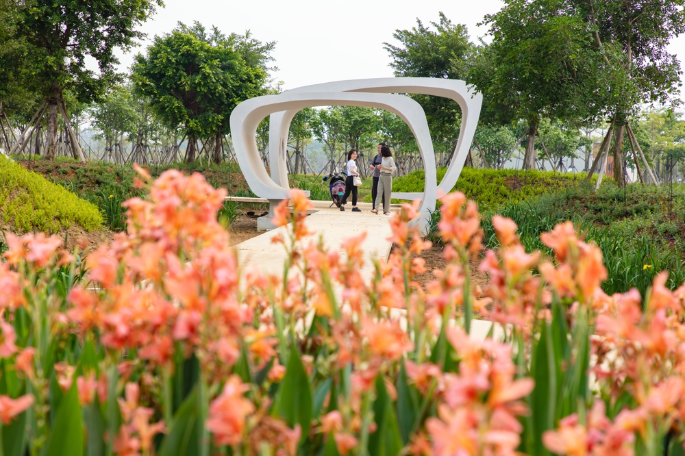
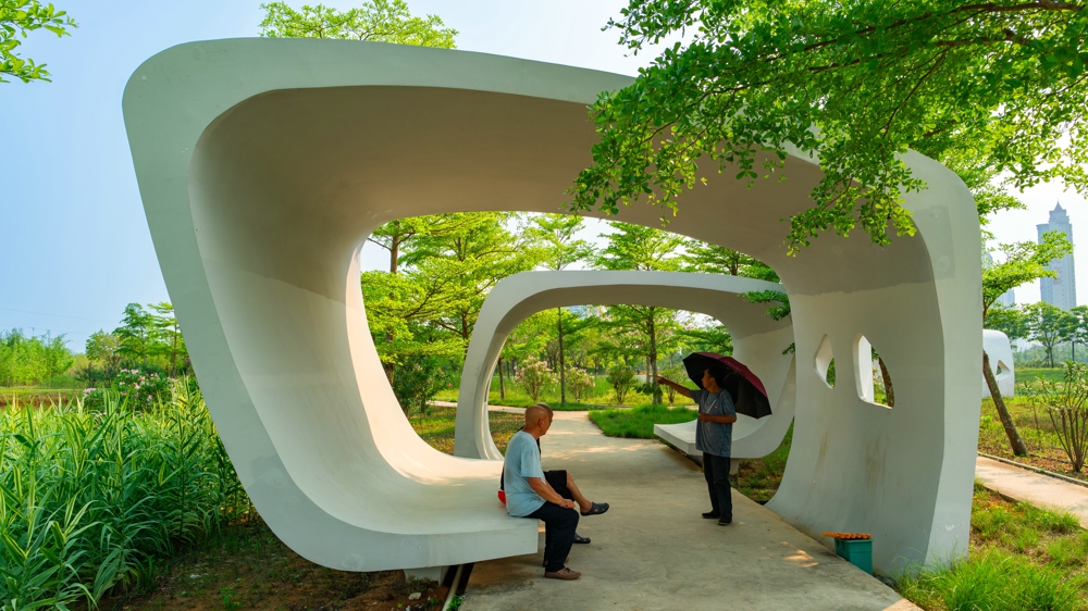
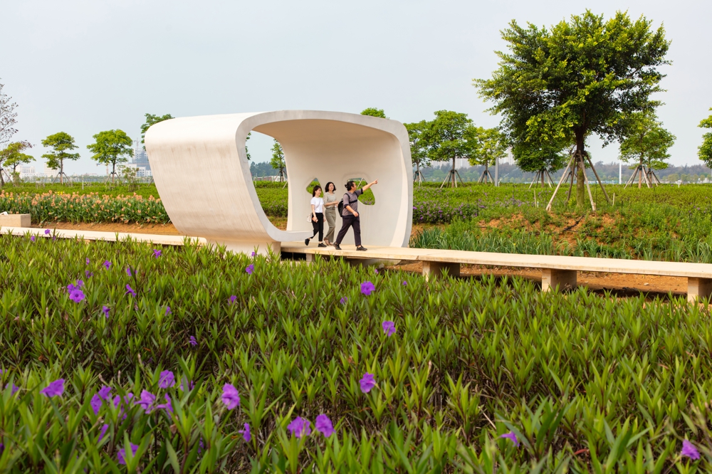
This project is a comprehensive one for water environment management and landscape construction. It is determined by cooperating with various professional programs such as water conservancy and hydrology. The final determination is as follows: 1. The current dike is retreated to reserve sufficient natural succession space for the mangroves (50-100m), on the condition of the flood control requirements met.; 2. Reduce the height of the flood control dyke to less than 1.5m, and reduce or eliminate the height difference between the dike and the surrounding by vertical design, avoiding sight barrier of the flood control dike; 3. Establish a traffic recreation system that adapts to changes in tidal water levels, and design facilities at different heights, such as plank roads, platforms, mangrove science corridors (overhead), and bird watching houses to weaken barrier’s impact and to provide the opportunity to experience the tides. Based on environment engineering, combine the gray and green facilities, comprehensively coordinated the contradiction between flood control, moisture prevention and recreation. Taking the levee as the boundary, two landscapes are formed: mangrove + brackish water tidal wetland landscape between the dykes, and the freshwater plant + freshwater storage and purification wetland landscape outside the dykes.
4. Conclusion
Compared with other national wetland parks with good natural conditions, the project site does not have a congenital and sound background condition. The transformation from extensive aquaculture to the national wetland park is the practice to realize the “Two Mountains Theory” of China and “City Development Founded on Good Ecology Theory” of Beihai. Retaining the cultural memory of the ponds texture and giving it various ecological recreation functions are innovations of such ecological restoration and landscape design projects, and could play a positive role in ecological restoration in coastal areas of China.
