Neimenggu Baotou the Yellow River Wetland Planning

Project Information
- Project Location:
- China Baotou, Neimenggu
- Project Scale:
- 12222 Hectares
- Design Time:
- November 2016
Project Profile
1. Project Statement
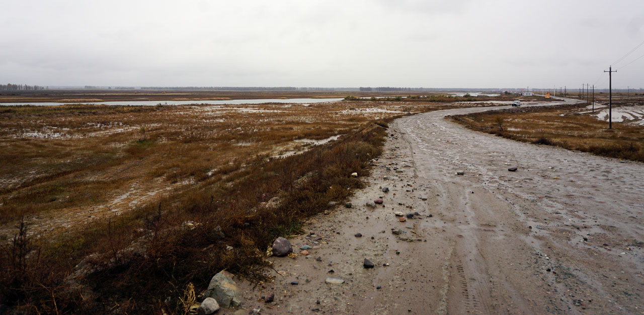
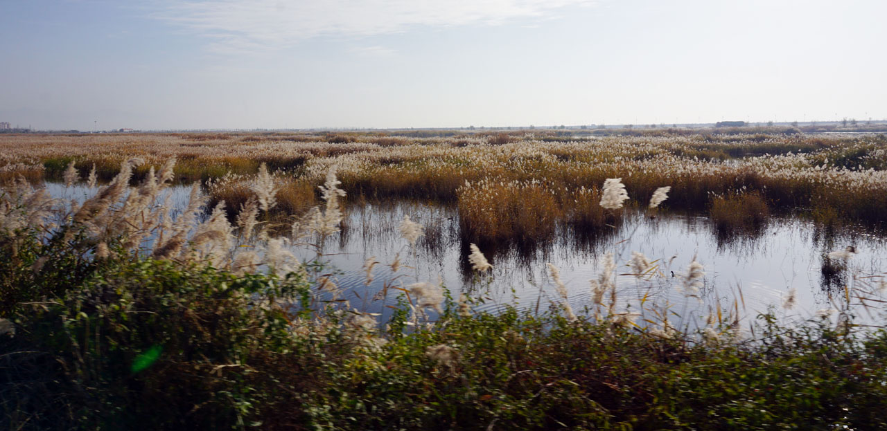
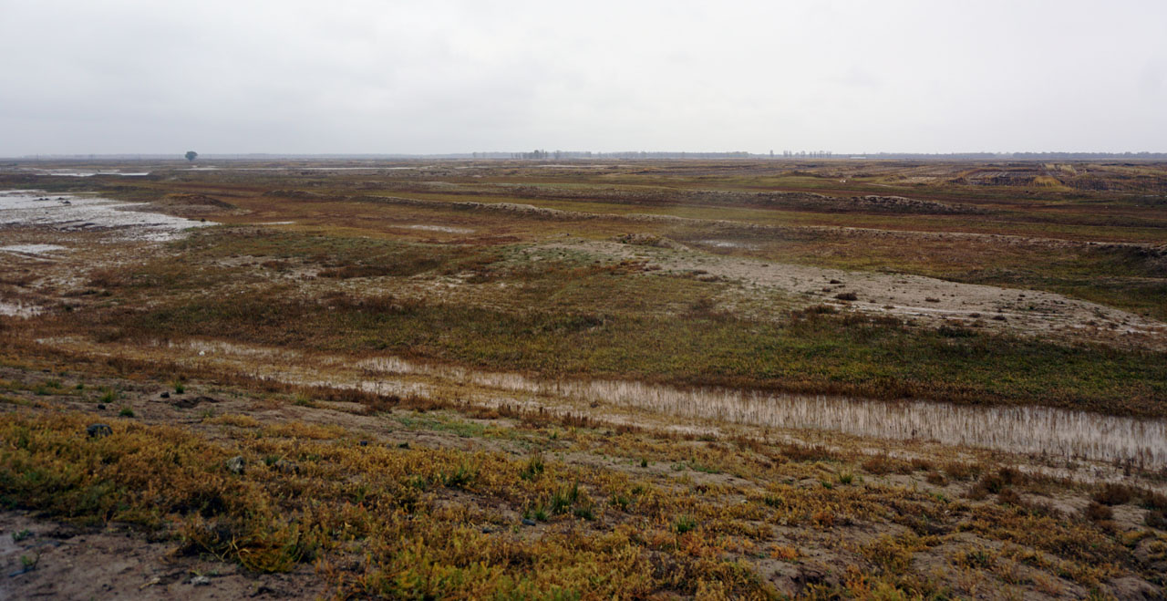
The Yellow River Wetlands in Baotou City, Inner Mongolia, represent the northernmost latitude of the Yellow River wetlands in China, spanning 163 kilometers. To unify planning and protectively develop the wetland resources along the Yellow River in Baotou City, and to address issues such as coordinating urban development and wetland conservation, this plan was organized based on the "Inner Mongolia Baotou Yellow River National Wetland Park Master Plan (2012-2019)" drafted in 2011. The plan first systematically plans the overall wetlands along the Yellow River in Baotou, aiming to create a natural ecological corridor, a historical and cultural corridor, a green economic corridor, a distinctive landscape corridor, and a leisure and slow-walking corridor. Secondly, it focuses on detailed studies of major wetland park areas such as Zhaojun Island, Xiaobai River, Nanhai Lake, Gongzhonghai, and Chifeng Plain (with a total area of approximately 12,222 hectares). It combines current conditions with the development needs of surrounding areas to formulate heterogeneous functional positioning and development strategies. Lastly, it emphasizes more in-depth development planning for the Xiaobai River wetlands to coordinate the joint development of wetlands and urban areas.
2. Objective and Challenge
Coordination of Wetland Conservation and Development:
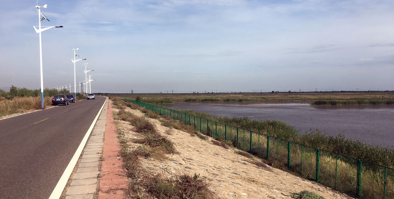
The spatial occupation of wetland protection buffer zones due to urban expansion and the disturbance of the original ecological balance of wetlands lead to a reduction and disappearance of buffer zones, making wetland habitats fragile.
Intense Competition Along the Yellow River Scenic Areas:
Several cities along the Yellow River have successfully utilized Yellow River cultural and landscape resources to create locally characteristic urban images. The construction of Baotou Yellow River National Wetland Park started relatively late and faces significant competitive pressure.
Based on the challenges faced by habitat protection and heterogeneous development along the Yellow River wetlands, following the planning concept of "large rivers adjacent to cities," the development goal of "city-river interdependence, city-river mutual prosperity" was formulated, aiming to shorten the distance between cities and rivers and maintain cultural and ecological genes.
3. Design Strategy
Starting with the protection of the Yellow River wetland ecological environment, integrating local cultural and tourism resources to create a green experiential economic belt and tourist destination, promoting urban industrial transformation and surrounding rural development.
(1) Natural Ecological Corridor - Conservation and Protection Belt of Yellow River Wetlands
Focuses on the water and habitat systems of the Yellow River wetlands to enhance their stability, laying a broad ecological foundation for the subsequent protection of important ecological resources and the creation of national and international brands.
(2) Historical and Cultural Corridor - Inheritance and Development of Yellow River Cultural Heritage
Systematically integrates local cultural resources and spatially reflects them, activating historical and cultural memories and enriching the cultural levels of wetland systems.
(3) Green Economic Corridor - Experience Economy Catering to Modern Industrial Development
Using project-driven industry to promote related industrial development, revitalizing rural areas along the route. Existing prototypes of environmental protection industries, green ecological agriculture, creative cultural industries, and tourism industries based on ecology and culture can lead development.
(4) Distinctive Landscape Corridor - Highlighting the Poetic Countryside Landscape of Yellow River Wetlands
Explores local landscape resources, enhances forests, changes landscapes, and enhances landscapes, creating segmented wetland landscapes with different characteristics, shaping ecological countryside and distinctive wetland landscape corridors.
(5) Leisure and Slow-walking Corridor - Shared Space for Tourists and Citizens' Recreation
Guided by the internationally mature national trail system concept, based on the Yellow River National Ecological Corridor, based on the river direction and distribution of tourist resources, slow-walking trails are set up, connecting wetlands, villages, scenic spots, and agricultural and forestry resources, forming an important part of the Yellow River National Trail System.
Node Plan Deepening:
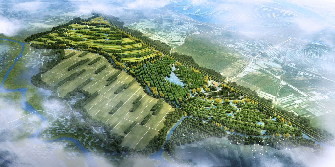
(1) Zhaojun Island - Outer Scenery, Detailed Historical Accounts
By strengthening Zhaojun Island's vast intertidal wetlands, it naturally landscapes and shapes historical commemorative landscapes based on local geographic features.
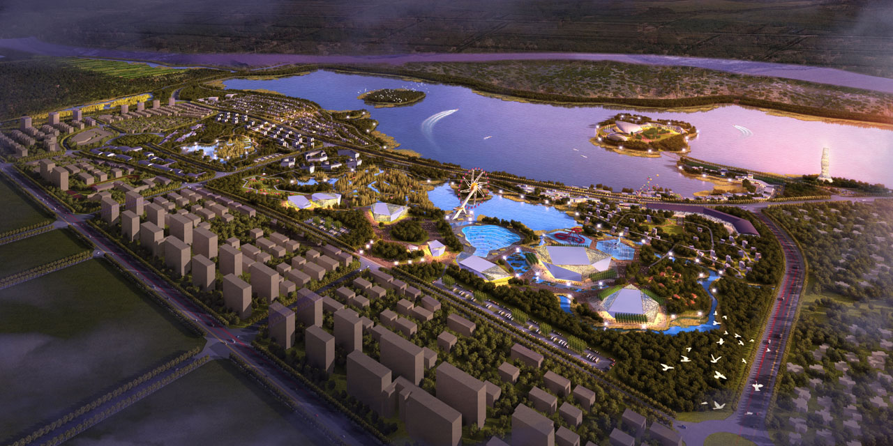
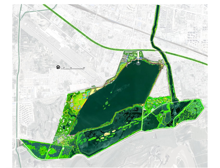
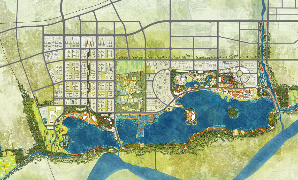
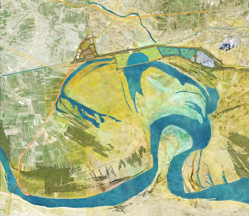
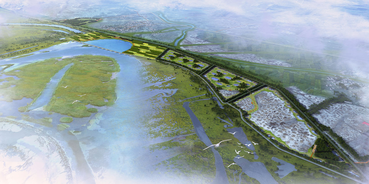
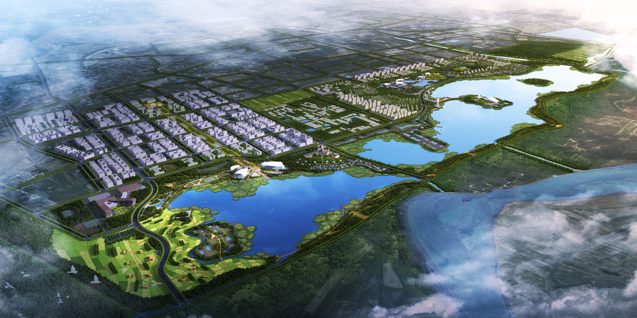
(2) Xiaobai River - Lu's City Harbor, Spiritual Station
Landscape level: Utilizing the resources of the Yellow River wetlands and Xiaobai River wetlands, it links the entire Yellow River cultural and ecological vein of wetland landscapes; it combines ecological popular science demonstration and ecological leisure wetland landscapes.
Urban development level: Respect the functional structure of the twin city, with the construction of the Yellow River Water City as the goal, creating a multi-functional Baotou Holiday Park integrating health care, sports and entertainment, cultural inheritance, ecological residence, vacation tourism, etc., serving Huhehaote, Baotou, E'erduosi, radiating the northwest. Urban leisure headquarters, in line with the southern new world, water rhyme Xiaobai River; along the Yellow River to enjoy the reunion, the new image positioning of the northern new water city.
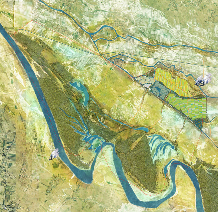
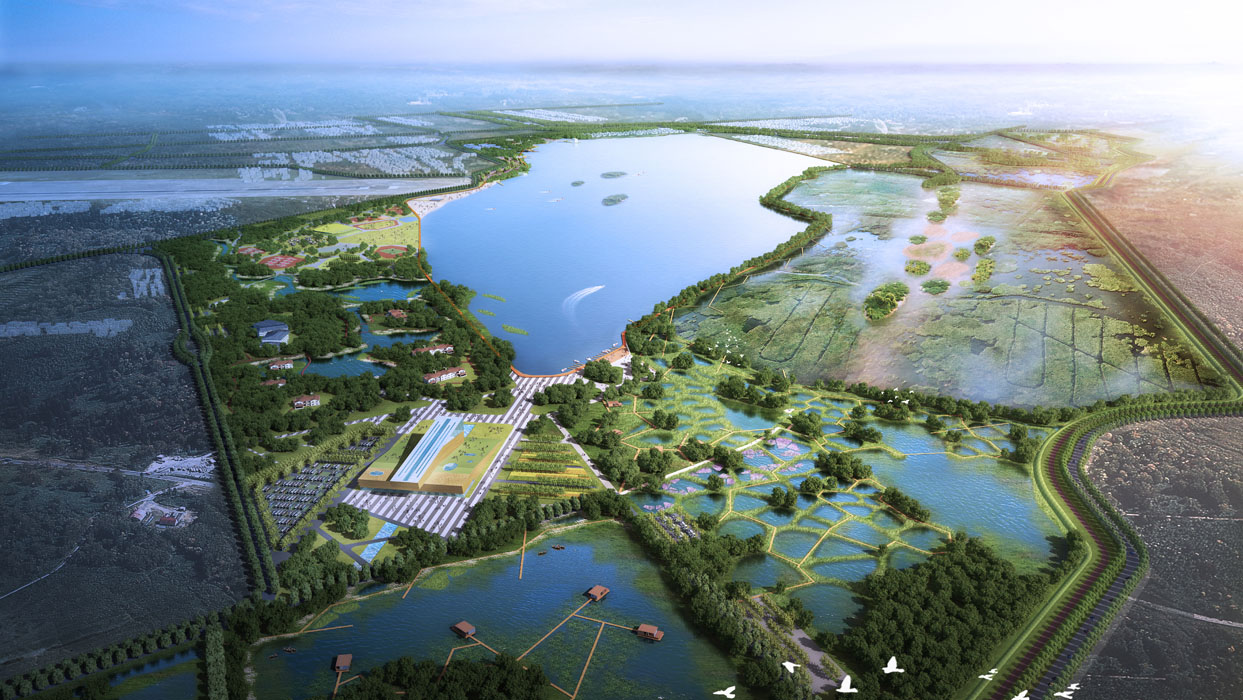
(3) Nanhai Lake - Bird Paradise, Wetland Countryside
Respect the planning content and construction of Nanhai Lake Wetland Park. Relying on existing water bodies to create bird habitats and create beautiful productive wetland landscapes.
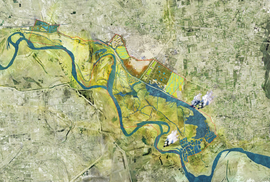
(4) Gongzhonghai - Ecological Succession, Perception of Nature
Based on ecological low-impact development strategies, through the gradual restoration of forest swamp habitats, the site is shaped into a large-scale laboratory for natural succession.
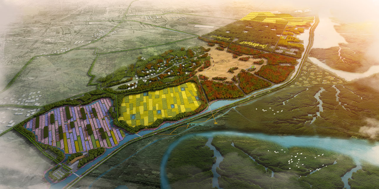
(5) Chifeng Plain - Water Grassland, Chifeng Song and Dance
Relying on the good natural scenery of Chifeng Plain wetlands, create a landscape feature of water grassland and wetland island interest, reflecting the unique grassland culture of Chifeng.
By overall controlling and node creation of Baotou along the Yellow River wetlands, enhancing the overall attractiveness of the Yellow River along.
4. Conclusion
The planning clarifies the protection and development strategies for the current situation of the Yellow River wetlands and the deep excavation of Yellow River culture. Through five strategies, it integrates local cultural and tourism resources, inherits and continues regional cultural characteristics, creates green experiential economic belts and tourist destinations, and promotes urban industrial transformation and surrounding rural development.
