Shanghai Chongming Ring Island Avenue (South Section)


Project Information
- Project Location:
- China Shanghai
- Project Scale:
- 120 Miles
- Design Time:
- July 2017
Project Profile
1. Project Statement
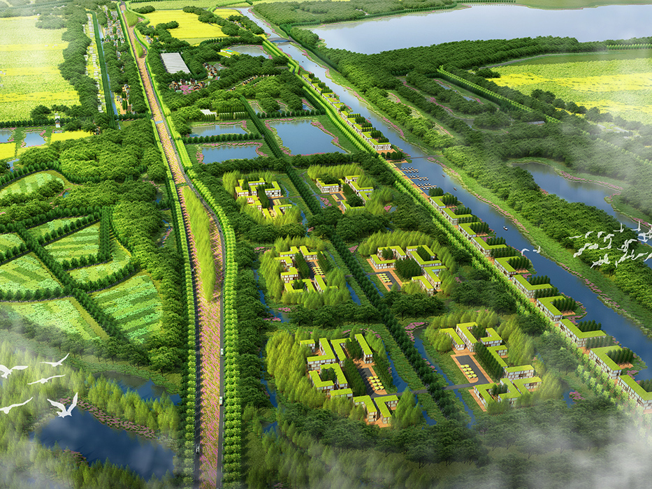
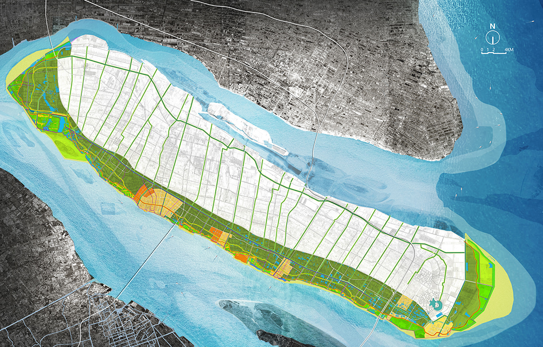
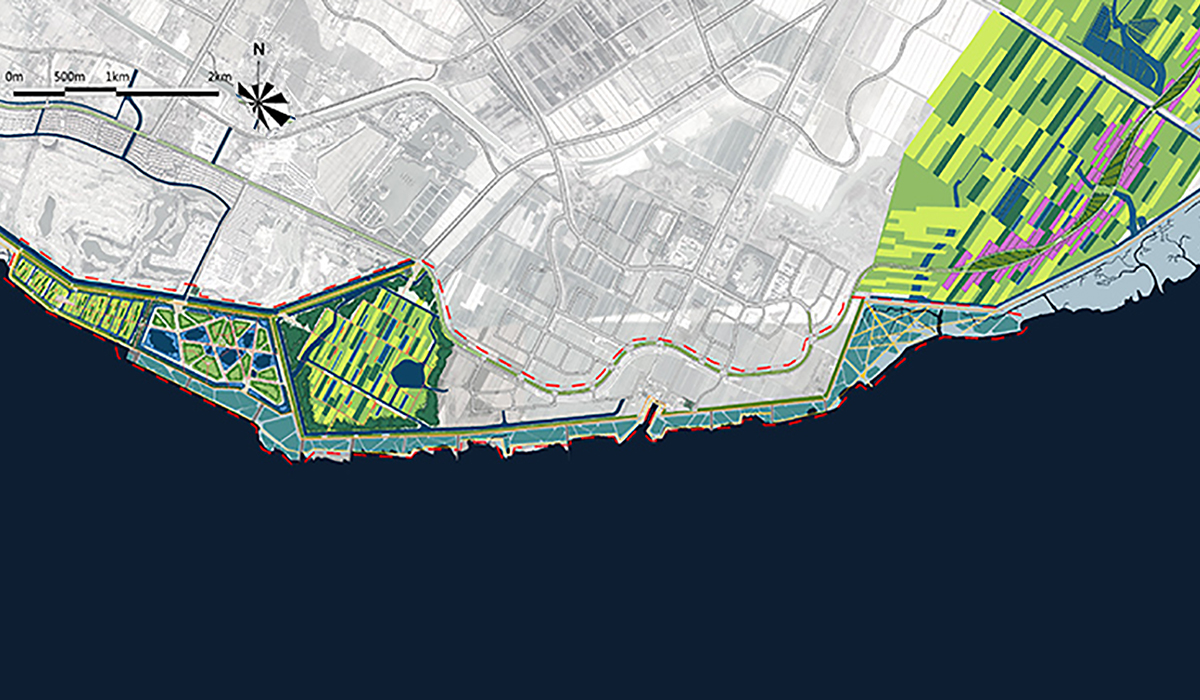
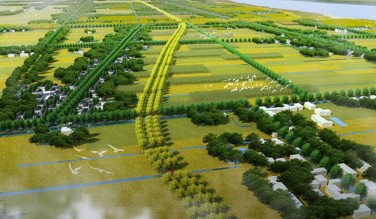
The planning area is located on Chongming Island in Shanghai, covering a 120 km stretch along the southern part of the island. It is divided into five sections from north to south: agricultural land, rural countryside, urban area, industrial zone, and ecological protection area, offering diverse landscapes.
The entire design area has a good ecological foundation and obvious resource advantages. It features rich island landscapes with layers of "fields-water-forest-city-countryside," a well-developed network of rivers and canals, pleasant riverbank mudflats, and a rich spatial experience.
2. Objective and Challenge
The existing riverside greenway is filled with fast-moving private cars, compromising its recreational use and safety.
The route selection for the Chongming Island scenic road faces issues: southern expansion destroys embankments and mudflats, while northern expansion destroys forests and fields. There are policy contradictions, and it goes against Chongming’s ecological philosophy.
The ecological impact of riverside motorways: blocking biological migration corridors and creating insurmountable barriers for wildlife.
The overwhelming scale of vast rivers and seas versus basic human needs.
The inconvenience behind the island tourism brand and attraction: a paradise for cyclists yet a retreat for the lost.
Along the route development: tourist influx has not brought real development to the area, creating a contrast between high leisure demand and declining villages, and an eco-city with structure but no substance.
3. Design Strategy
Based on the interpretation of higher-level planning and related case studies, the project proposes positioning the southern section of Chongming Island as a “world-class riverside ecological belt.” The overall goal is to create an ecological landscape belt, a sports and leisure belt, and a smart town belt, adhering to the principles of “ecological island establishment, environment-friendly development, human-nature integration, culture-ecology interaction, and sports-tourism leisure integration.”
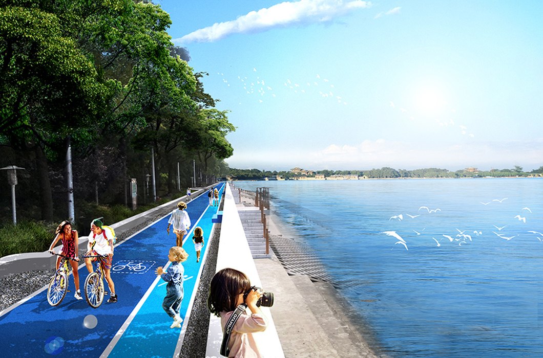
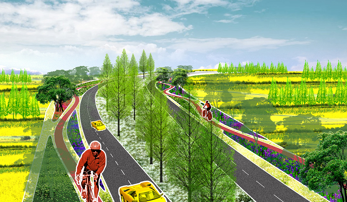
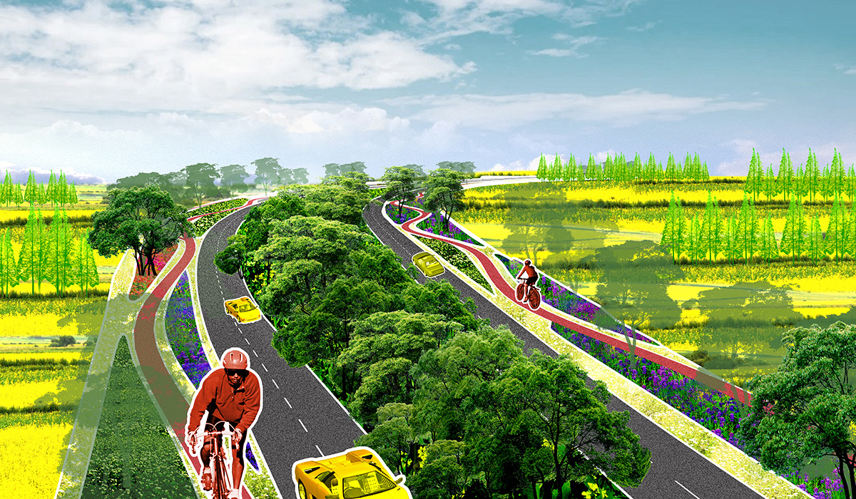
- Utilize a continuous sponge ecological base to create a 300-meter motor vehicle restricted zone;
- Employing landscape ecology theories, comprehensive flood safety pattern analysis, and road ecology’s “300m” threshold theory, the ecological sensitive areas of the site are analyzed to reasonably delineate ecological protection redlines, establishing a 300-meter motor vehicle restricted zone to effectively protect the ecological base.
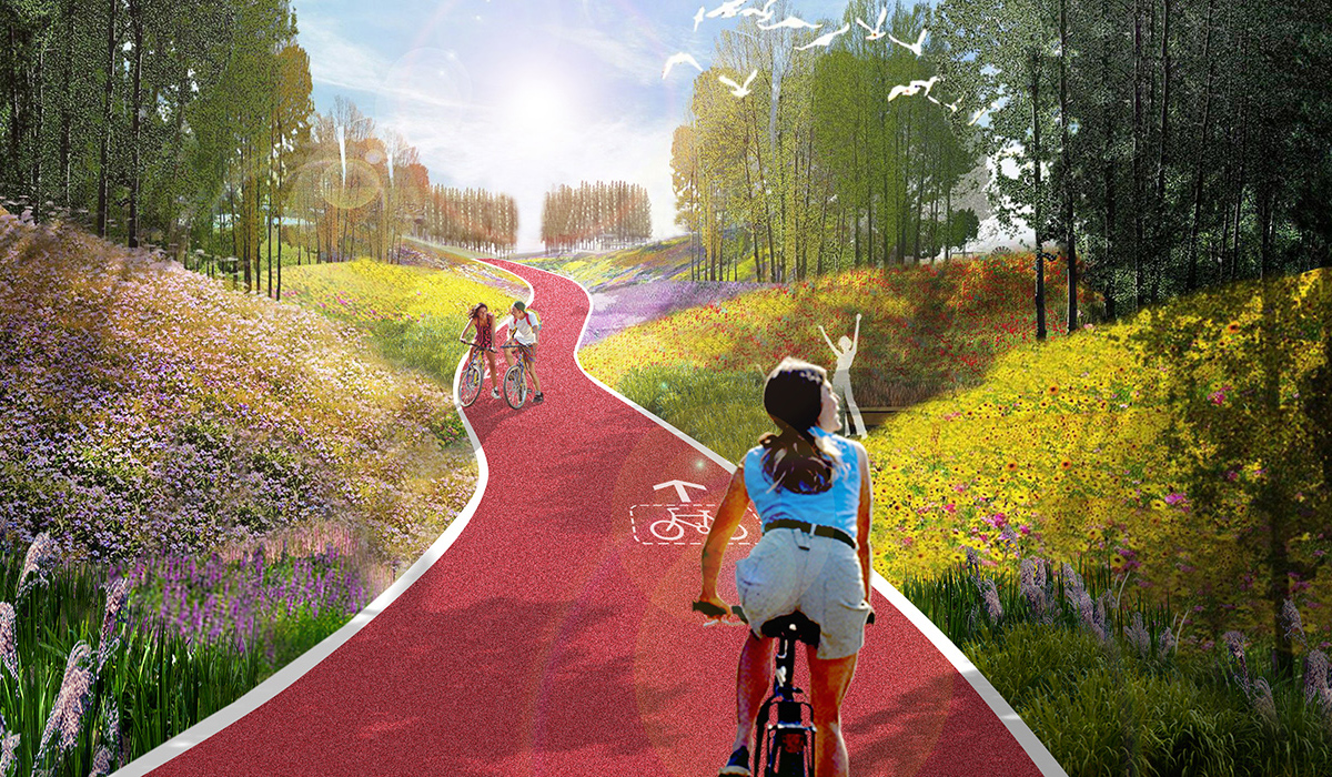
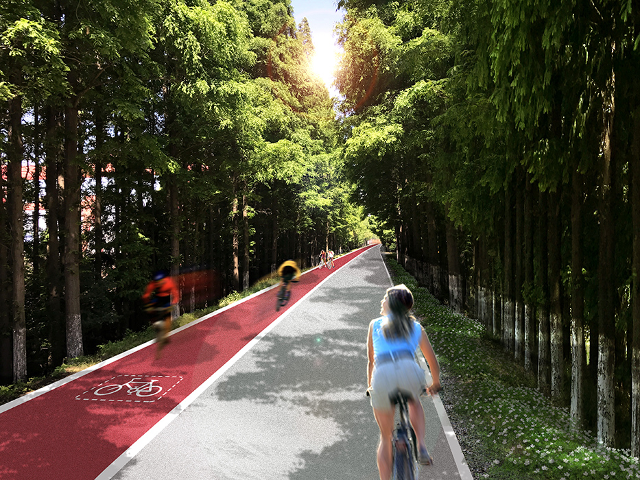
- Scenic road as the axis, with a network of diverse slow traffic modes;
The recreational network is composed of a scenic road axis, a "roaming network" slow traffic system, and service nodes every 6 km.
The "scenic road" is a combination of a landscape avenue and Chongming Avenue, with five divisions and five combinations along its entire length, connecting with the river at three points. The route selection principles are:
- Ecological: avoiding ecological sensitive areas.
- Economic: minimizing demolition and following existing road sections.
- Diverse: connecting numerous scenic resources.
- The slow traffic network, covering the entire site with four horizontal and thirty-nine vertical routes, creates an ecological, safe, and comfortable slow traffic environment. The route selection principles are:
- Convenience: purely slow traffic spaces with more local loops.
- Humanization: integrating small spaces north of the shelterbelt.
- Scenic: organizing scenic nodes along the route and enhancing viewpoints.
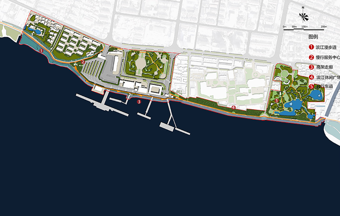
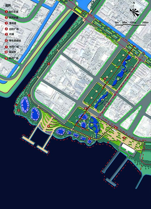
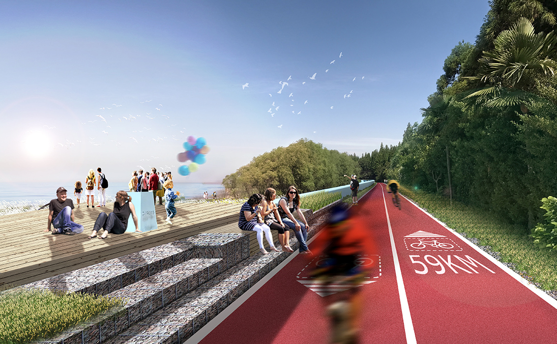
Convenient service nodes to create the most comfortable slow traffic space;
Three levels of service nodes are set up based on service levels and radii:
- Level 1: 15 km radius, providing medical emergency points, shops, visitor centers, bicycle rental points, rest areas, toilets, public parking lots, and bus stops.
- Level 2: 5 km radius, offering visitor centers, viewpoints, bicycle rental points, rest areas, toilets, and public parking lots.
- Level 3: 3 km radius, including viewpoints, bicycle rental points, rest areas, and toilets.
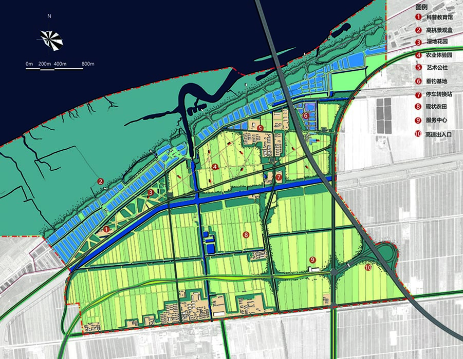
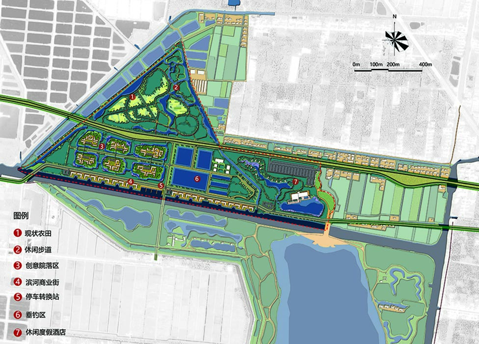
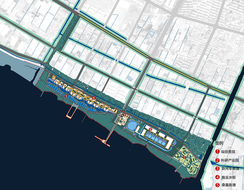
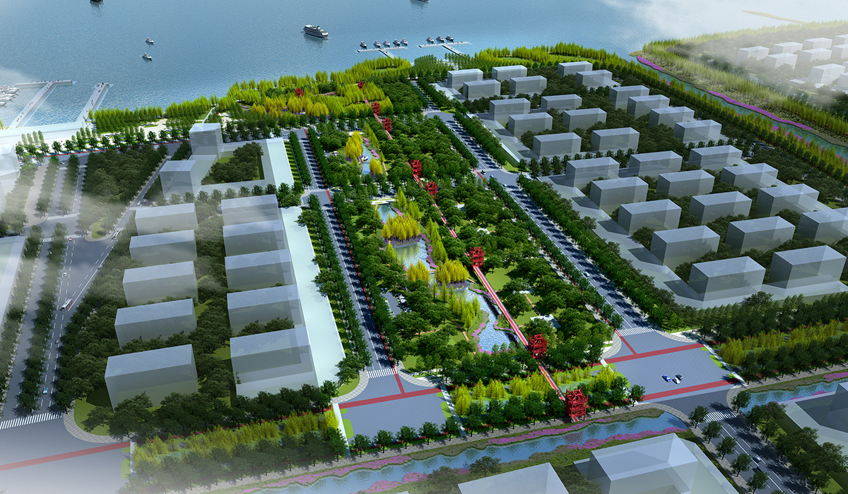
Scenic road linking five development zones to drive overall development along Chongming’s southern edge;
The scenic road connects five development zones: agricultural transformation, tourism expansion, innovation cultivation, smart manufacturing upgrade, and residential enhancement, driving overall development along Chongming’s southern edge.
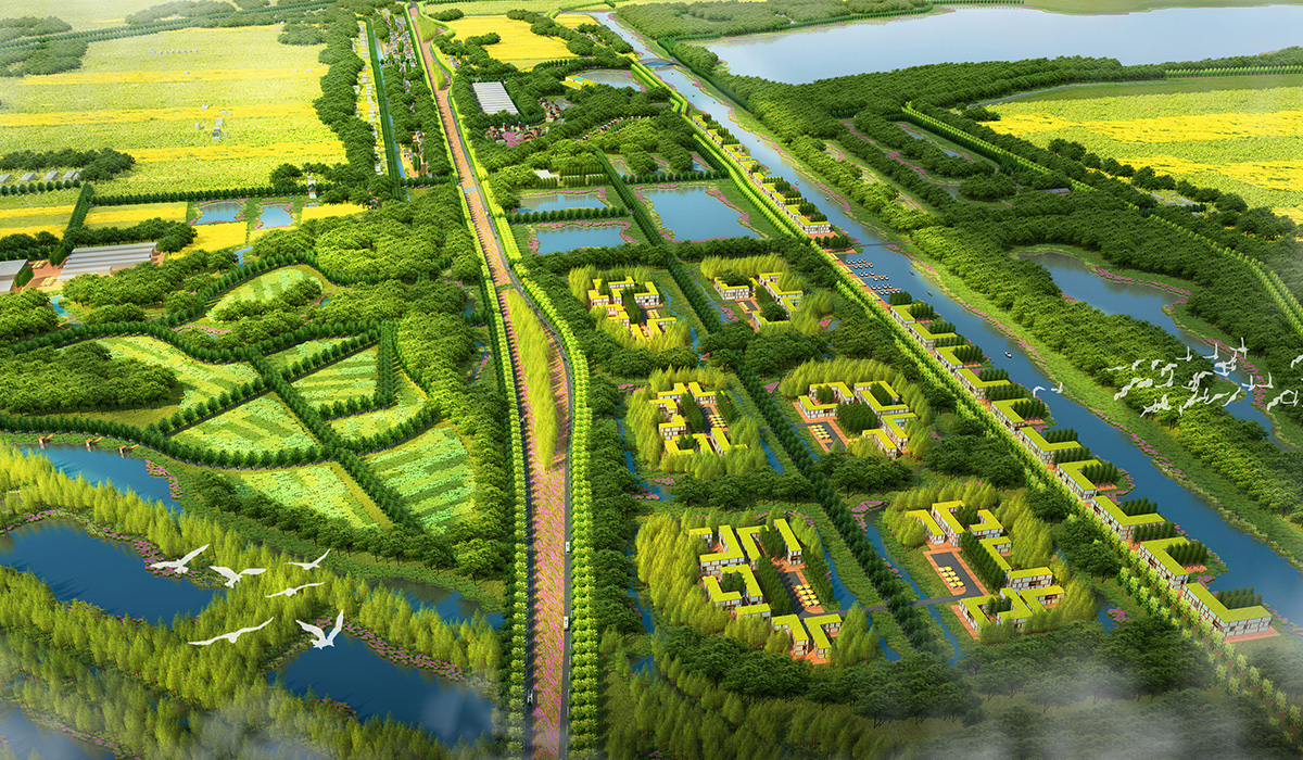
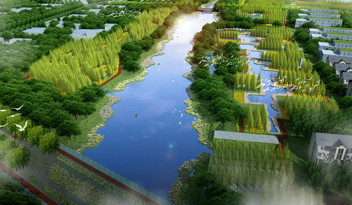
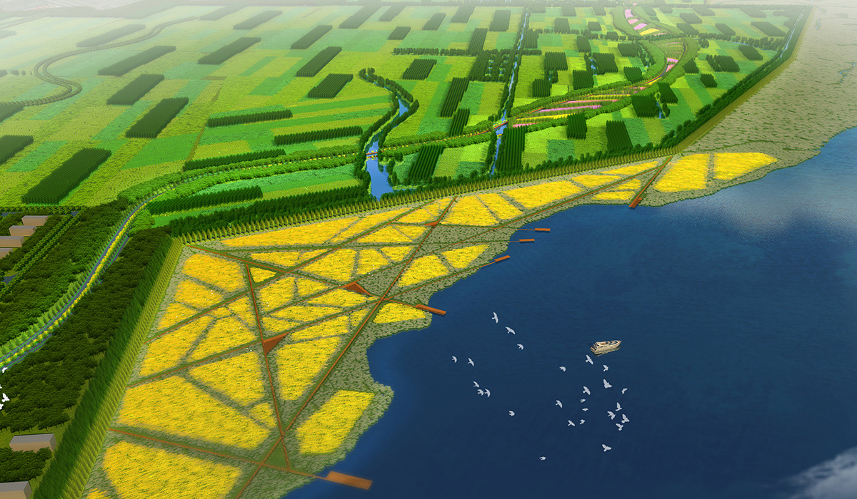
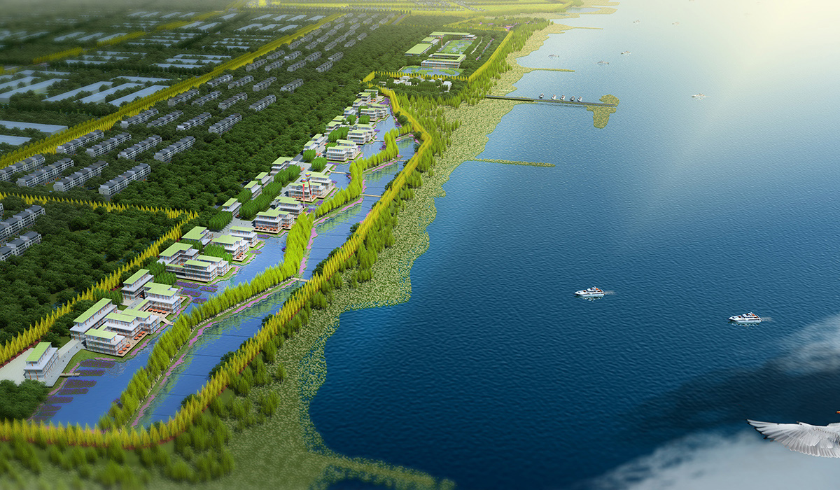
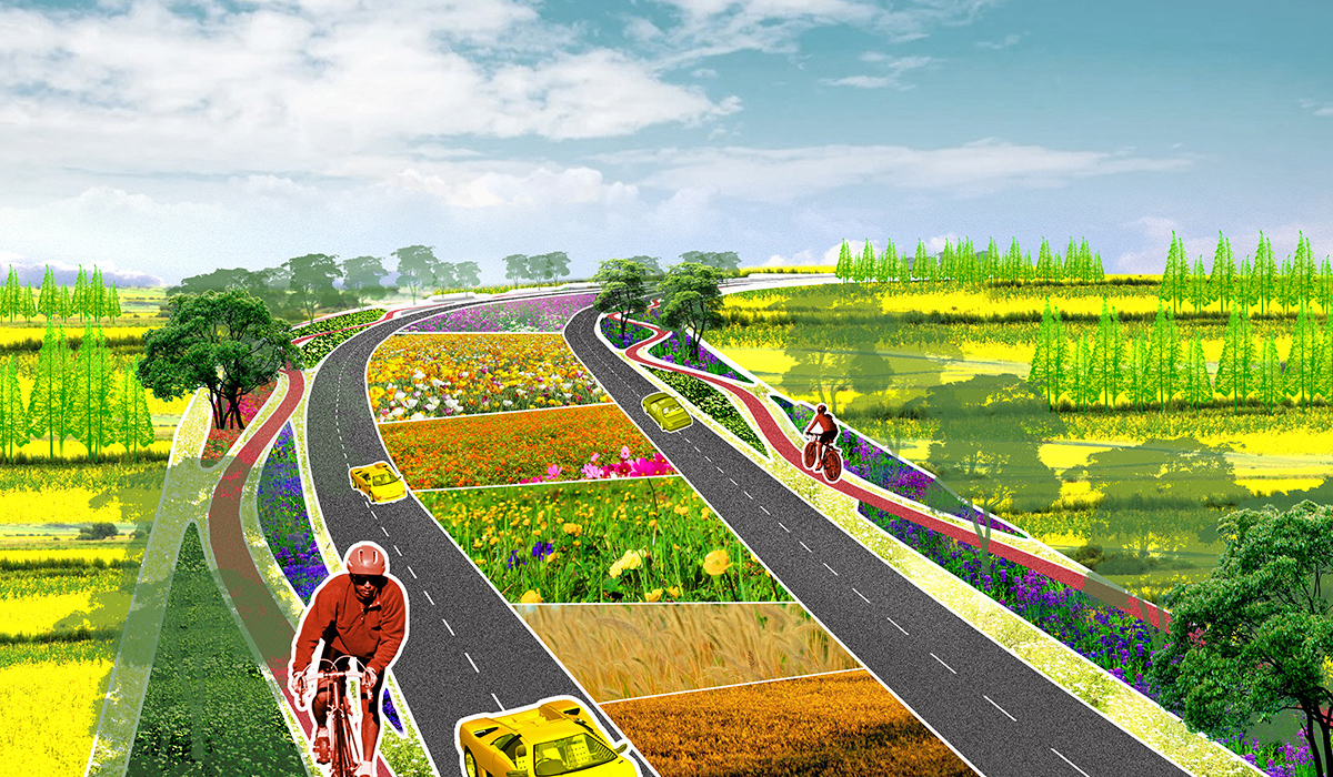
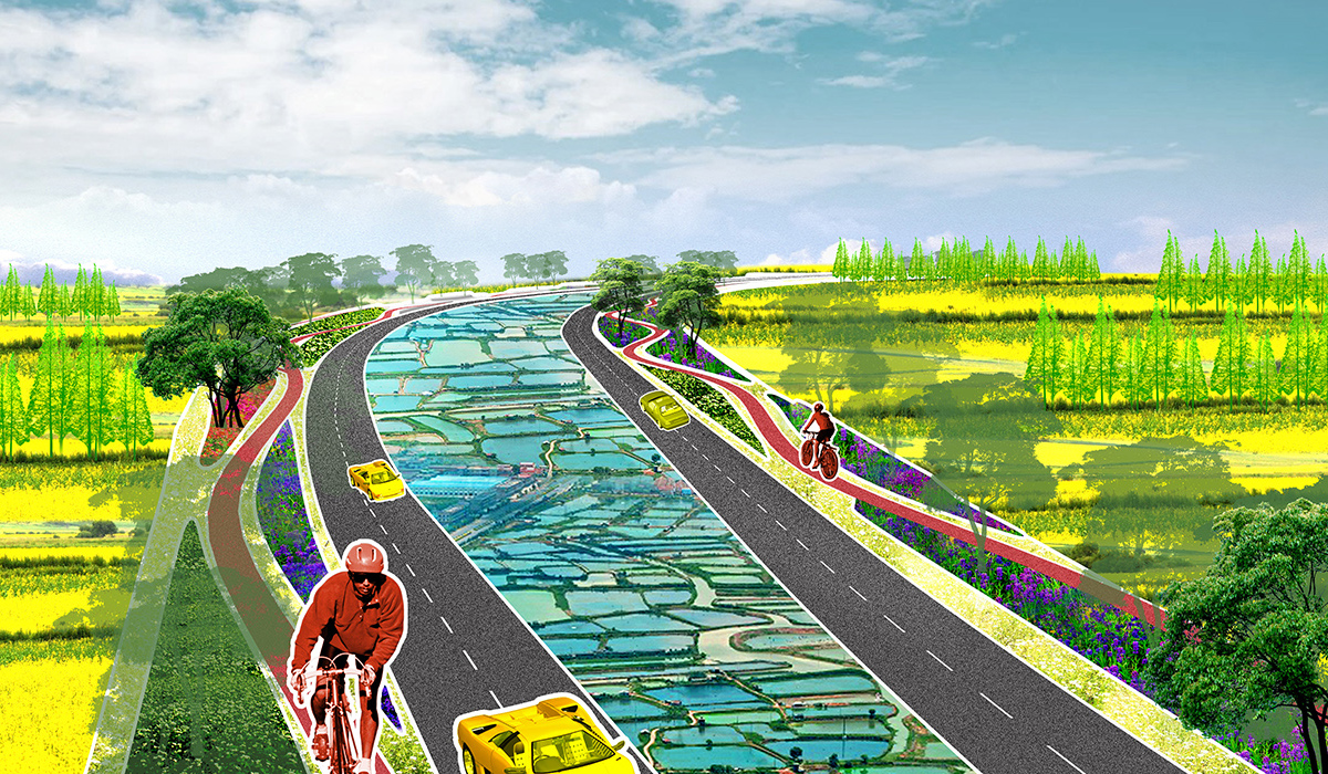
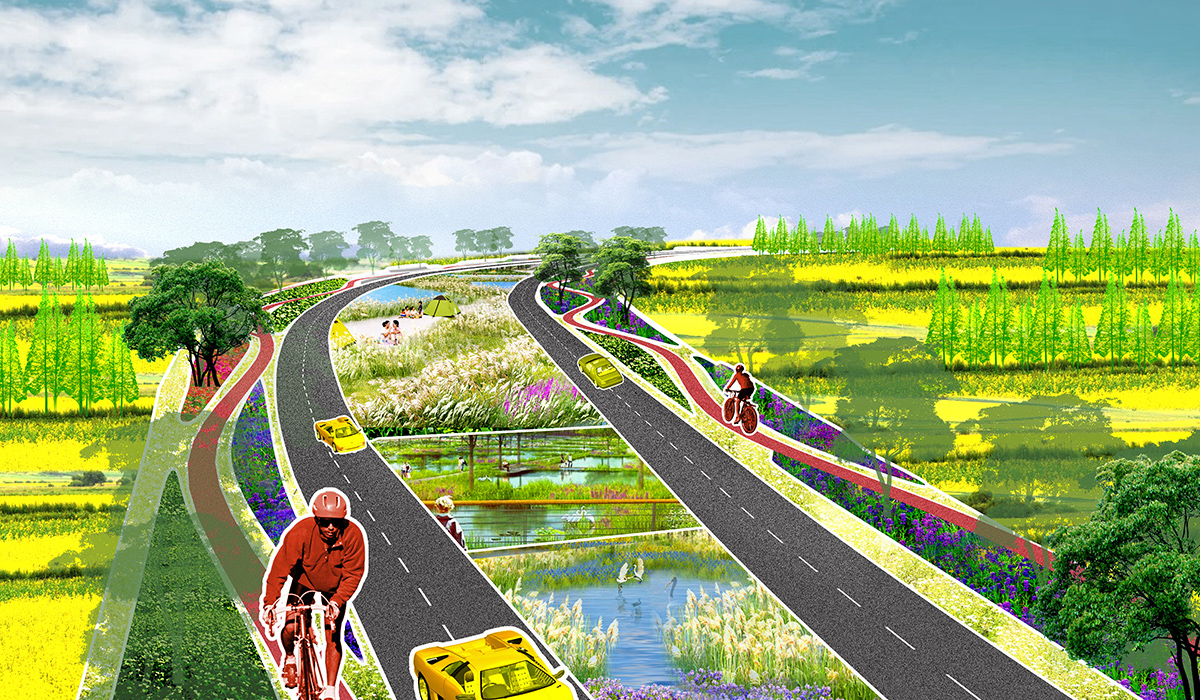
Diverse landscape patterns to create a vibrant riverside;
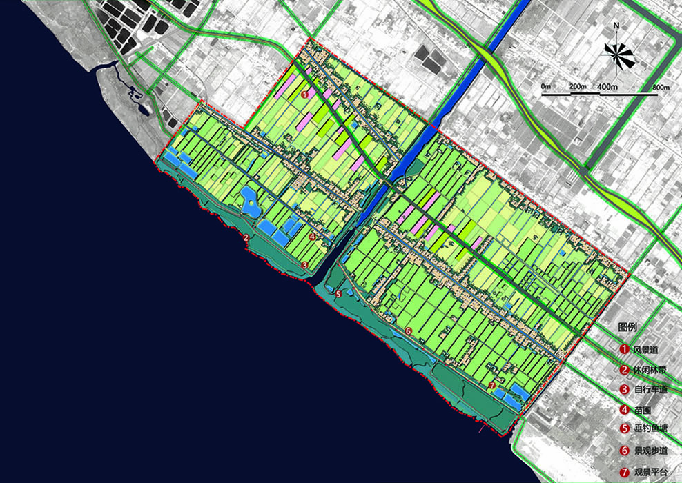
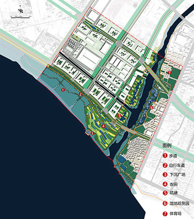
Six landscape patterns are used to create a vibrant riverside space, based on the site's current state, diversity, and functional positioning. The six patterns are:
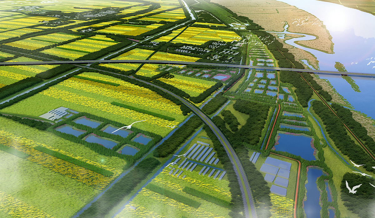
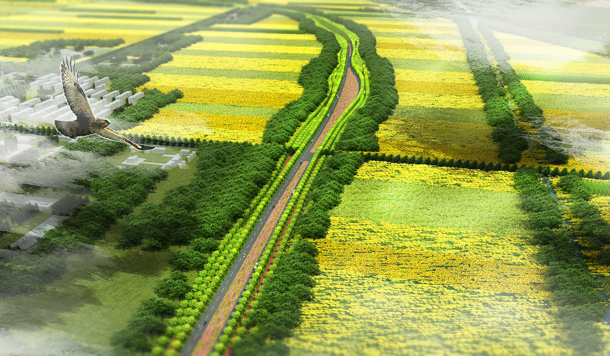
- Field and forest network + scenic road (ecological conservation zone).
- Flower sea and forest network + scenic road (agricultural countryside zone).
- Urban development + scenic road (urban vitality zone).
- Factory transformation + scenic road (planned industrial zone).
- Wetland and forest network + scenic road (fishery experience zone).
- Sports health leisure + scenic road (ecological livable zone).
Intelligent systems to create a new image of Chongming as an ecological, healthy, fashionable, and modern area.
