Hubei Huanggang Old City Ecological Infrastructure Planning Renovation and Enhancement
Project Information
- Project Location:
- China Huanggang, Hubei
- Project Scale:
- 363 Square Kilometers
- Design Time:
- November 2015
- Client:
- Huanggang Municipal Urban and Rural Planning Bureau
Project Profile
1. Project Statement
The plan establishes aquatic ecological infrastructure across systems to comprehensively address Huanggang's complex water issues. By planning and designing aquatic ecological infrastructure across scales, it specifically implements the concept of a "sponge city." Creative attempts have also been made to integrate ecological infrastructure planning with urban planning and control regulations.
2. Objective and Challenge
2.1 Objective
The overall goal of the plan is to establish aquatic ecological infrastructure in Huanggang, providing a scientific theoretical basis and feasible implementation pathways for constructing a "sponge city." Simultaneously, it aims to build an ecological framework for Huanggang's "resource-saving and environmentally friendly" dual-model society, proposing suitable urban development strategies and spatial layout directions to achieve "social harmony" and "ecological coordination" in urban-rural integration.
2.2 Challenge
2.2.1 Challenge 1: Systematically Managing Complex Water Issues
Despite constructing numerous pumping stations and municipal pipelines to address water source, flood control, and water quality issues, these singular engineering measures and "gray" infrastructure have failed to solve Huanggang's complex and systematic water problems. Instead, they have exacerbated water resource waste, increased flood protection pressures downstream, and further damaged riparian habitats. In this context, Huanggang urgently needs a forward-looking solution that comprehensively addresses water issues to guide future urban planning and development.
2.2.2 Challenge 2: Implementing the Concept of a "Sponge City"
Since the concept of a "sponge city" was officially proposed, its principles have gained widespread recognition, and understanding of its implications has deepened. However, the challenge lies in integrating the concept into planning and ultimately guiding the construction practice of sponge cities. This is a practical issue faced by urban decision-makers and practitioners, including the significant challenge for Huanggang in constructing a "sponge city."
2.2.3 Challenge 3: Effectively Connecting Sponge City Planning with Traditional Planning
Before the concept of a "sponge city" was introduced, Huanggang had already formulated a comprehensive urban plan and had prepared detailed control plans for some areas, which did not consider the requirements of sponge city construction and often did not adhere to its basic principles. The integration of Huanggang's sponge city planning with these traditional plans, especially statutory plans like control plans, is a daunting task that must be addressed.
3. Design Strategy
3.1 Establishing Aquatic Ecological Infrastructure to Address Water Issues
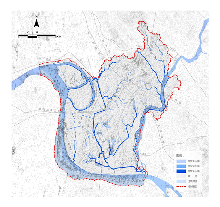
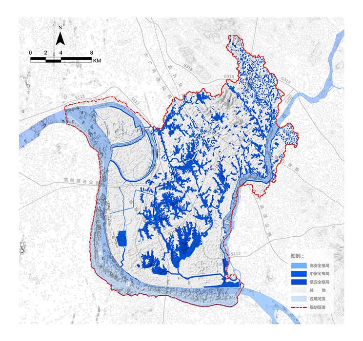
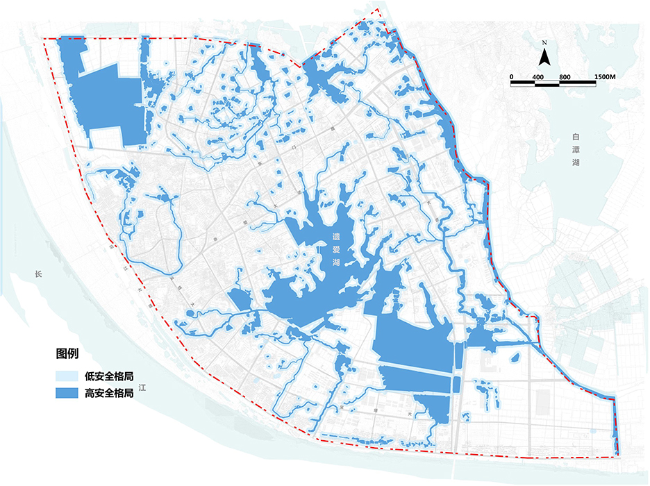
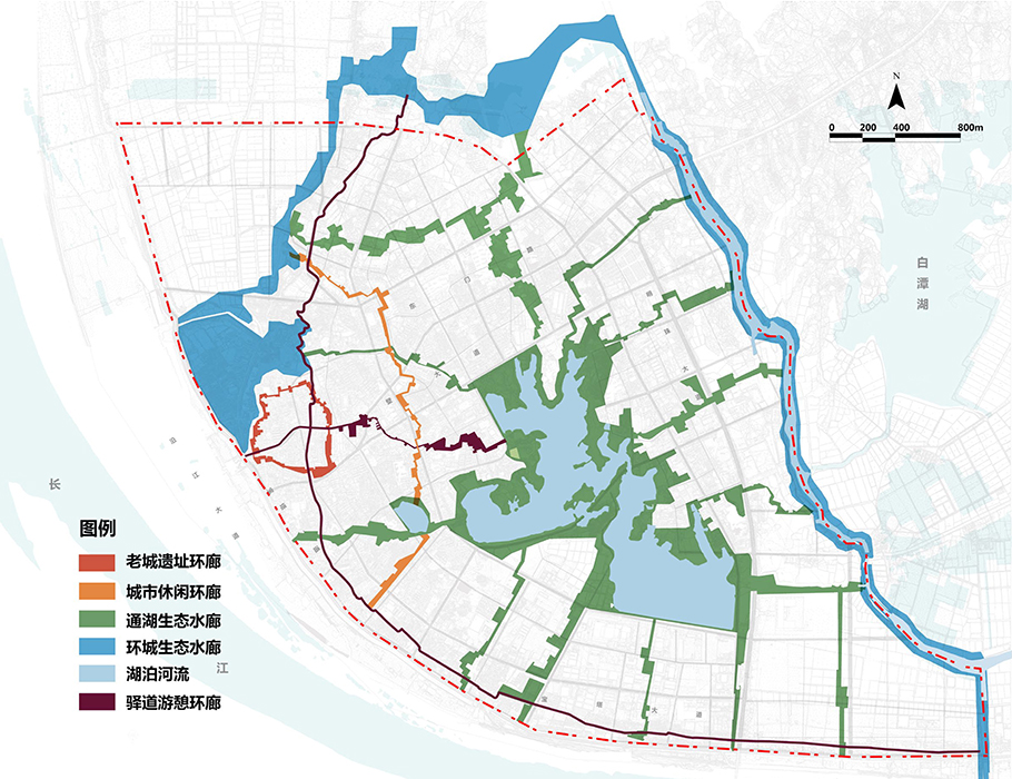
Based on hydrological process analysis and considering biological processes, cultural heritage preservation, and human recreational activities, the plan identifies landscape elements critical to regional water systems, biological systems, and human recreational systems — "water security pattern," "biological security pattern," and "recreational security pattern." These three landscape patterns are systematically integrated spatially to form a comprehensive ecological security pattern centered around water, serving as the basis for constructing Huanggang's ecological infrastructure.
3.2 Implementing Aquatic Ecological Infrastructure at Multiple Scales
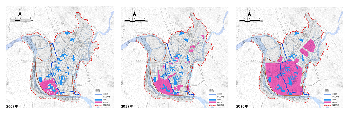
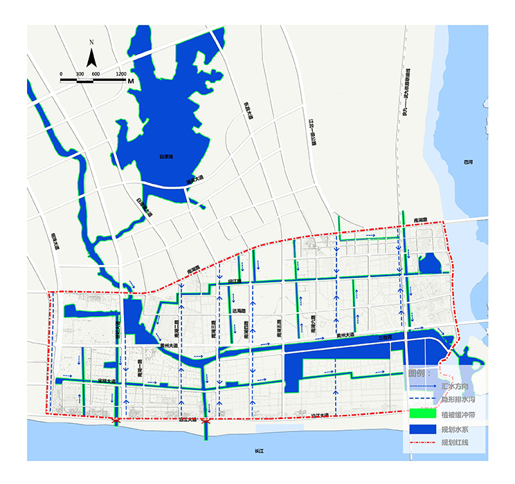
At the macro level, aquatic ecological infrastructure planning aims to delineate regional water ecological redlines to safeguard urban ecological spaces, serving as a prerequisite and basis for urban master plan revisions. Key control indicators include annual runoff control rates and regional flood control and drainage standards. Based on Huanggang's natural environmental conditions, the plan aims for an 85% control rate of post-planning annual runoff volume, ensuring no flood disasters under 24-hour heavy rain every 20 years.
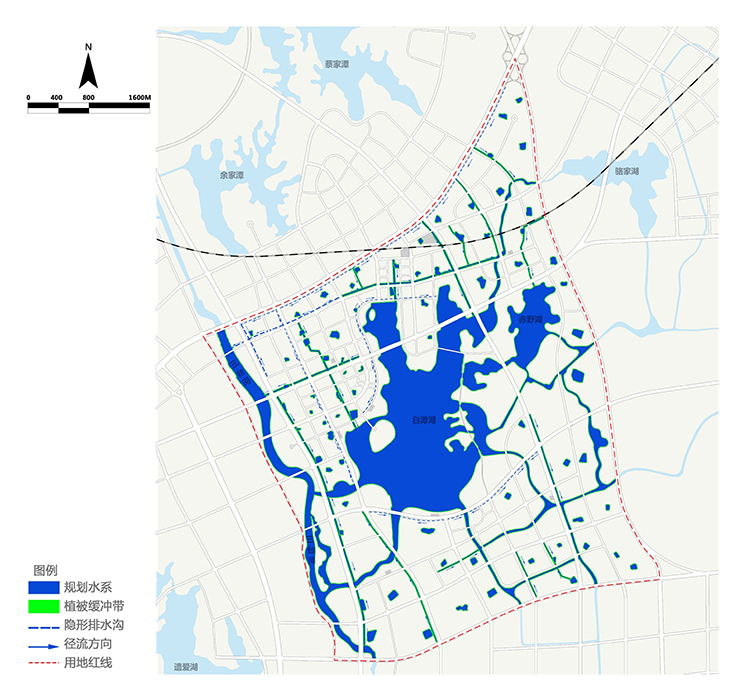
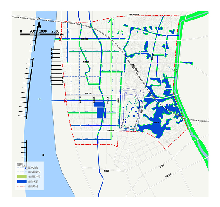
At the meso level, aquatic ecological infrastructure planning aims to establish control plans for three zones: Yuwang Industrial Zone, Nanhu Industrial Zone, and Chengdong New Zone, to organize urban surface runoff effectively and ensure the natural connection between urban water systems and regional water systems. The main control indicator at the meso level is the annual runoff control rate, with each zone targeting an 85% annual runoff control rate after planning.
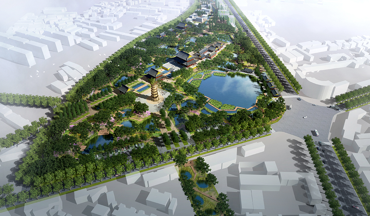
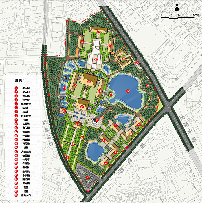
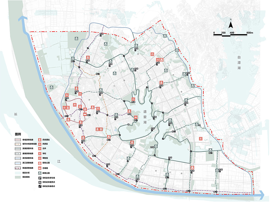
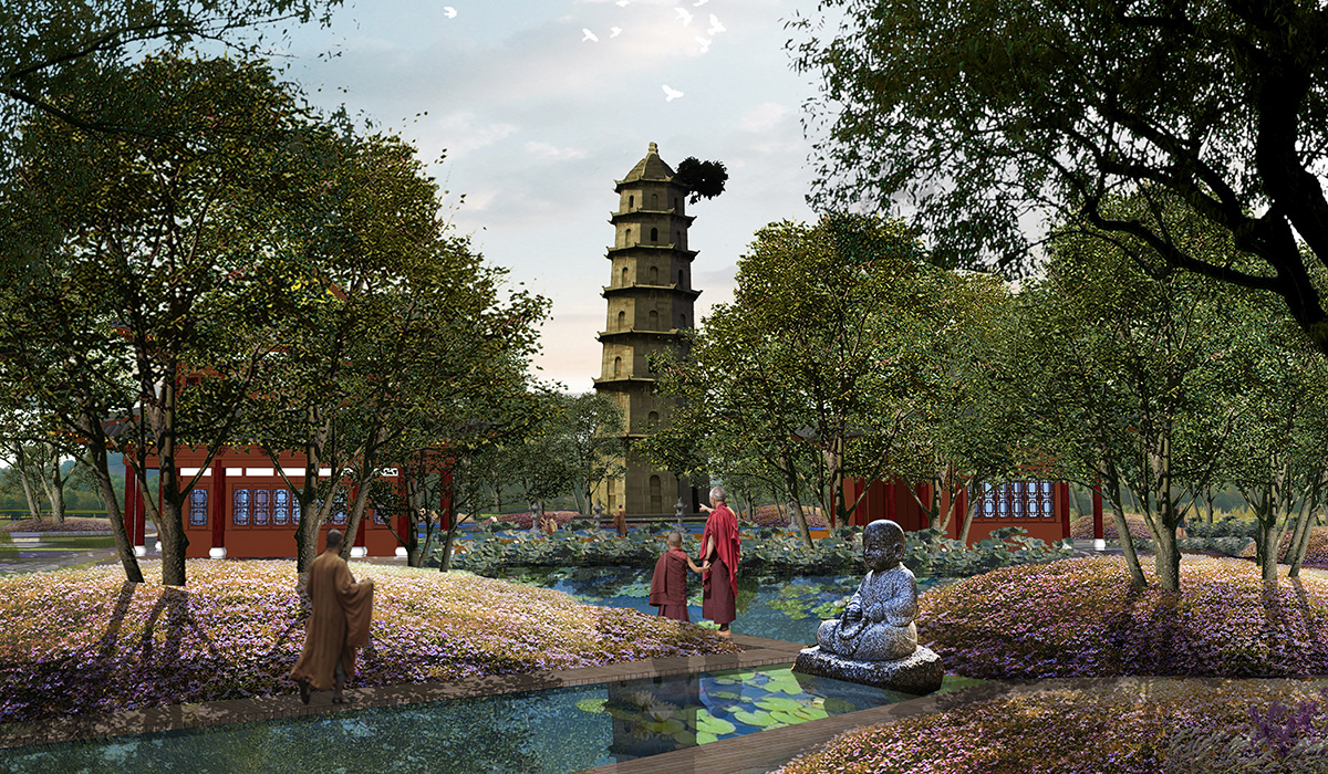
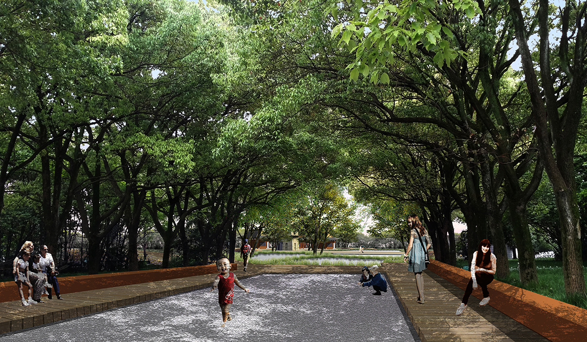
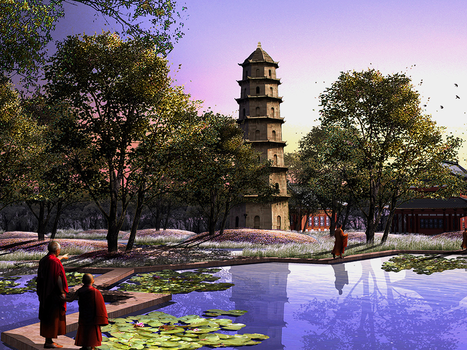
At the micro level, the implementation of aquatic ecological infrastructure aims to extend the ecological service functions of regional and urban aquatic ecological infrastructure to every plot. By selecting typical sites of regional and urban aquatic ecological infrastructure, the plan designs the site-oriented based on ecosystem services, implementing the concepts of "sponge city" and "aquatic ecological infrastructure" into specific locations.
3.3 Integrating Aquatic Ecological Infrastructure Planning with Control Regulations — Using Yuwang Industrial Zone as an Example
Based on the current land use characteristics and ideal aquatic ecological infrastructure in each zone, the plan attempts to perfect the ecological water system in the control detailed planning through various feasible land transformation modes without changing the existing layout and land indicators. This aims to achieve the goal of ensuring the ecological water system services in each zone with minimal changes.
4. Conclusion
The plan establishes a comprehensive ecological security pattern, with river systems as the backbone, linking key detention bodies, biological habitats, and human recreational landscapes. The total area is 105 km², accounting for 25% of the total planned area.
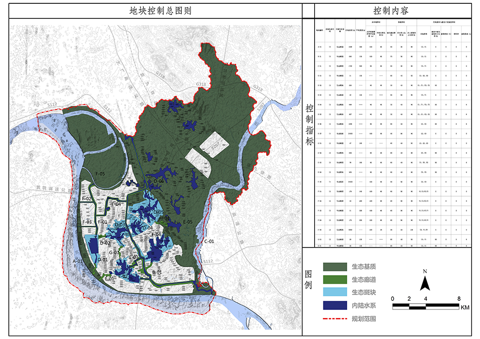
The plan delineates a total area of 143.8 km² for aquatic ecological redlines, accounting for 39.6% of the total planned area. It is divided into 22 plots, implementing and controlling spatially through plot control diagrams.
After planning, Yuwang Industrial Zone has an area of 352 hectares for aquatic ecological infrastructure, accounting for 9% of the planned area; Nanhu Industrial Zone has an area of 280 hectares, accounting for 9.7% of the planned area; Chengdong New Zone has an area of 528 hectares for aquatic ecological infrastructure, accounting for 21% of the planned area.
