Baotou Nanhai Wetland and Surrounding Area Planning
Project Information
- Project Location:
- China Baotou, Neimenggu
- Project Scale:
- 5615 Hectares
- Design Time:
- December 2015
- Client:
- Baotou Nanhai Wetland Management Office
Project Profile
1. Project Statement
Baotou Nanhai Wetland is located southeast of the city, adjacent to the Yellow River. It was once part of the old riverbed of the Yellow River, which shifted southward, creating the water surface and marshland. The Nanhai Wetland, being close to the city, plays a vital role in improving the local ecological environment, regulating climate, purifying air, beautifying and enhancing the regional environment, and maintaining ecological safety. However, the wetland faces multiple conflicts such as habitat destruction, urban expansion, airport development, and surrounding agricultural growth. The key issue for this project is how to achieve ecological protection and appropriate development of the Nanhai Wetland.
2. Objective and Challenge
This region lies at the intersection of the Central Asian and East Asian-Australian migratory bird routes and serves as a crucial wetland resource in desert and semi-desert areas, rich in avian species and a haven for rare birds. Baotou's Nanhai, along with the Donghe River that flows into it, is recognized as the birthplace of Baotou City, carrying ancient myths, the migration of people during the Ming and Qing Dynasties, and the bustling commercial activities of the Republic of China era, making it a cultural heritage site for Baotou residents.
Nevertheless, Nanhai Wetland faces several challenges. Firstly, its external boundaries have been gradually encroached upon by surrounding urban and rural areas, losing its natural ecological space attributes, necessitating redefinition of functional zones and guiding the movement of visitors and animals. Secondly, its internal infrastructure and recreational facilities are outdated, unable to meet contemporary needs for ecological protection, educational purposes, and recreational activities, requiring a comprehensive upgrade to enhance visitor experience and create diverse habitats.
The project aims to establish a national wetland park and nature reserve, focusing on protecting the wetland habitat in the Yellow River semi-desert region and international endangered species, preserving the cultural memory of Baotou's origins and ethnic integration, and coordinating sustainable development of the surrounding urban and rural areas. Ultimately, it aims to make Nanhai Wetland an eastern landmark and international symbol of Baotou's ecological advancement.
3. Design Strategy
Macro Level:
Ecological System Restoration Planning
Redefine protection boundaries and management jurisdictions within the area, simplifying protection efforts and avoiding current multi-departmental management conflicts. Strictly protect areas that need preservation and reasonably develop those suitable for leisure activities, balancing ecological protection with public needs.
Implement strategies for water system planning, environmental conservation, and mosquito control, focusing on maintaining the habitats of endangered species like the relict gull, black stork, great bustard, and white-tailed eagle, minimizing the impact of development on their habitats.
Modern Agriculture Coordination Planning
Propose a "National Agricultural Park" concept to address agricultural issues around Nanhai Wetland, including agricultural park system construction, wetland restoration, land use changes, rural development, and farmer transition.
Transportation System Coordination Planning
Address major transportation issues such as airport economic development, airport biological safety, road noise pollution, and railway division of the urban area through macro-level regulation, boundary delineation, system sorting, and rational suggestions.
Cultural and Recreational Coordination Planning
Develop a city leisure area centered on Nanhai Wetland, supported by commercial services, cultural and educational activities, and characterized by health and wellness.
Meso Level:
Focuses on concept planning and design for the Nanhai Lake Ecological Leisure Area and the Nanhai Wetland Agricultural Experience Area.
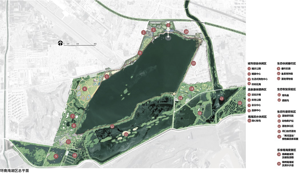
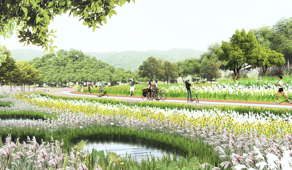
Nanhai Lake Ecological Leisure Area
Positioned as the interface between natural conservation and urban development, the core tourism display of the Nanhai "Wetland Reserve," and a comprehensive complex for urban ecological leisure and wetland scientific research.
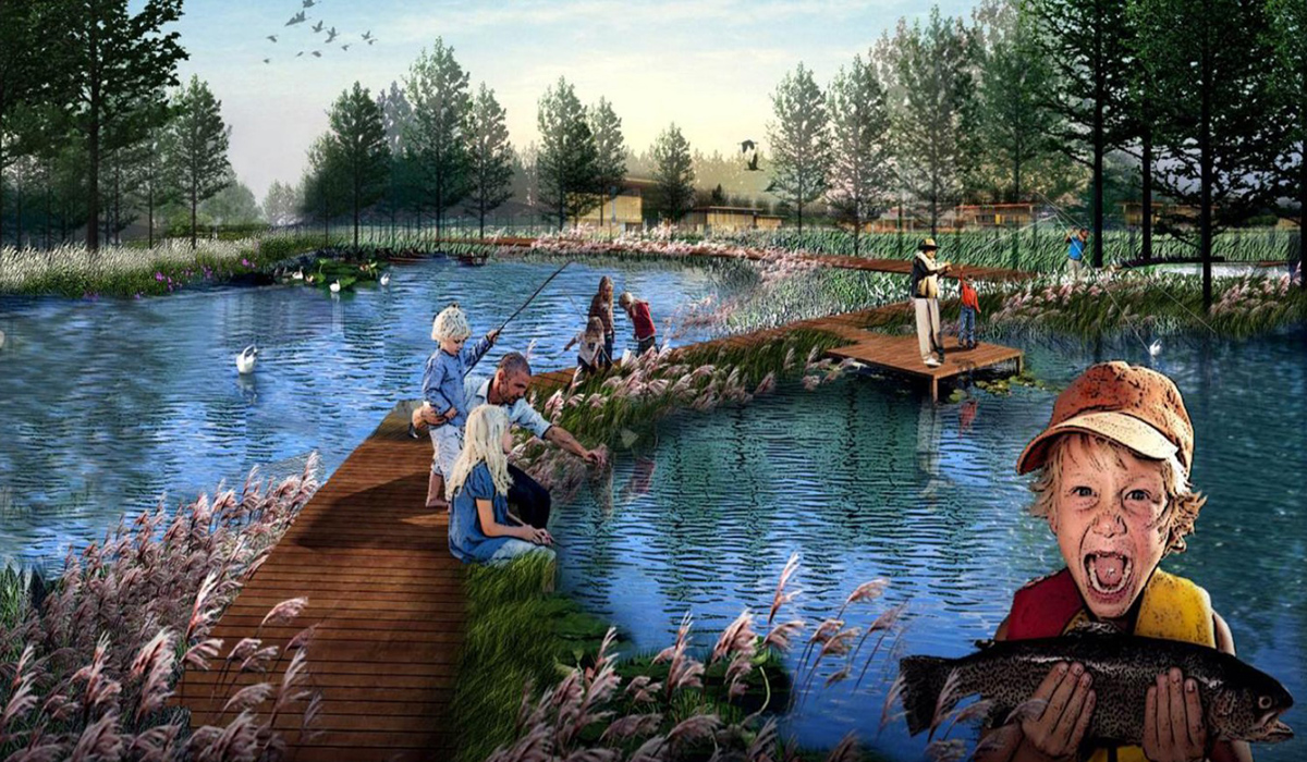
Includes seven sub-zones: Urban Comprehensive Leisure Zone, Hot Spring Health and Wellness Zone, Nanhai Waterfront Leisure Zone, Ecological Leisure Fishing Zone, Ecological Restoration Experiment Zone, Ecological Science Research Zone, and Nanhai Resort Zone.
Adopts a classification and prioritization approach, integrating various functions such as ecological protection and research, cultural and recreational activities, health and wellness, public entertainment, and urban services.
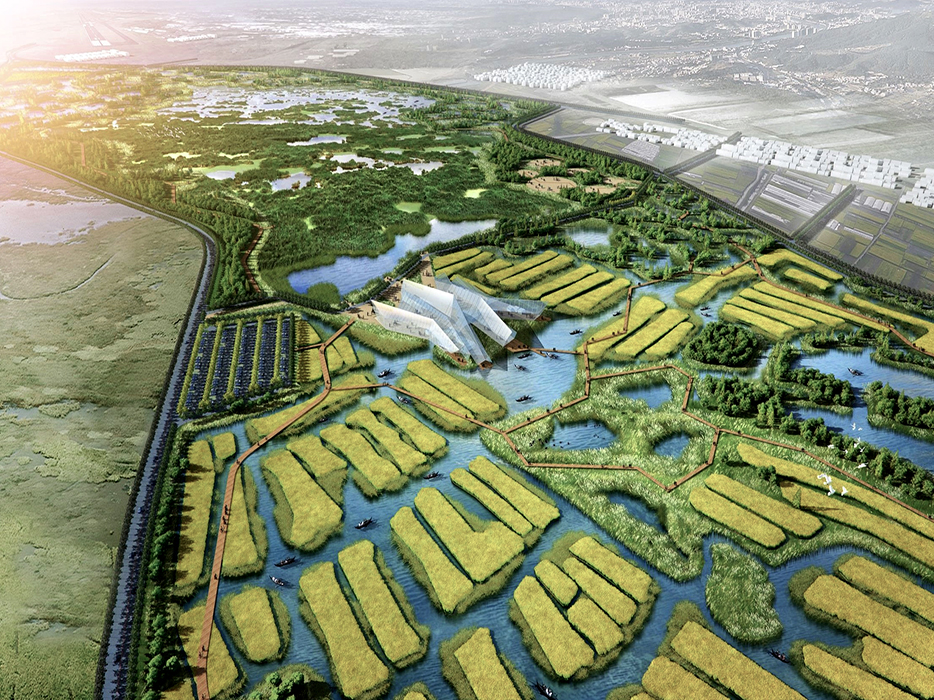
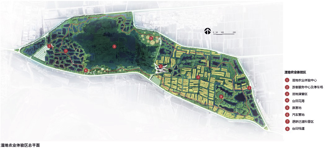
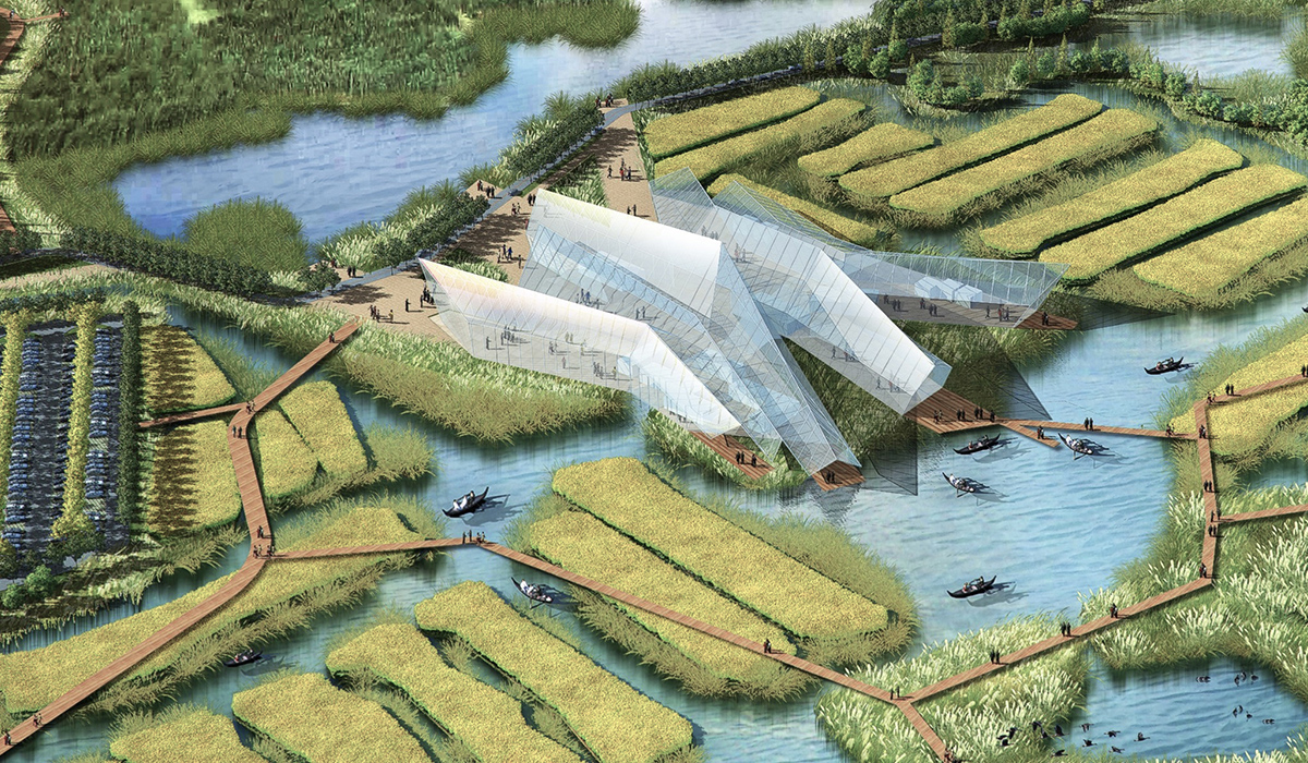
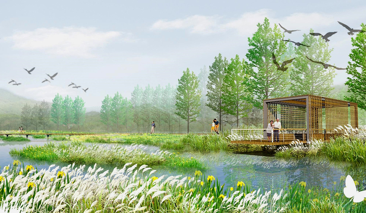
Nanhai Wetland Agricultural Experience Area
Positioned as the interface between wetland conservation and rural development, the core tourism display of the Nanhai "Wetland Park," and a comprehensive complex for agricultural ecological experience and wetland recreational activities.
Comprises two main sections: Wetland Recreational Section and Wetland Agricultural Display Section, incorporating a Wetland Agricultural Center for scientific research on wetland and agricultural production and related service facilities.
Micro Level:
Includes two parts: Wedding Expo Park and Donghe River Channel Landscape Design.
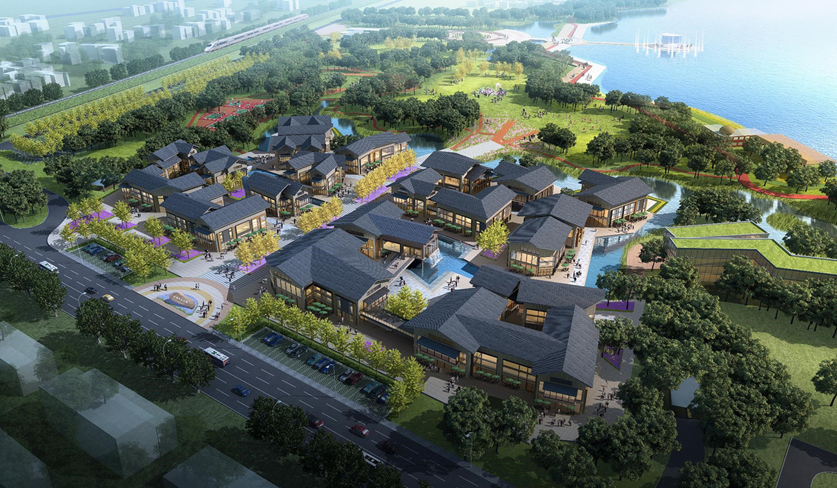
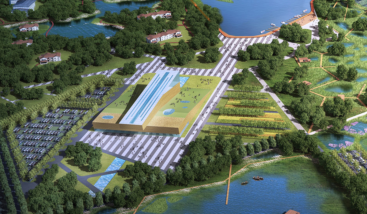
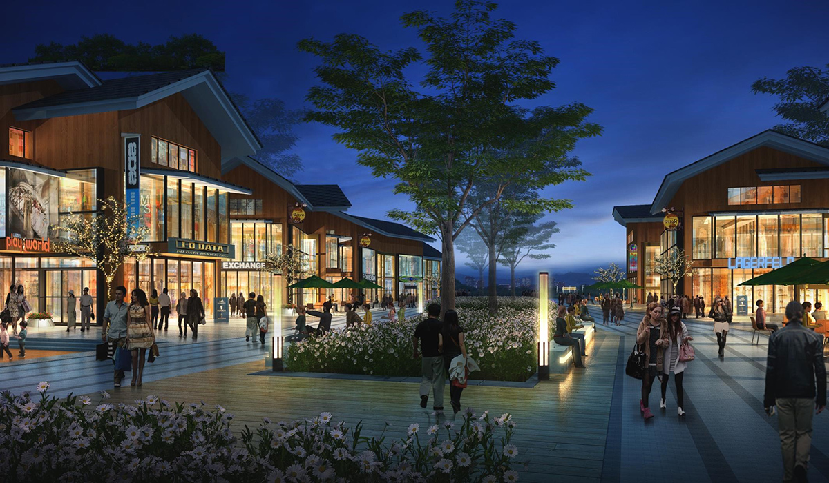
Wedding Expo Park Design
Located in the Urban Comprehensive Leisure Zone of the Nanhai Lake Ecological Leisure Area, primarily focused on wedding services and urban leisure, cultural display, public entertainment, and tourism services.
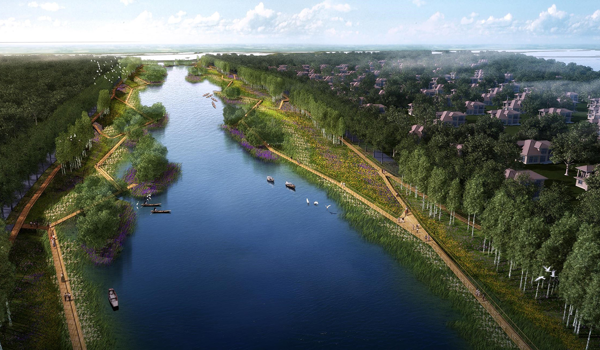
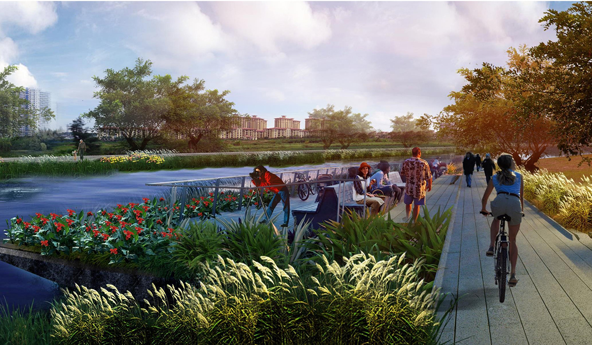
Donghe River Channel Landscape Design
Enhances and upgrades the landscape of the Donghe River Channel section near the Yellow River, addressing ecological, recreational, and cultural aspects through strategies like constructing a green ecological foundation, creating a vibrant waterfront, and preserving historical memory.
4. Conclusion
Through macro, meso, and micro-level strategies and designs, the Nanhai Wetland and its surrounding areas have been replanned at various levels and scales, aiming to transform the Nanhai Wetland into an eastern landmark and international symbol of ecological advancement for Baotou City.
