Nantong Wushan Forest Park


Project Information
- Project Location:
- China Nantong, Jiangsu
- Project Scale:
- 115 Hectares
- Design Time:
- February 2017
- Related Papers
Project Profile
1. Project Statement
To improve the overall quality of Wushan Forest Park and create a national 5A-level scenic area, the plan aims to address issues in the current riverside area, such as its single function, outdated facilities, and abandoned spaces. The goal is to transform the riverside area into a multifunctional ecological corridor that combines flood control, ecological restoration, leisure and recreation, cultural display, and popular science education. In suitable areas, natural-style riverbanks will be restored, and the functions of river embankments will be enhanced to meet flood control standards for a once-in-a-century event, rather than having a single flood control function. Additionally, a variety of activities will be introduced to the riverside area to strengthen the human-water relationship and create a flexible waterfront space.
2. Objective and Challenge
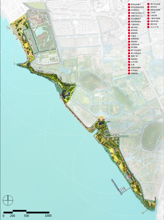
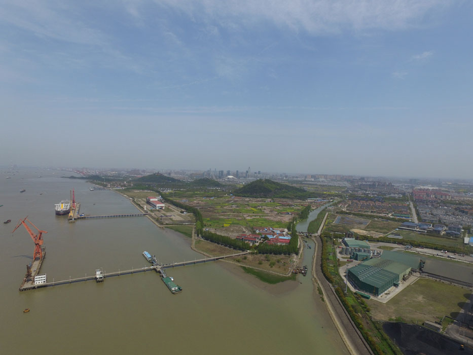
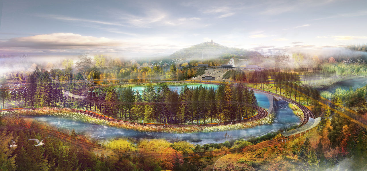
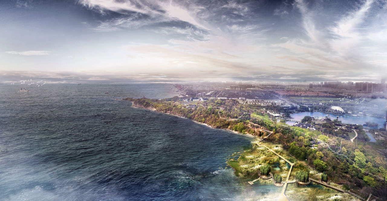
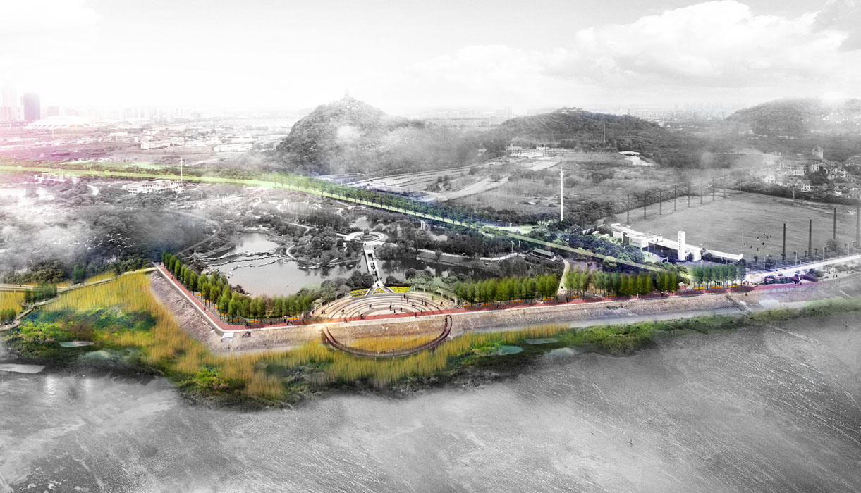
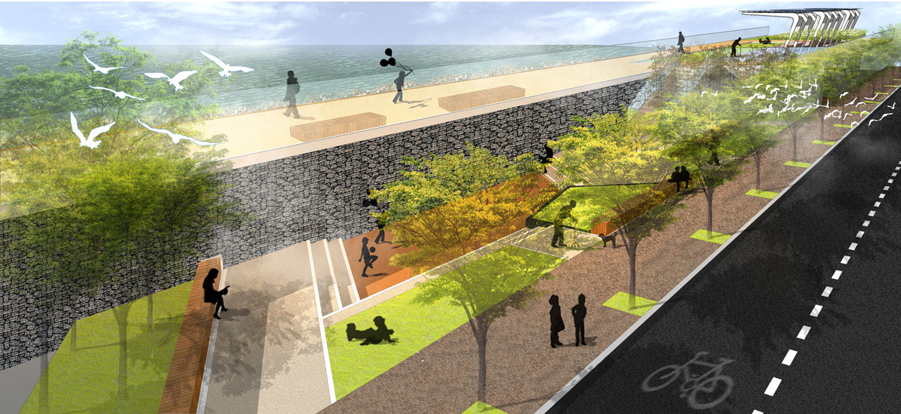
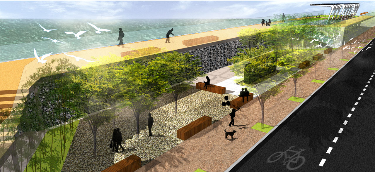
The project is located at the intersection of the Langshan Scenic Area green corridor and the Yangtze River waterfront green corridor in the southeastern part of downtown Nantong, adjacent to the Yangtze River. It extends from the current Riverside Park in the north to Kuzi Port in the south, with a length of approximately 6 kilometers and an area of about 115 hectares. The site is within the planned Wushan Forest Park, close to the famous 4A-level Langshan Scenic Area in Nantong. The northern section of the site has rich vegetation and ecological resources, which can be utilized to enhance visitors' landscape experience. The middle section currently features a strip-like riverside park with only basic sightseeing and flood control functions, and a lot of space with unclear functions and few rest areas, failing to meet future riverside usage demands. The southern section is largely occupied by industrial land, with a large hinterland and slow water flow. However, most of the site consists of vacant land or functions that are contrary to long-term goals and urgently needs ecological restoration.
The design goal is to create a comprehensive riverside park that is ecological, vibrant, healthy, and popular, serving as Nantong's future ecological icon, cultural showcase, and development engine.
3. Design Strategy
A comprehensive riverside park that is ecological, vibrant, healthy, and popular.
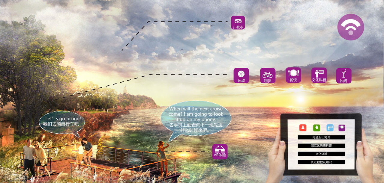
The design proposes strategies at macro, meso, and micro levels. At the macro level, from the perspective of Nantong City, the strategies include establishing water safety, biological safety, recreational safety patterns, and green corridor systems. At the meso level, from the Wushan Scenic Area perspective, the strategies involve building water ecosystems, riverbank systems, waterfront recreational systems, green vegetation systems, colorful Langshan landscapes, and historical and cultural studies. At the micro level, for the 6-kilometer waterfront site, the strategies include detailed interpretations of the overall riverside landscape design, segmented landscape design, key node landscape design, water purification design, slow traffic system design, public service facilities design, plant configuration design, and building renovation design.
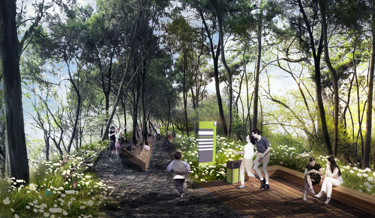
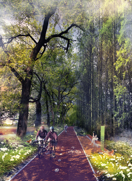
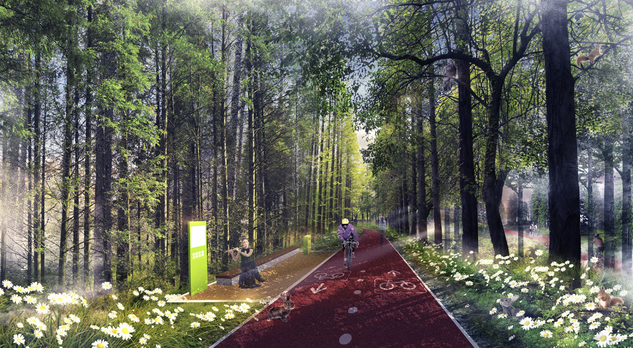
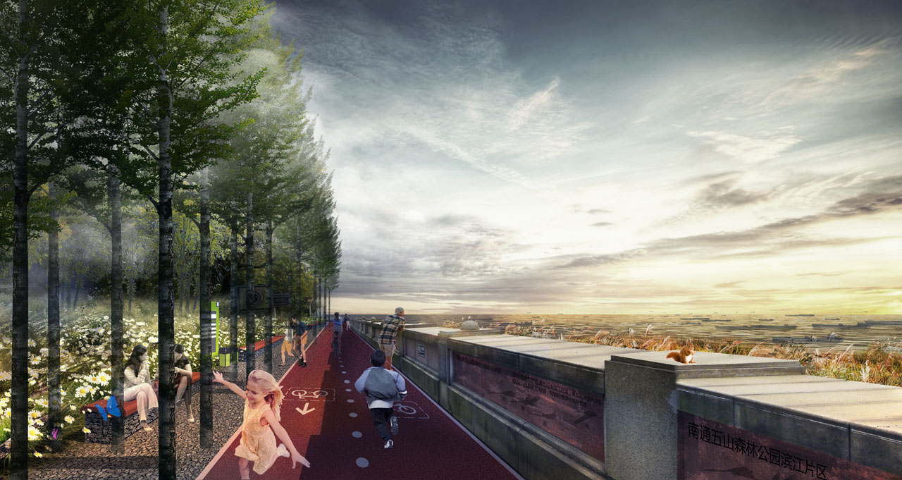
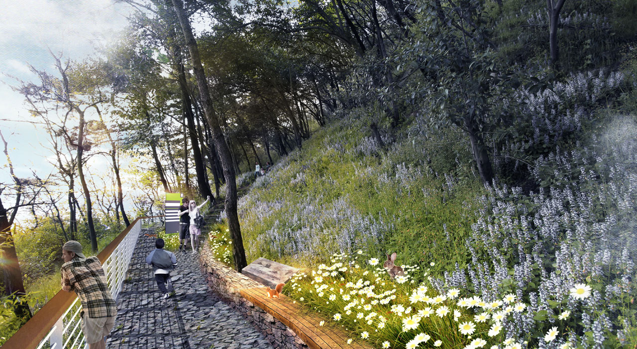
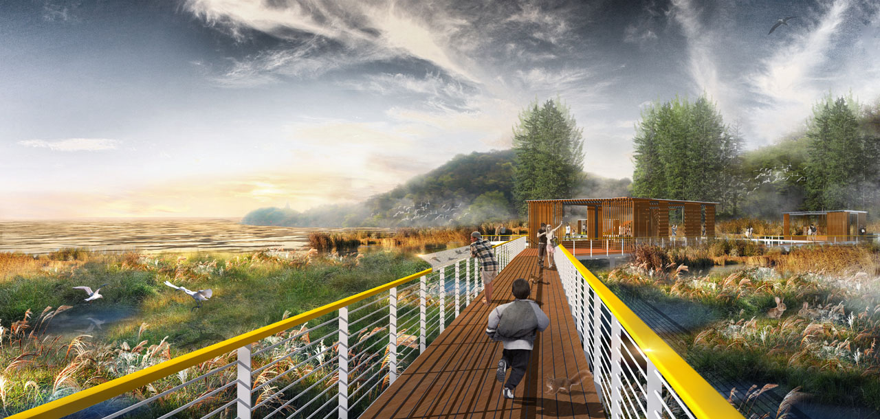
In the northern section, three different types of trails will be designed to provide diverse experiences without disturbing the existing ecological resources. In the middle section, the height difference between the flood control embankment and the adjacent road will be utilized to create rich spatial experiences, and service buildings will be designed to introduce commercial functions to the area. In the southern section, ecological restoration will be carried out to restore natural-style riverbanks, renovate existing shipyards, and introduce concepts such as sun lawns, flower seas, tree houses, and outdoor activities to create a unique suburban park along the Nantong waterfront.
4. Conclusion
Through these landscape design strategies, the previously deteriorating riverside habitat and neglected urban fringe have been successfully transformed into a multifunctional ecological riverside corridor. This enhances the human-water relationship, enriches riverside functions, increases riverside vitality, and prevents once-in-a-century floods. The constructed ecological riverside corridor protects and utilizes the original high-quality ecological resources, restores the industrial site ecologically, protects and renovates buildings, meets citizens' leisure and recreation needs, and allows nature to recuperate.
