Xinjiang Shihezi Jiangjunshan Beilu Restricted Construction Area Planning
Project Information
- Project Location:
- China Shihezi, Xinjiang
- Project Scale:
- 10.98 Square Kilometers
- Design Time:
- December 2016
Project Profile
1. Project Statement
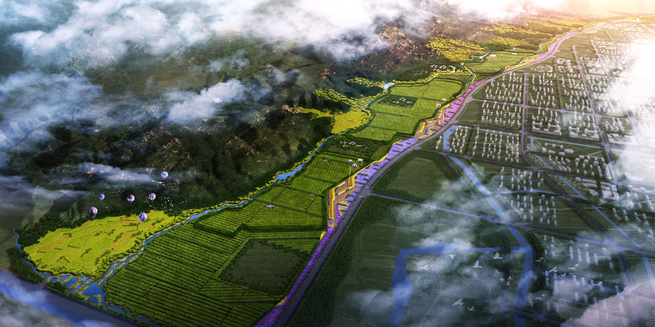
The project site is located in the open ecological area of Jiangjunshan in the southern suburbs of Shihezi, covering a total area of approximately 10.98 square kilometers. Jiangjunshan is a branch of the Tianshan Mountains, bordered by the Manas River to the east and the Beiyangshan Cemetery to the west. Together with Beihu, it forms an important ecological barrier for Shihezi.
The site is 150 km from Urumqi, 260 km from Karamay, and about 13 km from Shihezi city center. It is conveniently located next to the newly constructed S101 national highway to the north. The area boasts unique red cultural and historical resources, high-quality natural resources, and spatial advantages, making it a potential urban ecological leisure and specialty tourism destination.
2. Objective and Challenge
The site has rich tourism resources with strong development potential. Under the macro background of Shihezi developing into a "regional tourism and leisure city," the planning aims to create a distinctive landscape belt in the foothills area while protecting the ecological environment and integrating the relationship between the foothill zone and urban space. The plan aims to consolidate the site's existing advantageous resources, enhance its unique appeal, and build a tourism destination in the middle section of the northern Tianshan Mountains.
Jiangjunshan serves as an important ecological barrier for Shihezi, and the site is in an ecologically sensitive area at the mountain's foothills. Therefore, the primary task is to balance ecological protection, urban landscape, and tourism development. As a unique tourism destination, the site's current red cultural resources, vineyards, and potential geothermal resources offer some uniqueness and compatibility with leisure projects. However, they lack hierarchy and coherence, preventing them from fully leveraging their potential. Integrating and utilizing existing resources to maximize their appeal is a key focus and challenge of this planning.
3. Design Strategy
Given the unique planning objectives, the tourism project planning, landscape design, and architectural design are integrated as an organic whole, ensuring the project's ecological, scientific, and functional coherence.
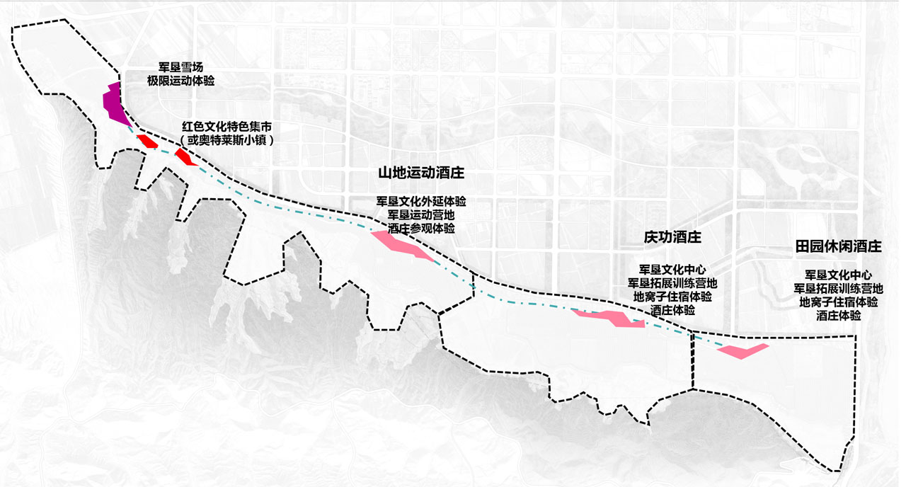
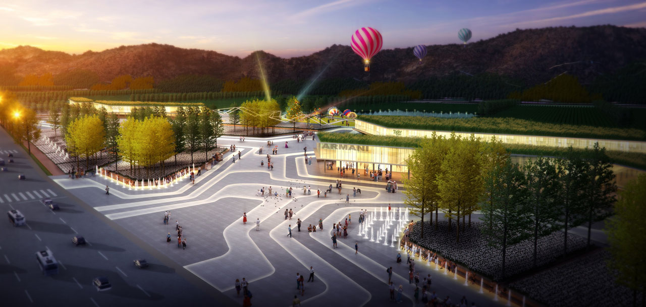
First, the project's resource value is assessed, and tourism planning is positioned. The image positioning emphasizes the promotional slogan "Remembering Hardships and Embracing Sweetness—Jiangjunshan: An Experiential Ecotourism Destination." Centered around military reclamation culture, it highlights distinctive features and reinforces the experience through themed cultural products. The functional positioning implements the three main thematic sections of the upper-level plan—military reclamation, ecology, and experience—enhancing the military reclamation culture and linking it with vineyard and mountain hot spring consumption, shaping the urban cultural brand, improving tourism services, and elevating the quality of tourism products. The layout possibilities for themed projects are proposed based on current conditions.
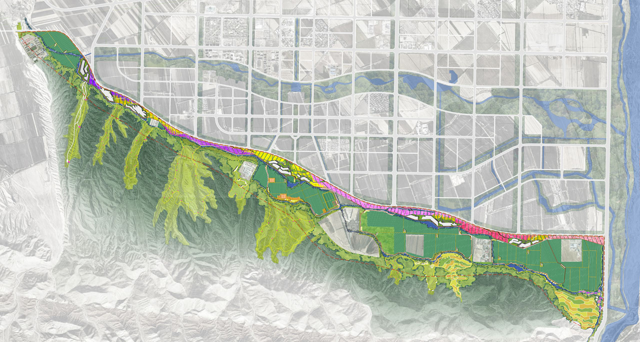
Secondly, the existing terrain, water system, transportation, vegetation, and urban spatial pattern of the upper-level plan are analyzed to organize the site's ecological landscape system, forming the landscape structure and ecological foundation of the characteristic foothill landscape belt. This provides a spatial foundation and service facilities for the tourism project's placement.
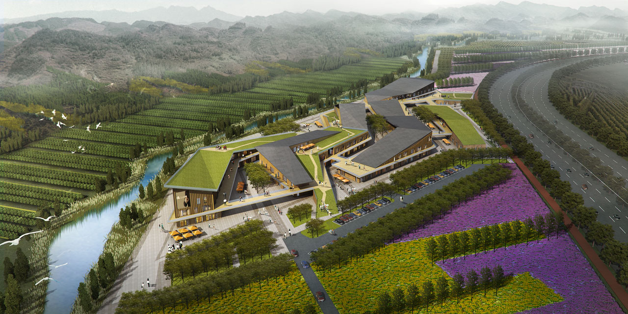
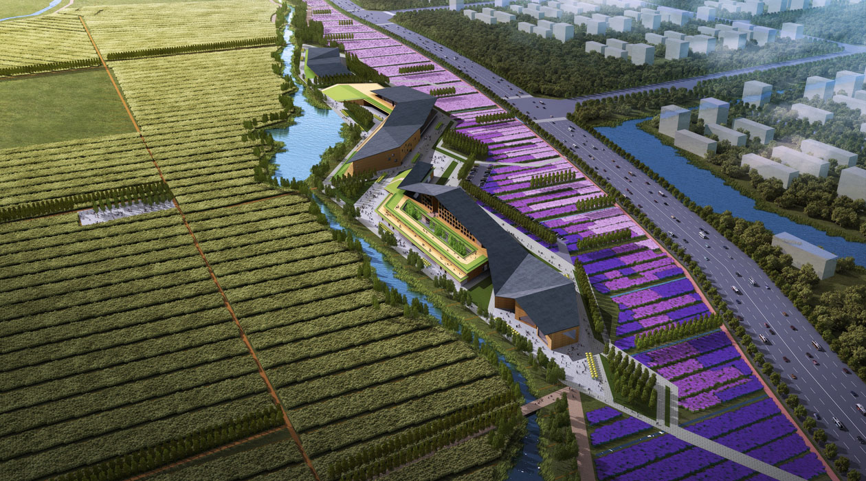
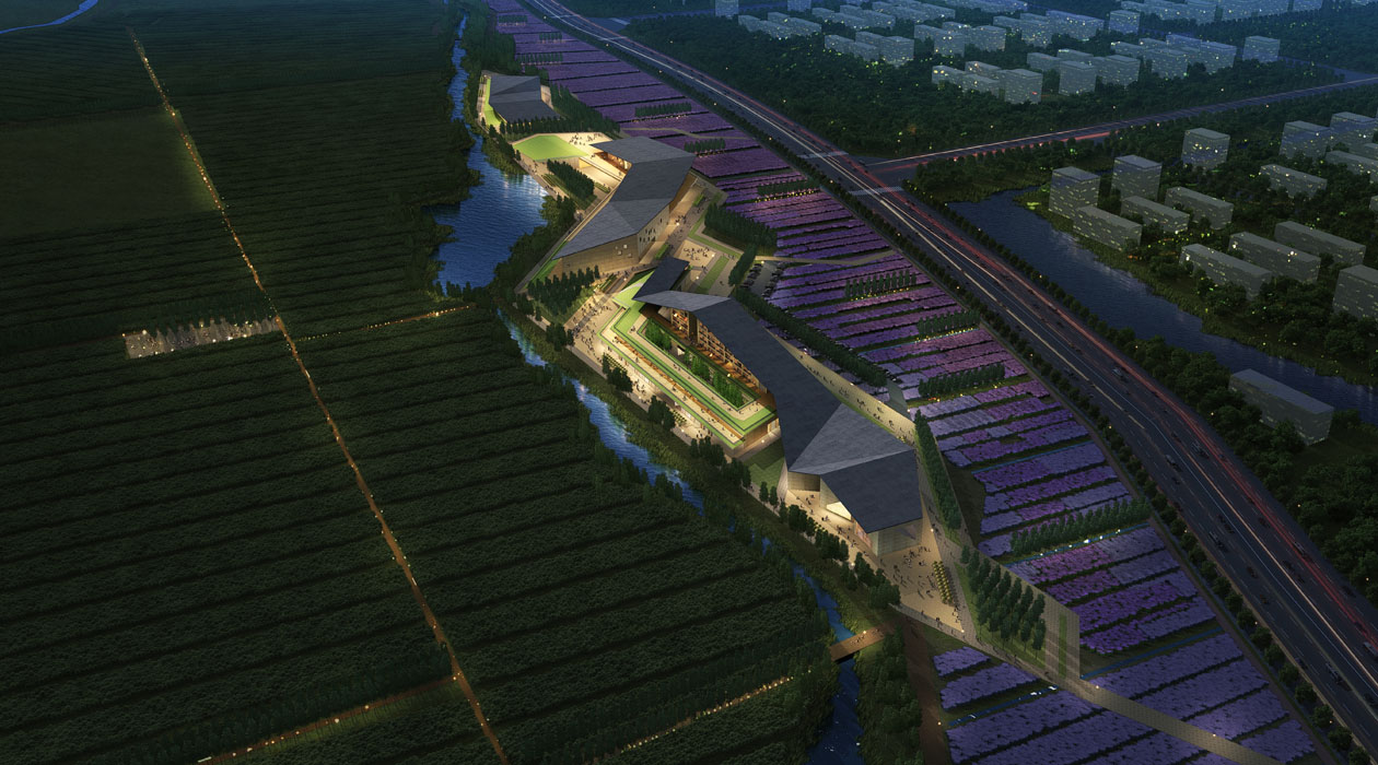
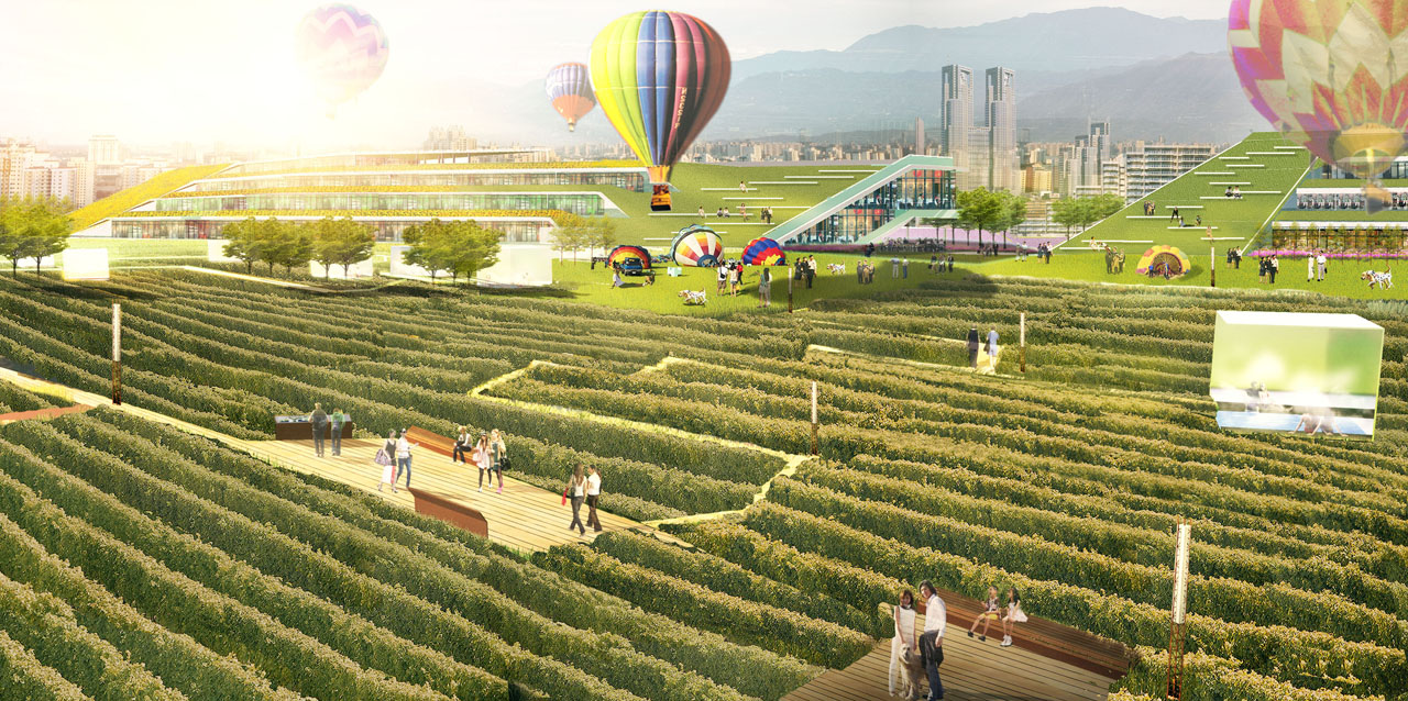
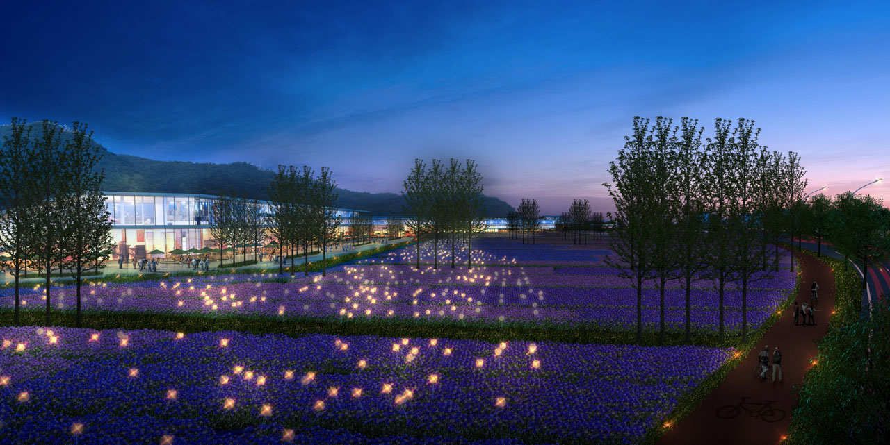
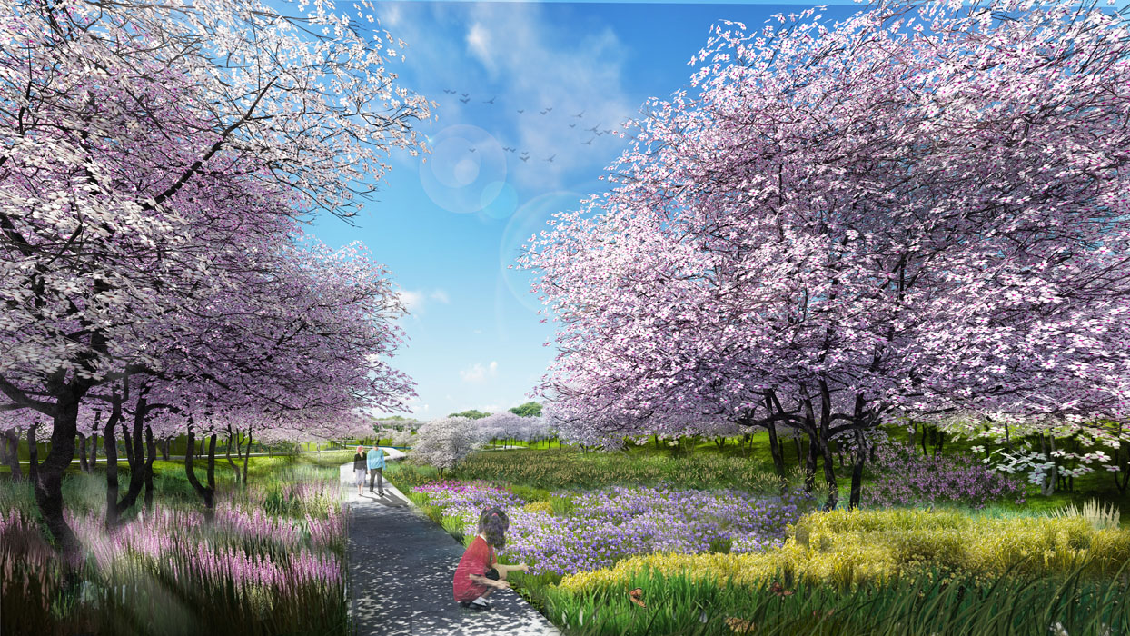
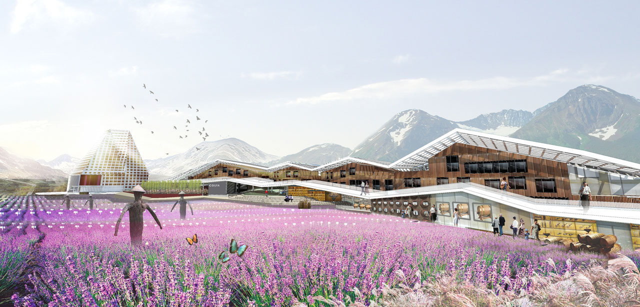
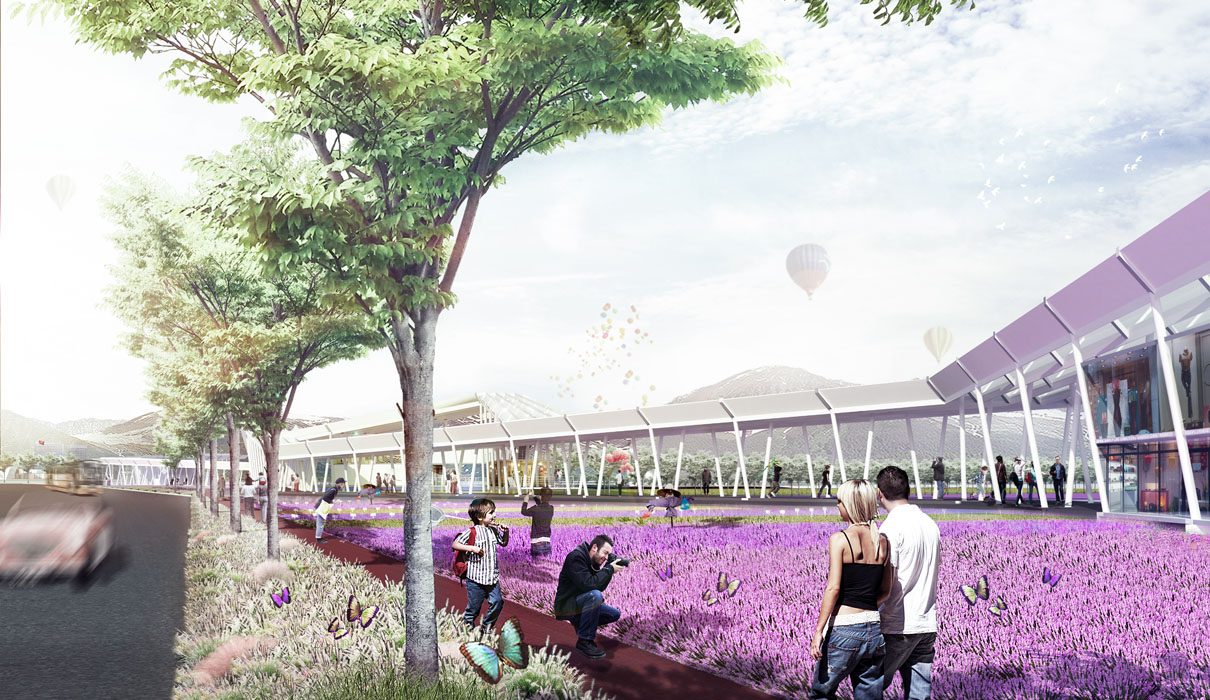
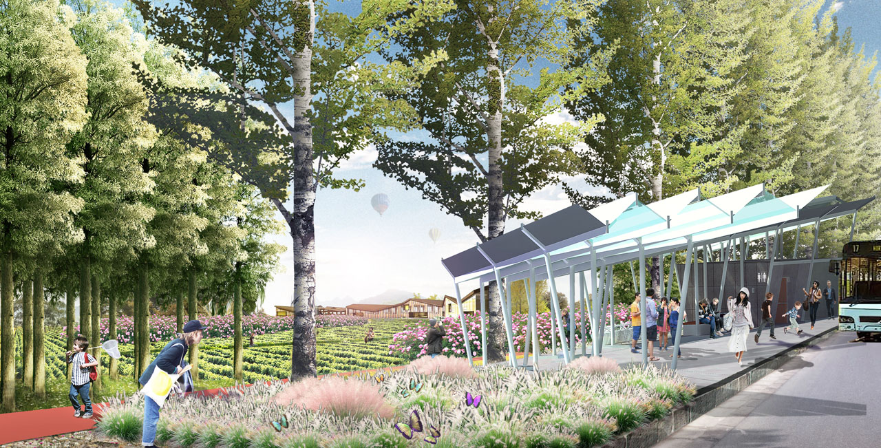
From north to south, from city to mountain, a leisure tourism floral belt is formed in layers—creating a landscape interface with native wildflower vegetation, laying out traffic services and leisure tourism project nodes; three distinctive vineyard clusters—forming three different themed leisure experience vineyard clusters (military reclamation, pastoral, and mountain experiences) based on different tourism resource layouts and existing vineyards; ten distinctive activity valleys—creating unique valleys for in-depth exploration based on the terrain, forming distinctive landscapes with flower vegetation and providing space for various outdoor mountain sports.
The three-tiered landscape structure divides the space for different intensities and features of tourism experiences, naturally coordinating and balancing leisure tourism with ecological landscapes.
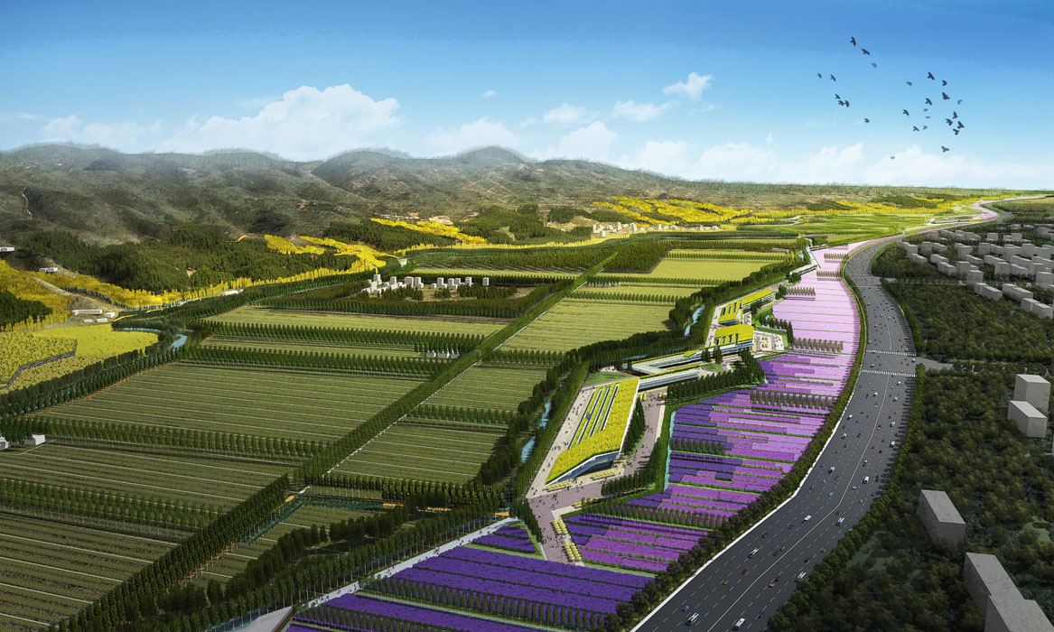
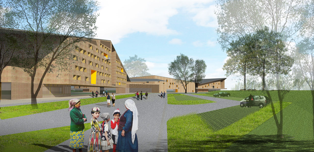
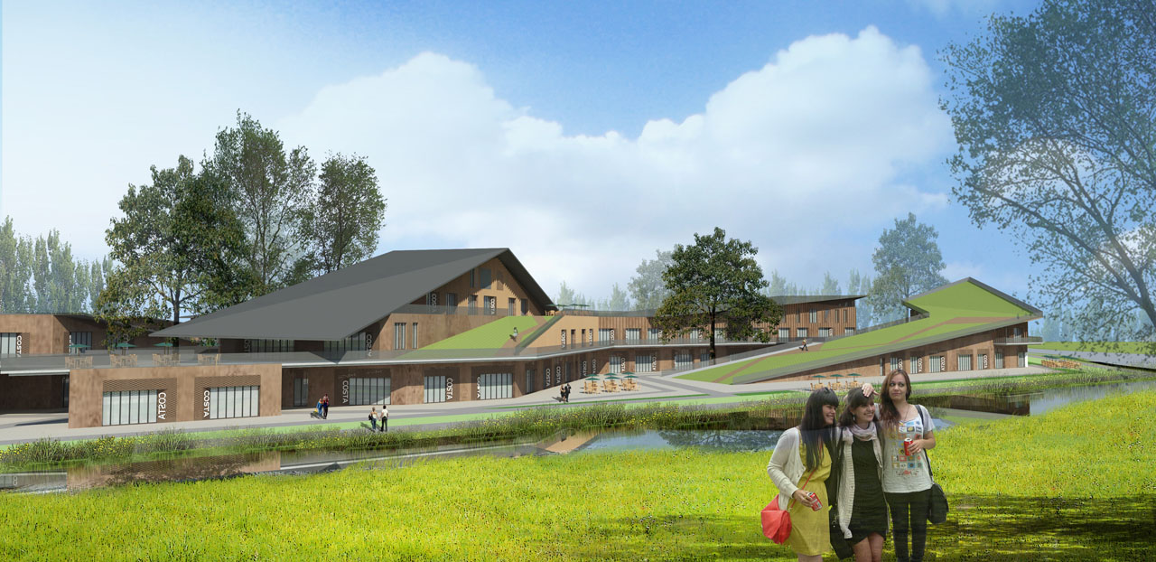
Lastly, four distinctive building clusters are designed based on local cultural features and mountain space. The buildings use modern rammed earth architecture language, combining cultural, geographical, and climatic characteristics to recreate the Silk Road and military reclamation styles, creating impressive local characteristic spaces. The continuous sloped roofs and terraces form a relationship with the background mountains. The building spaces connect with the park's slow-moving system and recreational spaces, complementing the park's comprehensive service functions and linking with farmland, water systems, and mountain views.
4. Conclusion
The project considers the ecological organization of the foothill zone, landscape planning, and leisure tourism resource development as an integrated whole, leveraging the comprehensive advantages of landscape planning. It balances the contradiction between development and protection while finding local characteristic resource advantages and integrating mountain features, military reclamation culture, and pastoral flavors into the landscape and architectural design language.
