Inner Mongolia Bayannur Beibianqu (Yongqing River) Redevelopment
Project Information
- Project Location:
- China Bayannur, Inner Mongolia
- Project Scale:
- 648 Hectares
- Design Time:
- October 2016
Project Profile
1. Project Statement
Bayannur City, a prefecture-level city in Inner Mongolia, is located in the western part of Inner Mongolia. It borders Baotou to the east, Alxa League and Wuhai City to the west, the Yellow River and Ordos City to the south, and Mongolia to the north, covering a total area of 64,000 square kilometers. The Hetao Irrigation District within its territory is the largest single-structured gravity irrigation district in Asia, and the Hetao Plain within its territory is known as the "Jiangnan of the Frontier." The northern part of Bayannur City is the Urat Prairie, the central part is the Yinshan Mountain area, and the southern part is the Hetao Plain.
This conceptual plan focuses on the banks of the Yongqing River, leveraging the opportunity of shantytown renovation to deeply explore and utilize existing natural and cultural resources. It aims to create a new "engine" for revitalizing the old riverside city and a new "business card" for urban dual-repair, while addressing issues such as ecological environment improvement, industrial structure optimization, integration of leisure and vacation resources, and the improvement of urban functions and service facilities.
2. Objective and Challenge
(1) Urgent Need to Renovate the Shantytown Environment
The comprehensive renovation project of the Beibian Canal (Yongqing River) shantytown will become a new model of shantytown renovation and development in the new era and new normal, further enhancing the vitality of the new city and ultimately achieving a new leap in urban construction in Linhe District.
(2) Urgent Need to Restore the Damaged Ecological Environment
Due to long-term delays in urban planning, lack of management, and severe shortage of municipal facilities, the Beibian Canal water system has been damaged, with shantytowns on both sides continuously encroaching on water systems and ecological land. This has caused severe water pollution, loss of irrigation function, and garbage-strewn channels with flowing sewage, severely affecting residents' lives.
(3) Urgent Need to Improve the City's Image
The long-term underdevelopment and outdated form of urban commercial service facilities fail to meet the growing needs of urban residents. In the context of a declining urban population, upgrading urban commercial service facilities and introducing new forms of commerce will bring new development opportunities, aiming to optimize the urban industry, improve residents' quality of life, attract external population migration, and enhance urban functions.
3. Design Strategy
Macro Level:
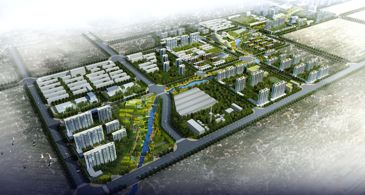
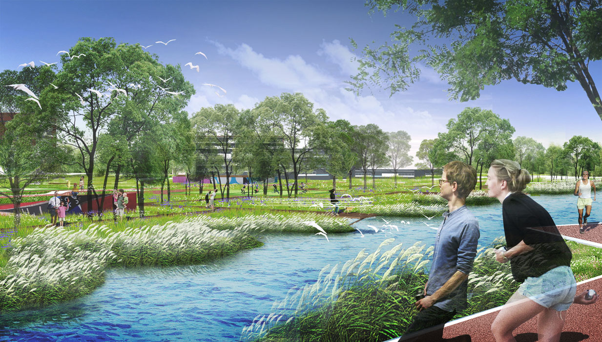
(1) Ecosystem Restoration
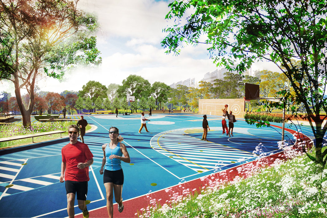
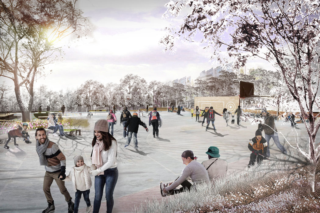
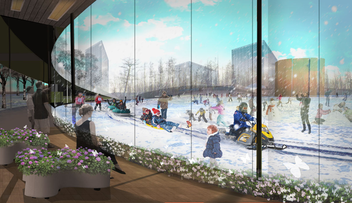
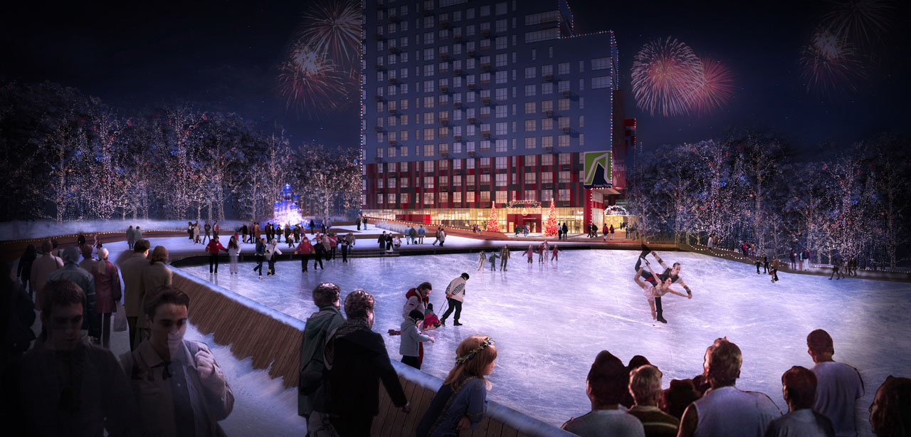
Including ecological integrity and localized climate feature design. In terms of ecological integrity, maintain the principle of ecological precedence at the urban design scale, ensuring the complete and smooth structure and corridors of the urban ecology. For localized climate feature design, aiming to minimize wind impact and maximize sunlight utilization, creating a comfortable outdoor environment, and enriching the visual environment with landscape systems to maintain residents' vitality throughout the seasons.
(2) Reshaping Transportation Corridors
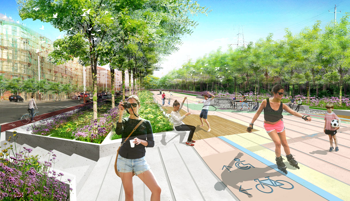
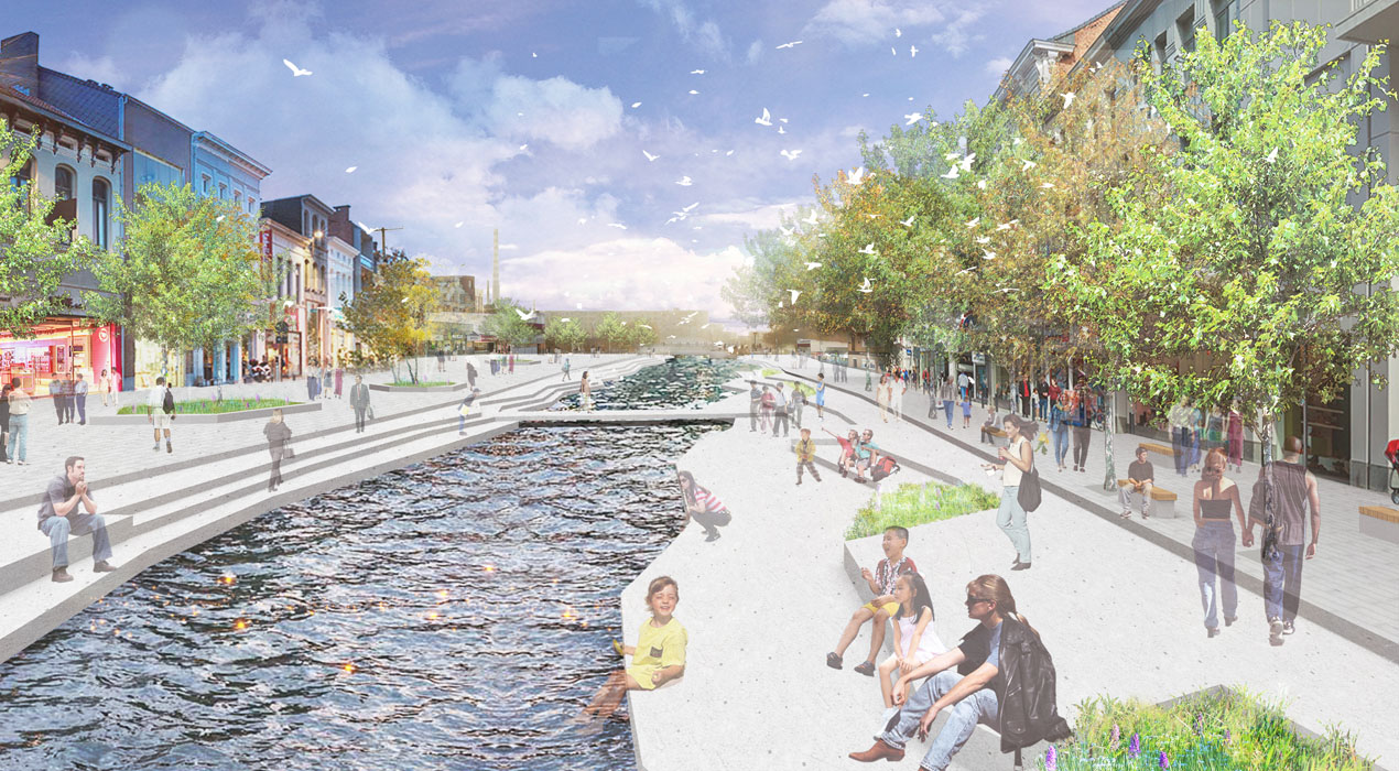
Addressing current issues of traffic disruption and inconvenience, reorganize and adjust the motor vehicle road network while promoting the construction of a slow-moving urban system. At the planning level, complete and adjust the upper-level planning road network, clarify the road structure within the planning area, and improve the motor vehicle and non-motor vehicle systems. Eliminate motor vehicle roads along the Beibian Canal, creating a continuous waterfront slow-moving system for residents to access the water easily. At the landscape level, aim to create interesting and city-specific transportation spaces to encourage residents' travel enthusiasm.
(3) Optimizing Urban Service-Oriented Spaces
In terms of driving the urban economy, advocate for the year-round utilization of public spaces, enhancing the attractiveness of public spaces in cold climates and driving urban vitality. Encourage mixed-use urban land, improve commercial supporting facilities, promote the construction of small-scale community-oriented commerce, limit the increase of large-scale traditional commerce, strengthen the integration of community and urban business districts, and meet the commercial supporting needs within a 10-minute walking distance. In terms of urban cultural activation, vigorously develop local characteristic cultures (Hetao culture, Yellow River culture, etc.), shape the urban image, improve urban cultural and educational facilities, and enrich residents' lives.
Meso Level:
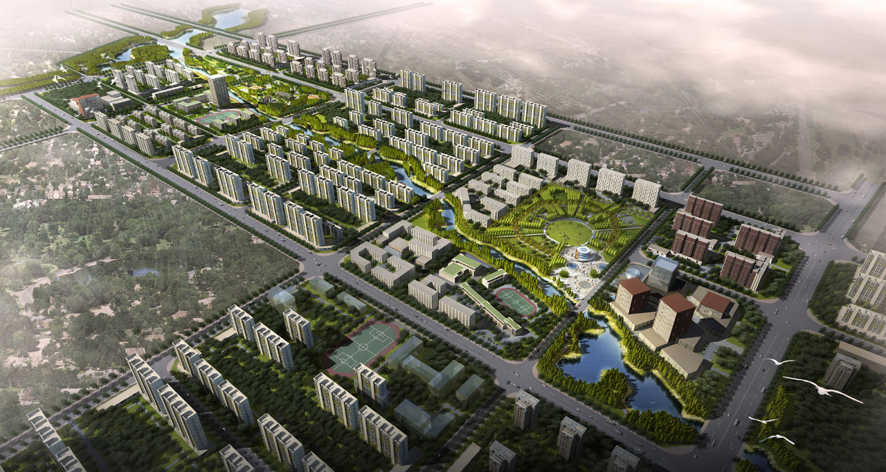
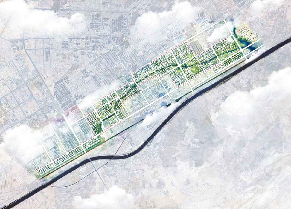
Divide the urban land on both sides of the Yongqing River into four zones:
(1) Healthy Residential Area
Objective: Waterfront Vitality Corridor.
The healthy residential area focuses on existing residential areas, further improving commercial service facilities and systematic outdoor activity spaces for residents, creating a waterfront vitality corridor for urban residents.
(2) Leisure and Cultural Education Area
Objective: Family Leisure Paradise.
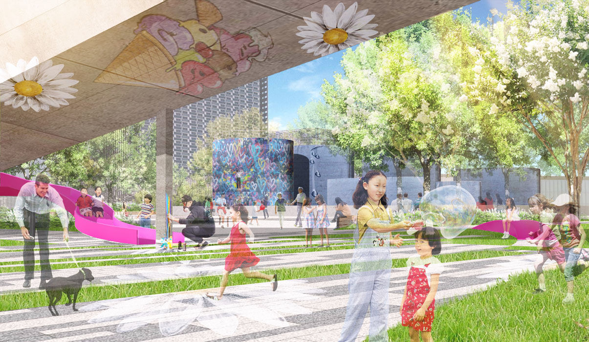
This area prioritizes shantytown renovation, combining the surrounding existing residential areas and schools to create a leisure and cultural education center, providing citizens with spaces for parent-child entertainment, outdoor fitness, science education, and children's activities, while retaining parts of the city's fabric and memory spaces, creating a cultural industry sub-center and a leisure paradise for families emerging from the shantytown.
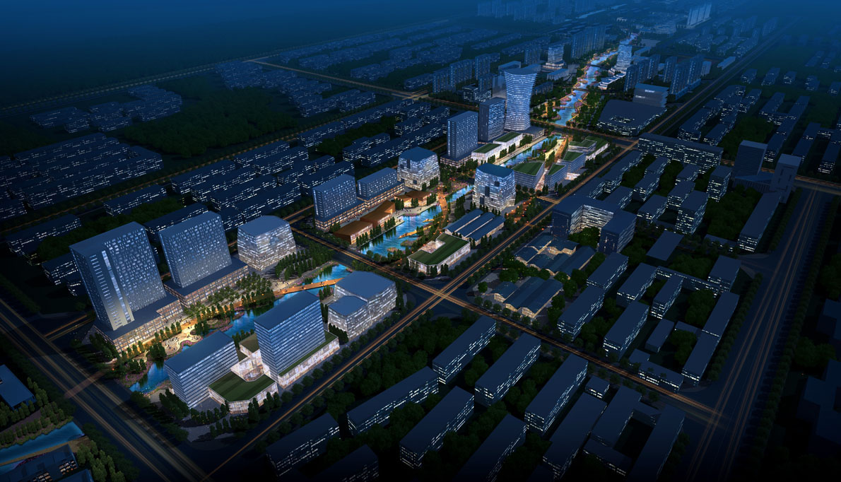
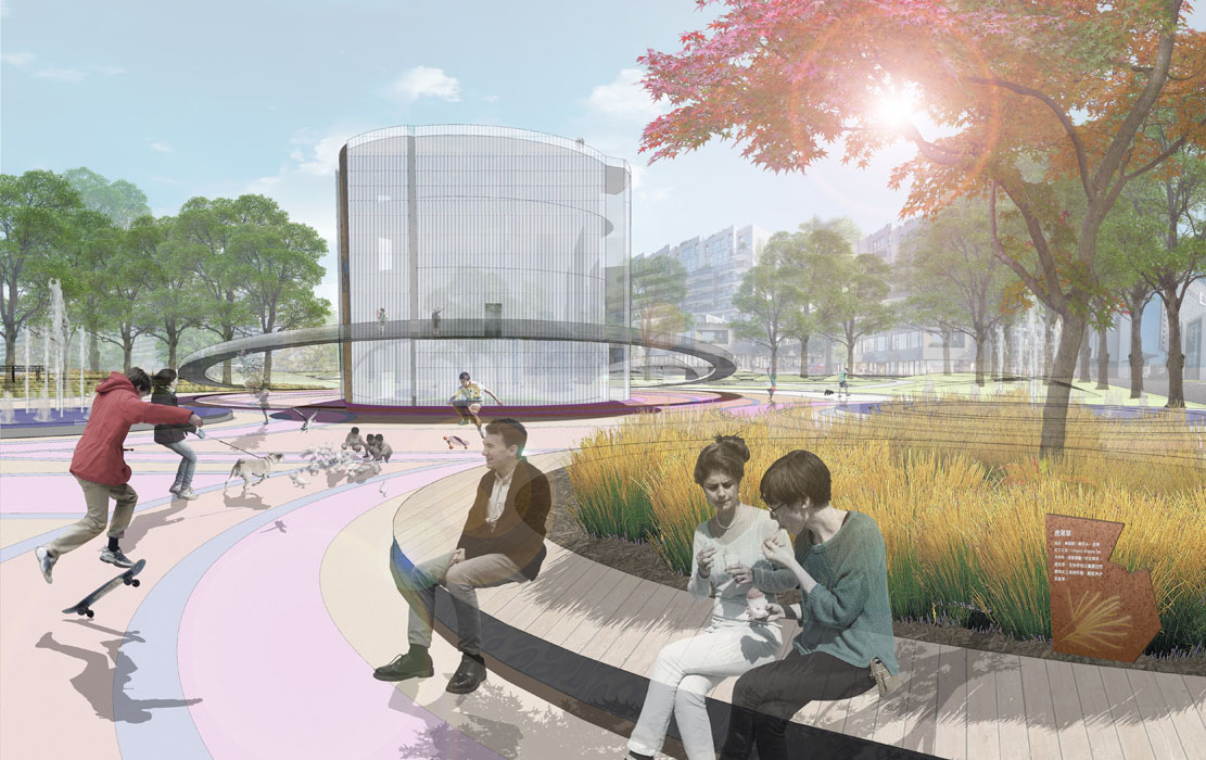
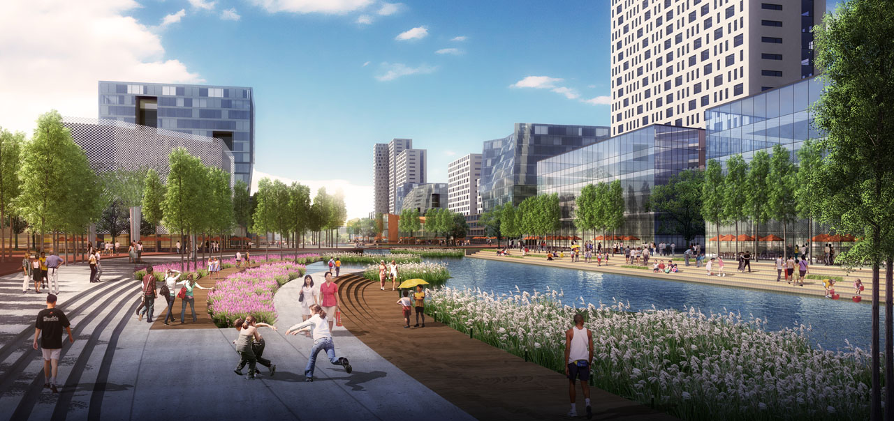
(3) Enjoyable Commercial Area
Objective: Mixed-Use Commercial Vitality Center.
Located in the core bustling area of the city, this area aims to create a new emerging leisure commercial core under the background of shantytown renovation, introducing new commercial models and creating a unique waterfront vitality commercial area, becoming a new business card for urban development and commercial activities, and providing citizens with a new commercial leisure experience.
(4) Green Vitality Area
Objective: Green Residential New Community.
Located on the eastern side of the city, this area mainly covers large areas of farmland, shantytowns, and industrial land, aiming to create a green ecological new community based on brownfield restoration. Introduce urban vocational education and cultural centers, creative health and wellness communities, and organic living communities, shaping a creative new city area.
4. Conclusion
Through the implementation of different levels of design strategies for the construction on both sides of the Yongqing River, the project aims to inject new vitality into the city, create a green ecological and residential vitality corridor, fully stimulate urban vitality, drive industrial development, promote ecological restoration, and enhance residents' sense of happiness.
