Beijing Haidian District Nansha River Downstream Ecological Restoration Project

Project Information
- Project Location:
- China Beijing
- Project Scale:
- 78.06 Hectares
- Design Time:
- March 2015
Project Profile
1. Project Statement
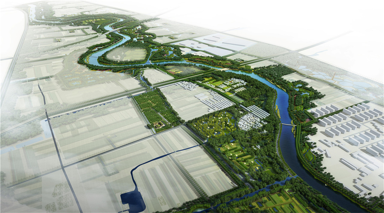
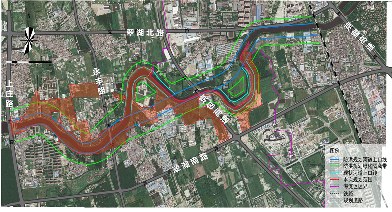
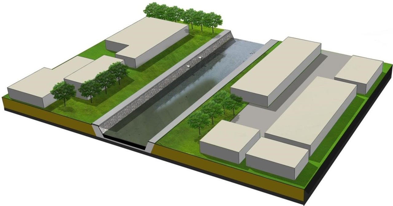
The Nansha River is located in the northern part of Haidian District, spanning a length of 16 kilometers within the district and covering a basin area of 220 square kilometers. It serves as the most crucial ecological corridor in northern Haidian and is a key part of the “T-shaped” green core of the region. The design section stretches from the gate of Shangzhuang Reservoir in the west to the Beijing-Tibet Expressway in the east, covering an area of 78.06 hectares. The current water resource shortage is 250 million cubic meters, with per capita water resources only one-third of Beijing’s average. The groundwater level in the northern area drops by 1.5 meters annually. The region suffers from low levels of river channelization and rainwater retention, with surface water mainly relying on storage from the Shangzhuang Reservoir, and ponds and wetlands accounting for only 4% of the storage and utilization. The river water quality in the northern area is generally below Grade V, with even worse conditions downstream of the Nansha River due to severe organic pollution. The riverbanks are compressed by construction land, lacking vegetation buffer zones and waterfront spaces.
2. Design Strategy
The goal is to transform the Nansha River into an ecological, productive, culturally rich, and vibrant river. The planning adopts the concept of constructing ecological infrastructure to leverage ecosystem services, allowing nature to play its role and maximizing ecological, economic, and social benefits. The overall design objective is the "New Urban Pastoral" demonstration project. The comprehensive ecological management of the Nansha River aims to make it an ecological, productive, culturally rich, and vibrant river.
Technical Challenges and Design Strategies
Current Issues:
- Hardened channels and water conservancy projects like dams alter the natural water cycle.
- Untreated sewage from production and living activities pollutes the water environment.
- Human activities modify natural vegetation, leading to habitat simplification and fragmentation.
- Disorganized riverside traffic lacks continuous open spaces, resulting in a lack of river vitality.
Design Strategies:
- Improve water system infiltration conditions to restore the natural water cycle.
- Reduce pollutants entering the river to enhance water quality.
- Reasonably arrange riverside vegetation to restore continuous, diverse natural riparian habitats.
- Fully utilize riverside landscape resources to create a pleasant riverside recreation environment.
Technical Innovations and Features
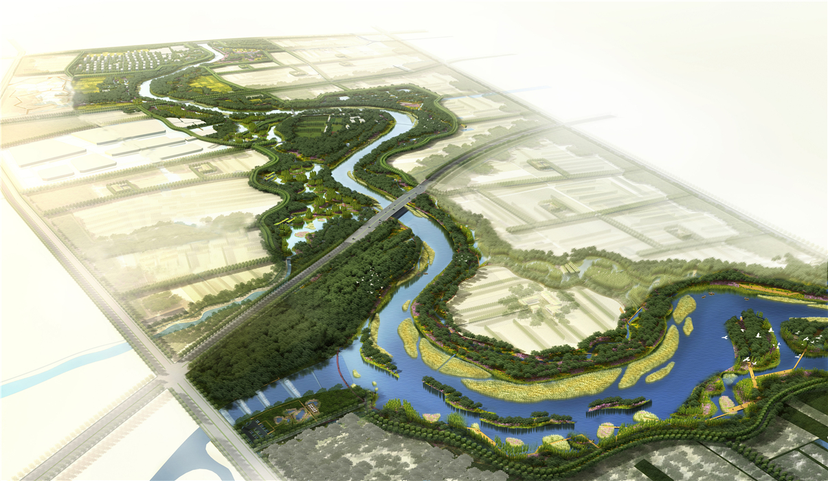
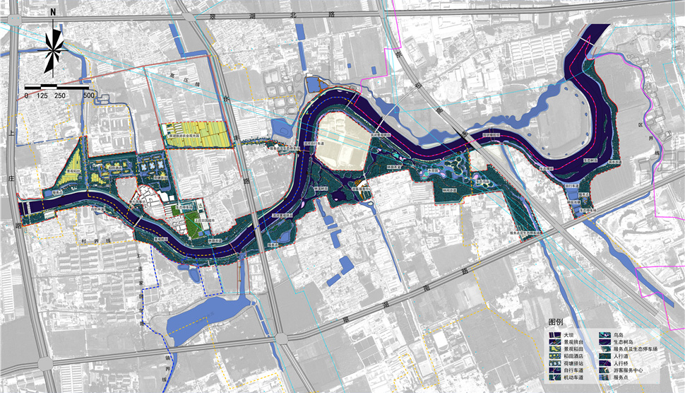
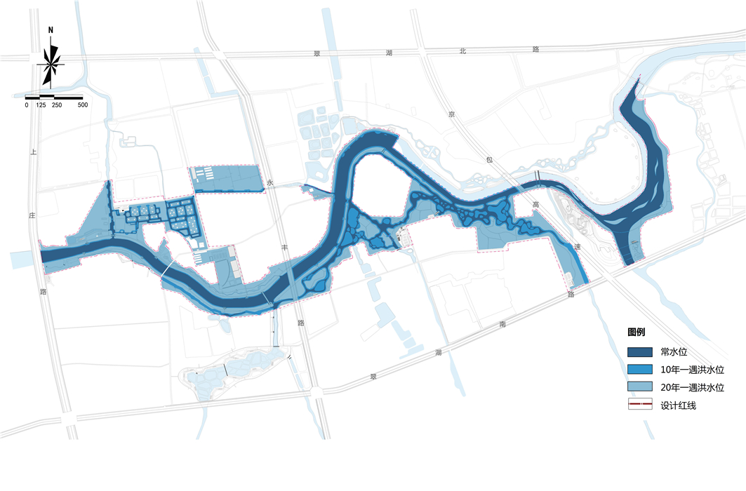
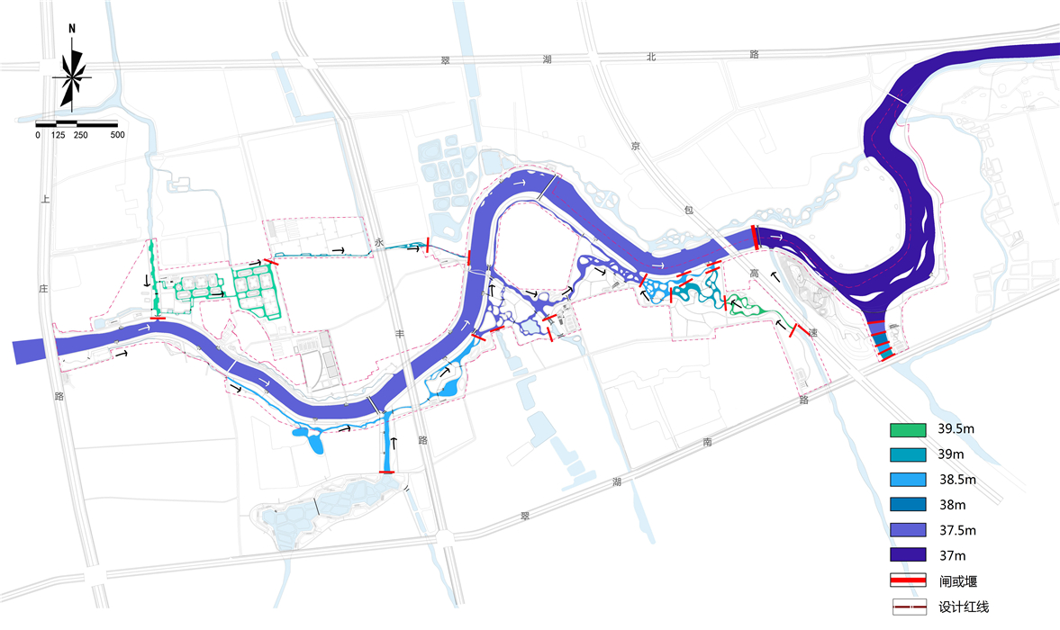
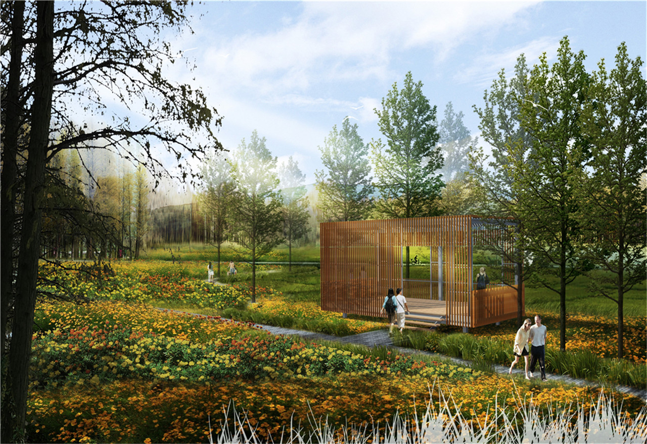
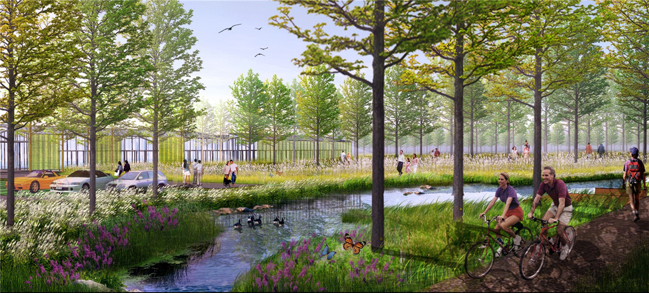
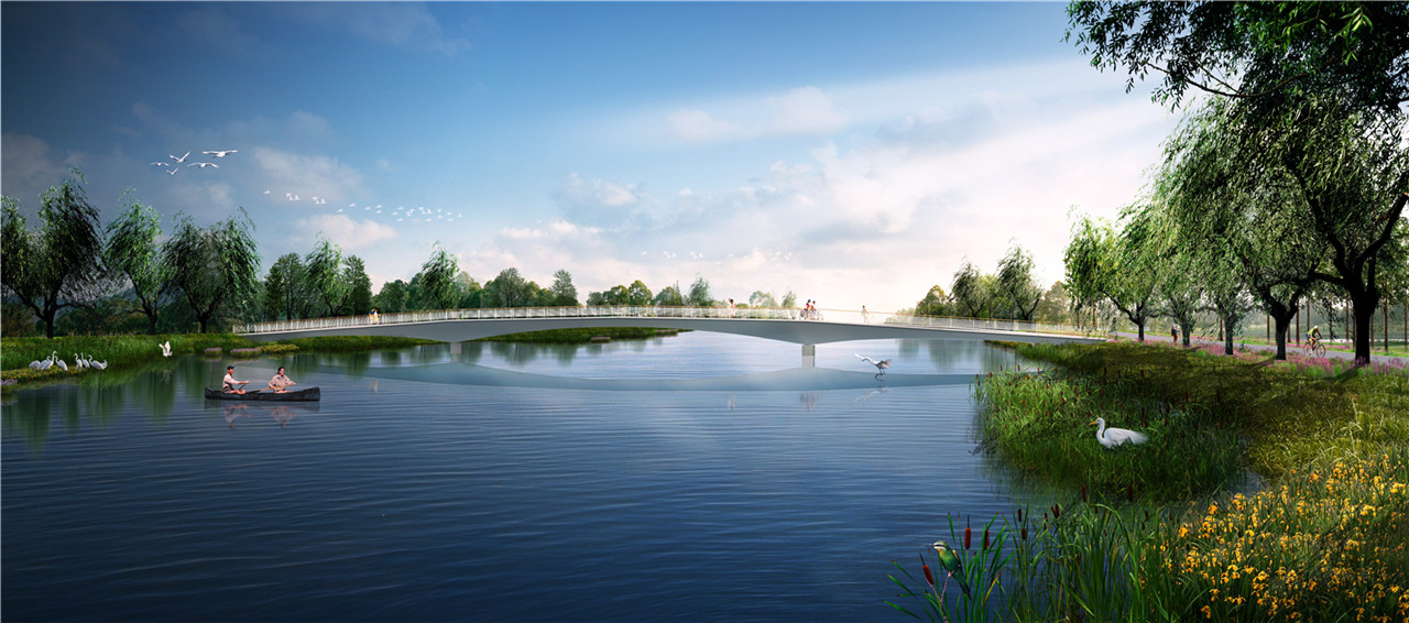
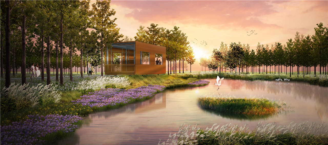
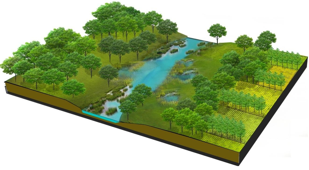
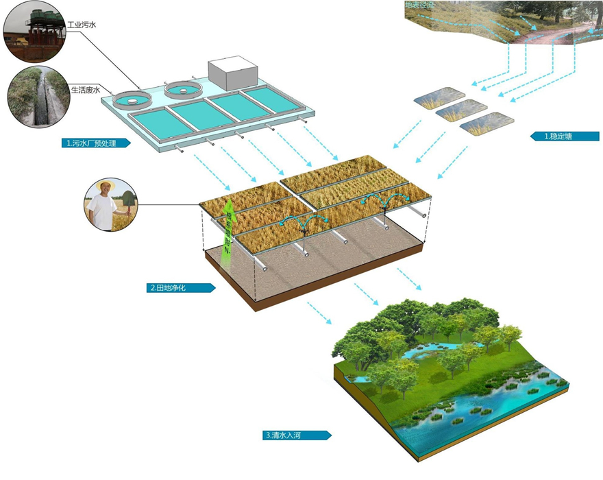
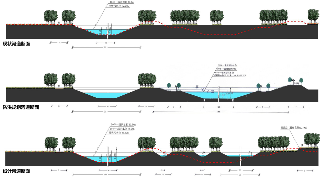
The design retains the existing main river channel and excavates two new inner rivers, forming a "one main, two auxiliary" compound river system. This approach meets flood safety requirements while preserving large areas of well-growing existing forest land and creating buffer zones for flood retention and water purification. The natural forms of tributaries are restored, and additional ponds are created along tributaries, enhancing the wetland areas at the confluence with the main river to strengthen water storage and purification functions. This results in both inner river and riverbank wetlands, extending the river’s ecological functions into the broader landscape. Production wetlands such as lotus ponds, fish ponds, and rice fields are introduced to absorb nitrogen and phosphorus from wastewater treatment plant effluents, creating a productive river corridor. The existing forest land is retained and improved with a network system, diverse layers, and various aquatic plant types to provide more diverse habitats and foraging environments for wildlife. A segregated traffic network for pedestrians and vehicles, optimized service facilities, and a regionally linked ecological recreation system are established. The comprehensive ecological management of the Nansha River will enhance the overall quality of northern Haidian District and become a prominent scenic area.
“Sponge River” Concept
Through the flexible retention and storage of various riverside wetlands, rainwater is slowed down and stored rather than being drained away, achieving natural accumulation, infiltration, and purification.
Components of the Sponge River
- Vegetated swales to transport, retain rainwater, and capture pollutants.
- Riverside wetlands for rainwater storage and water quality improvement.
- Natural main river channels and riverside wetlands mutually adjust to stabilize flow.
Utilization of Rainwater Resources
- Stored rainwater in riverside wetlands during wet seasons can be used for irrigation and road sprinkling.
Total Runoff Control
- Under normal rainfall, vegetation and riverside wetlands retain and infiltrate rainwater, maintaining an annual runoff control rate of 85%.
Runoff Peak Control
- In heavy rainstorms, riverside wetlands and river spaces retain and regulate runoff, keeping the peak of a 20-year return period 24-hour rainstorm within the river channels.
Runoff Pollution Control
- Multiple purifications of incoming water through vegetation buffer zones, wetland plants, and soil raise water quality to above Grade IV.
