Xinjiang Shihezi Western Shelterbelt Ecological Corridor
Project Information
- Project Location:
- China Shihezi, Xinjiang
- Project Scale:
- 67 Hectares
- Design Time:
- April 2017
Project Profile
1. Project Statement
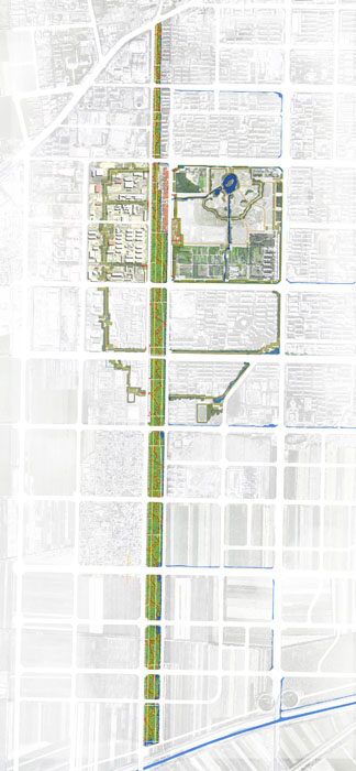
The site is located on the western side of the old city group of Shihezi City, between the main urban roads, Xi San Road and Xi Er Road. It starts from the Lanzhou-Xinjiang Railway in the south and extends to National Highway 312 in the north, spanning a length of 5.8 kilometers from north to south and an average width of about 150 meters, covering a total area of 67 hectares. The shelterbelt was planted in the 1950s as a protective greenbelt to separate the Shihezi Western Industrial Zone from the urban residential area. It has a history of nearly sixty years.
The west side of the site is adjacent to the Shihezi Western Industrial Zone, which, during the early urban development period, was an important base for industrial growth. It was home to the "Three Eight" enterprises, including the Bayi Woolen Mill, Bayi Cotton Mill, and Bayi Sugar Factory, marking a significant chapter in the city's industrial development history. The Shihezi Western Park, located between Bei Yi Road and Bei San Road on the east side, is a comprehensive park with a wide range of facilities, being a popular holiday destination for residents in the 1980s and 1990s. The western shelterbelt area is an old spot in this young city of Shihezi, bearing the beautiful memories of several generations about youth, struggle, and childhood.
As the industrial zone underwent a transformation in industrial functions, the connection between the residential and production areas diminished, leading to decreased human activity. The shelterbelt, factory areas, residential spaces, and Western Park are separated by walls, creating a closed and isolated space. The Xi San Road shelterbelt area in the western industrial district has gradually declined, becoming a forgotten corner of the city.
In the new urban master plan, the western shelterbelt will extend southward, forming a secondary north-south landscape axis of the city, supported by the main road Xi San Road. The water system of the shelterbelt will serve as a corridor connecting the north and south urban water networks, playing a significant ecological role. The Xi San Road shelterbelt will transform from an urban pollution prevention barrier into a link between the industrial cultural memory of the old city and modern urban life. The landscape renovation project of the slow-moving system of the shelterbelt will also become an opportunity to revitalize the old industrial district.
2. Objective and Challenge
Considering the location of the Xi San Road shelterbelt in the city and its position in the urban blue-green ecological system, along with its unique cultural significance, we have positioned the project as a "composite industrial heritage park under the background of ecological civilization - an urban vitality conveyor belt in the green forest." We hope to connect the urban memory and future through this old industrial green corridor, allowing Shihezi residents to "remember the nostalgia" and the glorious years of hard work, as well as their memories of growing up with this city, bringing vitality back to this old place.
While addressing urban needs and current conditions, the project also faces multiple challenges.
Firstly, for the shelterbelt landscape project to truly become a regional urban vitality conveyor belt, it is necessary to plan the shelterbelt in coordination with the surrounding areas.
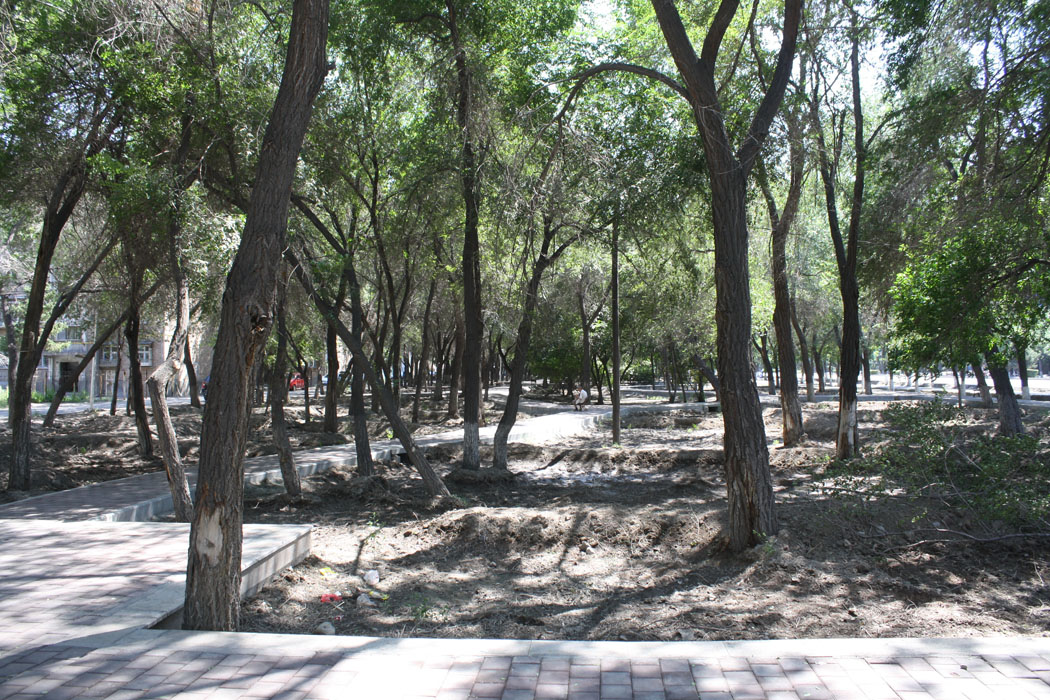
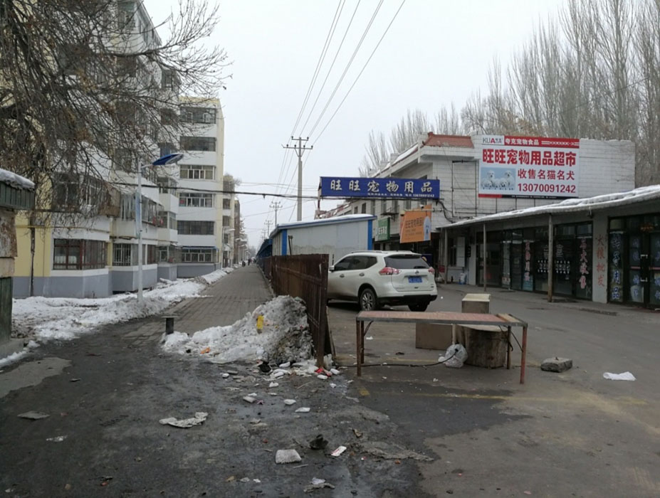
Currently, the factories, parks, and residential urban spaces around the shelterbelt are isolated by walls, creating closed spaces. There are illegal buildings and a narrow, cluttered market space with poor sanitary conditions within the site, making it difficult to meet the future development needs of the shelterbelt as an urban vitality green axis. Only by breaking the spatial isolation between the industrial area, old park, and the surrounding urban functional blocks of the shelterbelt, and considering the shelterbelt as part of the overall urban area development, can we truly achieve the goal of enhancing the vitality of the old city through the transformation of the shelterbelt leisure space.
Secondly, the Xi San Road shelterbelt carries the cultural memory of the city's old industrial area, and how to reflect the genuine memories of the Shihezi people regarding the old "Three Eight" factories and the western shelterbelt through design is a significant challenge for the project.
The old factory area has many culturally valuable production facility relics and unique architectural elements, and the plan should fully utilize the unique industrial landscape elements in conjunction with the future leisure facilities of the green corridor to create a memory corridor for the industrial heritage park.
Thirdly, as the Xi San Road shelterbelt will become an important part of the urban leisure green axis and the blue-green system, its ecological and urban service functions need urgent improvement and enhancement.
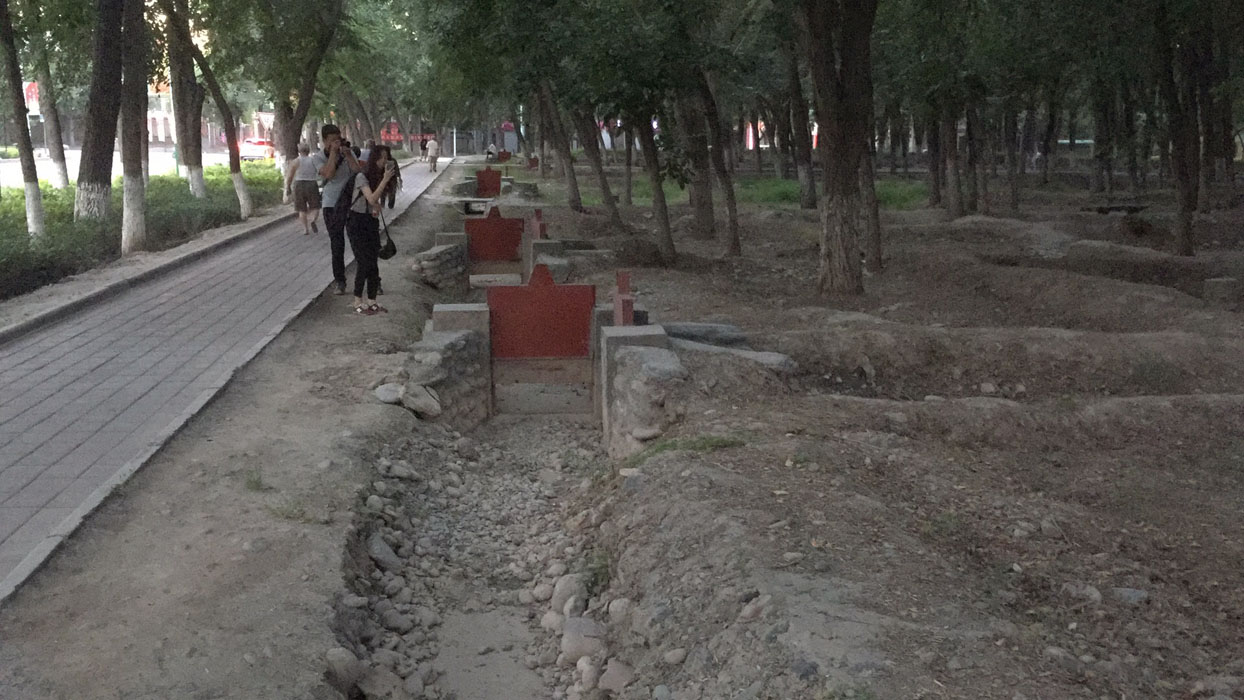
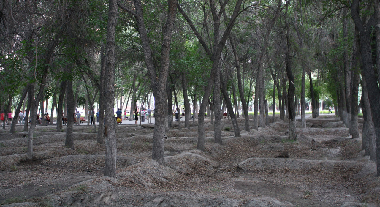
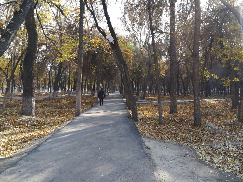
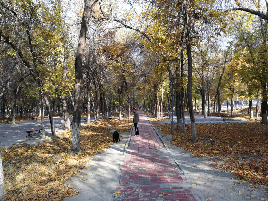
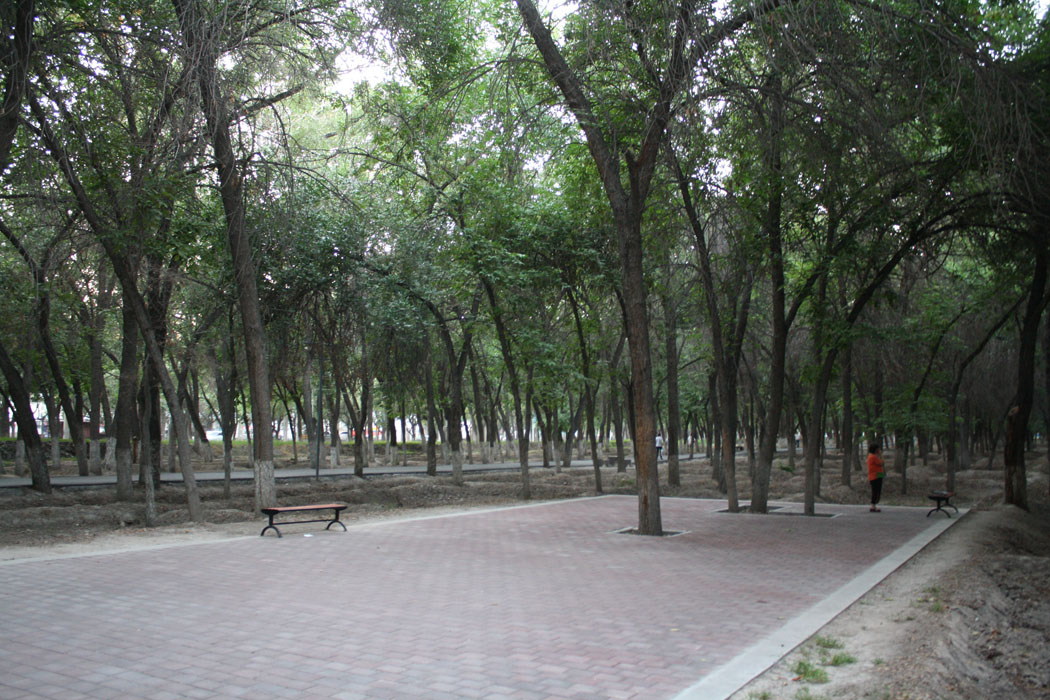
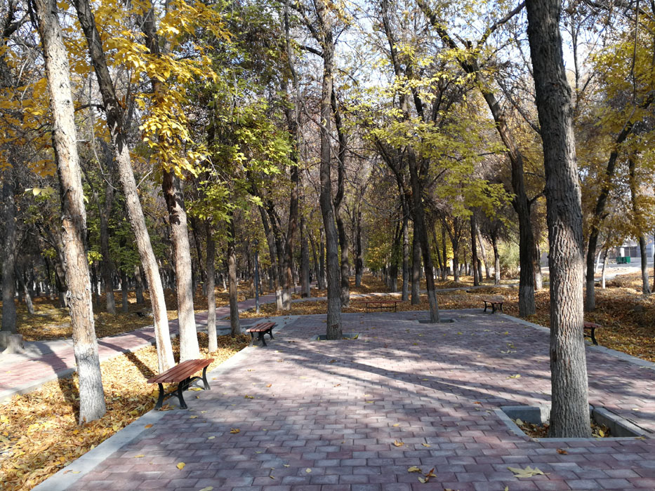
The existing shelterbelt primarily serves irrigation purposes, with limited water sources and quantity, resulting in an incoherent water system. The site has poor external traffic connections, and the relationship between entrances, exits, bus stops, and surrounding functions is not well coordinated, with limited space hindering circulation; the internal road layout lacks systematic planning, with discontinuous main roads and common issues of road surface subsidence and damage, posing a threat to pedestrian safety. Activity areas are unevenly distributed, with single-function facilities providing only basic seating, and the facilities lack comfort, quality, and maintenance.
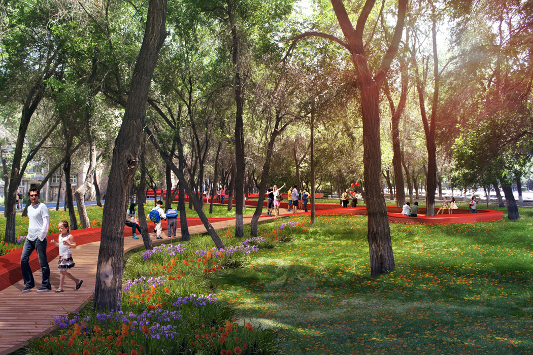
Lastly, the western shelterbelt is a valuable landscape resource with a history of over 60 years, and protecting the large trees during the landscape enhancement project, while creating a characteristic slow-moving corridor without moving a single large tree, is a technical challenge for the project.
The shelterbelt north of Nan Er Road has excellent growth conditions, being the most significant resource of the site, primarily consisting of Fraxinus chinensis (Chinese Ash) with comfortable understory spaces. However, the high planting density and intertwined branches from years of growth present difficulties for future renovation work.
3. Design Strategy
Strategy 1 - Industrial Revitalization - Seize the Opportunity of the Era to Revitalize the Old Industrial Area
Step 1: Overall Planning
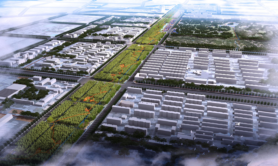
Incorporate the industrial area and Western Park into the overall research scope, creating an industrial memory experience corridor connecting the characteristic spaces of the area with a belt and a ring. Define the transformation positioning of different blocks, forming an integrated creative industrial heritage district. Transition from a city environmental protection isolation belt resisting industrial pollution to a modern urban vitality axis that drives industrial transformation in the old industrial area and serves as an urban landscape feature.
Step 2: Functional Activation
With the change in the role of the shelterbelt, reorganize functions, and plan for the redevelopment of land slated for demolition to form a new industrial revitalization axis and incubator in the western district.
Clear the shelterbelt land, open up urban roads, and connect the greenways of the shelterbelt. Reclaim residential and village house land occupying the shelterbelt space and reorganize the pet market and vegetable market on Xi Er Road.
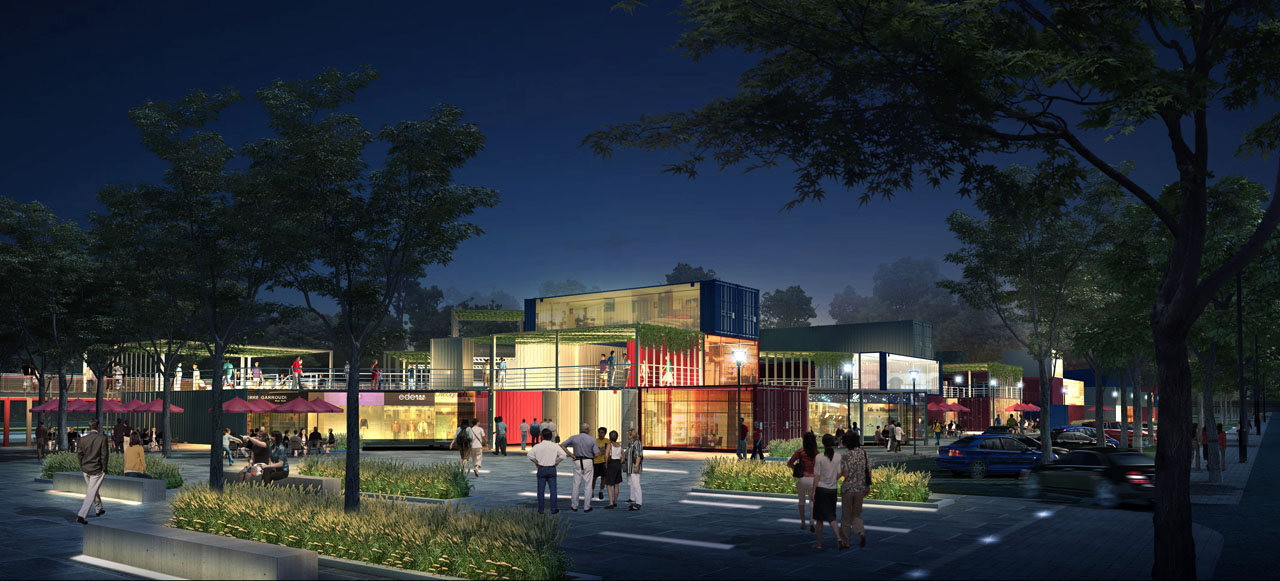
Integrate functions to drive industrial revitalization. Leverage the locational advantages of the secondary urban axis of Xi San Road and the main urban roads of Xi Er Road and Xi San Road. Fully utilize the reclaimed shelterbelt space, integrating diverse functions such as urban life services, recreational and leisure spaces, and new creative industrial office spaces into the park corridor. Use the park corridor as an axis to drive the transformation of surrounding urban industries and increase land value.
Strategy 2 - Cultural Heritage – Remembering the Nostalgia and Preserving the Cultural Memories of Shihezi's Old Industrial Area
Key Point 1: Deeply understand the history of the industrial area and the characteristics of the cultural spirit of the "Three Eight" factory area in the hearts of Shihezi people. Use the theme of the "Red New Silk Road" to connect the story nodes of the urban military reclamation industrial construction, creating a 1.5-kilometer-long industrial memory corridor.
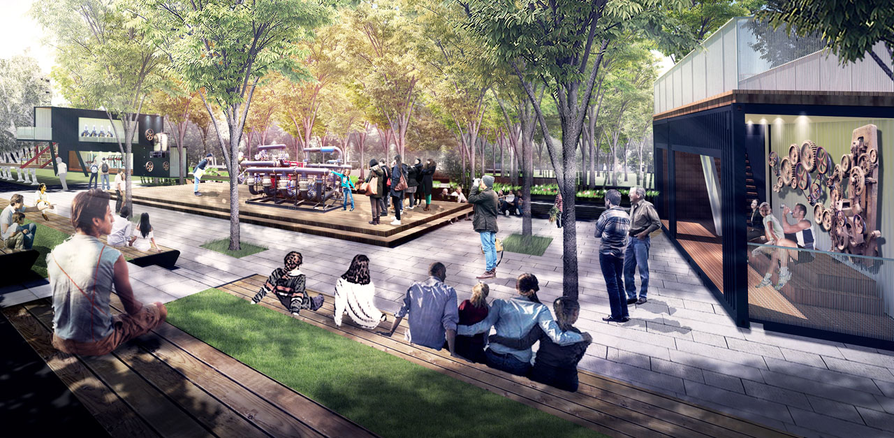
Key Point 2: Extract typical elements characteristic of the old industrial area and incorporate representative industrial production parts and scenes from the factory area into the shelterbelt space. Tell tangible old stories, forming a truly citizen-friendly industrial museum corridor.
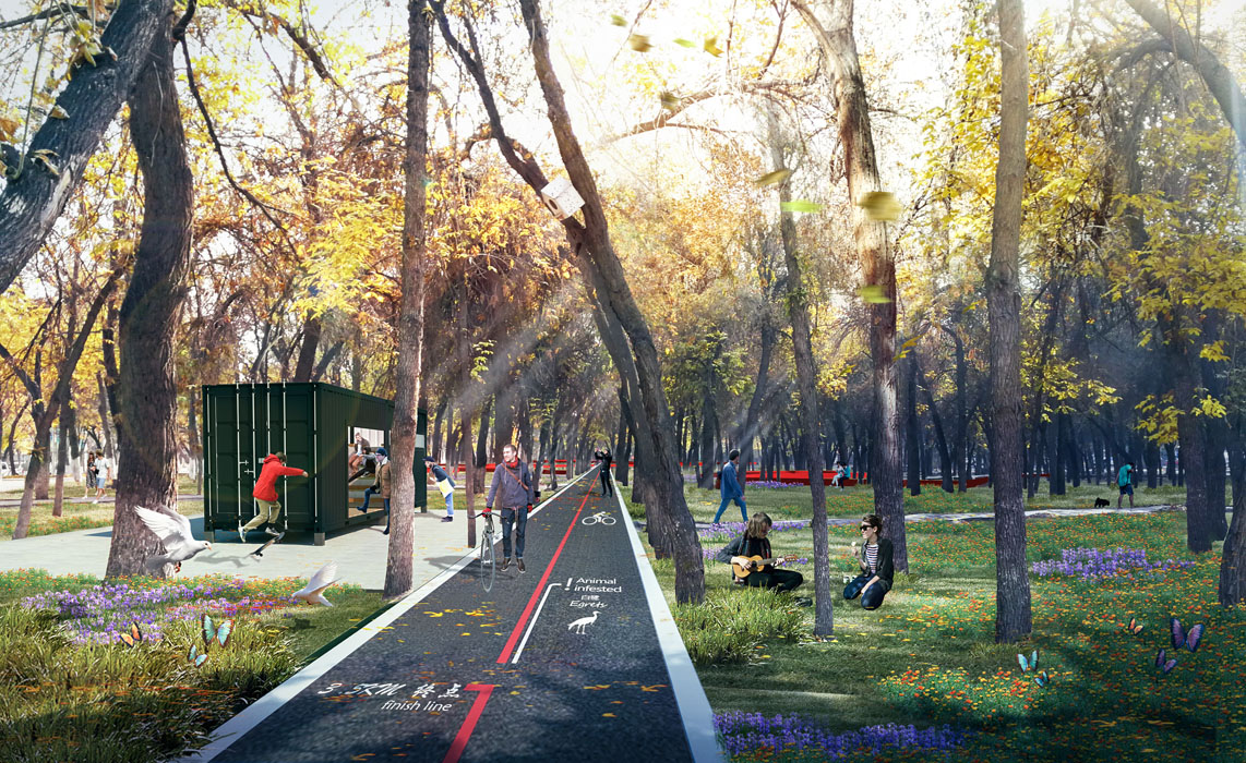
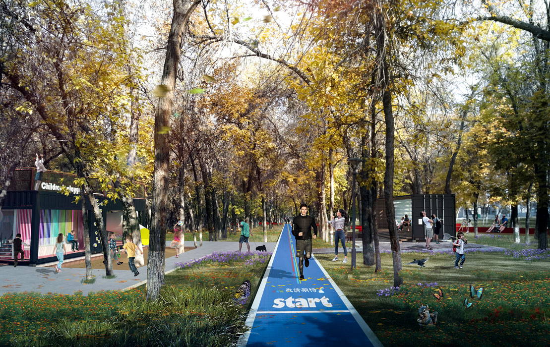
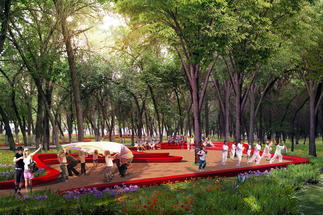
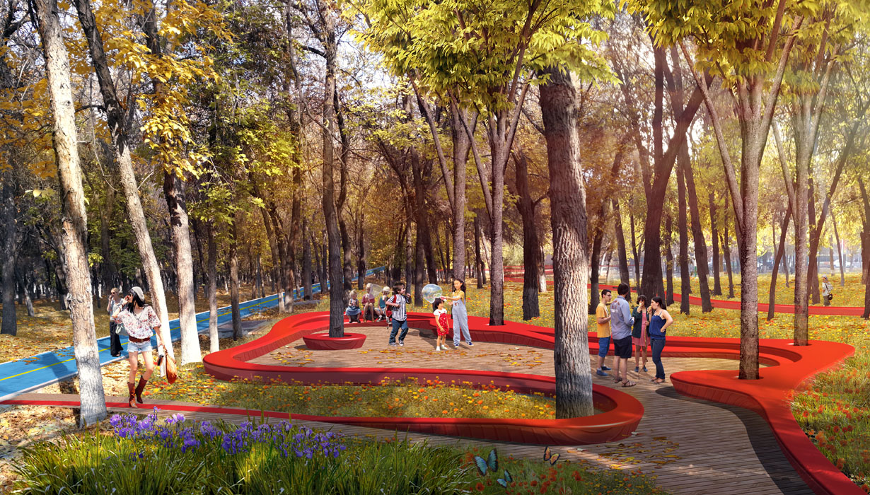
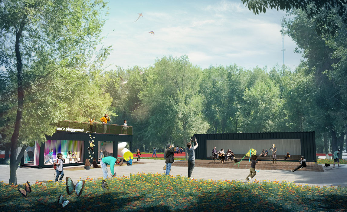
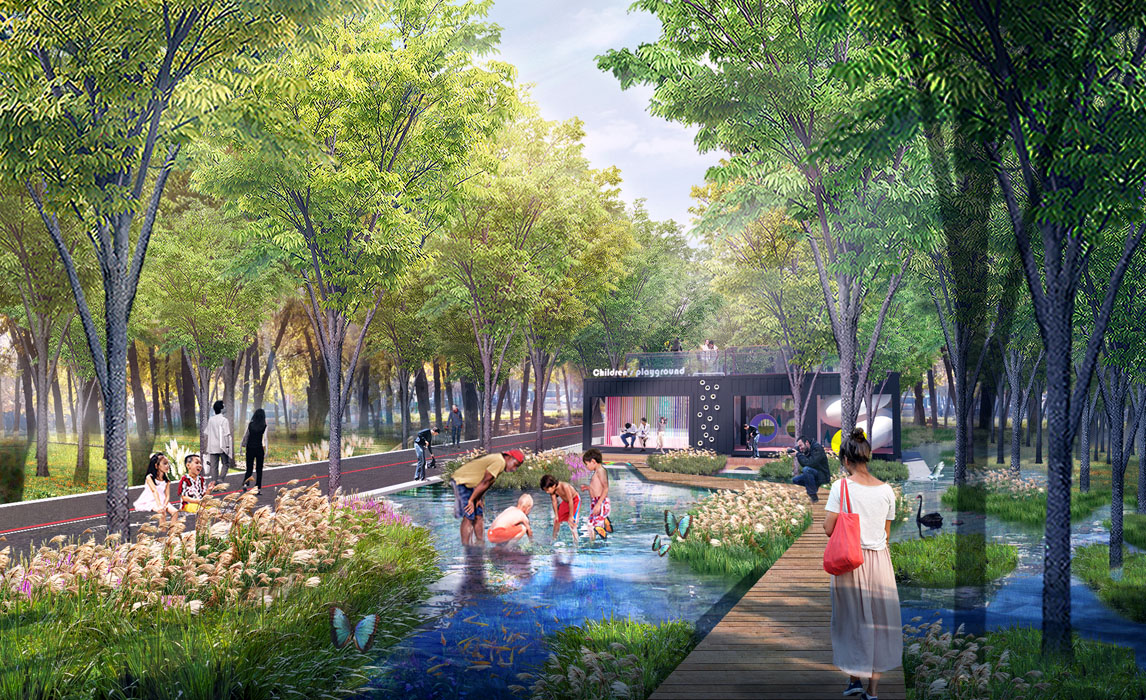
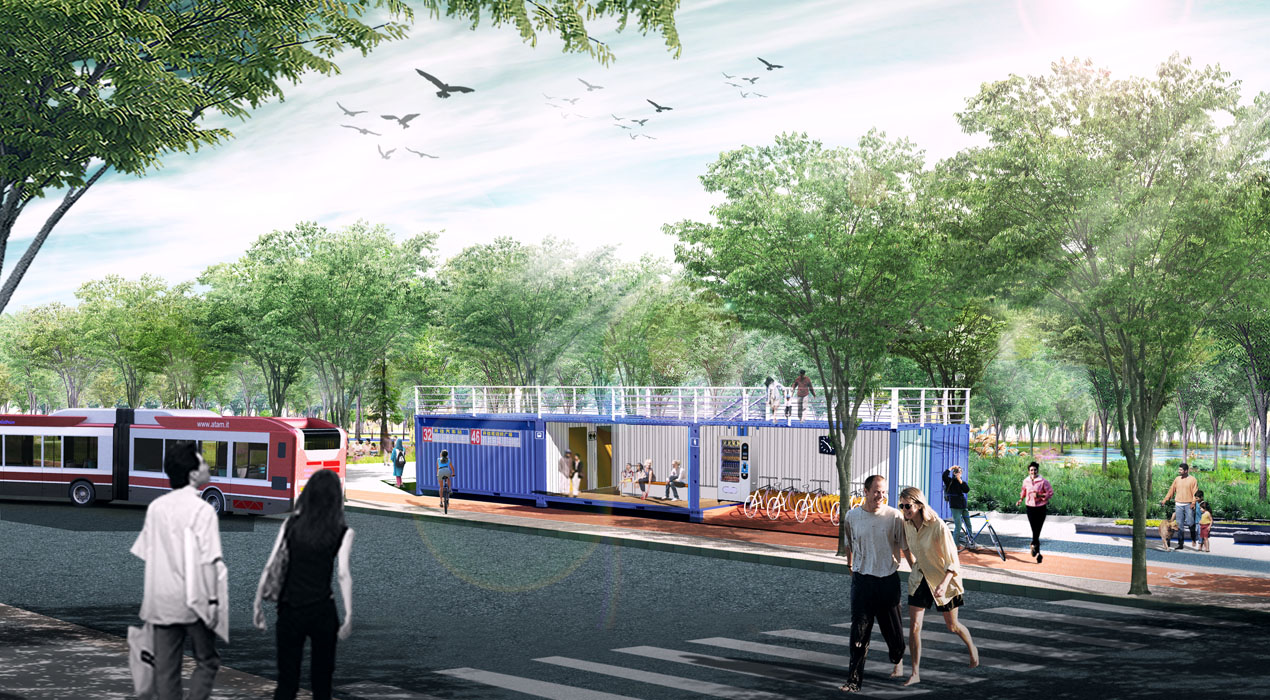
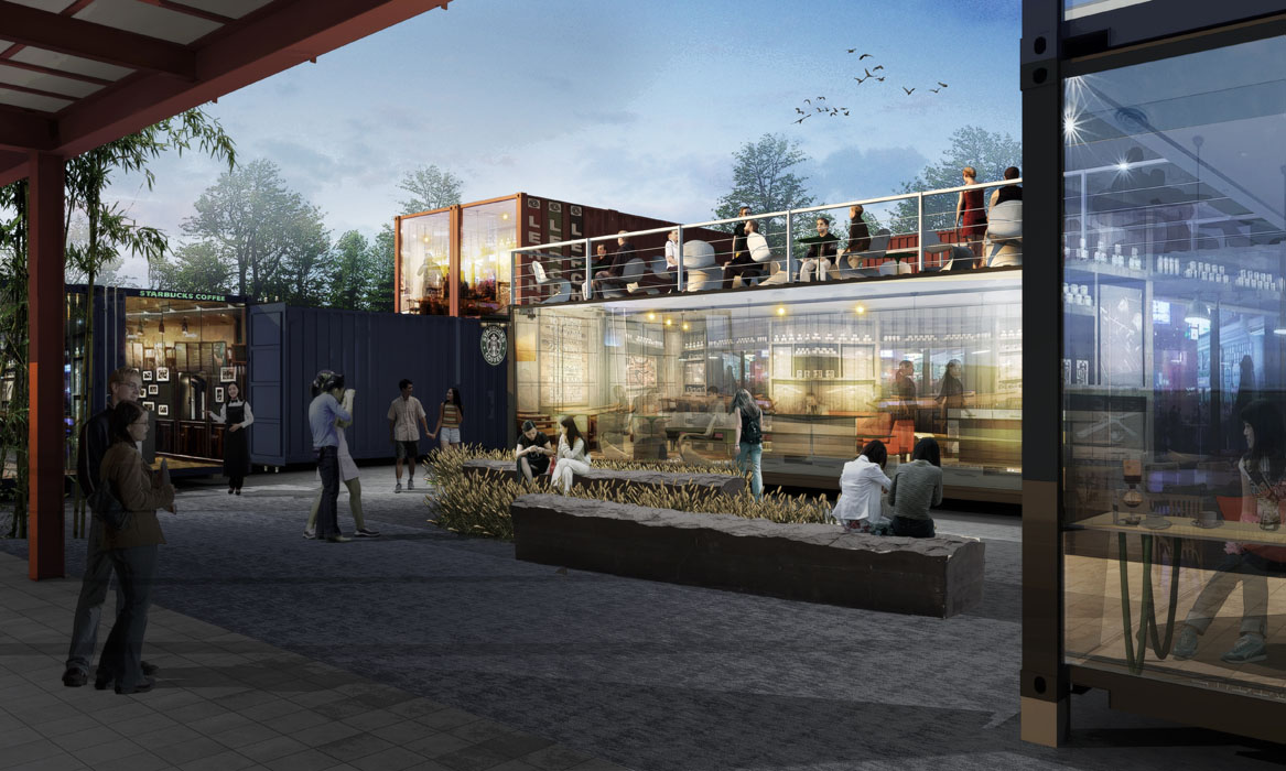
Key Point 3: Arrange a series of industrial-style functional nodes using containers as elements, according to functional requirements.
Utilize container elements as the design language, using specific specification containers as raw materials for modular functional retrofitting. Arrange them according to the functional needs of the shelterbelt urban area, highlighting low cost, fast construction, and distinctive old industrial cultural features.
Key Point 4: Make every effort to preserve every tree on the site, which also means retaining the cultural memory within the site.
The trees in the shelterbelt are nearly sixty years old, witnessing the military reclamation industrial spirit of the older generation of Shihezi people. They are a valuable shelterbelt cultivated with the hard work of Shihezi people for sixty years and are the core resource of the Xi San Road shelterbelt project. Protecting the trees and displaying the irrigation methods of the shelterbelt is also a heritage of the city's military reclamation spirit and the history of ecological civilization.
Strategy 3 - Function Enhancement – Improve Functional Positioning to Meet Diverse Urban Functional Needs
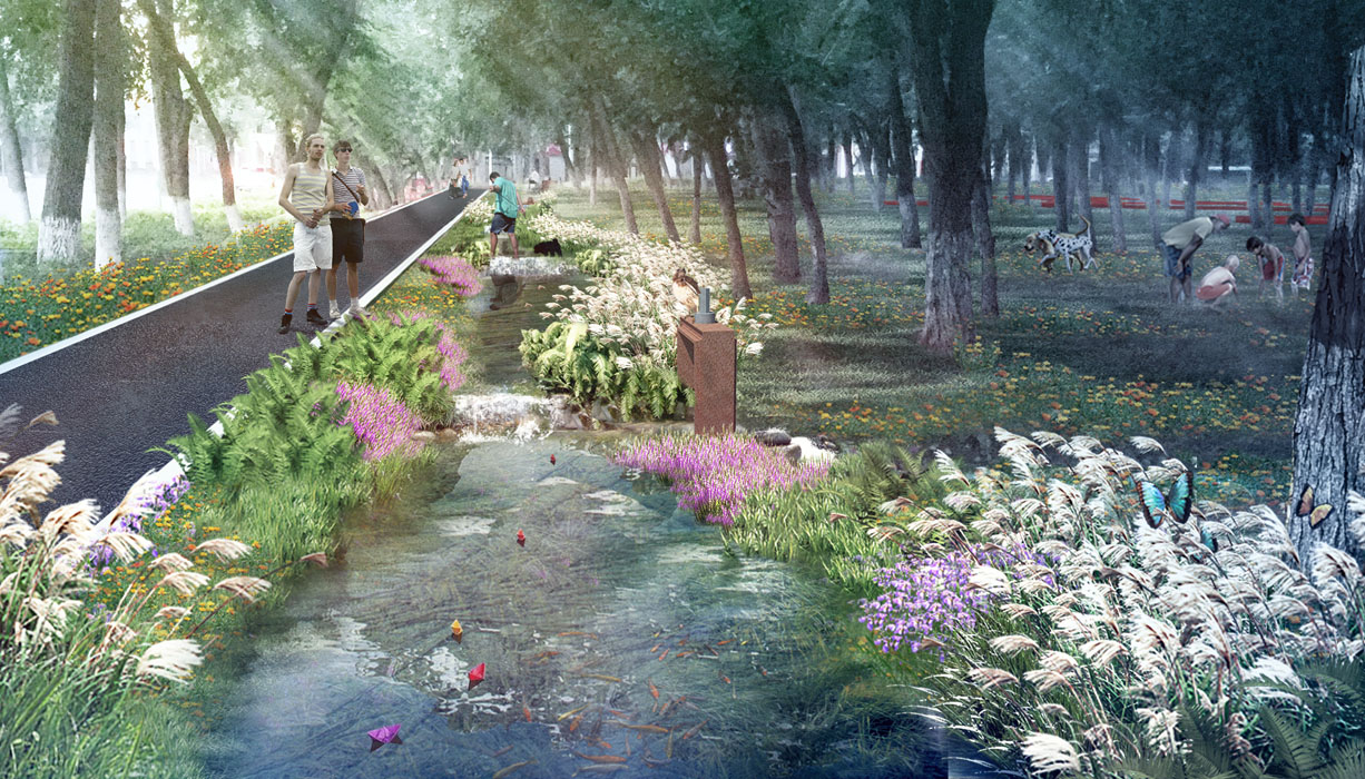
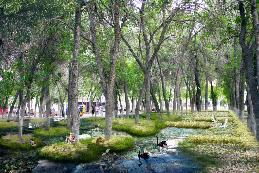
The former protective green space of the old industrial area must adapt to diverse urban functional needs under the new background, enhancing functional positioning and improving functionality from both ecological and living service perspectives. Transform the water system of the shelterbelt into a regional sponge greenbelt, serving as a connecting section of the ring water system in the central city's blue-green system planning; simultaneously, provide urban transportation function supplements, daily leisure for residents, and future special commercial supporting services.
Ecological Function Enhancement - Water System Transformation
Implement dual-use water, adopting a model of shelterbelt irrigation combined with characteristic water features to ensure irrigation and create landscapes. Conserve water, directly draw water from the planned upstream water source, Sigong Trunk Canal, and collect and purify rainwater from surrounding urban spaces and roads, transitioning from simple shelterbelt irrigation to a characteristic landscape water system. Connect the north-south linear canal system and perform ecological transformation, retaining the local characteristic grid irrigation pattern of the shelterbelt, forming seasonal water features locally, enriching planting spaces, and improving the habitat of the shelterbelt.
Urban Living Services - Comprehensive Landscape Enhancement and Construction of a Multi-functional Urban Slow-moving Corridor
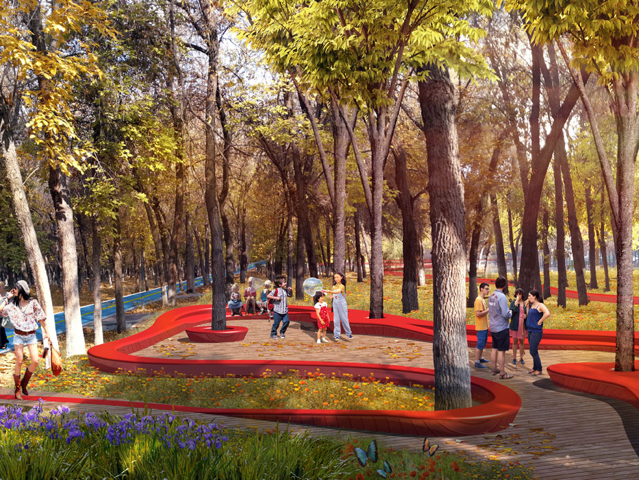
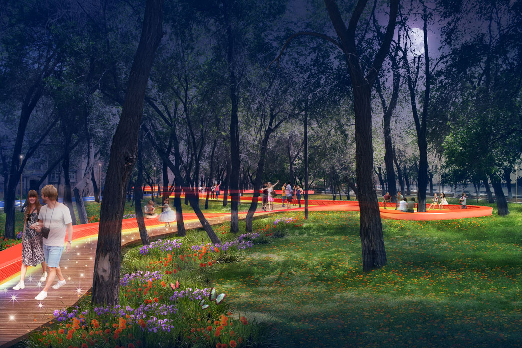
In terms of transportation services, integrate park entrances and exits with public transportation nodes, provide comfortable waiting spaces for buses, and improve slow-moving transfer and rental service facilities. For recreation services, improve the slow-moving system, utilize existing roads and activity spaces, and set up multi-level, multi-functional activity spaces to offer a rich recreational experience. Design a distinctive forest underpass slow-moving landscape with flexible and composite curved slow-moving facilities, meeting leisure function needs without affecting the growth of large trees in the shelterbelt.
Strategy 4 - Modular Design - Simplify the Construction Process and Resolve Conflicts Between Current Conditions and Engineering
Faced with the dense old trees and the difficulty of large machinery entering the site, in addition to strictly adhering to the principle of low-impact transformation by fully utilizing existing conditions, the plan proposes an implementation strategy for leisure facilities through modular design, factory prefabrication, and assembly with small equipment to ensure that not a single tree is moved during the construction process.
4. Conclusion
The Shihezi Western Shelterbelt project is not merely a renovation project for a slow-moving system. Due to its unique location and historical background, the project bears the important mission of urban industrial cultural heritage transmission, driving old city transformation and revival, and constructing the urban ecological system.
Starting from regional research, the plan redefines the function of the shelterbelt from the new starting point of industrial area transformation and development, while also protecting the shelterbelt itself as an important symbol of urban historical culture and urban ecological civilization. Creatively integrate industrial heritage, industrial elements, urban recreation, and living services into a composite functional slow-moving and recreational system by fully utilizing the existing understory space. With flexible pathway space design, low-impact transformation strategies, and modular construction design, the plan maximally protects the growth space of shelterbelt trees, preserving the unique memory of the old place, allowing this old industrial green corridor to move from history to a future full of vitality.
