Quzhou Changshan County International Slow City Zhalewan Flower Valley
Project Information
- Project Location:
- China Quzhou, Zhejiang
- Project Scale:
- 52 Hectares
- Design Time:
- July 2016
Project Profile
1. Project Statement
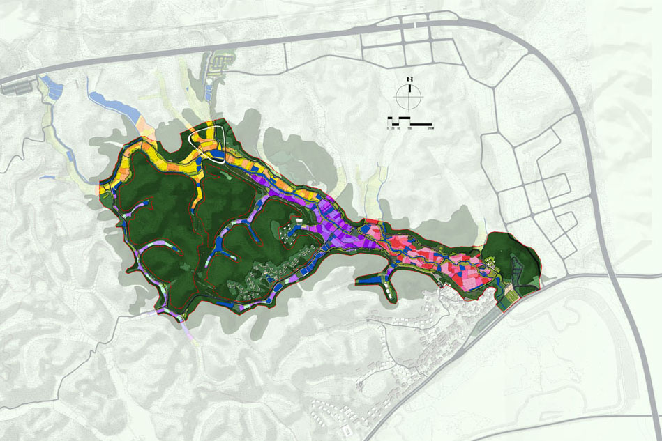
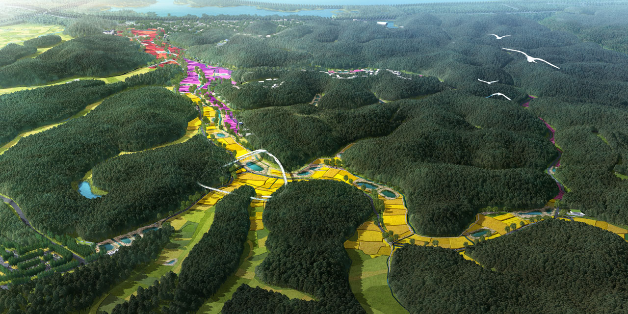
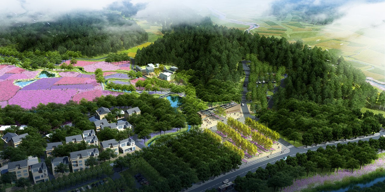
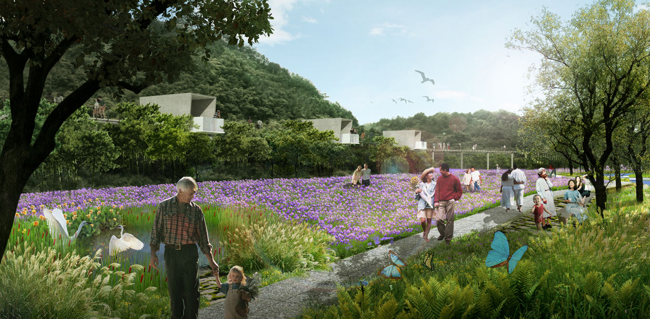
The project is located in the green core area of the eastern new district of Changshan County, Quzhou City. It lies at the intersection of the "International Slow City" planning area and the eastern new district, adjacent to Zhalewan Village. The project covers an area of 52 hectares and has convenient long-term transportation plans. The site within the red line has a distinctive terrain with two mountains surrounding a valley, crisscrossed by channels and rivers, offering rich and beautiful natural resources. It fully reflects Changshan's landscape pattern of "eight mountains, half water, and half farmland."
The planning and design adhere to the principles of low-impact development, fully respecting and preserving the existing site texture and topography. The site will be organized and planted with flowers that are both ornamental and economically beneficial. An elevated viewing system will be constructed to avoid occupying existing vegetation growth space. The existing roads will be utilized to create a circular electric sightseeing route. The design approach aims to preserve the authenticity of the site while highlighting ecological and economic aspects.
2. Objective and Challenge
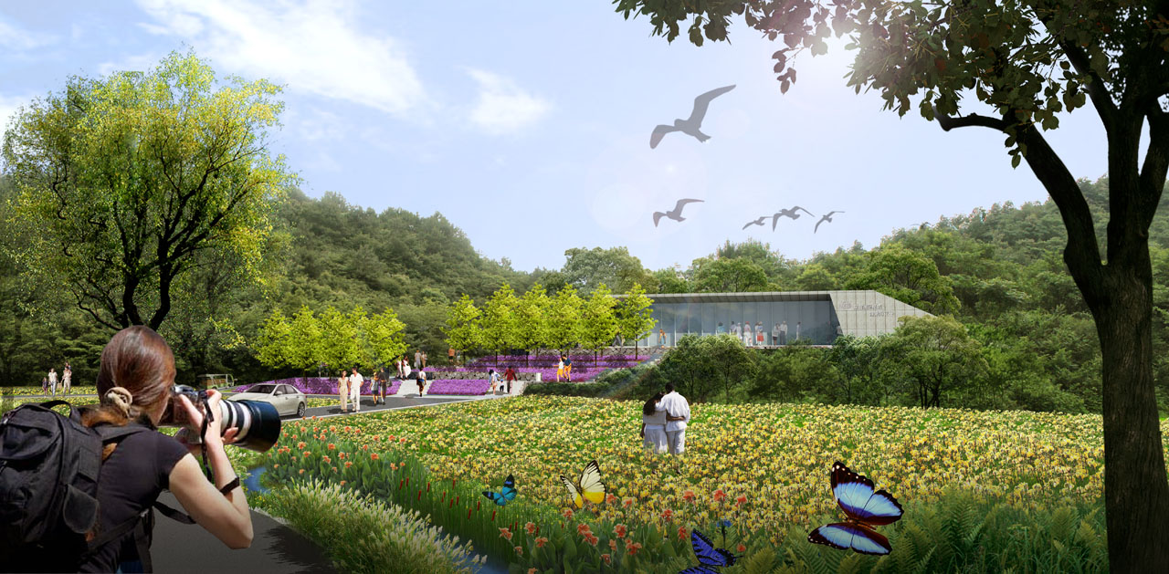
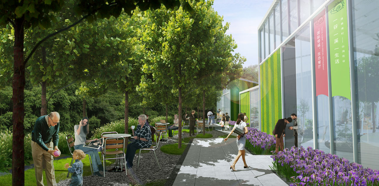
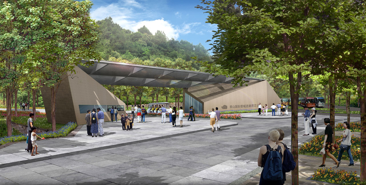
The design area is located at the gateway to the Changshan International Slow City. Currently, the village's development and landscape resources do not meet the tourism reception and image requirements. Farmlands are idle, the village suffers from population loss, infrastructure is inadequate, road traffic is discontinuous, and forest vegetation landscapes are monotonous. To meet the image requirements of the Changshan International Slow City start-up area and its service reception functions, a low-impact viewing system will be used to create a flower valley park that is highly integrated with nature, showcasing the rural mountain valley countryside.
3. Design Strategy
Six Key Features Highlighting the Charm of Flower Valley
Feature 1: Preserve the Landscape Pattern and Site Texture
The agricultural and mountain landscape resources of the site will be preserved and continued, maintaining the site's authenticity to the greatest extent possible.
Feature 2: Continue Traditional Farming Wisdom and Promote Traditional Farming Culture
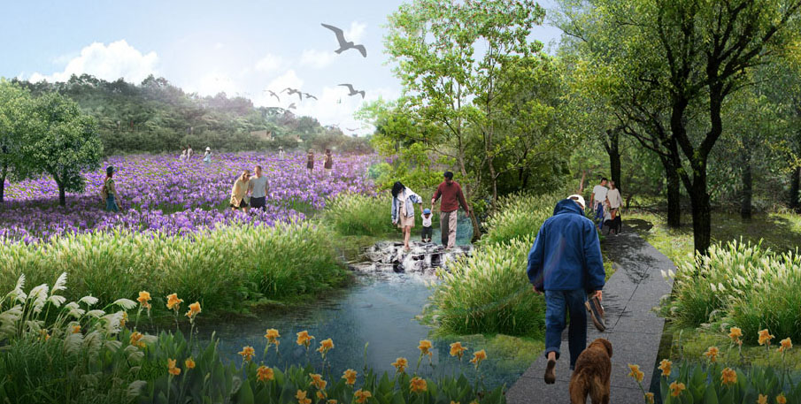
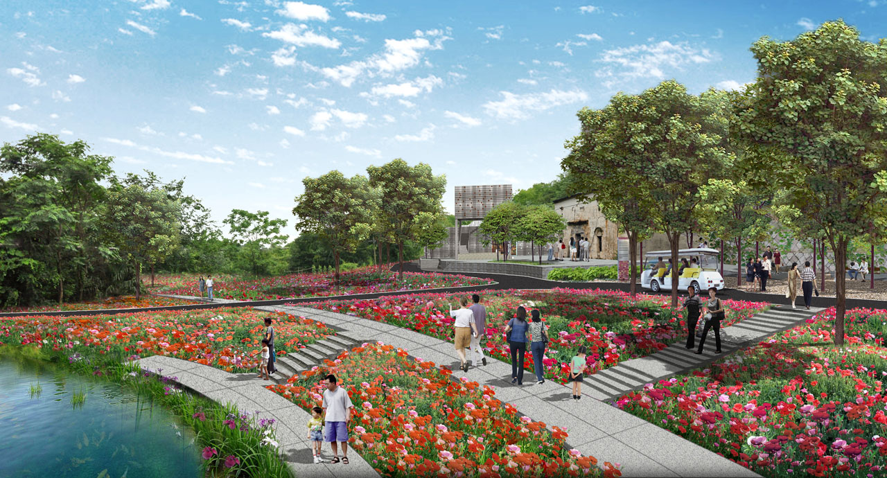
Using a ratio of four acres to one, retention ponds will be added along the valley fields to address the alternating drought and flood conditions caused by uneven rainfall distribution. This solves the problem of controlling non-point source pollution water quality while ensuring irrigation water for farmland during droughts.
Feature 3: Install Weirs to Enrich Water Layers
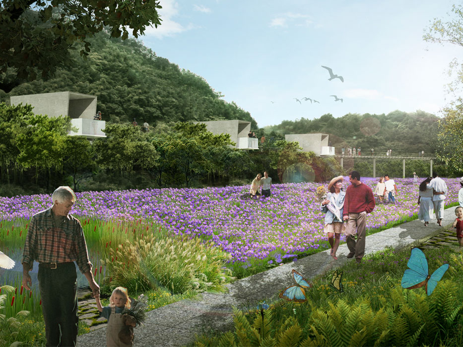
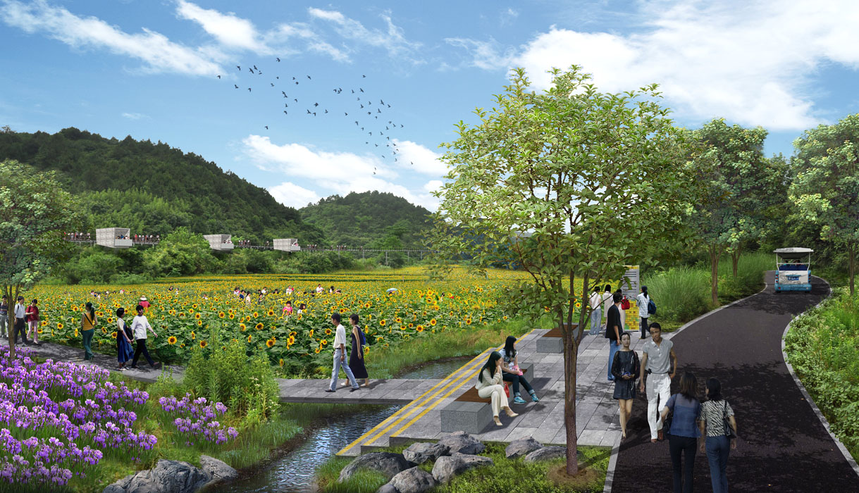
The current main river in Zhalewan has a severely incised riverbed, making it difficult to locate the source of the water despite the sound of flowing water. By installing weirs, the river's storage capacity will be increased, and the water level will be raised, making it easier for visitors to engage with the water and enhancing the potential for water-based interactions.
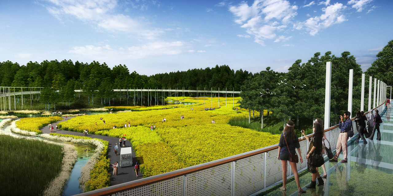
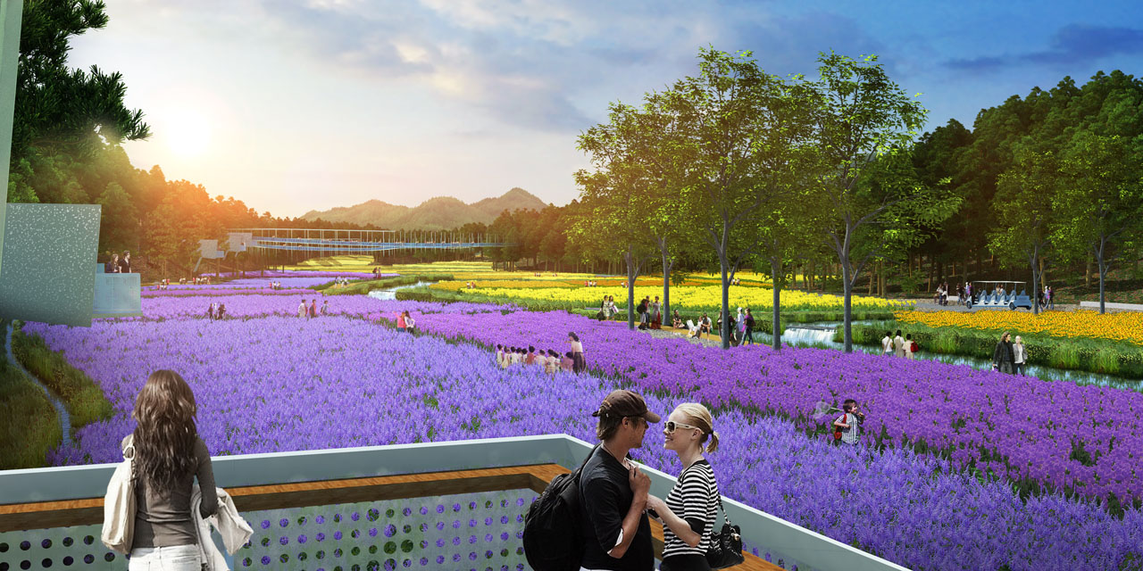
Feature 4: Low-Impact Development with an Elevated Viewing System
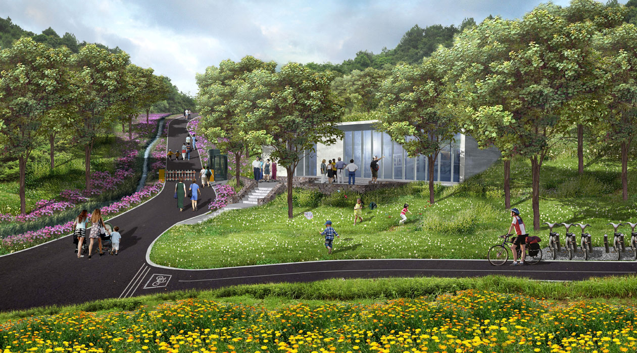
To preserve the site's landscape resources and conserve valley space, a low-impact elevated viewing system will be implemented, with semi-mountain trails connecting various landscape areas and a circular bridge offering panoramic views of the entire region.
Feature 5: Construct a Tourist Loop Using Existing Roads
The existing roadbeds on the site will be utilized, with some new constructions to create an electric sightseeing loop. Walking paths will be set between fields to cater to different viewing preferences.
Feature 6: A Planting System with Year-Round Flowers
Four colorful planting zones will be planned, adopting a three-season rotation method to create a sea of flowers.
4. Conclusion
Through these landscape design strategies, the agricultural landscape around Zhalewan Village will be comprehensively showcased to visitors.
