Xinjiang Shihezi G30 Ecological Corridor
Project Information
- Project Location:
- China Shihezi, Xinjiang
- Project Scale:
- 10.5 Square Kilometers
- Design Time:
- December 2016
Project Profile
1. Project Statement
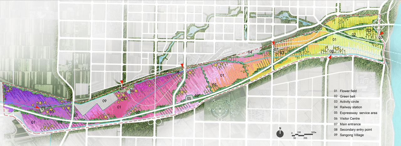
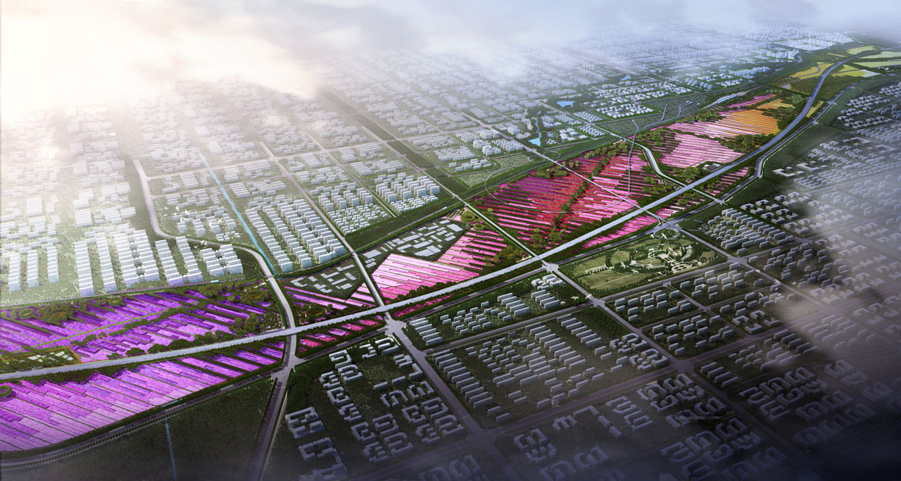
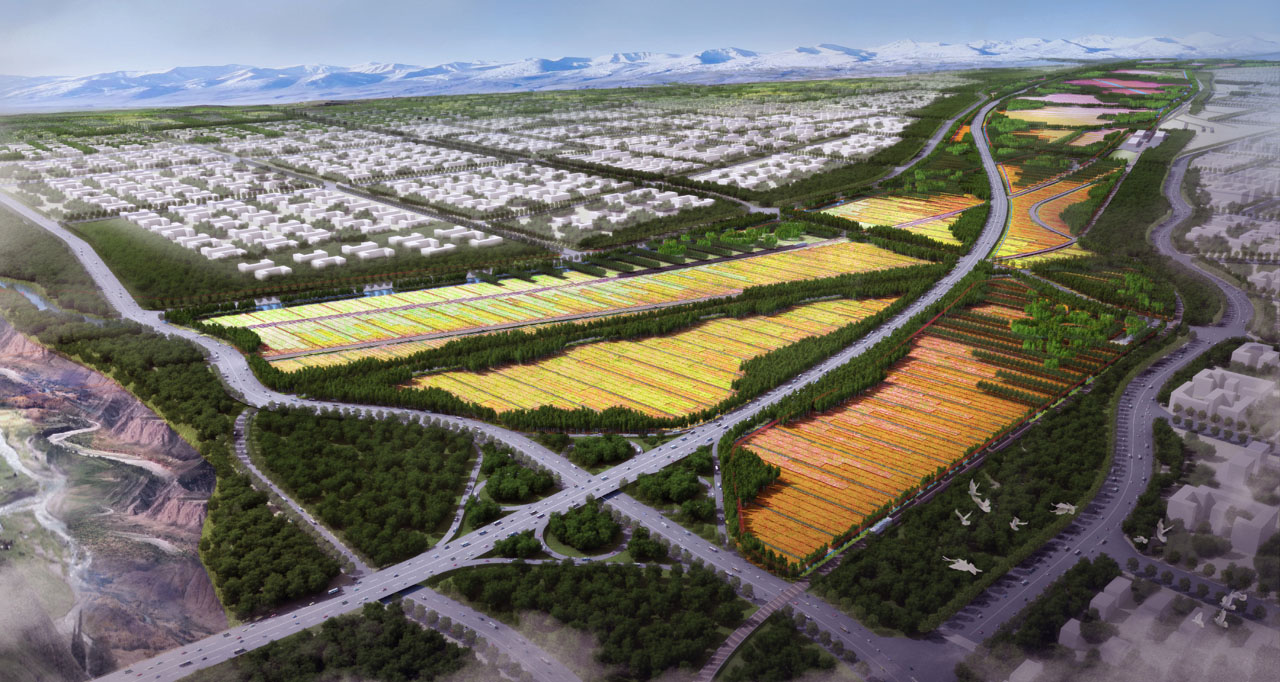
The G30 area is about 13 kilometers long and covers around 10.5 square kilometers. It is located in a key position in Shihezi City, serving as a major transportation corridor and a city gateway. In the city's master plan, this area is designated as an ecological green space, providing a great opportunity to create a beautiful landscape that showcases Shihezi’s commitment to ecological development.
The project aims to enhance the landscape of the large agricultural fields by creating a vibrant "One Land of Splendor" flower field. The plan is to develop a "1+2+3" military reclamation agricultural leisure landscape belt that promotes industrial upgrades. With new opportunities from the Belt and Road Initiative, the project explores modern urban agricultural development ideas, highlighting Shihezi's role as a leader in the Tianshan North Slope Economic Belt and its unique city culture of military reclamation.
2. Objective and Challenge
The goal is to create a distinctive G30 landscape belt that highlights Shihezi’s unique city characteristics and becomes a core attraction. The project will build on the site's features, explore Shihezi's city identity, and develop targeted strategies. A practical and feasible plan with a clear implementation timeline is essential to achieve the desired landscape effects.
60% of the site is within a basic farmland protection area. The planning must maintain the farmland's use for agriculture while creating a distinctive landscape. The Tianshan North Slope Silk Road region typically features vast mechanized fields and rural villages. A challenge is how the G30 corridor can reflect Shihezi’s unique landscape and city culture.
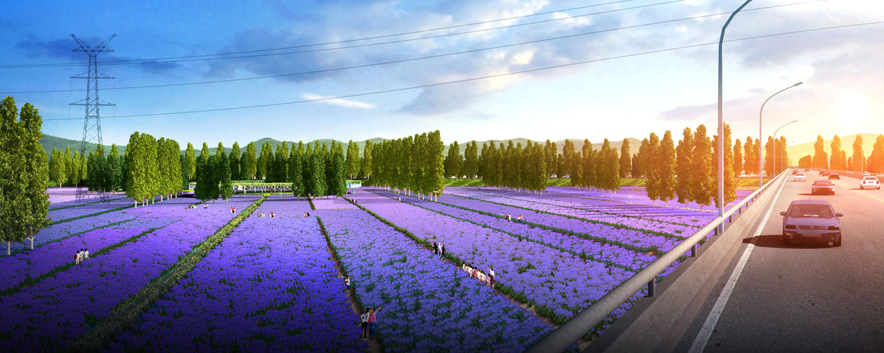
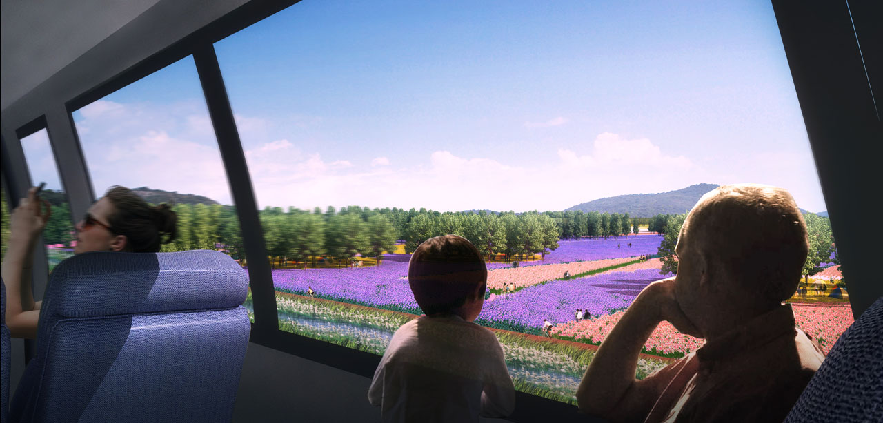
Given the location's importance, the brief visual impressions from trains and highways are vital for G30 as a city showcase. Creating a memorable visual experience in a short time is essential. Additionally, transforming a transportation corridor into a leisure landscape requires overcoming negative perceptions of such spaces as isolated, noisy, and unsuitable for stopping. The design must soften the visual impact of crisscrossing roads, overpasses, culverts, and embankments.
3. Design Strategy
A. Industry Strategy: Balancing Landscape Enhancement and Industrial Upgrades
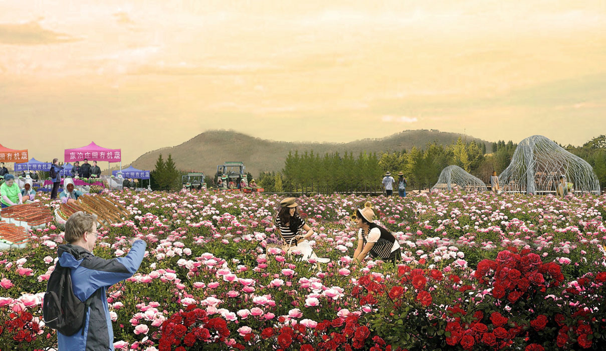
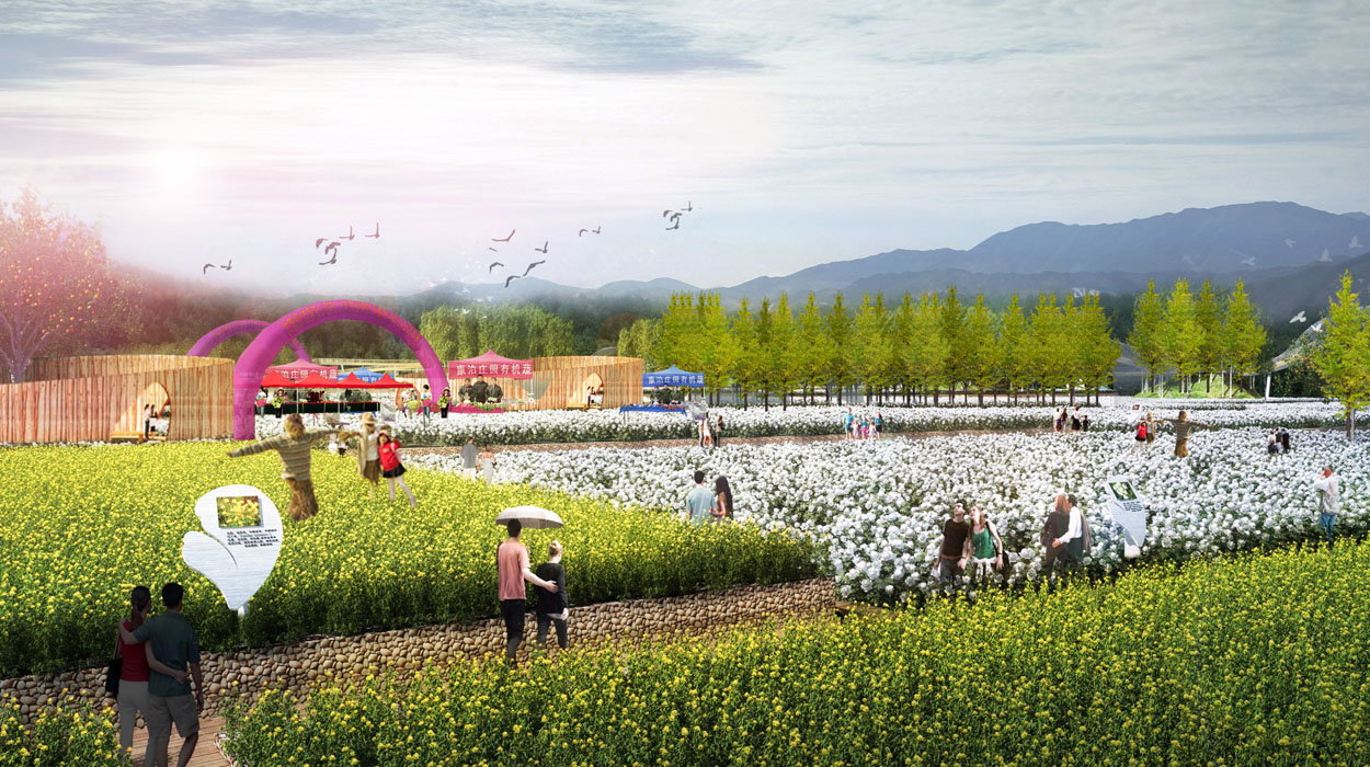
Landscape Enhancement: Transform the basic farmland into a diverse and vibrant flower field.
- Step 1: Choose crops with high economic and visual value that don't conflict. Expand from traditional crops to include grain, oil, spices, medicinal, and research plants with both economic and ornamental value. Ensure crops have different flowering and harvesting periods for year-round appeal.
- Step 2: Preserve and enhance existing irrigation facilities, emphasizing their landscape value. Continue the local irrigation landscape tradition, manage irrigation systems, and plant boundary forests to protect soil and water. Add secondary irrigation channels, enhance new forest irrigation, and create seasonal channel landscapes.
- Step 3: Use mechanized farming methods to achieve artistic effects efficiently. Use GPS for precise planting, weaving colorful flowering crops into a tapestry-like landscape. Design planting blocks based on maximum machine planting width to create a woven tapestry effect.
Industrial Upgrades: Enhance the value of agriculture through research, processing, and tourism projects. Introduce transportation services, special tourism, and urban living functions based on surrounding land use and site characteristics. Divide the site into functional areas, integrating marketing, education, and services for farm products to complete the agricultural tourism chain.
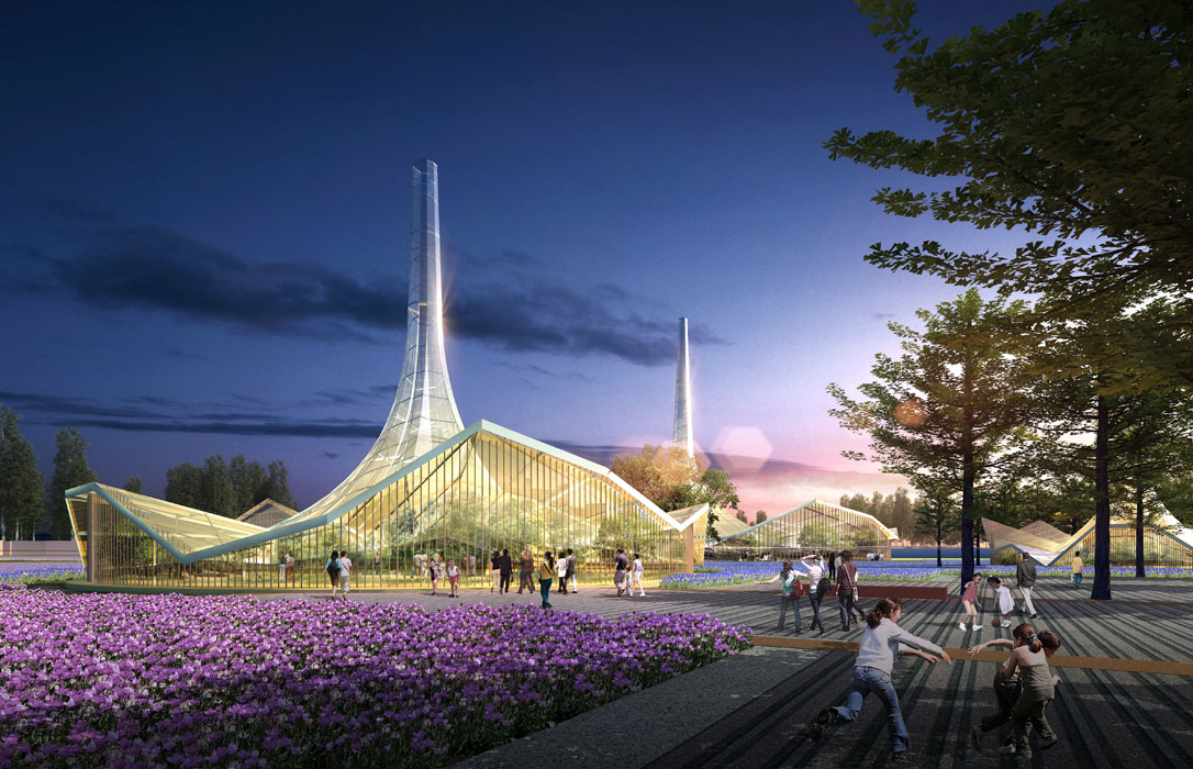
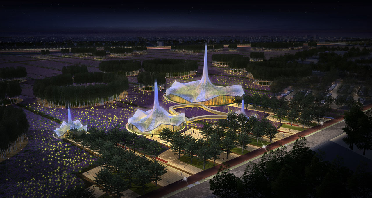
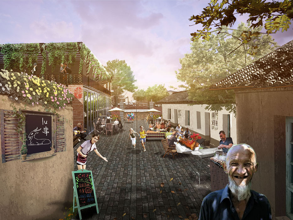
B. Cultural Strategy: Showcasing Shihezi’s Unique Military Reclamation Culture
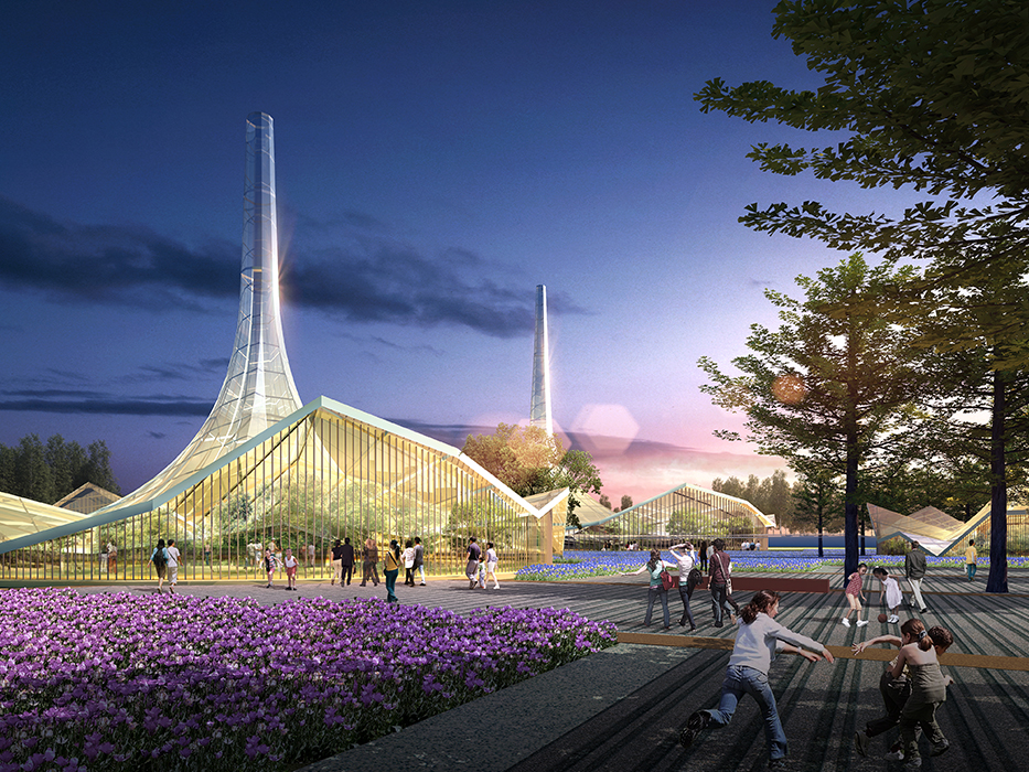
Use mechanized farming to create an artistic landscape that reflects the efficiency and precision of military operations. Design iconic nodes and structures inspired by historical military reclamation camp layouts, architecture, and production facilities to create an engaging military reclamation-themed landscape.
C. Visual Strategy: Creating a Moving Visual Gallery for Travelers
Differ from the uniform roadside landscapes by creating framed views with landscape forest belts. Open views rhythmically to capture travelers' interest. Design forest belt "windows" for complete visual impressions and scenic views. Analyze visual experience scales during vehicle movement and determine appropriate view widths for consistent forest belt planting.
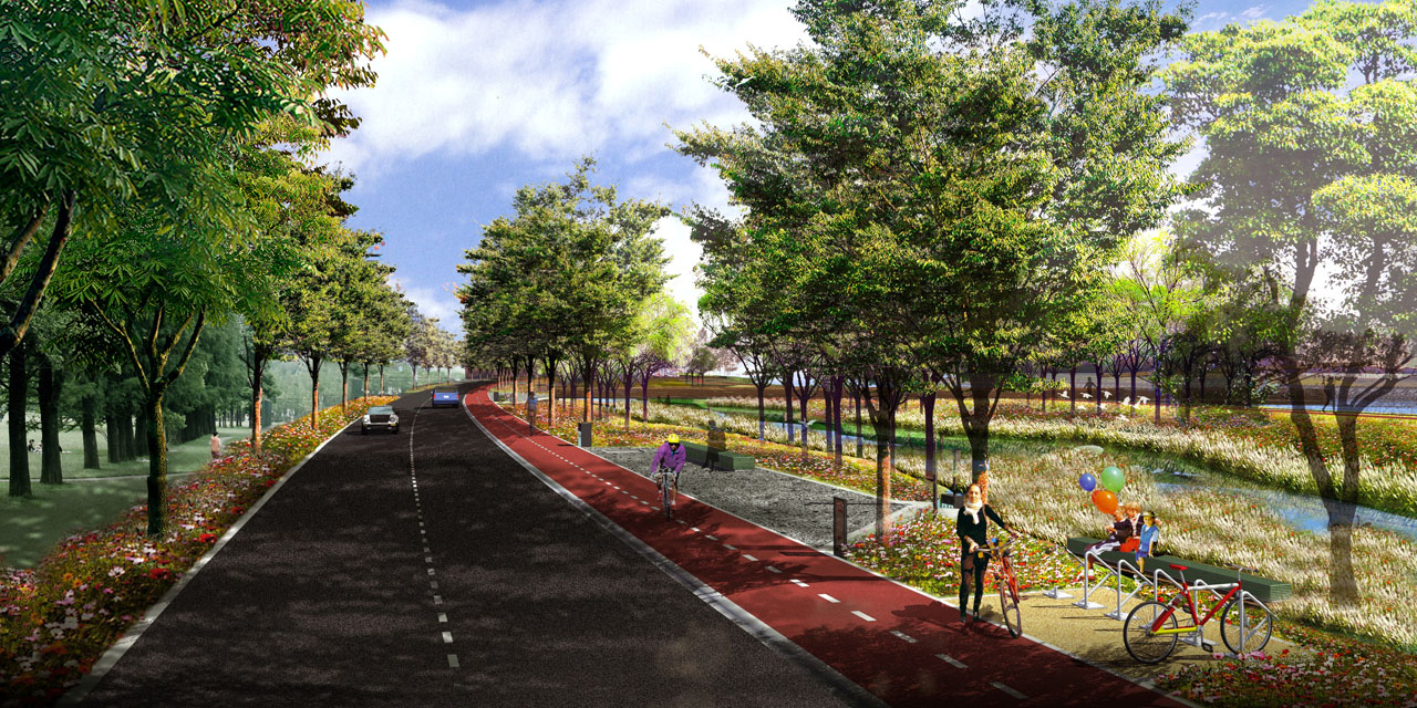
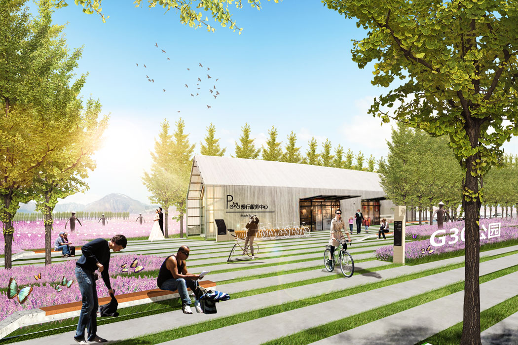
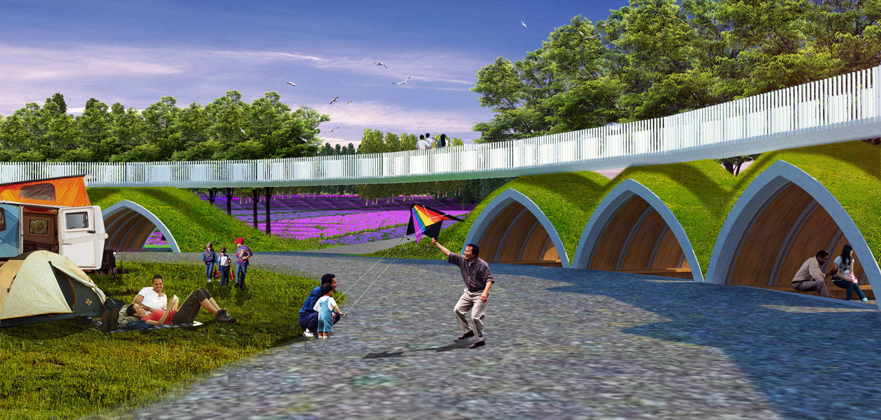
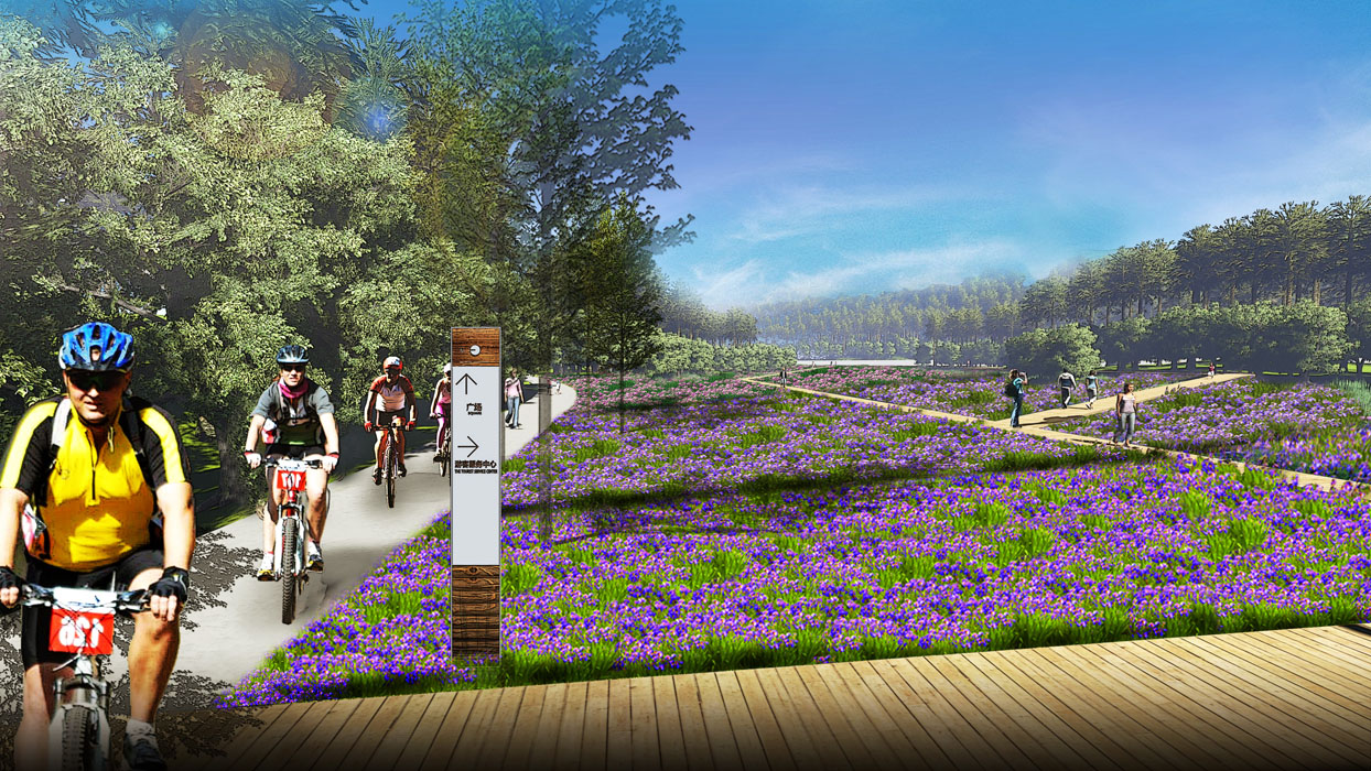
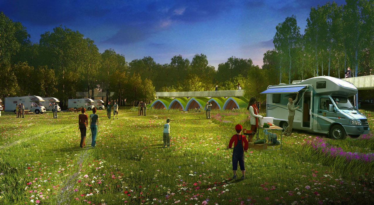
D. Recreation Strategy: Developing Comprehensive Recreational Facilities and Experiences
- Address accessibility issues caused by high-level roads dividing the site by creating a continuous walking system connected to urban paths. Design convenient parking entrances and ample service nodes for comfortable pedestrian access.
- Use planting to block interference and create an internal landscape atmosphere. Address noise and danger from passing vehicles by using boundary forests to shield and isolate, creating self-contained recreation spaces. Establish independent spaces for roads and activity areas separate from urban traffic.
- Build a modular leisure system for connectivity, independence, and comfort. Mitigate negative impressions from space occupied by roads and utilities by using tree rings to shield and consolidate spaces. Guide paths to avoid unfavorable factors and provide various-sized activity nodes to meet diverse needs.
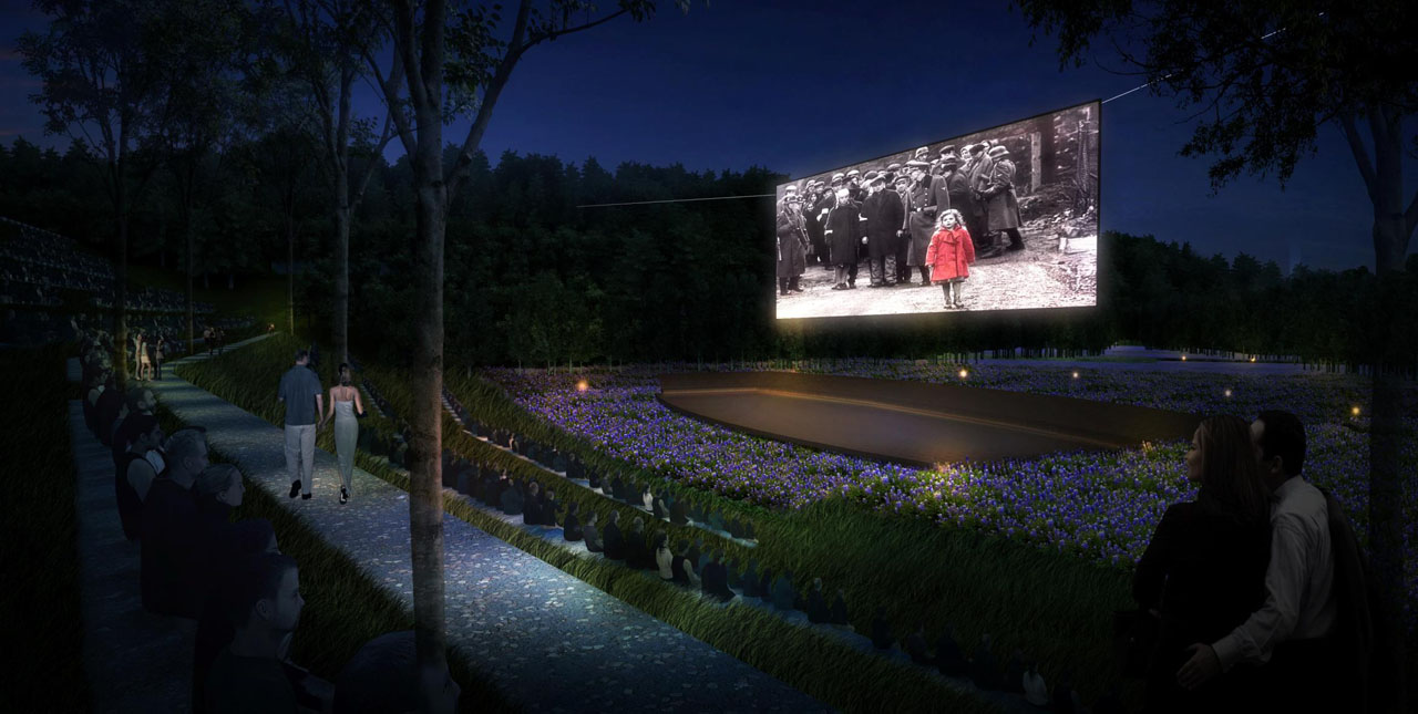
- Plan various festival activities to use the site flexibly, considering local climate conditions. Incorporate Internet-based management and services for a convenient experience, reshaping the grand, beautiful tapestry of modern agricultural field culture.
4. Conclusion
The plan uses the site's transportation corridor and farmland constraints to propose a flower field landscape belt. By integrating the existing irrigation field resources, the project leverages site scale and location advantages to enhance the landscape while focusing on land productivity and leisure functions. Through landscape improvement, the G30 corridor can truly become a comprehensive corridor and industrial demonstration area, integrating transportation, ecology, production, and recreation.
